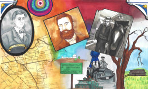
Daniel McCray – Anti-Slavery Evergreen Resident

In looking for Mayor John A. Quimby of Evergreen and San Jose, this interesting tid bit fell out of a family tree.  If I can find the author, I would love to get you more information on this stellar, little-known character.  In hopes that this was the origin of the McClay family along Norwood Avenue, I read on.  Though I couldn’t make that connection through the family tree, how this one time Florida Sherriff came to California during tensions that eventually led up to the American Civil War was fascinating.  This author, whomever it is, is detailed and follows land purchases into Evergreen.  Daniel McCray’s path would cross with Evergreen’s Farnsworth Family, Metzger family, and intimately with the Cottle Family.  It’s a wonderful piece of forgotten Evergreen history.

*SPECIAL STUDENT NOTE: There is language that is quoted directly from the time that may be alarming.  If you are upset, please discuss this with an adult.

Notes for Daniel McCray:
DANIEL AND MALINDA (McCROSKEY) McCRAY
of SANTA CLARA COUNTY, CALIFORNIA
1852 to 1873
by Norman McCray Scofield
DANIEL McCRAY, born 1811 in Washington County, Tennessee, near Jonesboro, spent his first sixteen years in that area. His grandfather Daniel had emigrated about 1760 from Scotland, probably locating first in Maryland. He soon joined the land seekers traveling south through Virginia’s Shenandoah Valley. He married SARAH NODDING in Maryland or Virginia. At least one of their children, Henry, was born in Virginia.
By 1765 Daniel and his family had penetrated the future state of Tennessee, then the county of Washington under the jurisdiction of North Carolina county of Washington under the jurisdiction of North Carolina. Daniel served in the Revolution, his records being in North Carolina. About 1800 most of the family moved west and took up land in Williamson County, Tennessee, Henry owned a whole section of land where the City of Franklin arose later, about ten miles south of Nashville, Henry sold it for a nominal sum, and he and his father returned to Jonesboro before 1810. His brothers, Thomas, William and Elisha also returned eastward to near Madisonville, Monroe County. Henry served in the War of 1810-12 as a Captain in the First Regiment of Tennessee Militia. Three of his brothers served in the same company with him Lt. Philip, Ensign Thomas and Srgt. William.
After 1830 the young Daniel probably joined his uncles in Monroe County, where there was plenty of work, clearing fields, cultivating and building.
On the 17th of October 1837 Daniel and Malinda were married. Daniel moved with his new bride to Summerville Georgia, where he had secured the position of Sheriff of Chatooga County.
Daniel and Malinda spent eleven years in Summerville and had five children. In 1848 they returned to the homestead on Fork Creek near Madisonville with Mary Lucinda ten, Julia F., three, their only surviving children. Franklin P. was born in January of 1849 in Monroe County. Through 1849 and ’50, Daniel’s brothers-in-law Joshua twenty two and Patrick twenty had sought permission of their father John McCroskey to join the gold rush to California. He had refused, pointing out the hazards and the uncertainty of success in gaining easy fortunes.
During these two years, Daniel must have been weighing in his mind the realities he knew in Tennessee, of small rock bound valleys and sharp climate, against the overblown reports of gold fortunes in California and its reported wide, flat, fertile valleys and moderate climate. Springing from a line of land seeking forebears the California lands must have been predominate in his thinking although the gold find was one of the wonders of the world and deserved at least an inspection.
It is also possible that one could sense in 1850 the gathering differences between the North and South over the slavery question. Although grandfather Daniel had owned one or two slaves, and father Henry one, they were concerned for their welfare. This is evident in grandfather Daniel’s will of 1818 “…that my negro man Alick shall have the choosing of his own master and misstress amongst my children and they shall not sell or run him out of the county.”
Daniel must have thrown his support to the California trip, because early in 1851, before the birth of his son Victor on the 16th of September, Daniel with a young friend ROBERT W. GRUBB (his future son-in-law), Joshua and Patrick McCroskey travelled by stage and rail to New York where they took passage on a steamer plying to the Isthmus of Panama and thence by local boat up the Chargres River as far as it was navigable. From there they walked across the Isthmus with their belongings on their backs to Panama City. On the ship from New York they had been crowded like cattle to accommodate passenger lists of two and three times normal capacity. By the time they reached the Isthmus, possibly five to ten percent of the passengers had come down with so-called yellow fever.
Many died in the primitive Indian village on the Chargres River. (See The Romance of the Age or the Discovery of Gold in California, D. Appleton, New York, 1867, a copy of which Daniel purchased in San Jose in 1867). The four men waited only two days before getting passage to San Francisco. After two days at sea Patrick sickened and died of yellow fever. He was buried at sea off Acapulco, Mexico.
Arrival in San Jose
On arrival in San Francisco, Daniel and Robert Grubb went to the gold diggings out of Sacramento while Joshua proceeded to San Jose. There he engaged in farming produce for sale in the San Francisco market, Daniel and Robert were convinced by the reports of Joshua that their forte lay in farming. They were found in San Jose in early 1852 engaged in farming, more to their liking than the hectic mine fields.
By the winter of 1856, Daniel had established the means to bring his family to California. He also probably had settled on land near San Jose that was considered Public Domain, based on the assumption that the land grants made by Spain were no longer valid when the territory was taken over by the United States.
Daniel returned to Tennessee by the route he had taken to California, leaving Robert Grubb to guard whatever property he had adquired. By April 11, 1857 the Daniel McCrays had packed their household furniture and dispatched it by sailing ship around the Horn of South America.
That afternoon they caught a train at Sweetwater, ten miles southwest of Madisonville for their trip to Charleston. The party consisted of Daniel and Malinda, aged 43 and36, Mary 19, Julia 12, Franklin 8 and Victor 6, Other members of the party were a Mr. White, Jones, Fred Graham and “Old-Ten” (Tennessee?) Weathers, possibly a relative of JOHN F. WEATHERS who was probably already farming near San Jose, their future son-in-law.
One can imagine the trip by wagon team from Oakland to Evergreen in a California May. Daniel may have acquired or built some sort of shelter on his land. Probably Robert Grubb had lived there while Daniel was in Tenneseee.
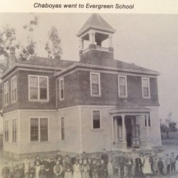
The children, Julia, Franklin and Victor, were enrolled in the Evergreen School at the junction of Evergreen (Aborn) and White Roads, two miles from their home in the east corner formed by the intersection of King and Tully Roads, then unnamed.
Mary L, McCray was married to ROBERT W. GRUBB on September 12, 1857. She was nineteen years old. They probably lived on the McCray ranch, A son Harry was born to Daniel and Melinda on December 10, 1858.
By this time the consuming topic of conversation was the validity of property titles, whether they claimed them as homesteads or had bought from earlier settlers. It began to appear that the United States Courts might uphold the legality of the land grants to appear that the United States Courts might uphold the legality of the land grants made by the Spanish monarchy or the Mexican government.
“On April 11, 1859 a very large meeting was held at the Evergreen School House to hear Mr. A. A. Green of San Francisco, discuss Spanish land grants in general, and the Chabolla Grant in particular… August 15th the San Jose Land Company gave notice that they would sell their rights to the lands known as the Five-Hundred-Acre tracts… The Commissioners of the Funded Debt of San Jose announced on the same day that they would sell titles to the same lands … The Mayor announced that he did not believe the Land Company owned any interest or title to sell.” (History of San Jose – F. Hall)
To explain the conflicting announcements, the City of San Jose claimed ownership of certain lands, because of the rights and lands passed down by the Pueblo de San Jose de Guadalupe, set aside for town and public use by the laws of Spain. The Land Company claimed some rights to these lands because of legal attachments they had made against them for debts owed them by the City of San Jose, specifically, for the balance and interest due on a building the members of the Land Company had had built, and sold to the City for the use of the first California Legislature meeting. Some of the Spanish land grants, such as the one made to Antonio Chabolla, Rancho of the Spanish land grants, such as the one made to Antonio Chabolla, Rancho Yerba Bueno Y. Socarye overlapped some of the lands claimed by the City as belonging to the original Areblo de San Jose.
Daniel took heed of these events and on November 28, 1859 obtained a Deed to 52 acres on which he lived from HIATT P. HEPBURN and HENRY WILKINS of San Francisco for $780, (Book O p. 503). These two men apparently had bought tracts of land from Antonio Chabolla on the speculation that the United States courts would eventually sustain the original Spanish land grants. The following December 12th Daniel obtained a Deed from the Commissioners of the Funded Debt for 54.9 acres the same body of land although slightly larger in dimension for $78.60, (Book N p. 2). It appears that Daniel felt quick action was necessary to protect the improvements he probably had made, so he was not in a position to quibble over 2.9 acres. No record has been found as to how Daniel acquired the property in the first place.
On January 2, 1860 Daniel added 89.77 acres to his original 52 acre piece, lying on the N, E., from A. B. CLADWELL and wife MARY A., paying $897, (Book M p. 702). A few days later, January 14th Daniel cleared title to a small area of 6.44 acres lying on the S.W. of the piece bought from Caldwell, (Book N p. 94).
By April 1861 the United States courts settled the matter of ownership of the Spanish land grant made to Antonio Chabolla, and numerous writs of ejection for possession of land occupied by settlers became obligatory for the Sheriff to serve on the squatters. He collected a posse of about six hundred to carry out his duties, but dismissed the posse when they gathered because they were unarmed and, when asked, were not in favor of arming themselves.
That afternoon nearly a thousand settlers paraded the main street of San Jose, on horses and in wagons, armed to the teeth, One contingent even brought a small caannon. They returned to their homes and no violence occurred. Some of the people in the parade were financially unable to clear the titles to their lands. Others had purchased properties from earlier settlers who claimed valid titles which now became null and void. Many were voicing disapproval of an act they believed fraudulent, not realizing that the decision were final in the highest courts. Matters were peaceably settled within a reasonable time.
On May 10, 1861 another son, Leon G. was born to Daniel and Malinda. He survived only twenty days.
On November 15, 1862 Daniel sold all his land, 141.72 acres, and buildings lying in the east corner of King and Tully Roads, to THOMAS H. FARNSWORTH for $26.00, (Book E p. 536). Even at this date the Tully Road is referred to as, “the road which passes said McCray’s house.” The exact reason for Daniel’s sale is not known. Another puzzle is that he did not take title to any other piece of property for two years. Where the family lived in the interim is not known. It is possible that Thomas Farnsworth did not need the buildings on the property and the McCrays remained there as renters.
On February 22, 1863 Daniel and Malinda’s last child was born, Amelia, called Ella. On October 26, 1864 Daniel purchased 148 acres near Pioneer on the Almaden Road for $1,500, whose western boundary was the Guadalupe River and its northern boundary south of Downer Avenue (now Blossom Hill Road.) The purchase was made from TRAVIS and MARTHA F. PHILLIPS, (Book T p. 68). By this date Franklin was 15 and Victor 13 and they had become well acquainted with their schoolmates in Evergreen.
Two schoolmates were Mary, 14, and A1ice, 8, daughters of ORVAL and SARAH COTTLE whose home and ranch were one mile on Silver Creek Road, south of its junction with King and Evergreen (Aborn) Road. Mary and Alice, the future wives of Franklin and Victor, attended Evergreen School with a number of their sisters. They walked to school via Silver Creek and Evergreen Roads, which were only wagon tracks. They told in later years of their struggles through mud nearly knee deep in gum boots whose appearance embarrassed them. They carried their regular shoes so they could change.
In October 1866 Daniel bought from JOHN G. METZGER 100 acres for $2,000 adjoining his holdings in Pioneer, (Book V p. 534). Apparently there was no adequate building for a grammar school because Daniel became one of three school trustees for their District who purchased a school lot for the City of San Jose on which a school house was soon built, known as the Pioneer School, (Book W p. 544, signed by Mayor J. A. QUIMBY and School trustees ANDREW REDMOND, FRANCIS L. EASTERDAY and DANIEL McCRAY.)
On June 26, 1873 Daniel and Malinda sold their 223.27 acres at Pioneer to WI LLIAM F. S. L. de A. GIESSENBERG for $11,150 (Book 30 p. 261). In the nine years the McCrays had acquired 248 acres for $3,500. Selling 223.27 acres for$11,150, they gain $7,650 with no allowance for improvements. Somehow, probably due to inaccuracies in the surveys they lost 24.73 acres in the transaction. This sale was no doubt for the profit involved, but also to allow the McCrays to move to Hollister and invest in the new lands just opened by the San Justo Homestead Association in the San Benito Valley, then contained in Monterey County. On August 18, 1873 they bought their first piece of land close to the center of town, and in the following three years they purchased four more plots, totaling 85.2 acres for an investment of $6, 275.
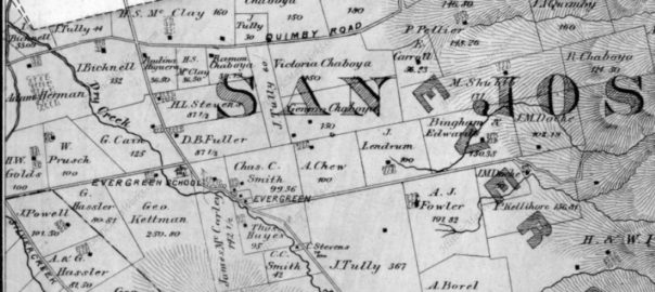
“Nor-wood”

mapThe lead for Norwood is a real stumper.  As a name, its quite popular.  Norwood Avenue dates back to the mid 1800’s.  So, what was it named after?  There were fabulous people named Norwood who would settle into Santa Clara County in 1849, but Mr. Joseph Gould Norwood would make his home in the Alviso/Santa Clara township, nowhere near Evergreen.  So, that’s not our Norwood.  I reviewed historical maps and grant records throughout Evergreen’s history looking for a Norwood family to tie this name to.  I couldn’t find one.

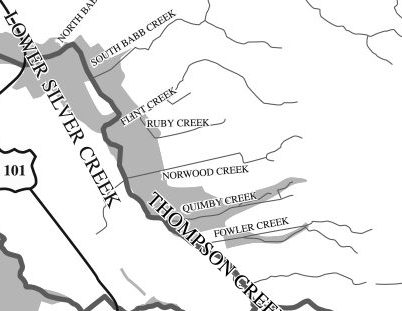
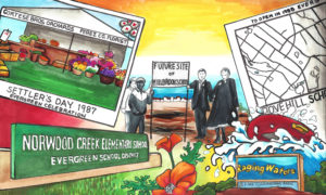
watershed1421300_242476552761125_6880580855870102685_oNorwood’s Creek is definitely a geographic feature of Evergreen and has been for a long time.  Today, the creek exists beyond the private road at the end of Norwood, but is diverted through housing developments through water tanks and pumping stations.  There’s probably a sizable water pipe under the street that later empties as Norwood Avenue ends on White Road.  That’s why the current path is a straight line at points.  This pipe system is necessary because Evergreen has had a long history of flooding with its sometimes unpredictable waterways.  Frank Cunningham lost his large property with a huge lake on it because the City of San Jose needed to be able to better control the watershed.

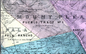
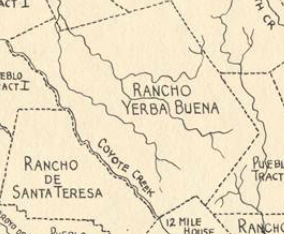
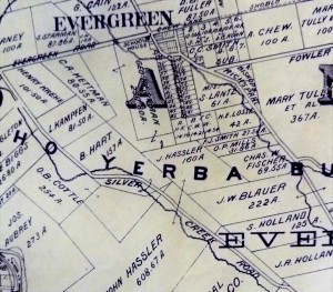
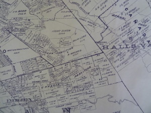
Map 006, San Jose, Evergreen, Silver Creek, Mount Pleasant, Pal000000Looking into Norwood, the Avenue itself in between Quimby Road and Tully Road came about between two maps.  In 1876, a County wide Atlas was created and there’s no mention of Norwood Avenue.  It runs along the line between these yellow, orange and the lower green section.  We are looking at once corners of Ranchos Pala and Rancho Yerba Buena, and the adjacent Pueblo Tract.  Tully Road isn’t a thing yet, but it will be located on the strong black line noting his and partner Wallace’s property.

Interior-FirstGeneration-PierrePellierThe Norwood Creek would feed into the farms, vineyards and orchards of Joaquin Higuera, Tully & Wallace, Pierre Pellier, and J. A. Quimby possibly at the time.  The creek would’ve provided a natural irrigation.  The Pellier Ranch was one of the largest in Evergreen with Norwood Creek traveling through it.  John Tully would own property all over Evergreen.  In fact, John Tully’s lawsuit from Antonio Chaboya opened up the conversation for other European farmers homesteading on Rancho Yerba Buena.

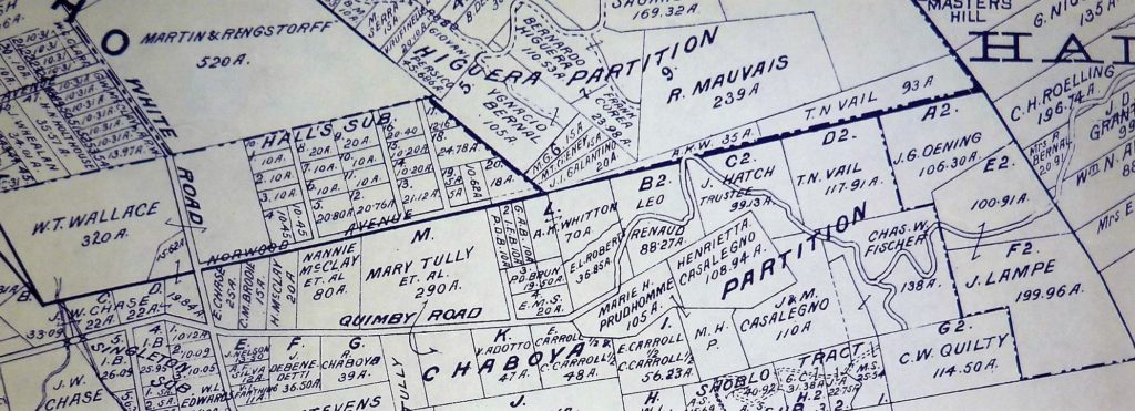
P1310185 (4)Fourteen years later, in 1890, Norwood Avenue runs through to present day Flint Avenue.  At its creation, it’s spelt Flindt Avenue.  Here, you see John Tully’s partnership with Wallace desolve with his passing and the family sold his half of the property away in small 10 acre lots.

6254426015_f091ee3233_bLarger farms like the McClay family’s, shown here to the left, and Leo Renaud on the South side of Norwood Avenue.  On the South corner of White Road and Norwood Avenue was Elmer Chase, Richmond Chase and Valley of Heart’s Delight Fruit Packing Co. owner.  With the elder Pelliers passing, the property passed to Pierre’s daughter Henrietta, who married Mr. Mirassou, then Mr. Casalegno.  One of her daughters would marry Mr. Renaud on Norwood Avenue.  The creekbed isn’t show here in this picture, but the properties are growing smaller.  The map would be impossible to read with all of Evergreen’s creeks also noted.  This area was awesome for vineyards.

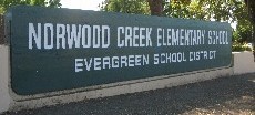
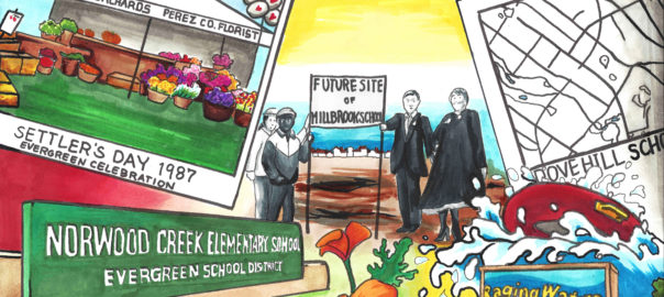
norwood-creek-elementaryRemington Drive where Norwood Creek Elementary School is located is most likely this beginning stretch of road off of Quimby Road which doesn’t quite connect but is very near the school’s location along Mr. Tully’s widow’s property.  The Hall’s Subdivision along Norwood Avenue would be one of the first in the area, along with the Cadwallader Subdivision.

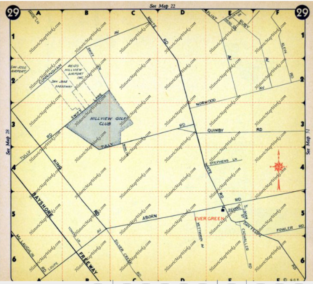
Evergreen - Page 029, Atlas: Santa Clara County 1956, Californi

This map in 1956 shows Norwood Avenue in the center.  Remington hasn’t become a major paved road yet.  Notice how Evergreen written in red is so much lower.  Its not that the Norwood area or the creek is outside Evergreen or Rancho Yerba Buena.

Norwood is the relationship it has with downtown Evergreen and its placement within the Rancho.  When broken into two parts its North Woods.  It is farthest North of the along the Rancho Yerba Buena border.  In all likelihood, the Creek was named Norwood long before the avenue.  It was a popular family name for people from northern lying woodlands.  This was the woods to the North of Evergreen along a main artery of White Road.  The Norwood area as the Rancho had streams trickling through it and densely populated with trees, with nearby farmhands houses on the North side.  The woods provided the Chaboyas a little buffer with their ranches along Quimby Road.  The forested area would create a natural boundary for the cattle as well.  John Tully would plant eucalyptus trees along Tully Road which still grow today in the heavily wooded area.  This would also refer to the area where Cedar Grove Elementary School is located, but we’ll talk about “Cedar” in Evergreen at another time.

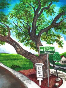
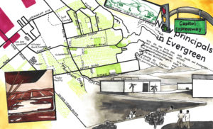
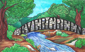
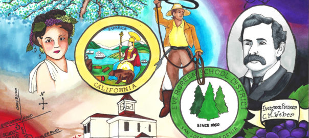
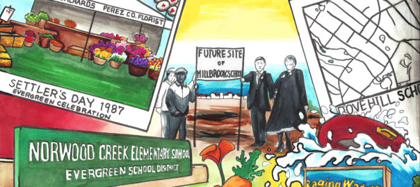
Here’s the artwork with references to Norwood Creek.

19851969

1850 - bridge19921847

Nirum Cadwallader – Evergreen’s generous Mining Tycoon

san jose newsNirum’s an awesome name, as is Cadwallader.  For the purposes of my research, I much prefer it to Smith, Stevens, Jones or John.  However, when looking into Mr. Cadwallader, he occurs all over the map.  The fabulous women of History San Jose pulled it all together for me.  I’m always looking for a portrait on my Evergreen individuals.  This one happens to be in print, not a photograph.

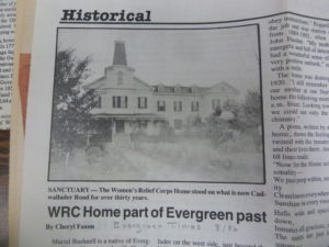
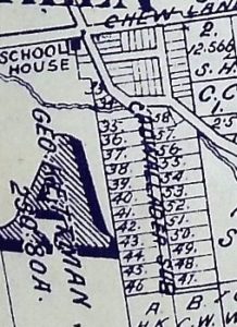
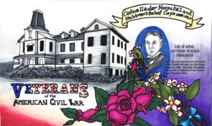
P1310185 (2)Mr. Nirum Cadwallader, for whom the school is named, as previously discussed donated the lands to both the Evergreen Schoolhouse at the corner of San Felipe and Evergreen Roads in 1860 and to the Women’s Relief Corps in 1887, located on Cadwallader Avenue.  The WRC is probably one of these subdivision plots.  By my estimation of the 5 acres donated, I think it’s probably 34 or 57.  Those are the only ones bigger enough and “on” Cadwallader.  At the time, Cadwallader Avenue started at San Felipe Road.  Now, there are only foot bridges connecting Cadwallader to Keaton Loop, formerly San Felipe Road.  We’ll discuss this in further detail later.  No doubt, Mr. Cadwallader helped shape Evergreen as we know it.

books cadwalladerbooks cadThe earliest records of Mr. Nirum Cadwallader appear from Birchville, California, because that’s where he initially struck it rich.  Originally from Ohio, Nirum Cadwallader would be apart of the Gold Rush of 1849.  In an illustrated version of Popular Science in 1866 would bring attention to Mr. Cadwallader’s patent on a technique of compressing air in dynamic to create larger blasts.

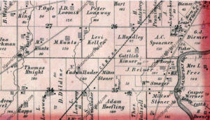
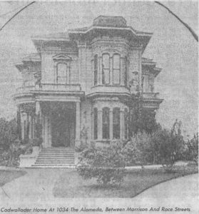
4592131824_302x427Nirum Cadwallader (1833-1890) was the great grandson of Ohio’s Seneca County’s Hopewell Township’s first settler, Nathan Cadwallader.  Nirum’s father Samuel Cadwallader and wife Mary would raise 7 children, of which Nirum was the eldest.  He would’ve been sixteen as he would’ve heard the news of gold from California.  As a young man, Cadwallader would work his way up the chain at the Milton Mining Company, surely getting the necessary experience that took him to his future heights.  The Cadwallader family name is quite popular there in Ohio and along the east coast, also spelt Cadwalader.  It and the family originate from Wales, being a descriptive term for the Welsh people.   The family’s lineage can be traced back to a Welsh King.  Chances are the Cadwalladers were well off in Ohio.  There are a long line of Cadwallader inventors preceding and succeeding him.  The first Cadwalladers would leave England in 1640, arriving in Virginia, and slowly migrating west from there.

Hopewell Township, Atlas: Seneca County 1874, Ohio Historical MAs a young man, Cadwallader would work his way up the chain at the Milton Mining Company, surely getting the experience that took him to his future heights. However established, Nirum Cadwallader would break out from Milton and arrive in California in 1855, at the age of 22.  Nirum would become a prolific businessman, acquiring stocks and equity in numerous mining, telephone, water and utility companies in Nevada County, California.  He was a very rich and well-respected man quickly after coming to California.  Mr. Cadwallader would be married twice, but his first wife passed away while he still lived in Birchville. I couldn’t find any records of the first marriage or the children they might have had.  After returning home, no doubt to grieve, Nirum would marry the much younger Emma J. Hart (1847-1930) also from Ohio, having 3 children together.  Nirum Cadwallader would own 160 acres in Ohio as shown to the left in this 1874 Atlas.  Samuel, his father, would live with Nirum for part of the year, probably during Ohio’s colder months.

cadwallader residenceIf you’re mining for gold in Nevada County, California, you would need quicksilver to obtain pure gold and remove other elements from the compound.  If you’re a forward thinking man with mining interests and better mining techniques like Mr. Cadwallader, you might look for some quicksilver mines of your own.  This is what probably brought Mr. and Mrs. Cadwallader to San Jose for good in 1881.  Although it is unclear whether or not he had any part of the Silver Creek Mines before their flooding and abandonment, Nirum Cadwallader would purchase land in the heart of Evergreen in the 1860’s, though they never lived there.  This was a second property to vacation from their downtown home, which was located off of the Alameda, in the heart of Downtown San Jose.  It’s been torn down.  When Cadwallader donated the land because he hadn’t built on it, he made a huge impact on the Community of Evergreen.  Mr. Nirum Cadwallader has been rumored to be a very generous man throughout his life.

scan0135In 1888, Birchville’s mining industry would dry up as the mines were picked clean.  The population of Nevada County quickly shrank.  Forward thinking Mr. Cadwallader had already set up shop elsewhere.  His patent made him rich, as did his business ownings.  Mr. Cadwallader died in 1890, a year after the WRC opened.  Mrs. Emma Cadwallade, the widow, would deed a park in his honor.  The small park still exists between 1st and 2nd Streets at Keyes Street.  It is the cutest wedge of land with palm trees.  This crossroads would dictate the direction you were heading before highways were built.  Monterey Road was the closest thing to a highway, also being a portion of the El Camino Real.  First Street heading North lead you Santa Clara and then the Alameda which turns to the El Camino Real to San Francisco.  Heading down Second Street took you towards Oakland via Oakland Road from Thirteenth Street.

P1320428In donating the property to the Women’s Relief Corps in December 1887, constructed in 1889,  a ceremony was held to commemorate the occasion in Evergreen on April 6, 1889.  The WRC took a year and a half to build on Cadwallader Avenue.  A mile long precession and banquet hosted by “ladies of Evergreen”, notable ladies like Mrs. E. J. Smith, Mrs. J. J. Jones, Miss Fowler, and Miss McClay.   The occasion was celebrated with Mr. and Mrs. W. L. Edwards, Mr. and Mrs. Samuel Cunningham, Mr. and Mrs. Lantz (neighbors nearby the WRC), Miss Minnie Keliher and the Chew Family.  It was said that Mr. Cadwallader held the event to show off his beautiful wife from Ohio.  She later remarried Mr. Taylor in 1910, twenty years later.

P1310185 (3)Mr. Nirum Cadwallader’s Evergreen property turned into one of the first densely built home developments in the downtown of Evergreen.  It was all located around Cadwallader Avenue, named in his honor.  Close by Cadwallader Subdivision were the Smith properties and General Store, Andy Kettmann’s Saloon and the Schoolhouse.  When the town grew, it did so because people enjoyed having neighbors and countryside in the places like the Cadwallader Subdivision shown to the right.  If you worked these farms nearby, you probably couldn’t afford lots of acres of your own.  Plus, you were too busy to ever profit off of the land or tend to it yourself.  Evergreen’s farming industry took the whole village to harvest.  Evergreen School Sessions would sync with the harvest season, because the kids would be home working as well.

signpostPatricia Loomis discussed the WRC’s opening with first person resources in her article “Cadwallader Ave. Has Had Problems” in her ‘Sign Posts’ series, revisiting historic events in San Jose’s history for the San Jose News in October 17, 1975.  What I hadn’t realized before I found Patricia Loomis’s Sign Post was that Cadwallader Avenue went through to San Felipe.  The road bridge would be washed out in 1893 after heavy rains.  At the time, Cadwallader crossed Thompson Creek, formerly known as Dry Creek because it ran dry in summer months.  The wash out surely as something to do with the redirecting of San Felipe Road.  It’s never been replaced.


Evergreen – A Vacation Destination?

1876 MapPart of the joy in this project has been trying to imagine Evergreen of yesteryear.  How I’ve initially ingested the information is through the visuals which develop throughout time.  The Pueblo de San Jose was established in 1777 as the first secular settlement in California’s infancy.  Small towns and communities would grow up around the city in order to feed and sustain it.  Evergreen was certainly one of these communities, with its first recorded landowners being the Chaboyas in 1821.

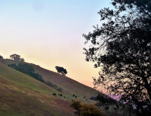
Screen Shot 2015-11-02 at 6.06.18 PMScreen Shot 2015-11-02 at 5.59.57 PMThe Chaboyas were cattle ranchers and orchardists.  This means much of the area was untouched in years that the cattle didn’t graze across certain acres.  Grazing in general is a natural grass mowing.  The land itself was scenic, beautiful hillsides drenched in trees and creeks in the 1800’s.  It was described at 8 miles outside of the Pueblo.
IMG_4183The relationship early landowners had with Evergreen into the 1850’s was very different than what we think of it today.  If you were a wealthy farmer, you had a house Downtown – or rather in the City of San Jose – and a vacation or second home in the town of Evergreen.  The Pueblo’s plots were close together and very similar to how it looks and feels today.  Victorian homes can be traced back to their original owners or builders.  The City spread from an epicenter at First Street and Santa Clara Street, being named after the Mission of Santa Clara founded in 1776.

1997300231This was certainly true of the Tullys, Quimbys, and Cadwalladers.  Shown here are the super trendy Tullys, Rose and John.  The Pelliers would own downtown then purchase one of Evergreen’s largest ranches off Quimby Road and Norwood Avenue.  Wealthy landowners would have large homes in Evergreen and a pueblo plot, or small lot, in the City.  John J. Montgomery would come to fly from Evergreen’s pastoral hillsides while teaching at Santa Clara University.  This was a several hour ride on horseback to the town Evergreen in the day, with limited roadways and no highways, at the time.

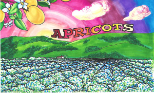
a 1945 - ApricotsPeople from elsewhere would travel to Evergreen for a slower paced lifestyle, as well as to tend their lucrative farms.  Farmhands would stay on site and the owners would travel back and forth to their downtown stores and homes.  Evergreen’s farming community and nature would also bring tourism to a young Evergreen Village.  If you were visiting San Jose, you had to make the drive.

CAM10475Quick history lesson, Gutenberg’s printing press would be invented in 1444 AD.  Throughout the 1800’s the printing press would rapidly improve.  The rotary press would be developed in 1843, while the Chaboyas owned Rancho Yerba Buena.  Off-set printing would come around in 1875, when the town of Evergreen was a farming haven.  Hot metal typsetting would be invented in 1884, around the time James Lick Observatory was built and William Wehner’s Mansion was constructed.  Books and publications could be created and distributed much quicker and for less.

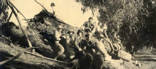
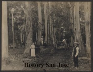
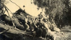
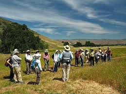
197812780Evergreen being popularized by books and newspapers, hiking groups would come to experience eucalyptus trees imported from Australia, giant oaks, scenic hillsides and natural creek life.  Evergreen would come to light through its fruit exports and famed residents.
images7Truth is beyond the suburban developments in Evergreen, there are still vacation spots with stunning vistas and hiking destinations.  Evergreen is still at the City’s edge and full of rural beauties, if you know where to look.
P1300662Also, there are still wealthy families who consider Evergreen their vacation destination.  These large ranches end up being a link to the past traditions of their families and our Evergreen.


Evergreen School District Growth

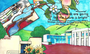
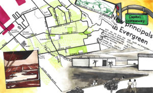
1960 planningSo, how did Evergreen turn from rural farming country to suburban gold?  When did that happen?  I can see it paralleled in the expansion of the Evergreen School District.  To the right is the artwork which symbolizes this change in Evergreen’s history.

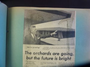
P1310885The Evergreen Community took on huge amounts of new residents as City Planning policies changed in the 1950’s.  A. P. “Dutch” Hamann was City Manager from 1950-1969.  At the time, Evergreen School District had one school, the schoolhouse, which then moved and is now off Fowler Road.  Evergreen would operate out of a single school for over 100 years.

P1310589Dutch Hamann would focus first on upgrades that made new development and expansion possible, then focus on incorporating or annexing large portions of land which hadn’t been before.  This was driven by a competition with neighboring cities.  Dutch wanted San Jose to be the largest city around.  Hamann’s City staffers executed 1377 annexations through his tenure.  Freeways and government services would rapidly expand throughout the new sections.  After moving from Monterey Road and downtown San Jose, Highway 101 would be completed through Evergreen and San Jose in 1959.

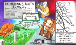
165) Kathrine SmithDuring this time, Evergreen, the District, outgrew the Evergreen Elementary School campus with Superintendent George V. Leyva.  K.R. Smith Elementary School would open its doors in 1962.  Katie Smith, one time teacher and superintendent would live to see the school opened in her honor at the age of 92.

1220710745410.jpg_w900In 1965, O. B. Whaley would open, being named after a well-respected orchardist and longstanding member of the Schools’ Board of Trustees.  Cadwallader Elementary would open the very next year, named after the gentleman who donated land to the WRC and the original school house.  Holly Oak would open the following year.  From 1962-1967, Evergreen School District would grow from two schools to five schools.

1-laurel-woods-elementary-schoolP1310940Evergreen didn’t stop expanding here.  As neighborhoods were built, schools were also constructed.  Evergreen School District continued growing with the opening of Laurelwood Elementary School and the District’s first Middle School, Quimby Oak, in 1968.  Quimby refers to J. A. Quimby, 1870’s Evergreen landowner and one time San Jose Mayor.

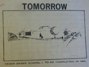
P13109021969 would see Cedar Grove Elementary School opened and is scheduled for a major update coming soon.  From 1960-1970, Evergreen School District would go from one school to eight.  The Evergreen Community would also have its first high school built, Silver Creek High School in 1969.  It would be East San Jose’s third High School.  Before, Evergreen teens would go to James Lick High School or Andrew Hill High School.

P1310879Dutch Hamann would leave City Hall in 1969, making room for anti-development candidates.  This, too, meant the rural Evergreen community would take a little breather from the expansion.  Farmers were being bought out by home developers, because the land was more valuable than the crop.  With all these new Elementary Schools being built, however, one Middle School wouldn’t do it for Evergreen’s growing young ones. Evergreen would open George V. LeyVa Middle School, named after the previous Superintendent.  George LeyVa would have a heart attack at 57.

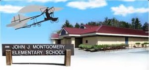
images92JJUXZ6With anti-development candidates in office and Mayor Norman Mineta at the helm of San Jose’s City Planning, schools would be opened to serve the newer developments while efforts would be made to preserve open space and farm land.  John J. Montgomery Elementary School would open in 1975, named after the pioneer aviator.

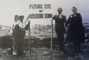
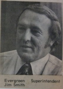
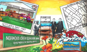
dove_hillP1310926One-time Evergreen teacher, principal, and then Superintendent, Jim Smith would also see the opening of several Evergreen Schools.  In 1981, Norwood Creek Elementary School would be opened.  Evergreen School District would continuing growth but at a more comfortable pace.  Millbrook Elementary School would open in 1985, and Dove Hill in 1988.  Again, a new Middle School would be added to the Evergreen School District’s portfolio with Chaboya Middle School in 1991.

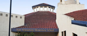
Silver%20OakTom-Matsumoto-ElementarySilver Oak Elementary School would be built alongside Silver Creek Country Club in 1994.  Tom Matsumoto Elementary School would open its doors in 1998 with the new construction of the Evergreen Village Square.

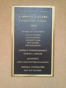
P1310861CAM09877James F. Smith Elementary School would open in the Superintendent’s honor in 2000, as the Ranch Country Club was being constructed.  I look forward to a sit down with the former Superintendent to discuss the pattern of growth studied in this article.  Carolyn Clark Elementary would open with the Mirassou vineyard developed into new homes in 2004 and as Evergreen Village Square townhome development continued.  Bull Dog Tech would branch off from LeyVa Middle School in 2014, providing a more technical education.

image001There’s now discussion of a much needed Elementary School in the Meadow Faire neighborhood between LeyVa Middle School and Eastridge Mall.  The best way I found to describe how Evergreen, the Community, grew up is through the History of School District.  I could track the land purchases and sales, but if you don’t know all of their names, this is clearer.  Schools would be implemented where construction was taken place or where communities in rural Evergreen had already development.  Dutch Hamann’s Planning policies meant a swift expansion from 1960-1970 and Eastside San Jose’s third high school in Evergreen.  A rate of growth within the Evergreen Elementary School District can be measured from 1970-present which is steady, necessary and likewise communicative of when the neighborhood was really established.  The Evergreen School served 47 children in 1887.  The District served 13,126 students in 2013-14.

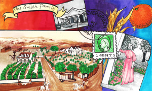
Furthermore, education and the Evergreen School District is a redundant theme throughout this artwork.  Schools are symbols of their neighborhoods and indicators of their timeframe, as just discussed.  Here are the pieces dedicated to the Evergreen Elementary School District.

1860 1962 1969 1975 1985 1992 2003


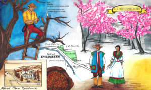
Alfred Chew’s Residence

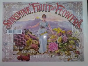
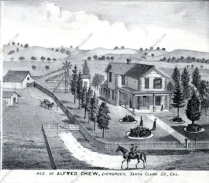
J.E. Brown, Theodore Lenzen Residence, Geo. H. Briggs, J.E. Ruc000000The people and places featured in books and publications back in the 1800’s were highly regarded as well as some of the only glimpses into other places at the time.  Alfred Chew was made popular by the Thompson and West Altas published in 1876.  Print was a limited medium, but made the exchange of information possible.  Tales of the Western Frontier being tamed were becoming public knowledge as fruit, dried and canned, would reach the East Coast from Santa Clara Valley.  The building of railroads brought many people to California through and after the Gold Rush, but also made the export of fruit and curiosity a real commodity.

mapImages of Santa Clara Valley were published for the whole world to delight in, along with our bountiful produce in the Valley of Heart’s Delight.  This would’ve also served as a tourism guide of landmarks to see when visiting the area.   Evergreen and Silver Creek were located in the Rancho Yerba Buena Survey, eventually becoming the whole of Evergreen.  The associated map for the above photo is to the right, from Thompson and West’s 1876 Atlas with Alfred Chew’s residence featured.  Fitting, the Survey of mention is in green.

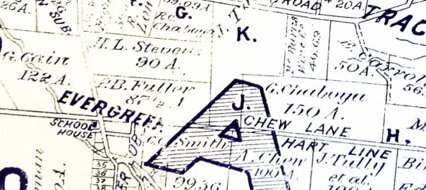
P1310192As you can see from this 1890 map to the left, before the turn of the century, Aborn Road was known as Evergreen Road west of White Road and San Felipe Road.  To the East of San Felipe Road, the heavily driven Evergreen artery Aborn Road was known as Chew Lane.   The Chew property is also featured here in the 1890 map at the top right corner along Chew Lane.  That got me chewing on who Alfred Chew was.

caMr. Alfred Chew (1834-1910) would do a little traveling from his Ohio home front before settling down.  Young Alfred would come with his parents, Morris Rees Chew and Mathilda Crumley, to live in Illinois before traveling West on his own.  In 1853, Alfred Chew would start his journey West with the Kirkpatrick Company, headed for Oregon and making the most out of getting lost at the Missouri River.  Kirkpatrick didn’t immediately arrive in Oregon that time.  Before becoming a farmer in Evergreen, Alfred would meander South into California.  We know about Mr. Alfred Chew for his leadership in early California Statehood in different areas of the State.  Alfred Chew would run cattle through Gilroy before he would suffer from typhoid fever.  Before returning home to Illinois in 1860, Mr. Alfred Chew would pursue government posts, and surely a different type of occupation than he had before.  He was the US Deputy Surveyor for San Luis Obispo County in the late 1850’s.  Alfred Chew would return to Illinois and marry Margaret Kennedy, returning to Evergreen with his new bride.

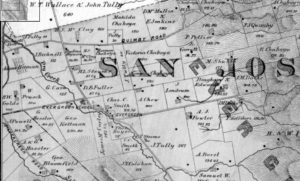
0000001876 MapAlfred Chew would come to Evergreen and begin farming in 1860 3 miles outside of Evergreen.  Alfred Chew would take his year’s profits and purchase a portion of attorney William Matthew’s property near downtown Evergreen in 1861, which was granted to him in exchange for legal services from the Chaboya vs. Squatters battle in years prior.  This 1896 map shows no road where Chew Lane and now Aborn Road exists.  Evergreen literally grew up with and around the Chew Family homestead.  This is a black and white close up of the 1876 Thompson and West Altas with Chew’s property under “SAN”, before the road in his name was created.  He would’ve moved in right next door to Charles Smith and Genrio Chaboya as one of the first residents of Evergreen.

ls1After his winfall year farming 200 acres 3 miles outside of Evergreen in 1859, Chew would buy 100 acres of his own and build his home in downtown Evergreen.  He would raise 7 children with wife Margaret, Mamie.  They would’ve gone to the Evergreen Schoolhouse.  Mr. Alfred Chew would return to civil service, elected to the Board of County Supervisors in 1873.  He would serve on the Board from 1874-1878.  Chew would also serve in Santa Clara County’s Assessor’s Office into the early 1900’s.  Both his wife, Mamie, and his daughter, Emily Ann or Emma, would teach at the Evergreen Schoolhouse down the street from his downtown Evergreen house.  Emma would also marry into the well-known, well liked Hostetter Family, who found their way to Santa Clara County with the Evergreen Farnsworth family guardians.  Over the 50 years Alfred lived in Evergreen, Chew’s neighbors would sell their large downtown Evergreen farms away to make room for subdivision housing.  Evergreen would continue to grow in population.  Chew’s farm had a very different fate.

Mr. Alfred Chew’s Obituary would read “PROMINENT SAN JOSE ORCHARDIST IS DEAD Alfred Chew,” County Treasury Watchdog Passes Away SAN JOSE, Calif.  Jan. 2. — Alfred Chew, for 33 years the “watchdog of the county treasury” and one of the most prominent orchardists of the county, died late last evening; at his home near Evergreen at the age of 75 years. For nearly half a century he had served the community as supervisor and deputy assessor or deputy tax collector.  He is survived by seven children… ”

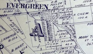
P1310203 (1)The Chew children would continue to live in and work on the Evergreen farm on Chew Lane.  Chew’s reputation and leadership in the early days of Evergreen was the reason its main artery was name after him over a hundred years ago.  You can see it crossing the “A” in this 1902 map along the Hart Line.

P1310198As you can see from the 1911 map to the left, this was the time Evergreen Road and Chew Lane became one Aborn Road.  John Aborn, another revered Evergreen character, was a local pioneer figure from before Alfred Chew’s time in Evergreen who fought for farmers with the Chaboya Family, making the town of Evergreen possible.  I wonder how his family must’ve felt about the renaming.  Regardless of how Alfred Chew would’ve felt about the change of the street’s name, he would never have witnessed the change of address.  The Chew Estate would stay in the family for a short while longer, all married and established, and the Chew family would move out of Evergreen in the 1910’s with Mamie’s passing.

MirassouWinerylogoP1310098Shortly after the Chews’ death and Aborn Road’s creation, the original 100 acres purchased from William Matthews in 1861 would be sold to another famed Evergreen family, the Mirassous.  Henriette Pellier would marry Mr. Mirassou, see her family carry on the tradition of winemaking and move the winery operations from Pellier Ranch off Quimby and Chaboya Road in 1911 to the Chew property off of Chew Lane.  There, the Mirassou family would have its famed vineyards and historic tasting room on Aborn Road for almost 100 years.

1866Through this artwork we’re trying to explain the transition from Native wilderness, to Mexican cow pastures to American homesteads.  The artwork that features Mr. Alfred Chew’s residence from 1876, though certainly built in the 1860’s, is a piece that tries to do just that.  Farmers moving into Evergreen would breathe new life into the ever green hills.  Leaders like Chew would shape a developing area and Evergreen’s identity to the rest of the Country.  It’s important to know who Chew was in Evergreen’s narrative.


Evergreen School House Rocks

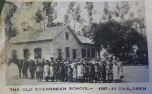
image001 The Evergreen Schoolhouse opened in 1860.  There were enough Chaboyas, both European and American homesteaders and rancheros families to open up a school in Rancho Yerba Buena.  It would be incorporated into the Santa Clara County Education system in 1866 as the township became more established.

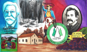
markhamFamed author Edwin Markham (1852-1940) would come to Evergreen Schoolhouse to teach in its early days after attending San Jose State University.  Teaching in Evergreen from 1969-89, he would recall the days of a single story school house, replaced by a larger two-story one.  A nearby redwood tree was planted in his honor after teaching there for twenty years, which I intend to find if it’s still around.  The Redwood would be over 100 years old now.  It is said the Evergreen helps inspire some of Markham’s work.  The commemorative redwood tree also might be the inspiration of the Evergreen trees in the School District’s logo.

P1310885In general, the School’s schedule would sync up with the fruit picking seasons and operate 10 months a year.  They insisted on keeping the school free to the public and secular from its inception.  My old time interviewees would recall the school house at the corner or San Felipe/White Road and Aborn Road, then Evergreen Road.  That may seem odd now, but it would’ve been located there the shopping center and Valero gas station stands today.  The land was donated by Mr. Nirum Cadwallader, who also donated the same amount of land to the WCR some years later, and upheld the donation by William Matthews in the transaction to Geo. Kettmann.  Education has been something Evergreen residents have felt strongly about since the town began.  The Schoolhouse had been there on Evergreen Road, now Aborn, since the 1860.  I think it’s so cool that today’s well-known creek crossings would’ve been somebody else’s path to school 150 years ago.

165) Kathrine Smithls1Katherine R. Smith (1870-1973), daughter of town leader and postmaster Francis J. Smith, would come back to Evergreen schoolhouse after being one of the first women to graduate from San Jose State University and teach down the street from her house.  The school house would remain there for a long time.  Katie is huge part of Evergreen History.

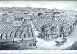
Charles C. Smith, F.J. Smith Store and Residence, Adam Herman,The two-story school house would be moved by rolling it over logs down the street on San Felipe Road and Yerba Buena Ave. during the 1950’s.  This is when San Felipe would’ve changed directions and Keaton Loop created.  Post World War and new City Planning developing in effect, Evergreen’s update began with this major move.  It also helps explain why this view of the Smith homes feels incorrect. From the drawing, the road now runs between the houses and business, and this driveway between them is essentially Yerba Buena Avenue.  Directly next to this road would’ve been Dry Creek, now known as Thompson Creek.  The Schoolhouse would come to stand where the General Store and Winery are.

P1310652That’s right, the schoolhouse moved across the street from Katherine’s House.  How rad is that?  Katherine, Katie, would become Superintendent of the Evergreen Elementary School District, watch the school outgrow this two-story facility and move to Fowler Road before expanding with new schools.  The Evergreen School is where Evergreen Elementary School is today.  Katie would live to be 103 years old and known as the Daughter of Evergreen.  As a staple of the Evergreen Community and a beloved educator, it only seems appropriate to name Evergreen’s second school in her honor in 1962.

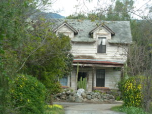
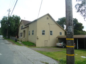
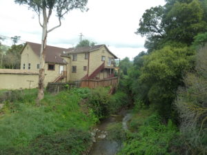
P1310650This two-story school house still stands today, or at least that’s what I had heard from fellow Evergreenians.  I did some digging.  I found what stands where the schoolhouse was last seen.  There is this odd, adobe looking, older apartment building, called the Chaboya Apartments, standing there now at the intersection of San Felipe Road and Yerba Buena Avenue.

P1310647What I was not understanding or seeing before was that the Evergreen Schoolhouse does still stand, but with the addition to the original building disguising it.  I took a closer look at what was there and found the Schoolhouse I was looking for hidden in plain sight!  I find it here farthest to the right in the picture to the right.  It would be naturally to extend evenly in each direction, but you’re pretty limited in repurposing a building with a creek in your backyard.  To say it’s gotten some body work would be an understatement, but that’s it with the stairs leading up to it.  Only the front got the more modern adobe facelift.

It’s an incredible finding as the Evergreen Elementary School District is an ally of The Evergreen Mural Walk project, as well as a source of its inspiration.  Education is something we’d like to focus on here in Evergreen and that strength came from within in many instances.  Katie is one of those inner strengths.  The students still living having used this facility are still a connected family here in Evergreen.  Here’s some of the artwork inspired by the early days of the Evergreen Elementary School District.

18701860


Wehner Mansion – a house by many names

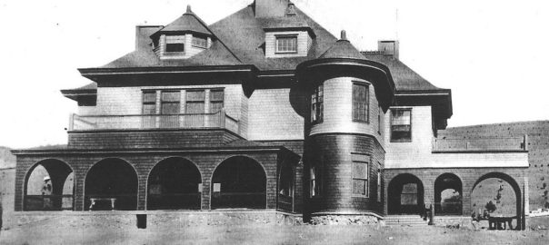
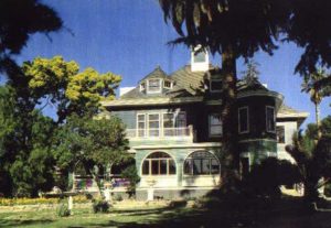
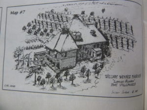
Sadly, lomasazulesthere are only a few original structures left from Evergreen’s early days.  There aren’t Victorian homes standing like there are downtown.  The old timers know the old town by the hundreds year old oak trees that marked their old homes.  These relics from the 1800’s are obscured by trees and fences for the most part.  This one is tucked back into the hills of the Villages Retirement Community, empty and unused.  The absence of warmth to this one time brimming mansion is one of the sadder things I witness in Evergreen.  Personally, I would love to it restored in time for my own wedding.  This is the Wehner Mansion, but over time, it’s had many names.

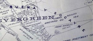
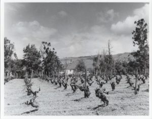
Heritage Room azules.pdfThe initial 718 acre property would be purchased in 1887 for $20,000 from Mr. McCarthy and construction would begin the following year.  Built by German immigrant, William Wehner, it was originally named the Villa Lomas Azules or Blue Hills Estate for its stunning color.  It is only fitting that Wehner’s house be colorful.  William Wehner (1853-1916), after coming to the United States from Hanover, Germany in the 1850’s, would be a famous Chicago painter, painting large scale panoramic paintings commemorating the Civil War.  His Evergreen home would became a winery as Wehner planted 175 acres of vineyards within a couple years.  William Wehner’s White Wines were award winning in 1888 and into the 1890’s.  Wehner would come to own and plant over 3000 acres of vineyards.

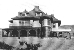
5985327859_3f314741f2_bThe Blue Estate or Villa Lomas Azules was a 3-story, Queen Anne style home built into the hillside.  The construction on the mansion was finally complete in 1891.  It was built by famous Chicago skyscraper builders from the firm of Burham and Root, designed by Richard Burham.  It would be the only home the firm ever designed.  The Mansion’s main architectural feature was its archway entrance for carriages along the bottom floor, but I love all the rounded features.  The Mansion also has a full basement, which later became wine storage.  The Blue Estate had an outdoor kitchen and a garden house, as well as a winery added in 1908.

P1310186 (2)In 1915, Wehner would sell the winery and vineyard portion of the estate to Albert Haentze.  The two men had a lot in common.  Haentze (1896-1947) was another German immigrant vintner from Chicago.  His main occupation before coming to California was a mortgage broker.  Haentze came to Evergreen and bought Wehner’s vineyard.  Mr. Albert Haentze would become the leader of the Santa Clara Valley Grape Growers Association until Prohibition.  Haentze renamed the winery Rancho Villa Vista.  William Wehner sold his vineyards in the knick of time.  Prohibition closed down the Evergreen wineries in 1918 and Wehner passed away only a year later.  The Santa Clara Valley Grape Growers would then consider canning grapes and crushing grapes for juices and syrup.

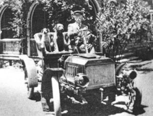
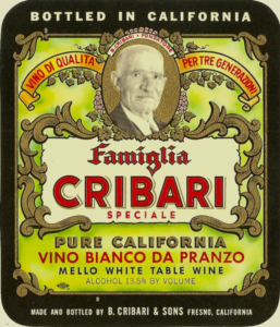
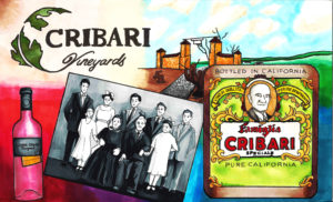
housevin-villagesIn 1933, Italian born, Benjamino Cribari (1859-1942) would purchase the first portion of the Villa Lomas Azules.   With Prohibition having been lifted, the Italian immigrant would raise his vineyards for altar and traditional table wines.  In 1940, the Cribari family would come to own the rest of the property.  It would then be known as the Cribari Mansion.

cribari1Benjamino Cribari, born in the Calabria, Italy, would come to the United States at the age of 29.  With his wife and two small kids in Italy, Benjamino would work on the railroad for a couple years before returning home to his family.  In 1902, the young Cribari family would relocate to Colorado and then California, where they bought 40 acres of land east of Morgan Hill.  At first, Benjamino, a farmer, would only sell wines to his friends and family before he needed to acquire more land to compete with his growing demand for Italian style wines.

The Cribari Wineries would move operations back to Morgan Hill in 1959.  The Blue Estate’s future became unclear.

P1310098In the meantime, the Mirassou Family vintners would come to lease the property.  They would rent the independent winery for winemaking and the full basement for storage.  The oldest winemaking family in America would use the historic facilities until its historic operations also had to relocate in the 1980’s.

P1320410The Evergreen wineries were being pushed out by development and a growing suburb.  Several developers purchased the property before the Villages were finally built around it.  The Historic value of the Victorian mansion is recognized by the condition of the home is quite questionable.  There’s much discussion about preserving the historic home, but the fruits of those discussions are yet to ripen.  It’s a beautiful piece of Evergreen’s history and someday, we’ll see the Blue Estate shine again.

Here’s our artwork which features the Wehner Mansion.

1940 1885