Tag Archives: Chaboya

Quimby Road – History


thumb200ca
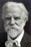
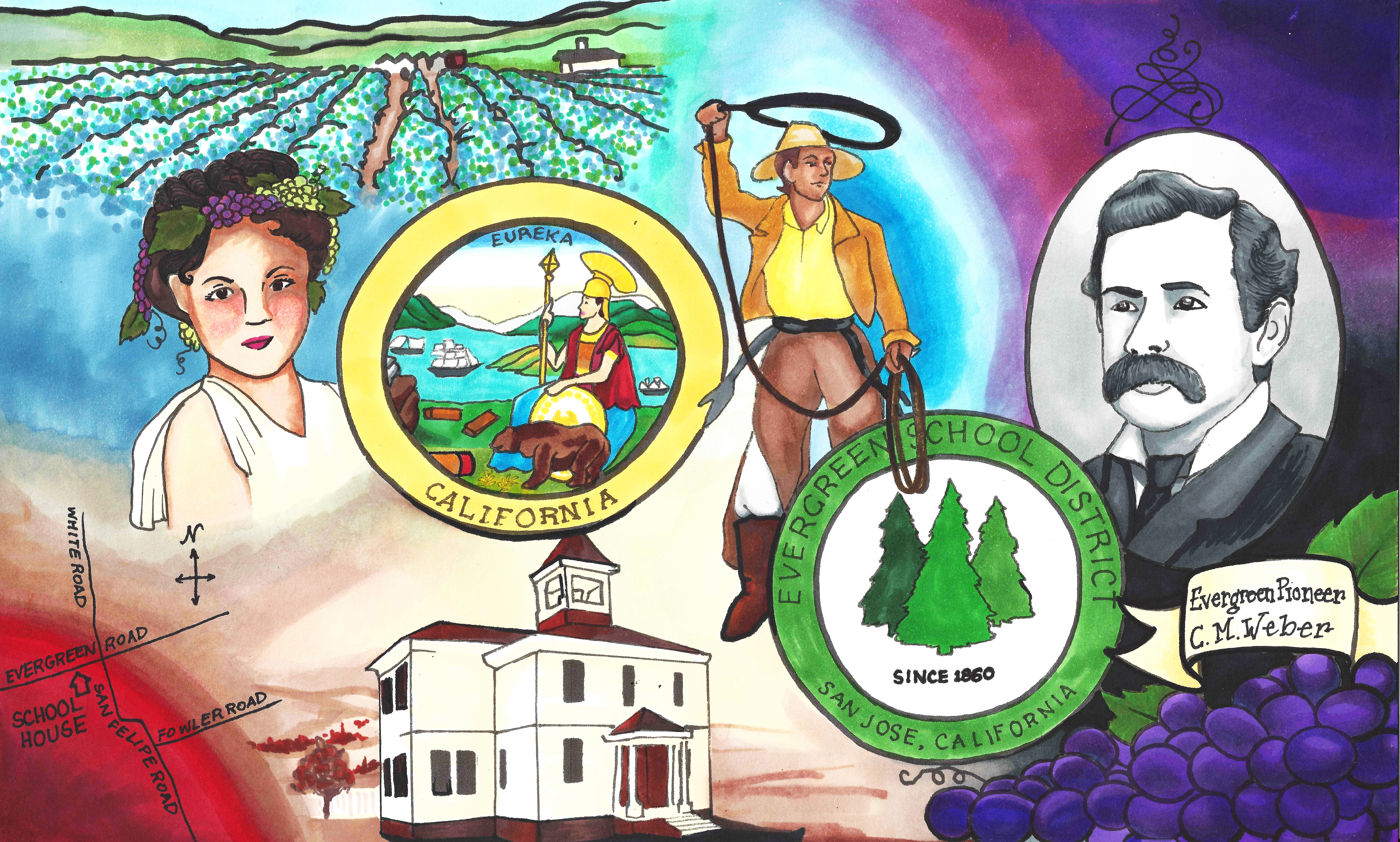
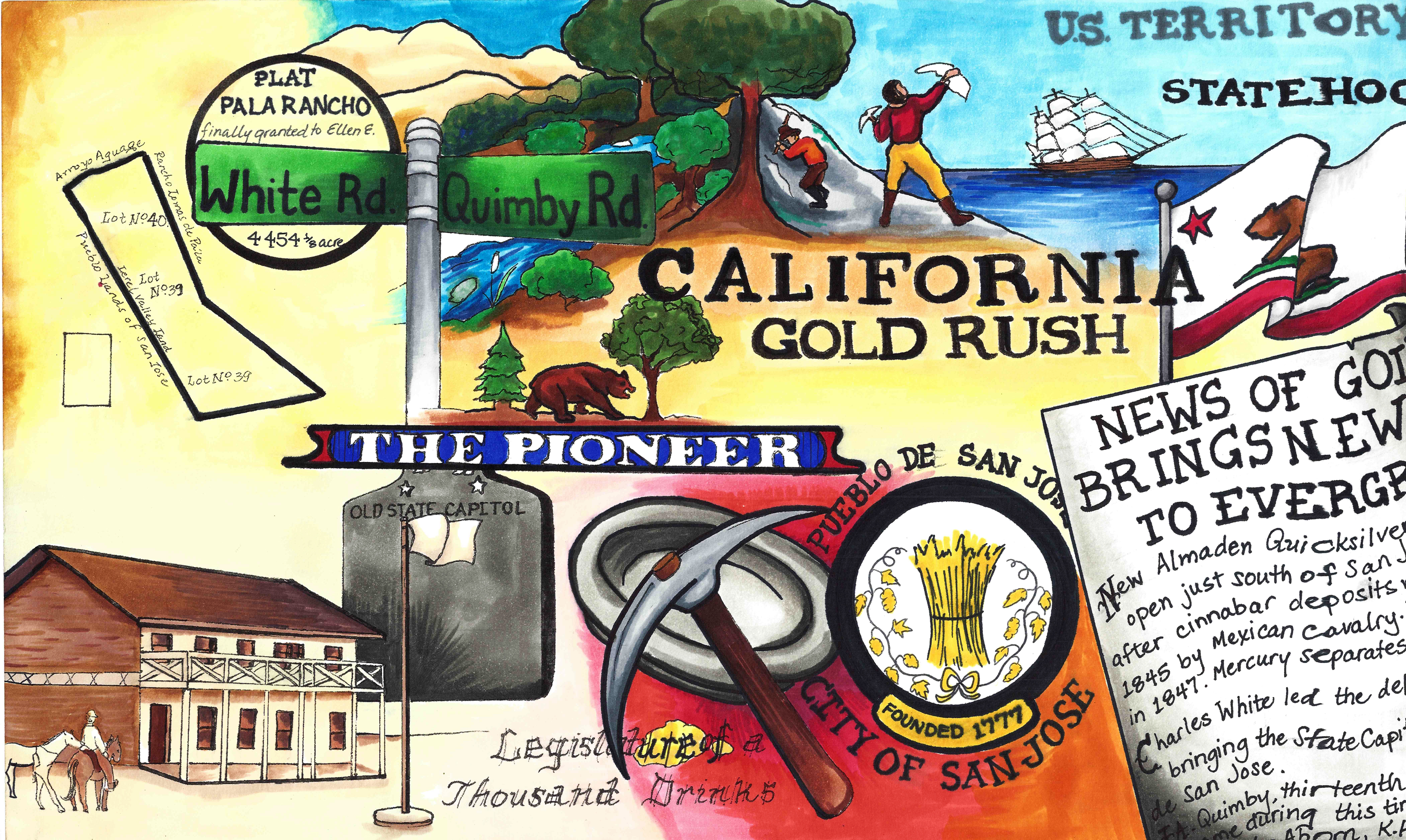
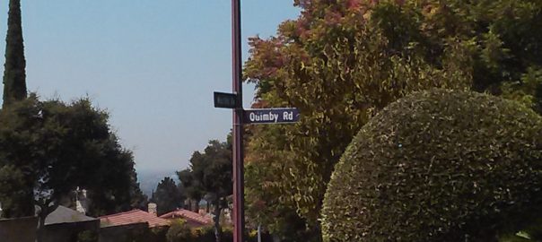
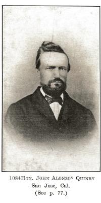
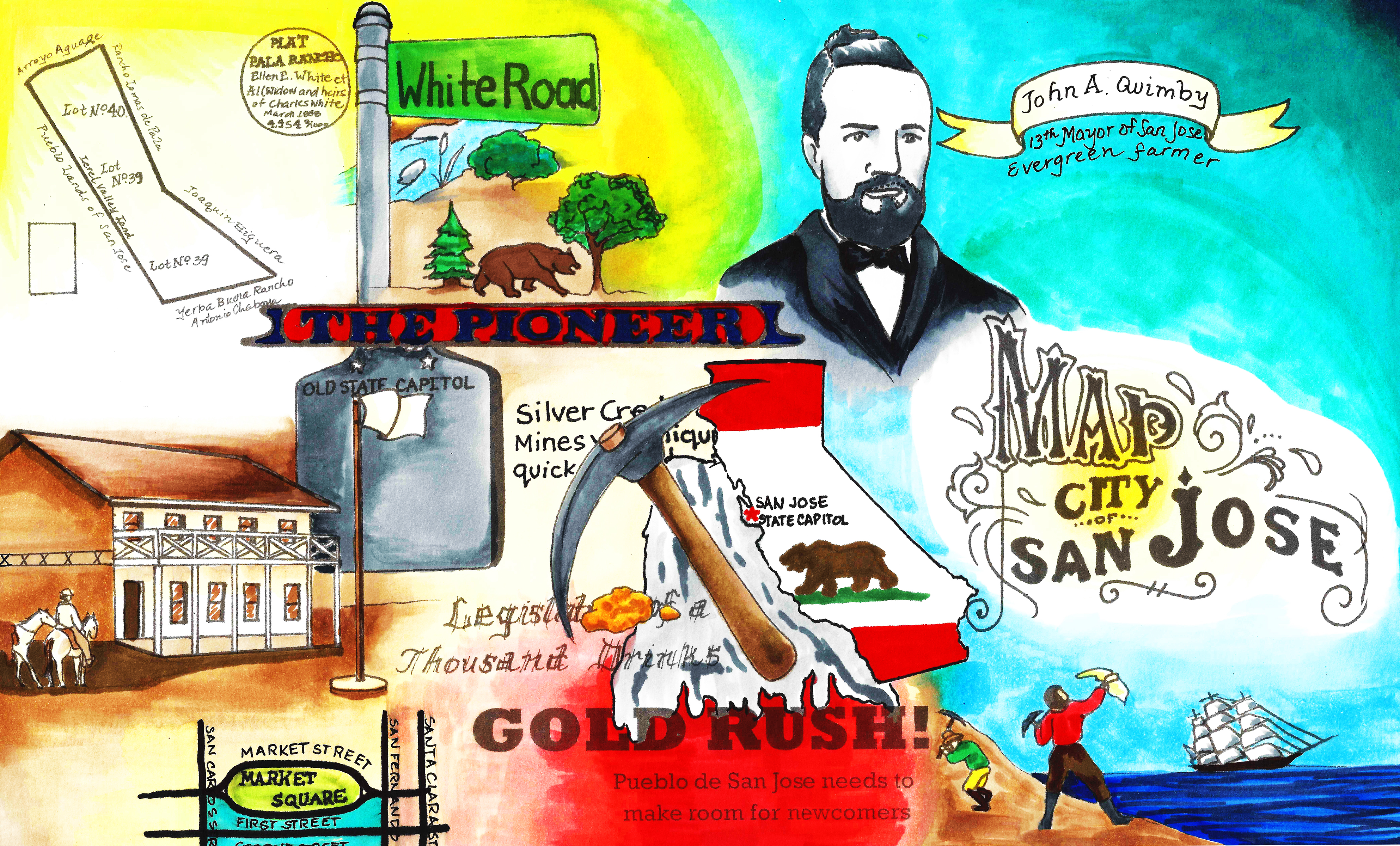
Quimby Road, from its 1860’s creation, has been an artery into the town of Evergreen, intersecting with historic White Road and King Road for over 150 years now.  We’ve discussed previously in Evergreen Mural Walk’s blog Evergreen’s Own Mayor Quimby.  John Alonzo Quimby, San Jose Mayor, is indeed the roadway’s namesake, whose second home outside of downtown was here in Evergreen in the 1860’s.  Quimby Road on our Best Drives List, however, is host to many powerful stories and breathtaking vistas.

P1310216 (2)

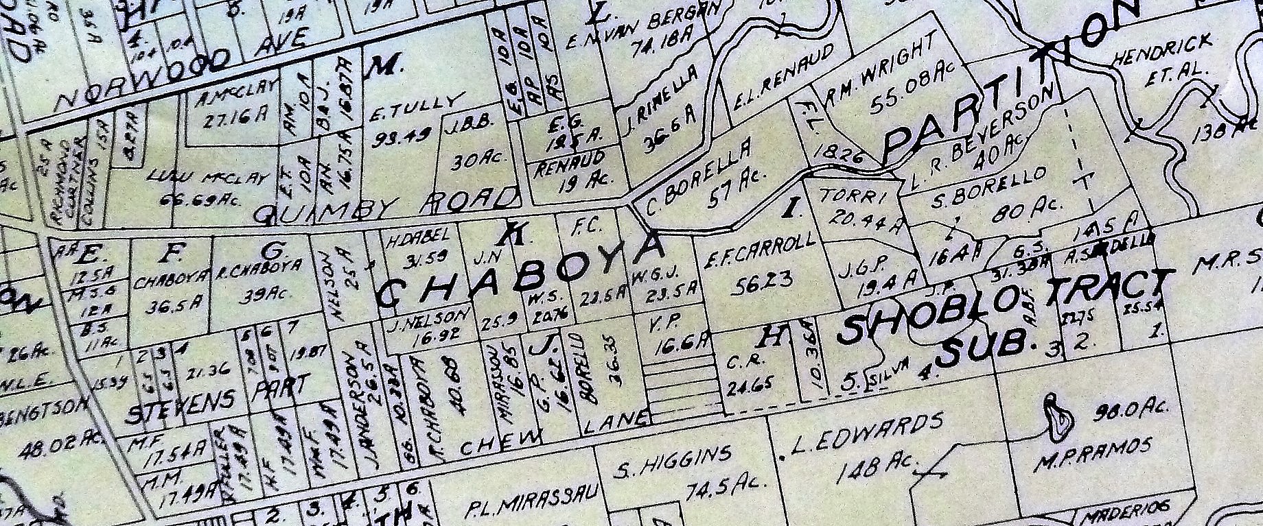
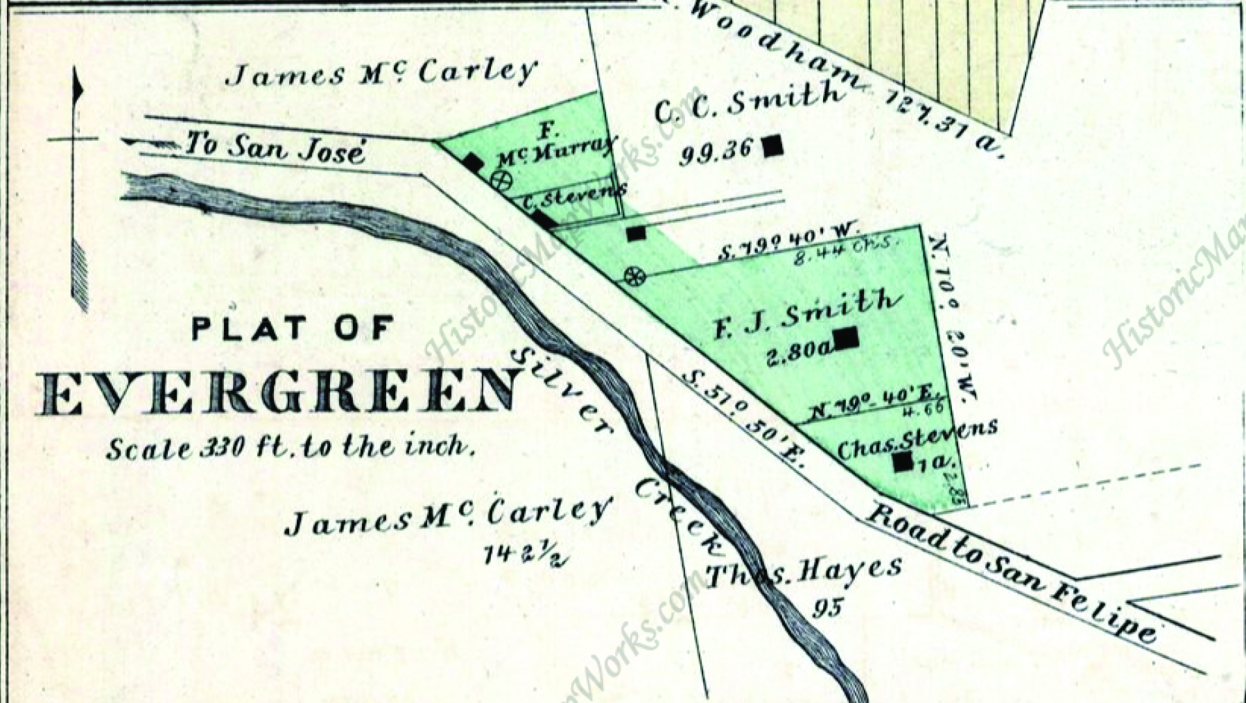
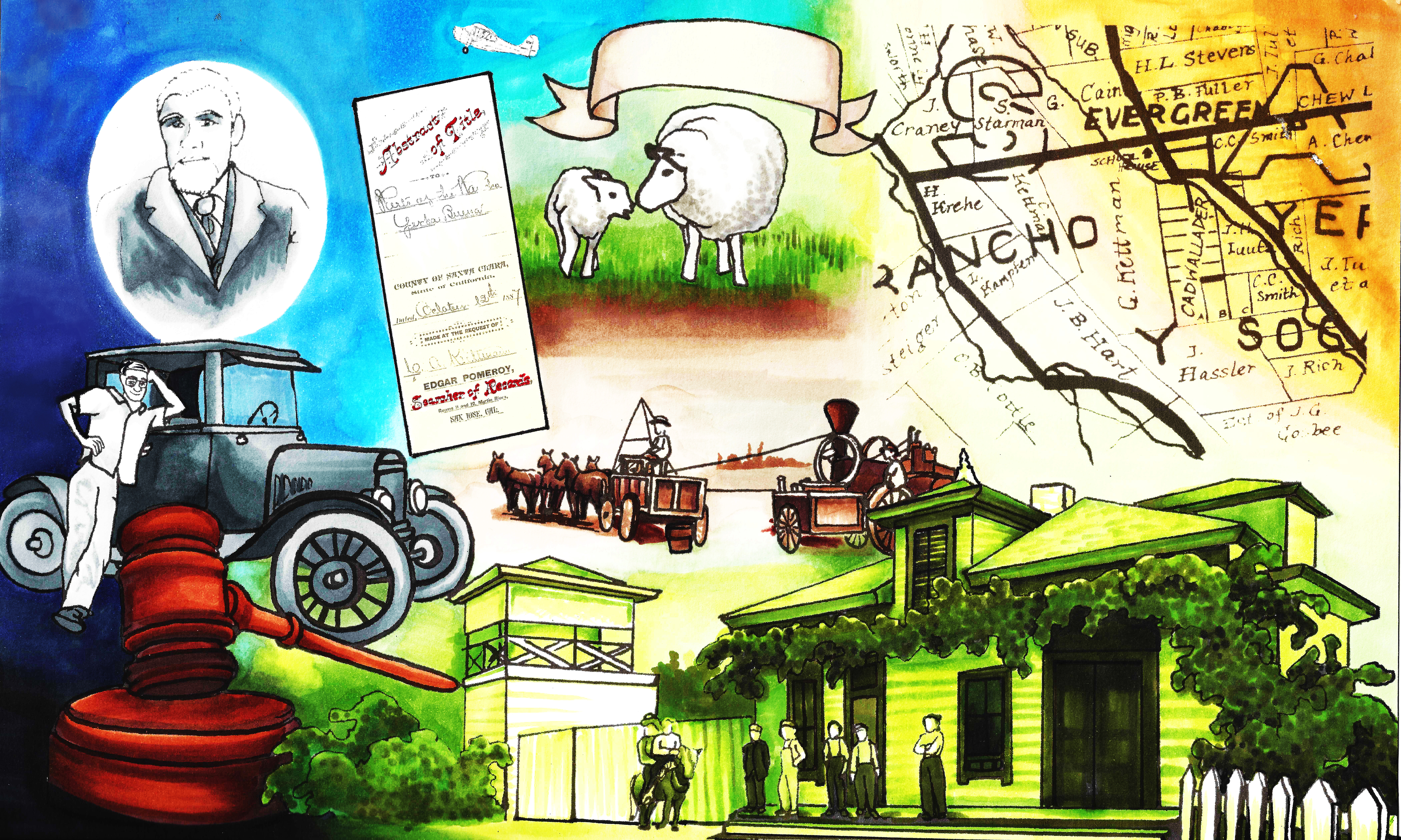
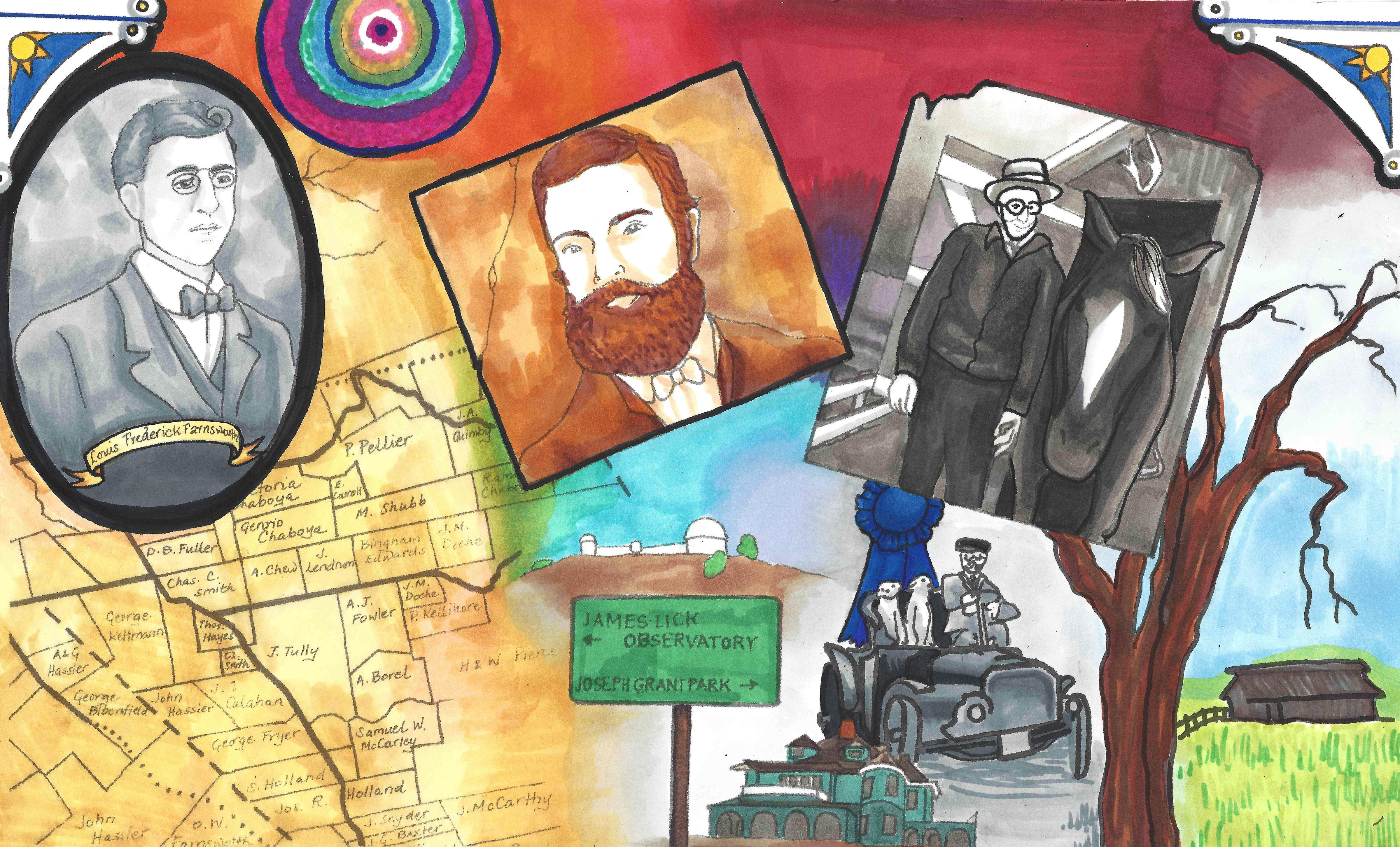
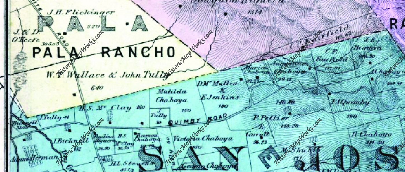
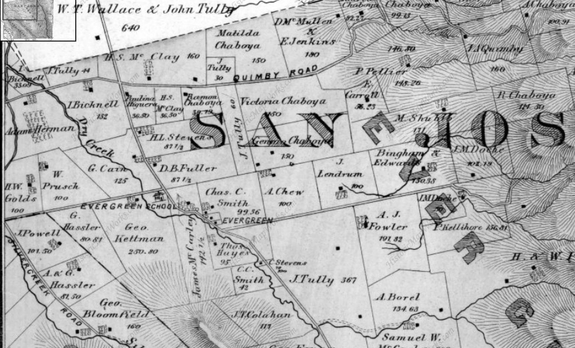
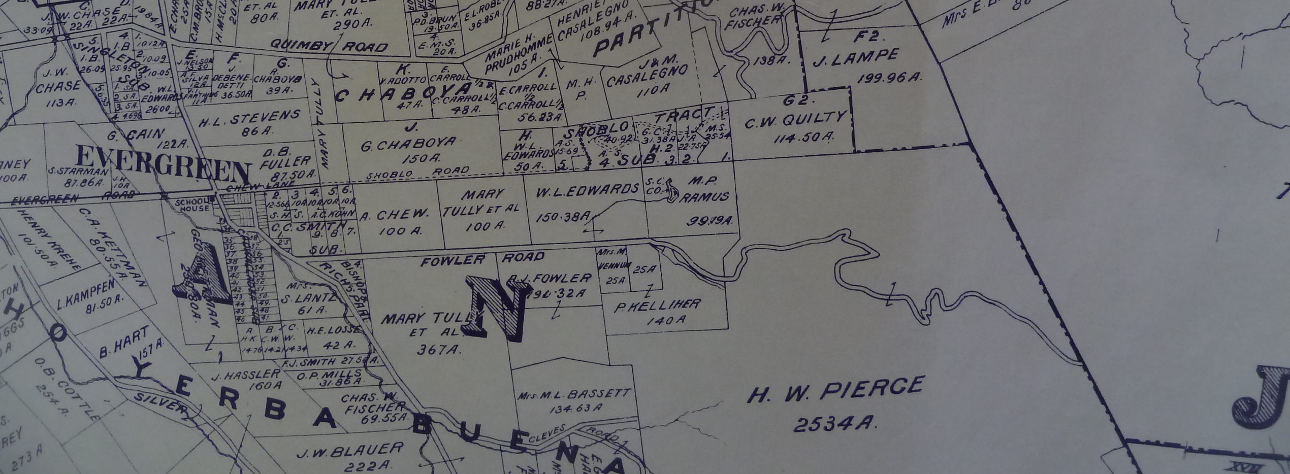
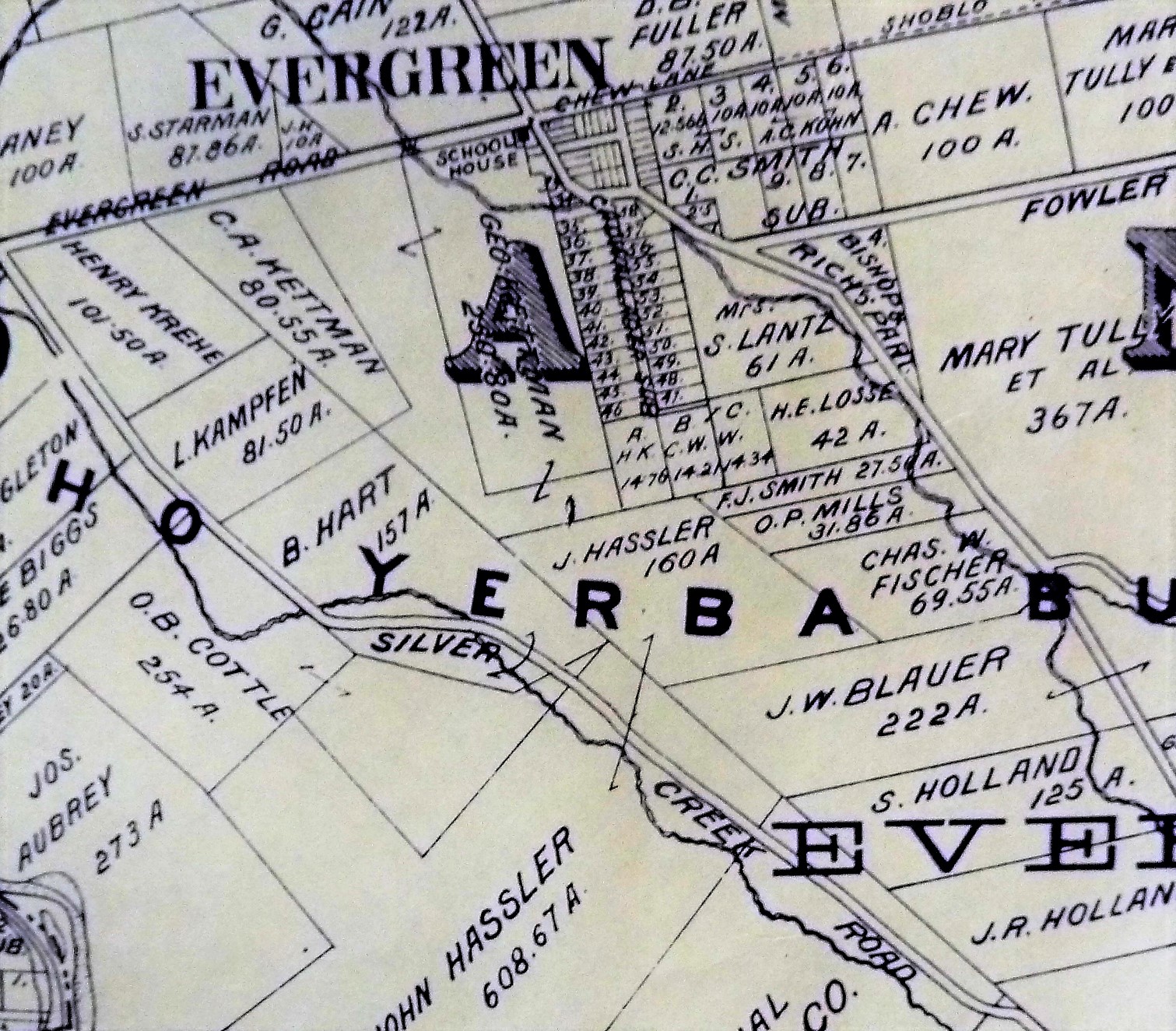
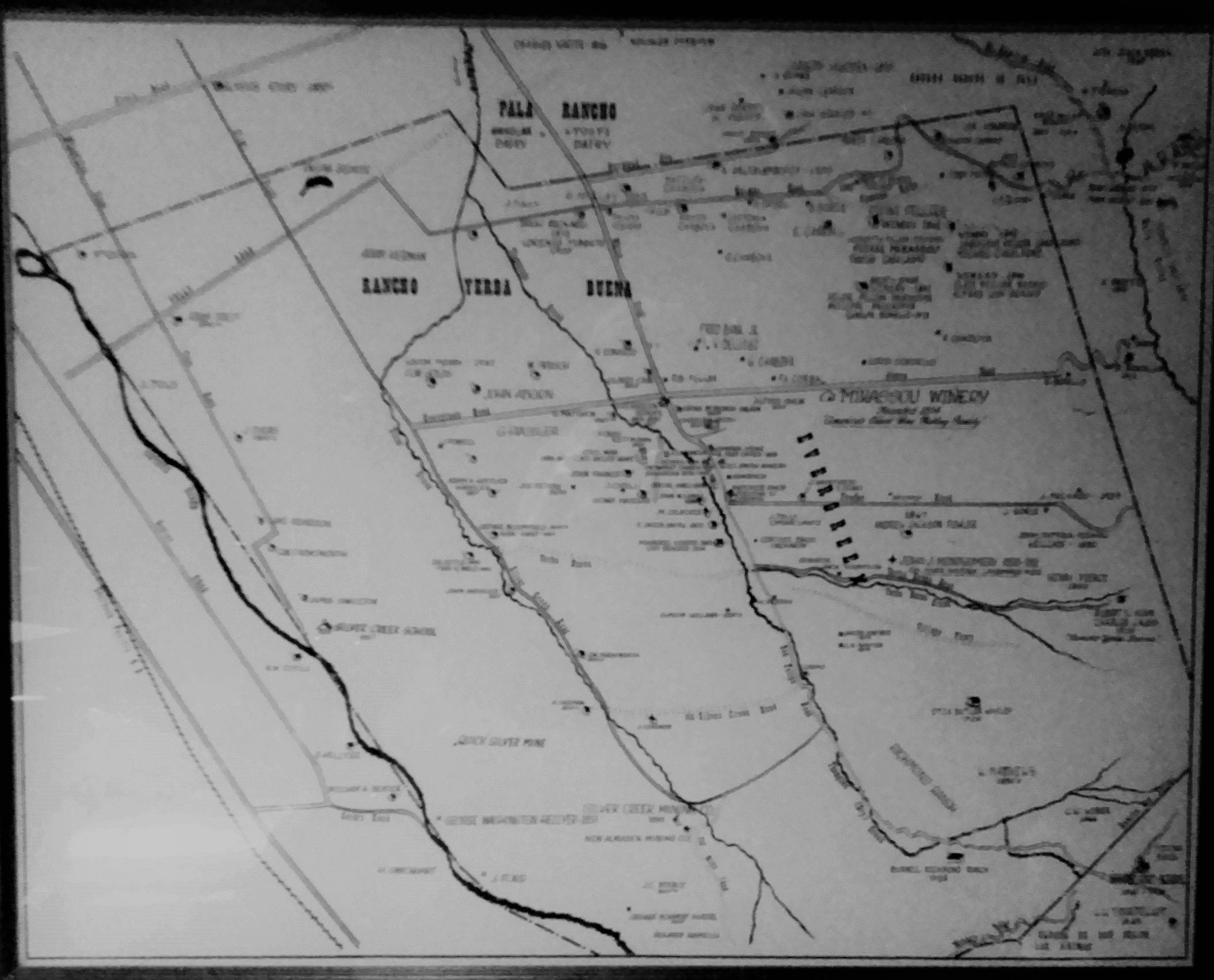
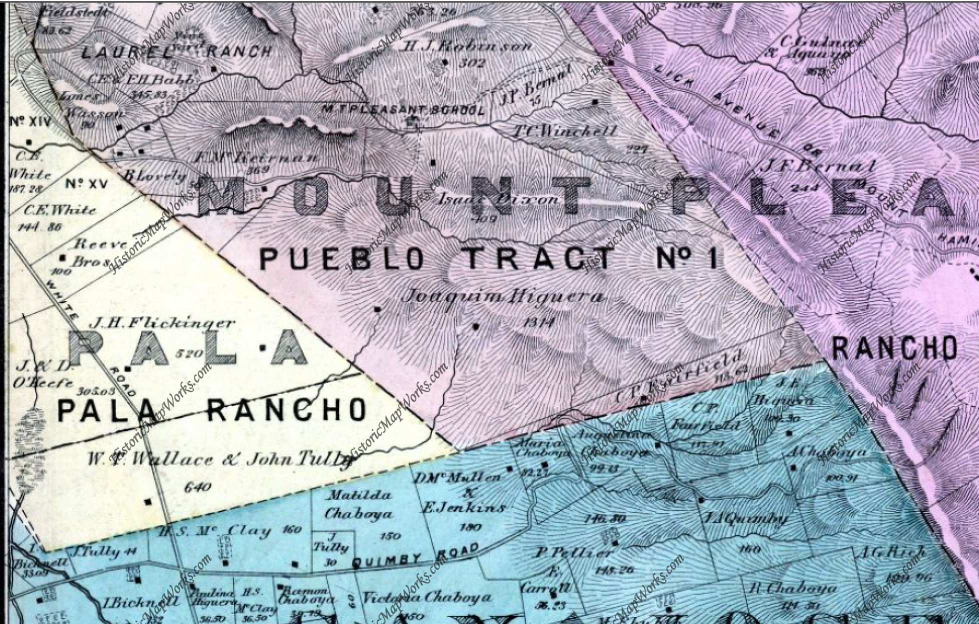
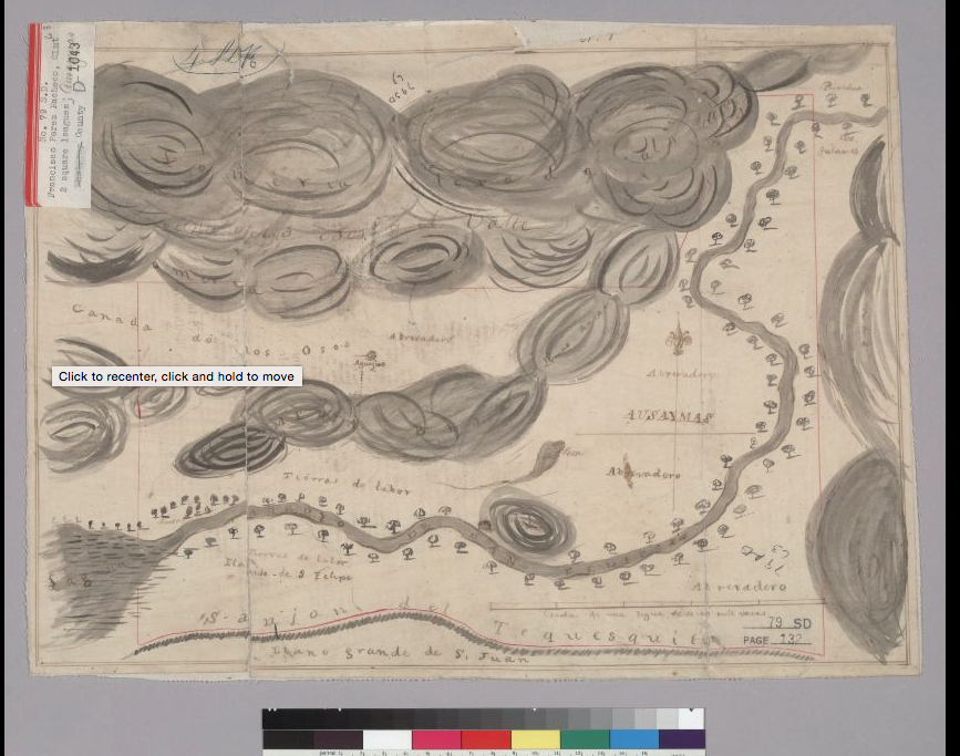
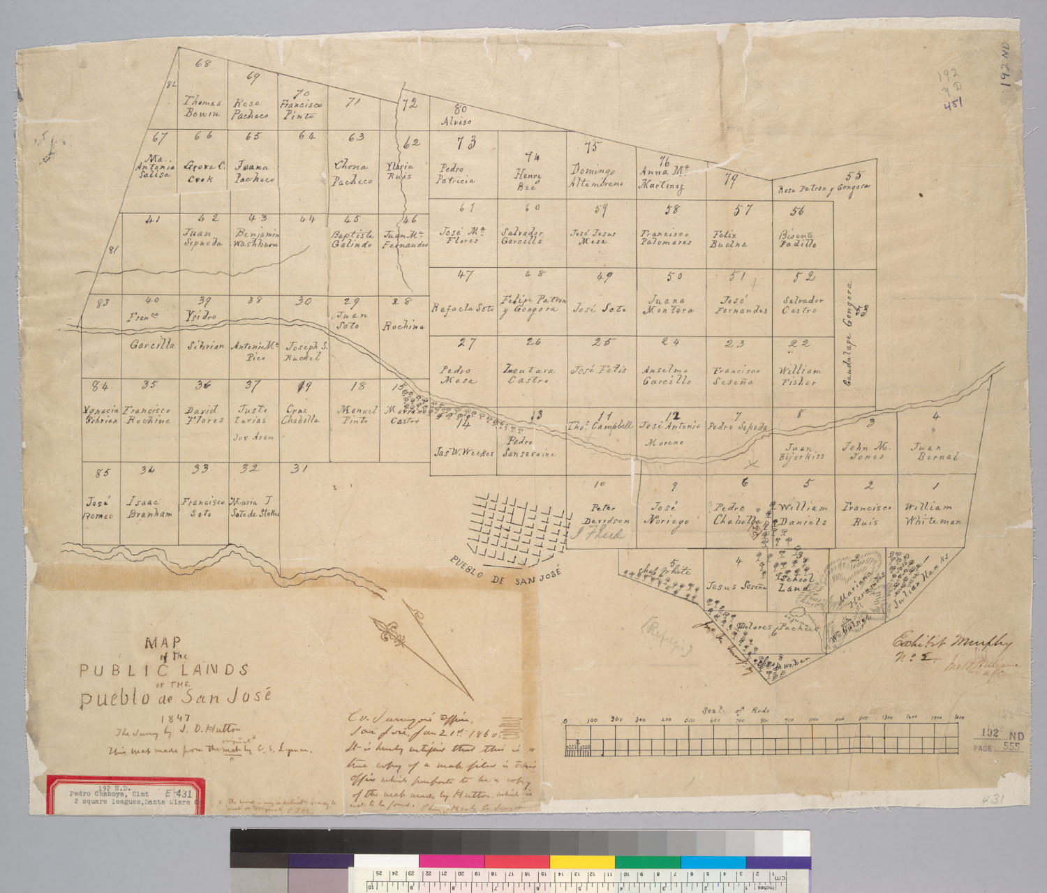
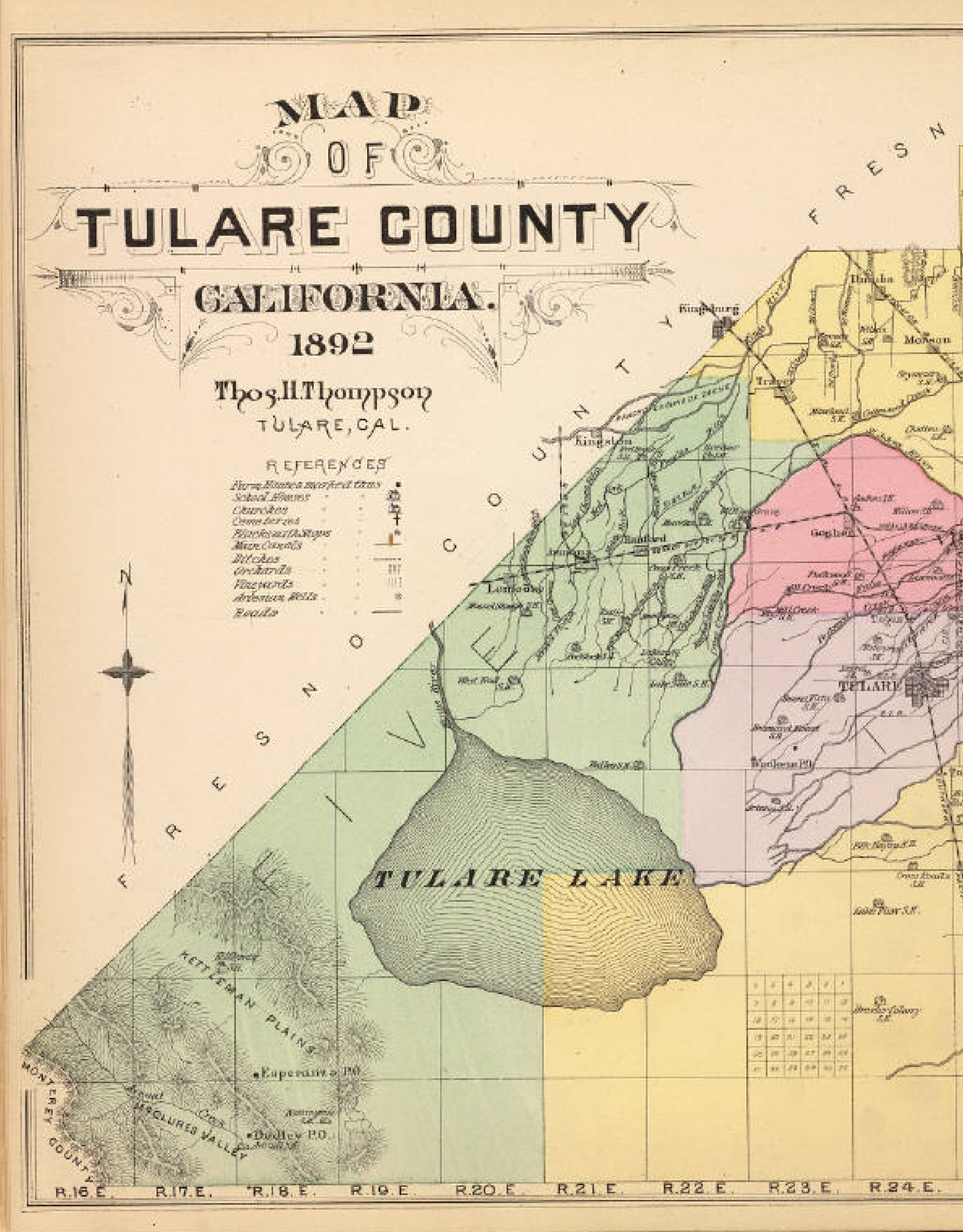
We’re looking at Quimby Road from the familiar now 1899 map, which I found at Evergreen Valley College’s library in the Heritage Room, curated by Colleen Cortese.  Let’s talk about what these parcels are now.

6254416259_78f082522a
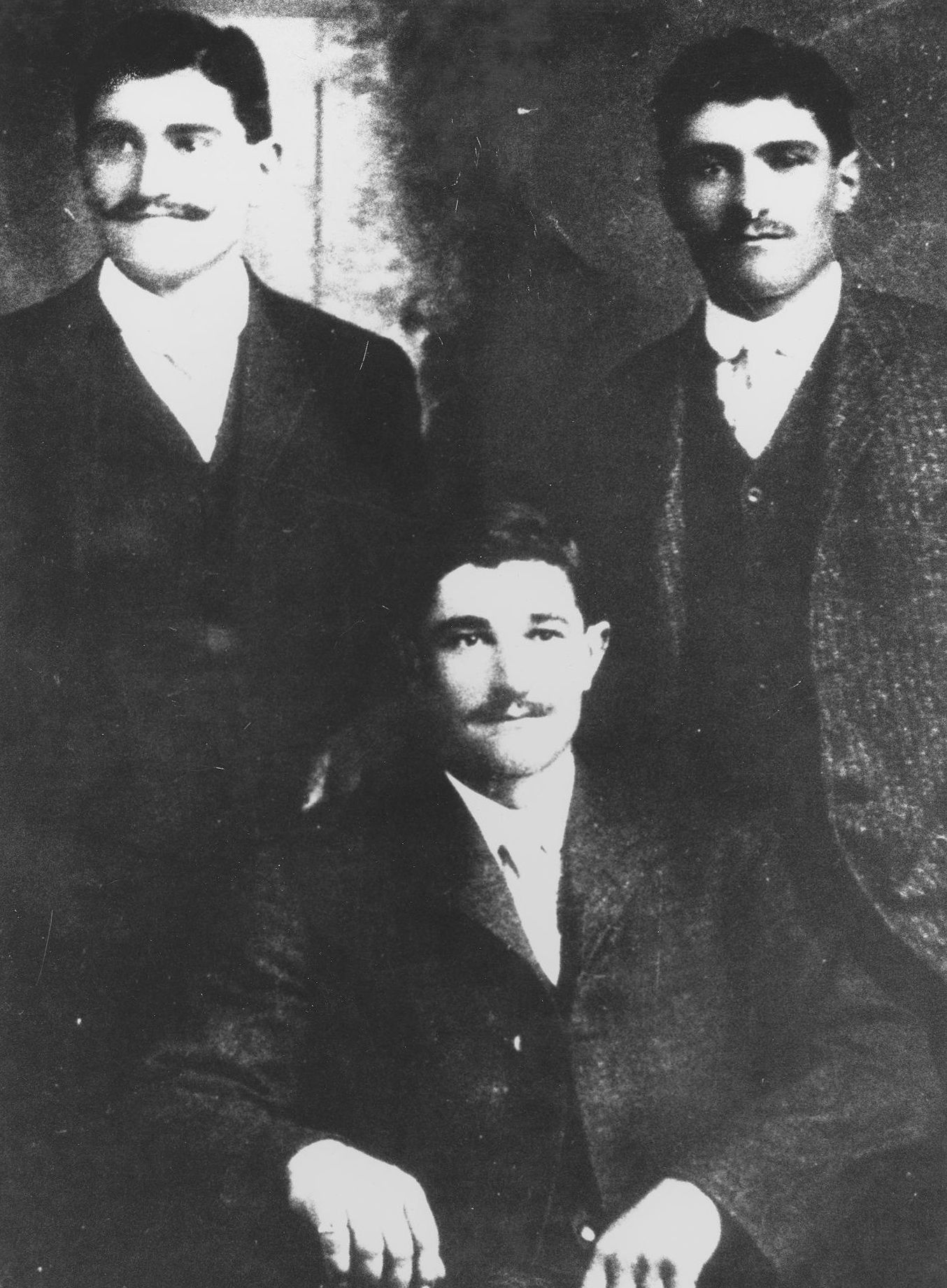
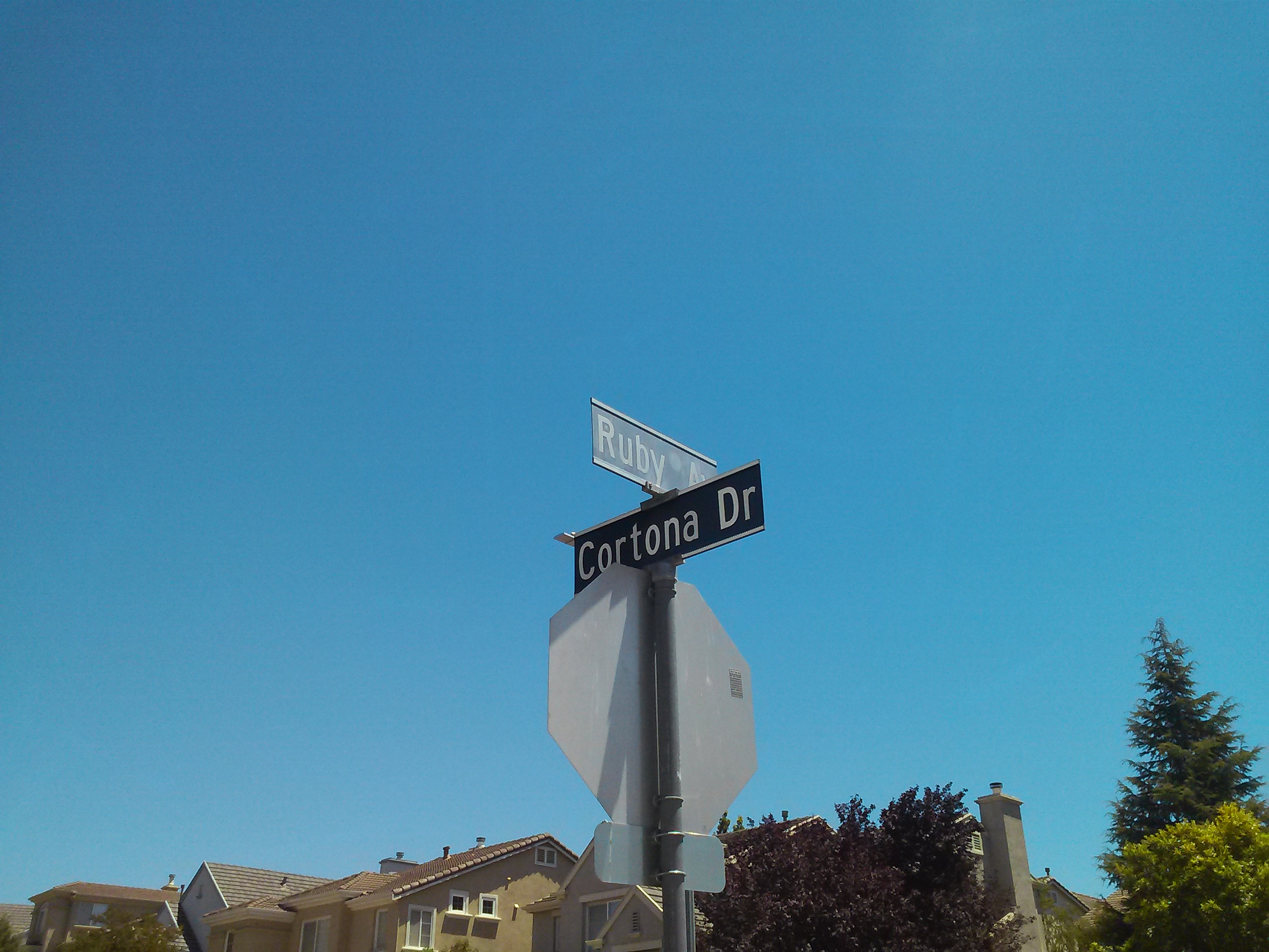
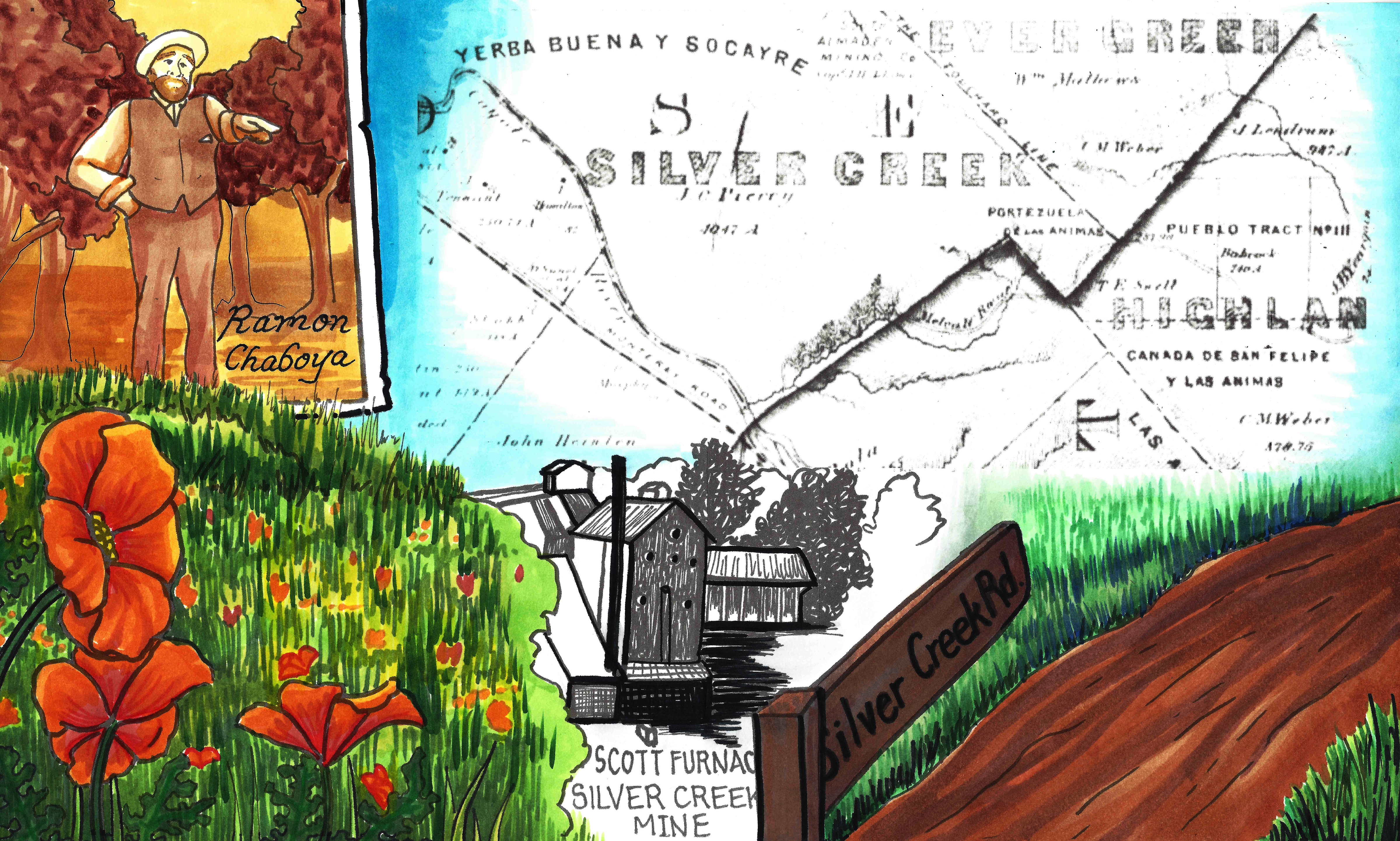
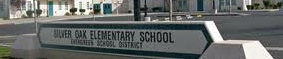
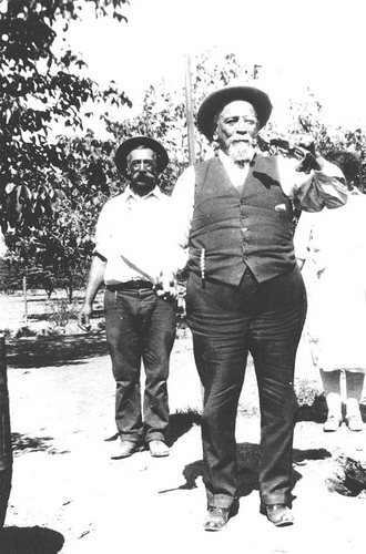
You can see White Road further left.  Left is west and a pinch south.  White Road runs North and South and Norwood Avenue, running off the map here, ought to point directly East.  The right of the adjacent Chaboya properties, belonging Ramon Chaboya, is the Evergreen School District Office and Quimby Oak Middle School.   This is Ramon, or Raymond, Chaboya to the left here.  The western border of the western, or left, Renaud property is Ruby Avenue which later builds through to the Mirassau or Mirassou property on Chew Lane, which became Aborn Road.  This is a particularly interesting tid bit because of the Pellier lineage
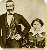
.CAM11091
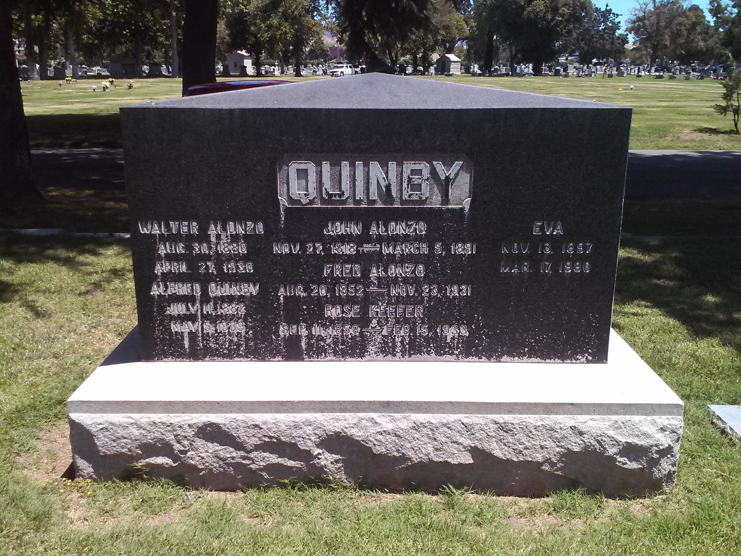
The roadway was named for the one time Mayor, long time civil servant and Evergreen rancher.  Strangely enough though, the Quimby Family property, in the family as shown above, isn’t located on Quimby Road in 1899.  It appears to have been downsized and passed down to the Quimby’s daughter, then Mrs. Wright, lived on Chaboya Road.  Can I be honest with you?  This M. Wright parcel feels more like the corner of the Pellier Ranch.  The straightened portion becomes Murillo Avenue and the offshoot of Chaboya Road is there.  This is where the Sikh Gurdawa is today.  It would’ve outline the neighboring Pellier Ranch in 1876 and become the driveway by 1899.

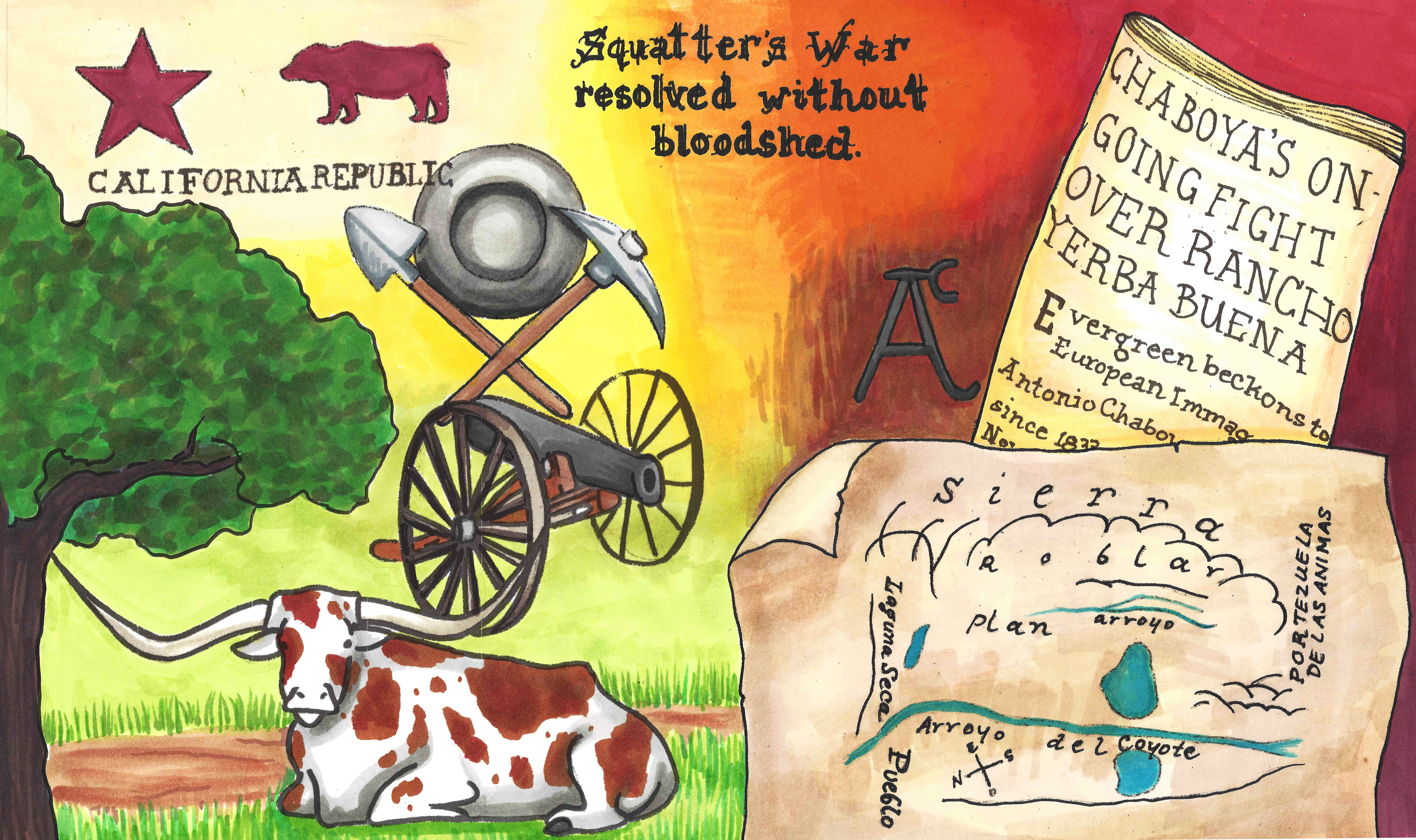
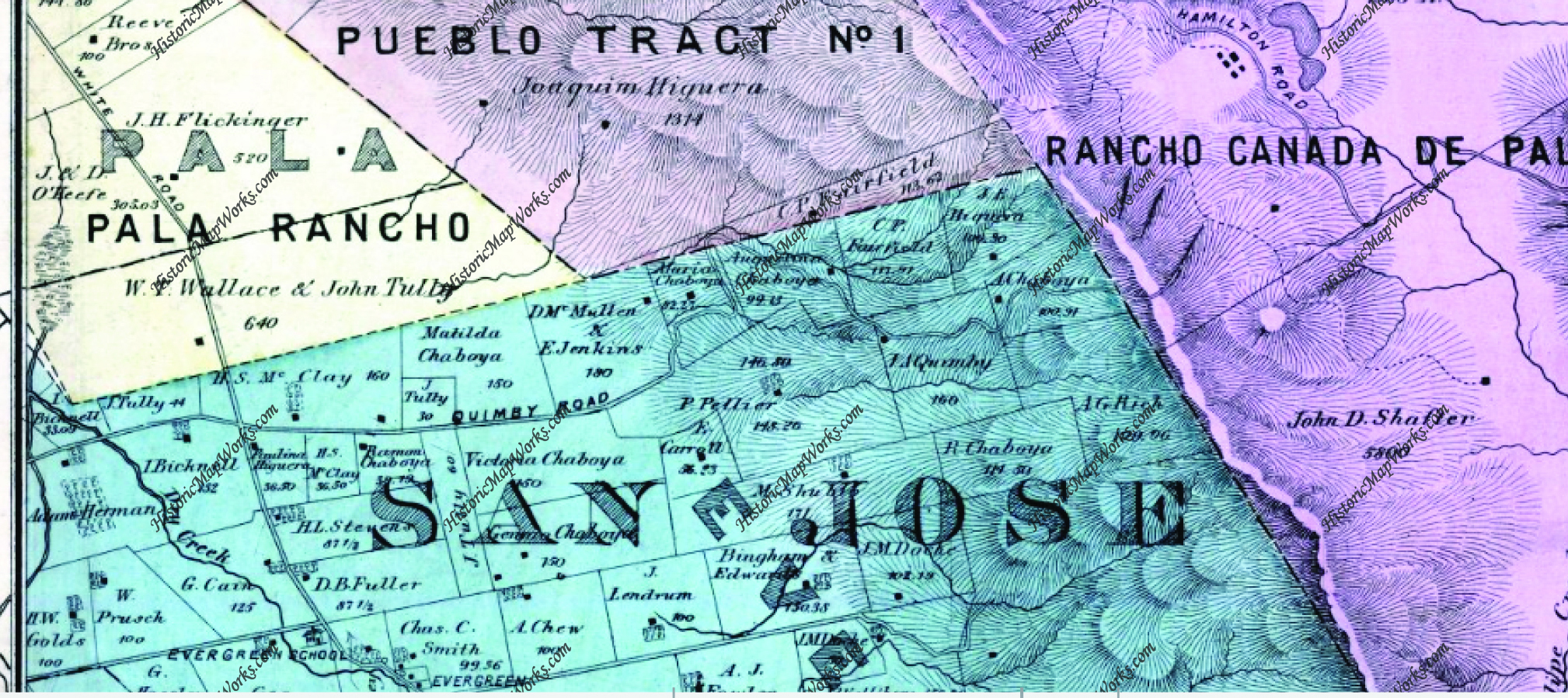
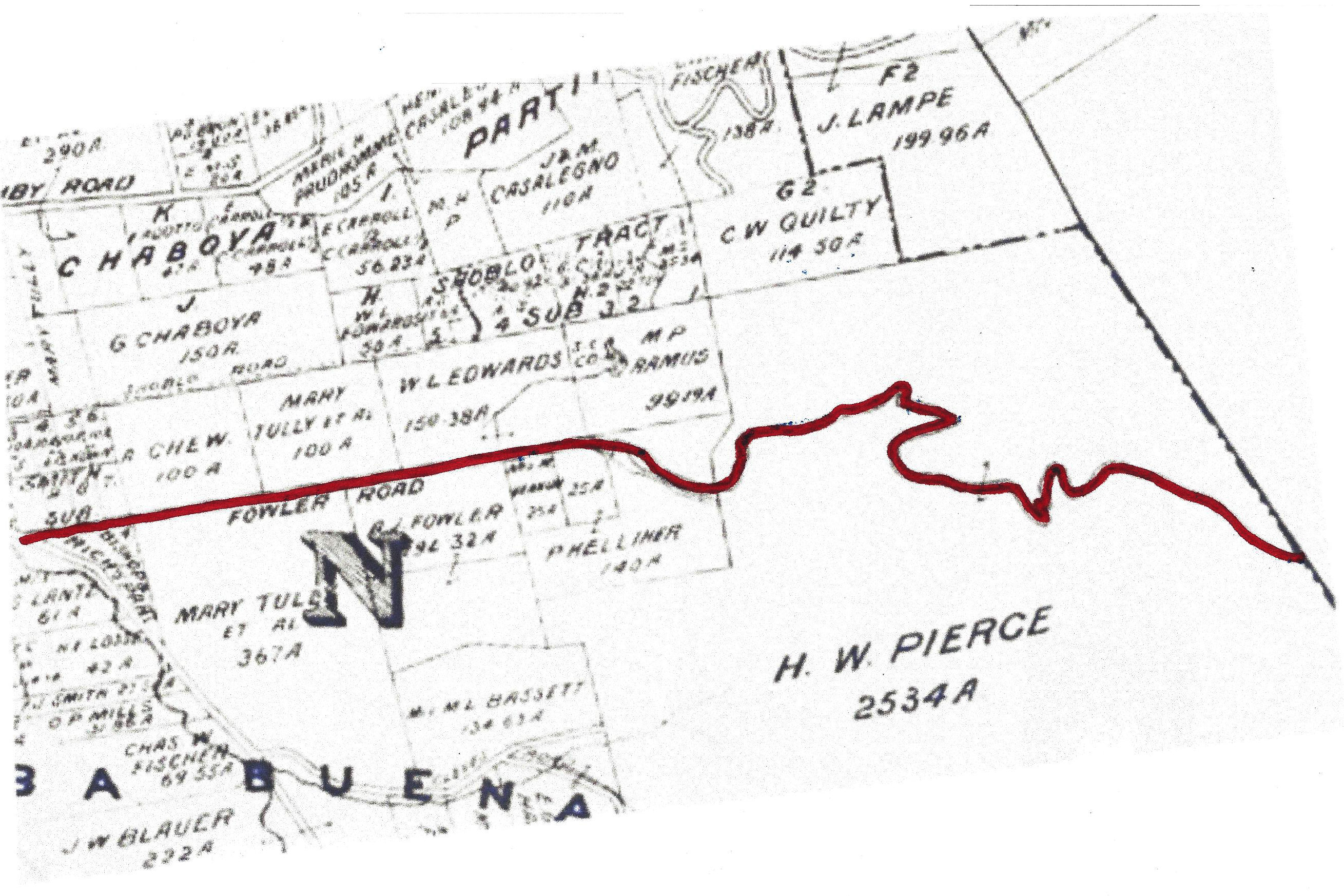
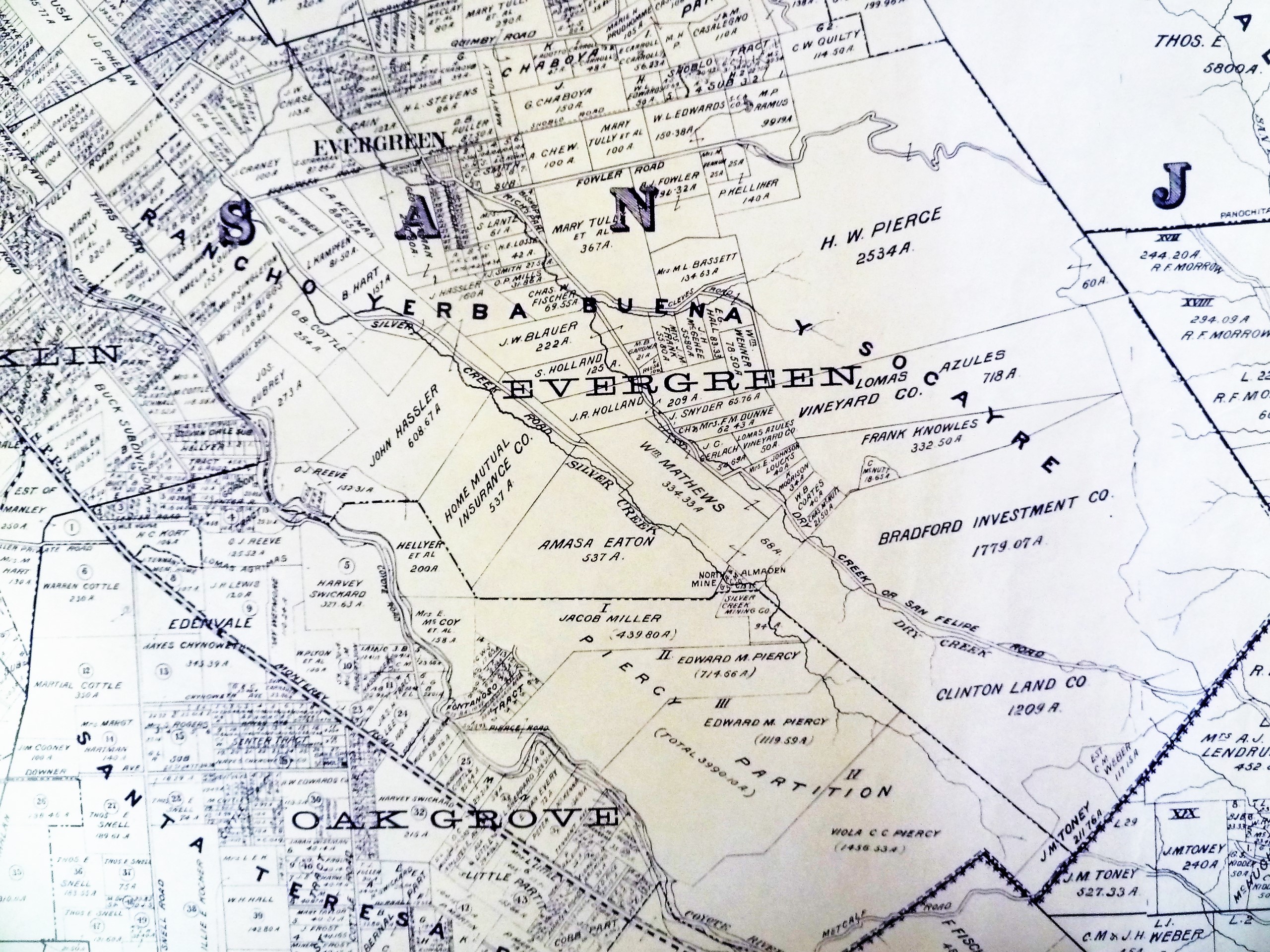
We’re going to look back at Quimby Road again, but this time in 1876.  I’m going to tell you that this zoom out is very deceiving.  The properties will appear to be the same size, but that is not the case.  They’re much larger and fewer.  They’ll just be bigger.  Check the acre size on the Ramon Chaboya and the McClay/Chaboya parcel to be sure.  Ramon Chaboya’s are both 39 acres.  The McClay/Chaboya parcel on Quimby Road is 36+ acres.

Map 006, San Jose, Evergreen, Silver Creek, Mount Pleasant, Pal

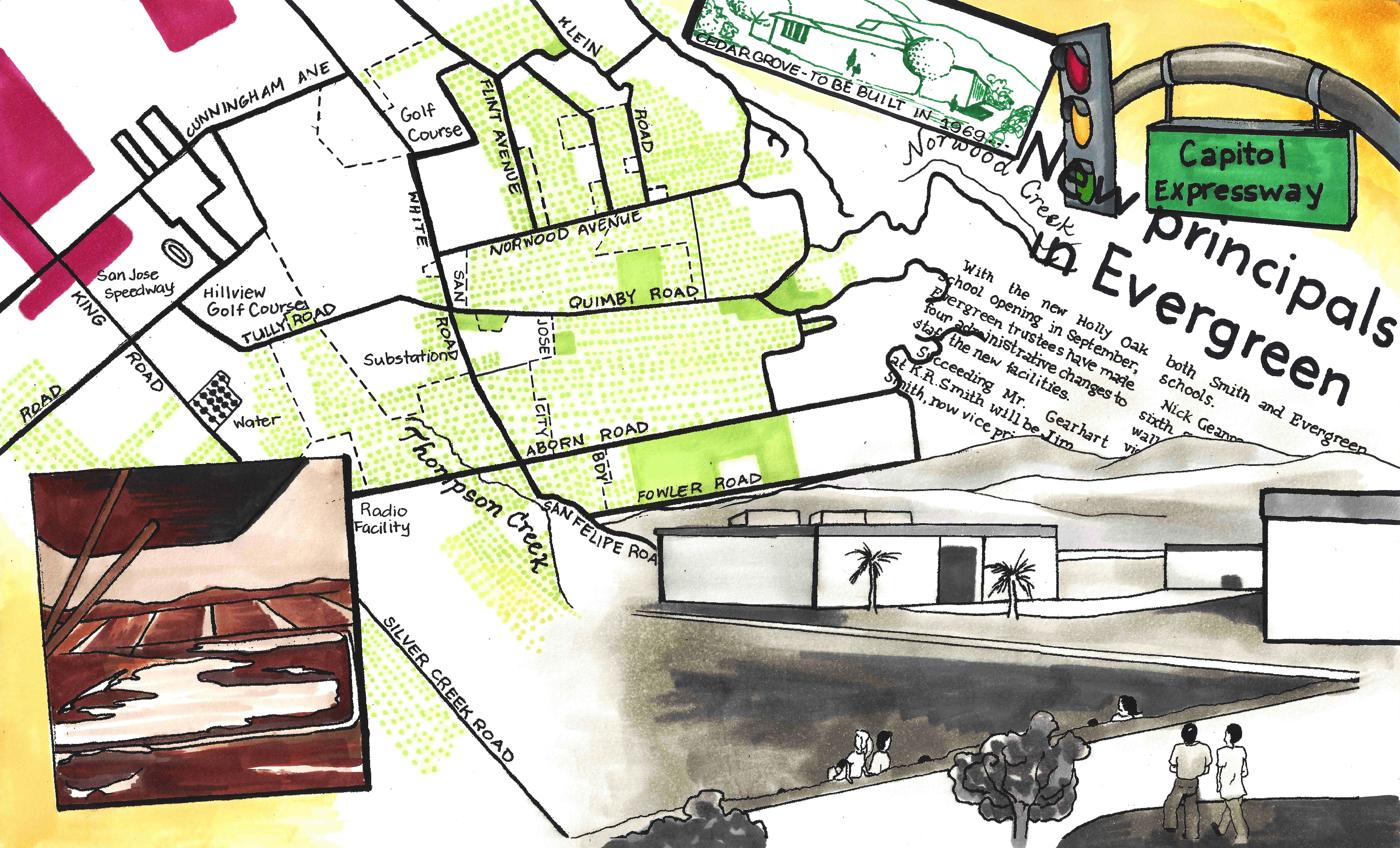
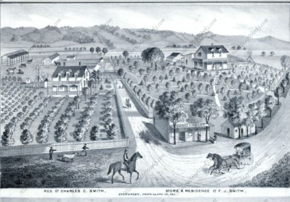
As stated above, Quimby Road connected Evergreen to downtown at its Northern end as Evergreen and Chew Lane did on the South side.  The portion of Tully Road where Quimby Road first appears was also known as Quimby Road.  This section was soon after renamed for the prominent businessman and landowner, John Tully, Lake Cunningham were developed.  You can see Cunningham on the Wallace & Tully parcel in yellow.  Tully Road would divide this property in half.

Along the dotted line, Norwood Avenue would’ve been built and Tully Road would border the Wallace Tully property to the North.  This is considered the boundary of Evergreen itself.

 6254426015_f091ee3233_bDuring the 1870’s, the Chaboya’s would spread out along Quimby Road with large ranches and a driveway that would later become Murillo and Chaboya.  Into the 1890’s the family would downsize and swap parcels with neighbors like the McClays, who would also downsize over the years as it passed down to later generations.  The Kettmann’s were upsizing, purchasing Mt. Hamilton land for goat herding, and surely used Quimby Road and Mt. Hamilton to get there.  The widowed Mrs. Tully was buying up property.  Also seemingly moving out of the Evergreen area is the Pellier Family, which couldn’t be further from the truth.

129607434_1399786458 12314282_198416020500512_5584157587879954674_o 
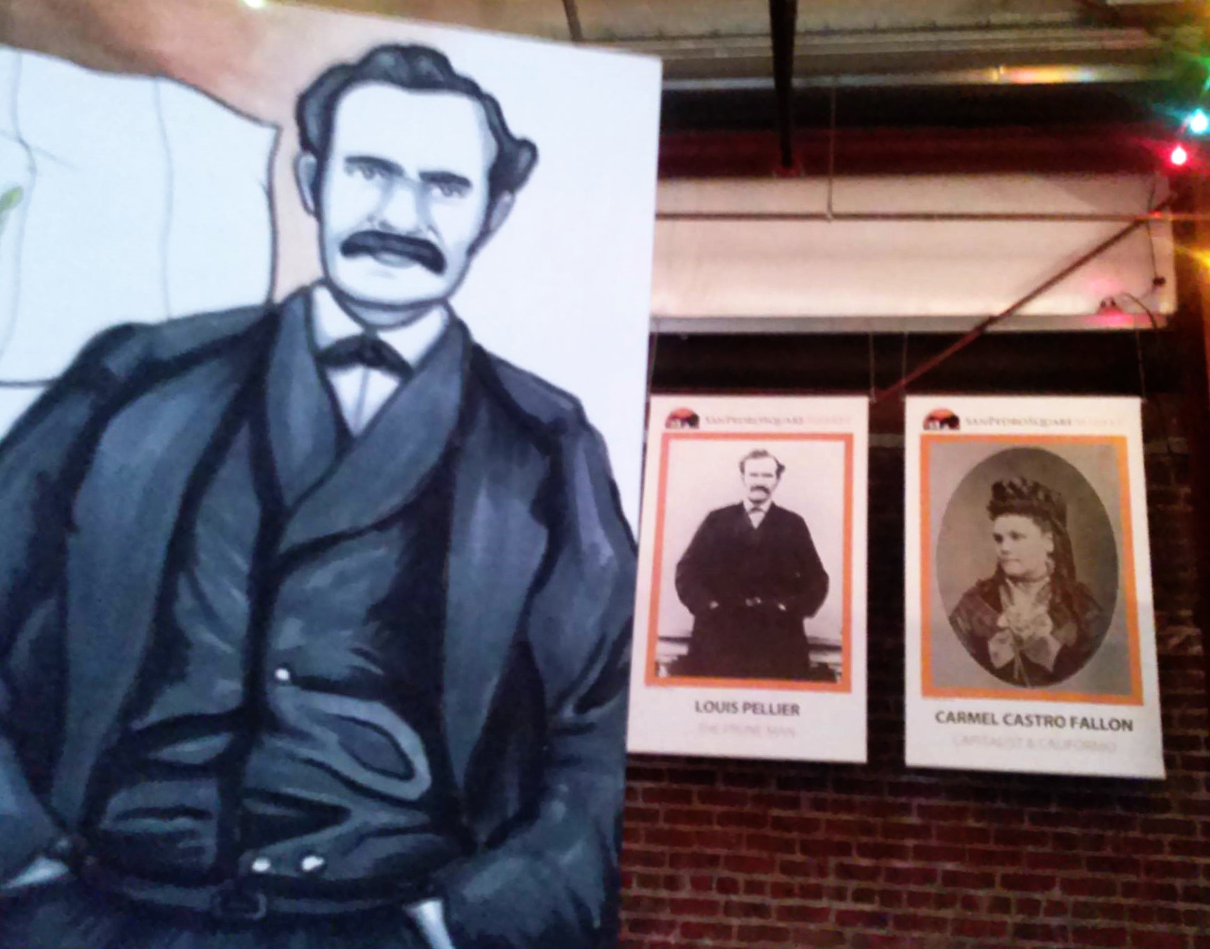
As we discussed before in RIP Louis Pellier, detailing a gravestone mix up, the Pierre Pellier family lost their budding male heir at the age of 16.  This was a huge blow for Mr. & Mrs. Pellier and their daughters , soon after the death of Pierre’s brother  .  There wasn’t another son.  Uncle Louis and his wife would have no children.  Uncle Jean would have children.  He is the only one who would carry on the family name.  But the Pellier daughters would step up, marry well and pass on their family lineage and French heritage.

Interior-FirstGeneration-PierrePellierMrs. Pellier’s distant family members, the Renaud’s, would move in near the French immigrants and begin planting vineyards on Quimby Road.  One Pellier daughter would marry into the Renaud Family, third cousins or further removed.  Elise Pellier would marry Alfred Leon Renaud and have eight children in 17 years on a Quimby Road Estate.  In fact, Alfred Renaud would’ve passed away before Rose knew she was pregnant with their last child in 1901.  I think a Renaud property is across from Evergreen Valley High School, but the larger E. L. Renaud property may stand for Elise Leon Renaud.  In fact, there are still grapes grown here.  The homestead may have been across  Evergreen Valley High School while the grapevines grew up the street.

148) Herman, Peter, & John Mirassou, circa 1905Again, a Pierre and Henrietta Pellier daughter would marry a French transplant moving to the Santa Clara County to engage in agriculture. Pierre Mirassou would marry Henrietta Pellier, the eldest daughter, and a wine dynasty would be born from their union.

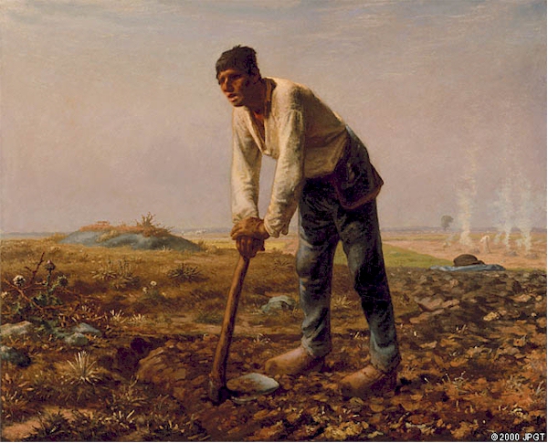
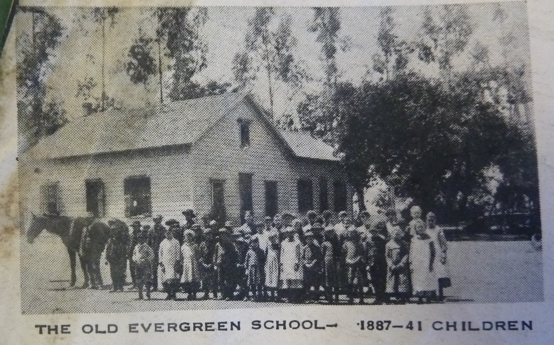
Pellier Daughter Josephine would marry Mr. Michael Casalegno, an Italian immigrant, and have six children on the Pellier Ranch.  I got to see their house, which has been moved and preserved within Evergreen.  This would’ve been the Pellier’s home at one point.  The largest ranch in Evergreen would again break up and become many of the largest ranches in Evergreen.  The awesome ending to this Evergreen story is that it doesn’t end and they continue to raise new generations in Evergreen today.  Rad.

I also need to confirm another historic Quimby Road lead that one of the Rinella daughters, a large Sicilian, Italian family, would marry into the LaMantia Family.  Mr. LaMantia would maintain orchards of his own and the vineyards for the Evergreen Cribari Winery.

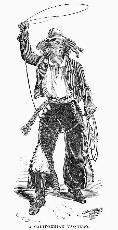
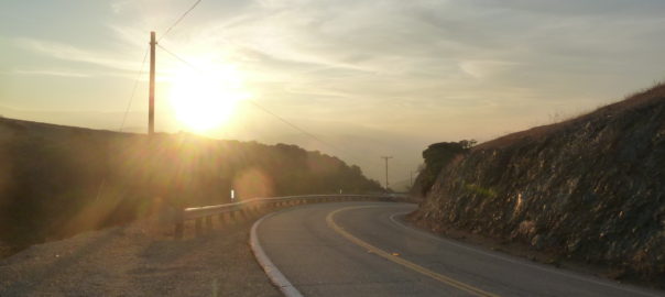
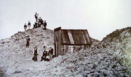
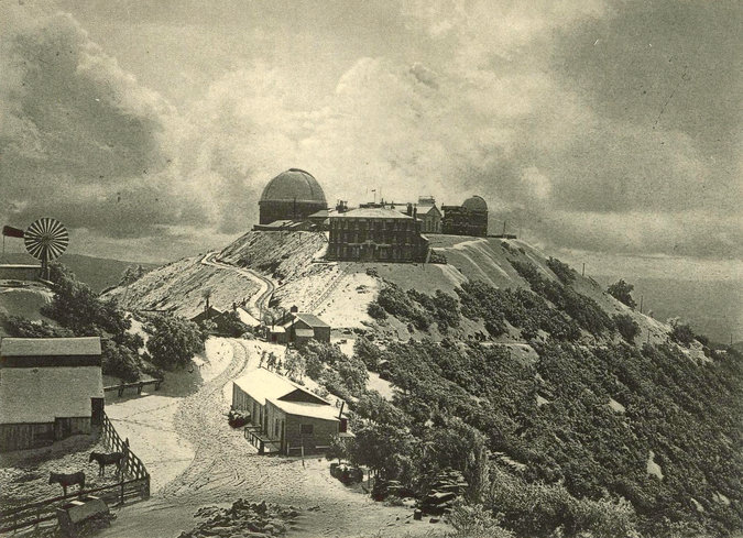
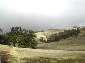
Back to Quimby Road in the late 1800’s, though.  It would’ve been paved fairly early as an alternative route to James Lick Observatory.  Alum Rock Road’s construction would have to be innovative and swift so the Observatory could begin its construction.  Evergreen’s awesome drives and almost unchanged roadways have a lot to do with East San Jose and the Observatory’s development in Santa Clara County.  Suddenly Evergreen’s thousands of residents were receiving a little more love from its Department of Transportation.

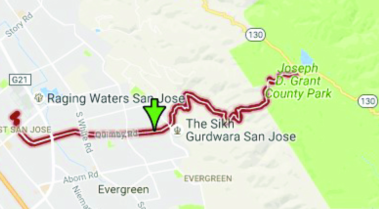
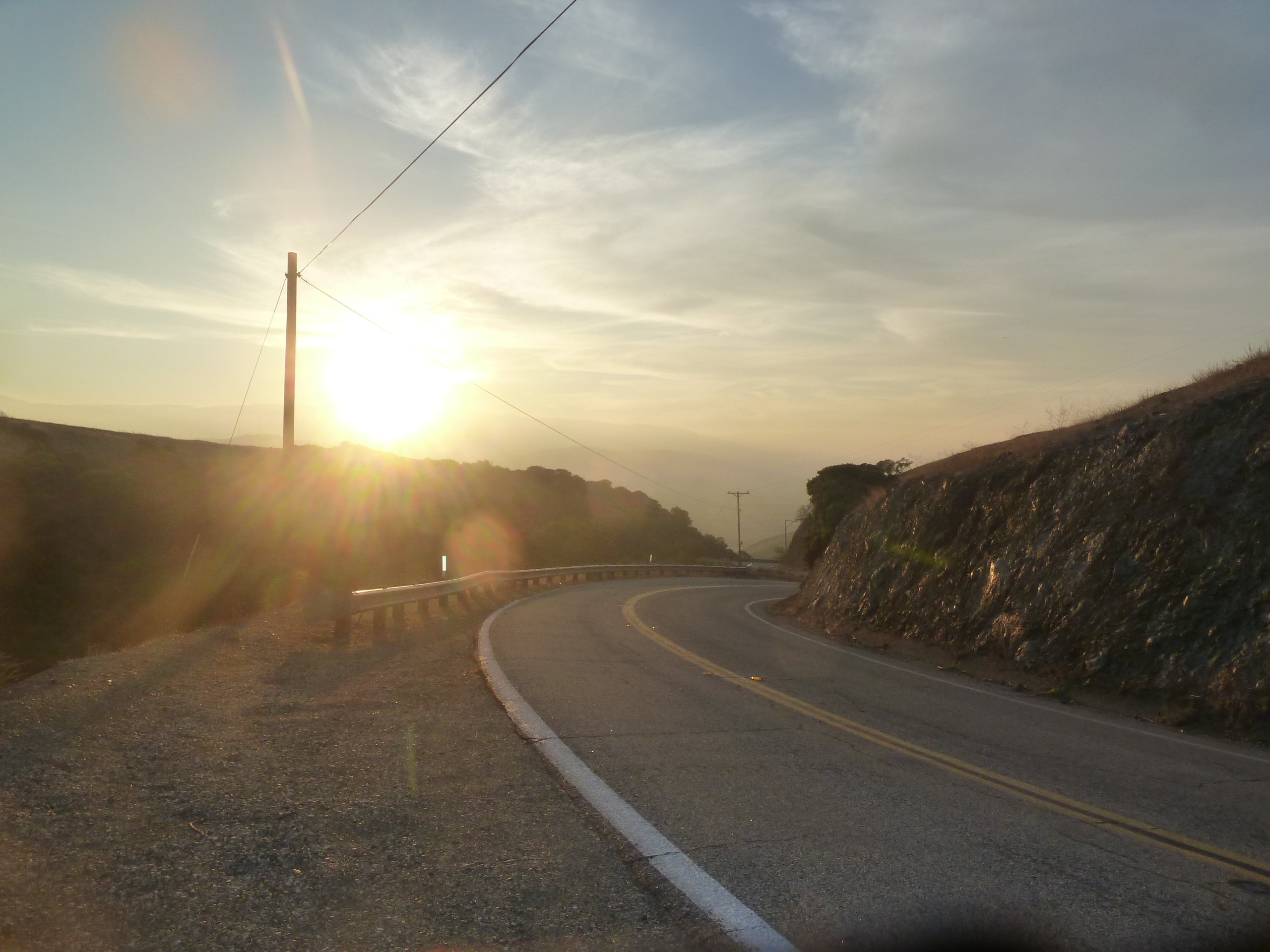
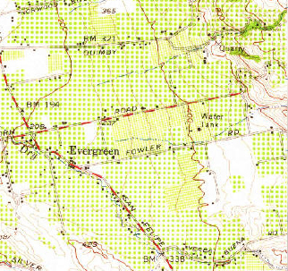
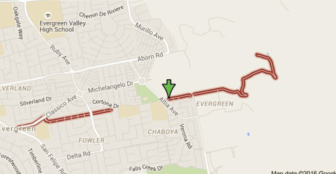
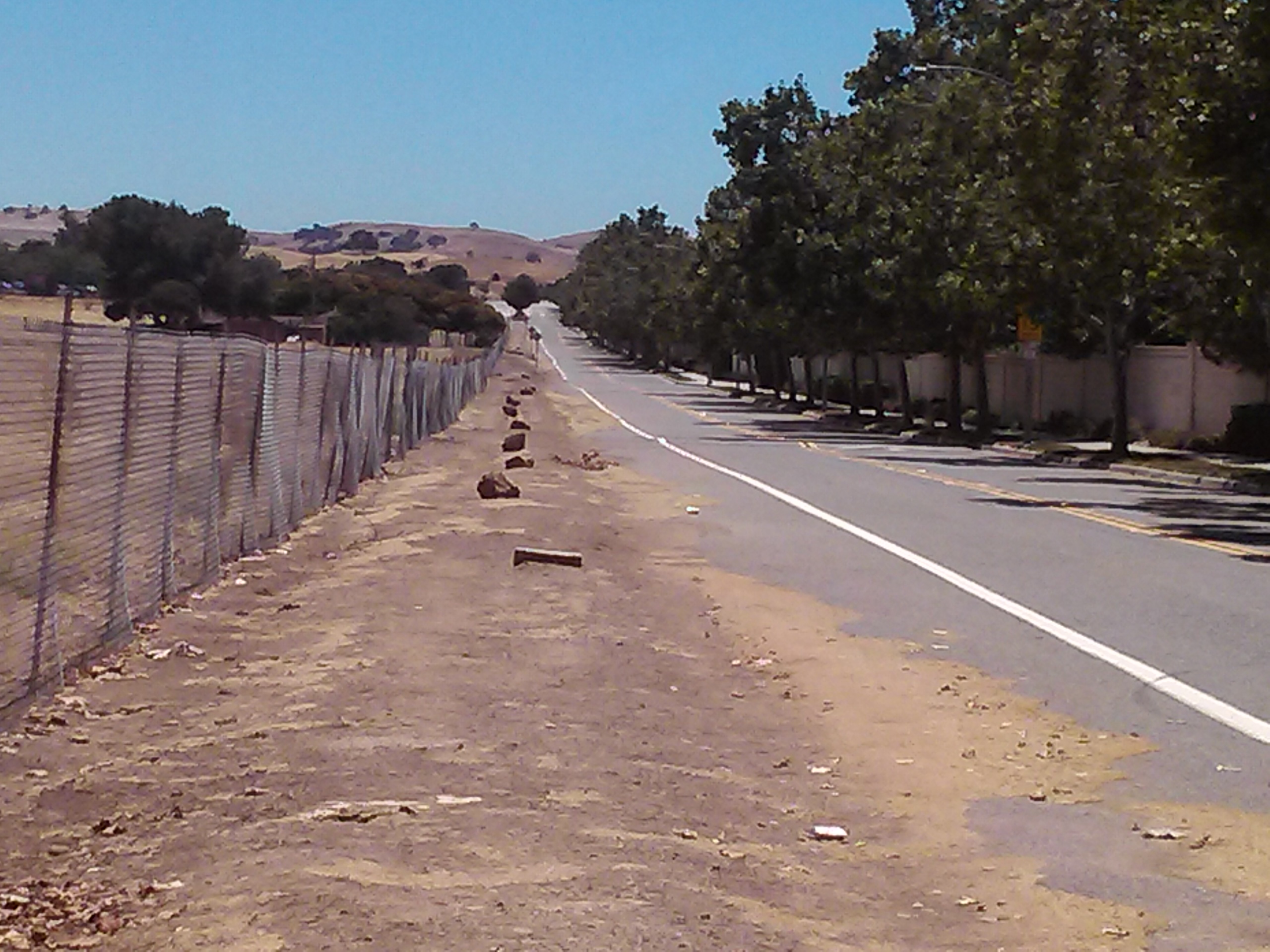
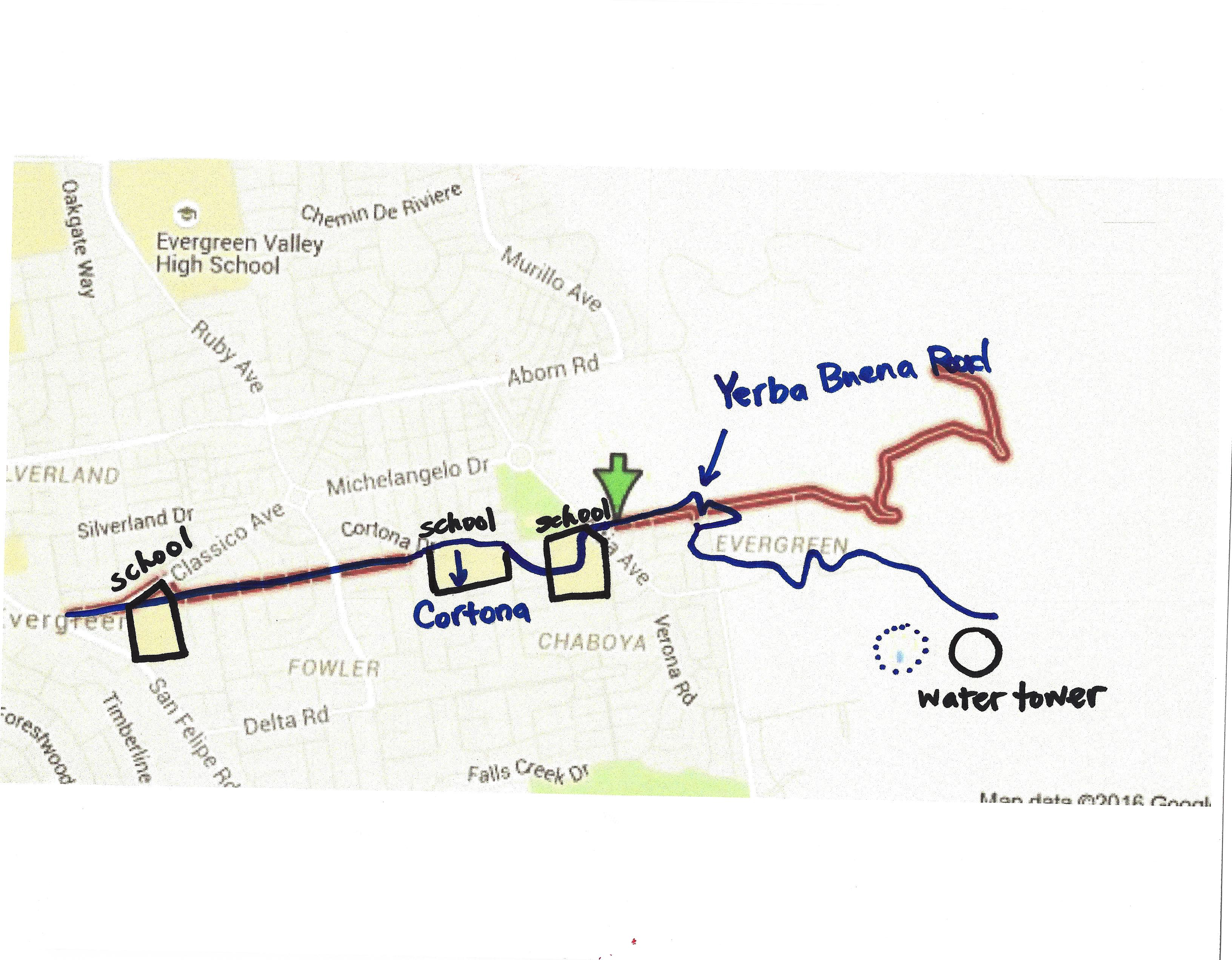
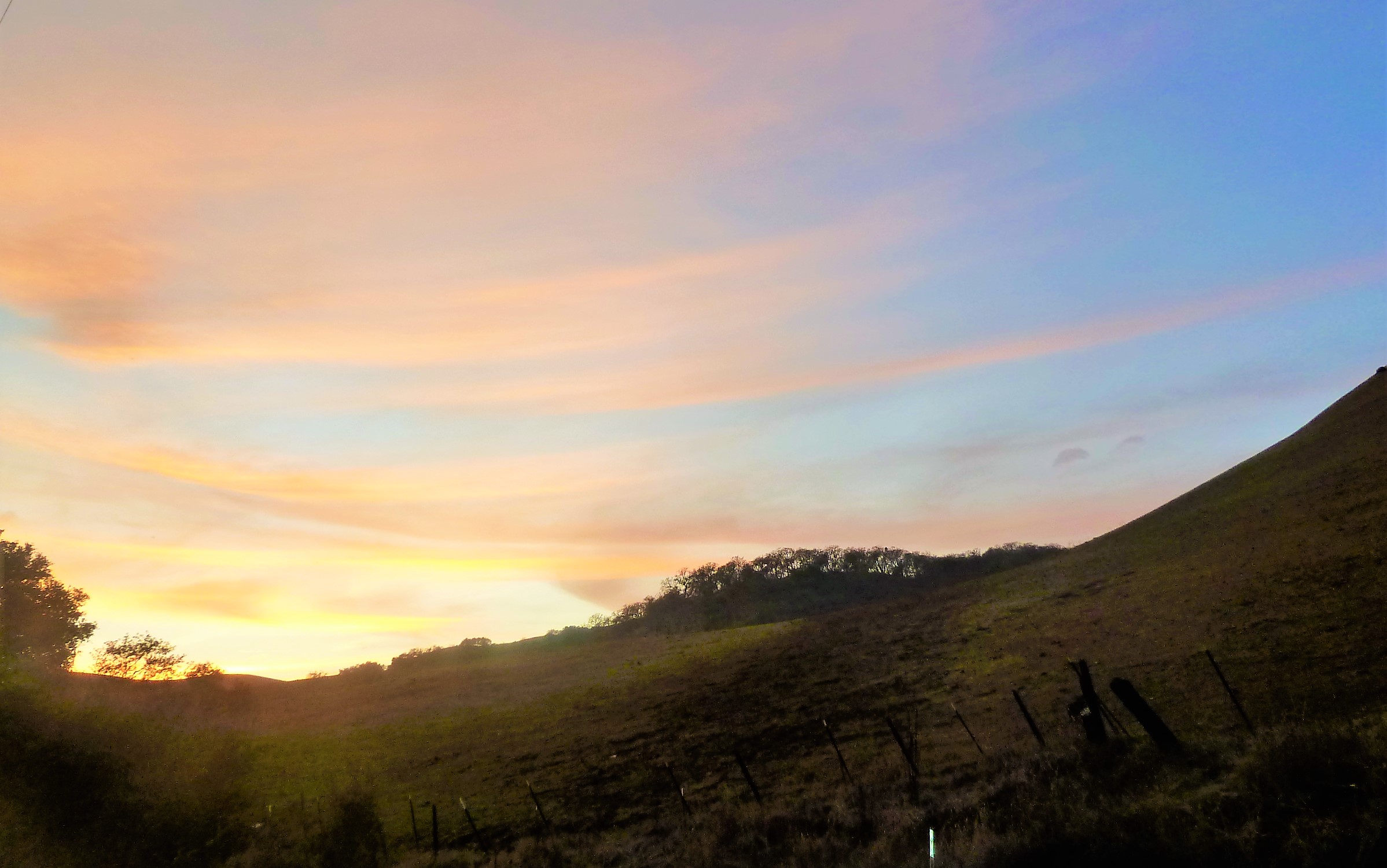
Let’s see if Quimby Road has changed much.  Here it is today.

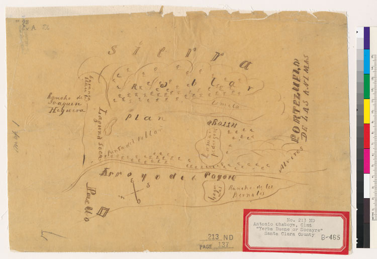
And the side by side.  Can’t find it earlier than 1876.

Map 006, San Jose, Evergreen, Silver Creek, Mount Pleasant, Pal

IMG_0163
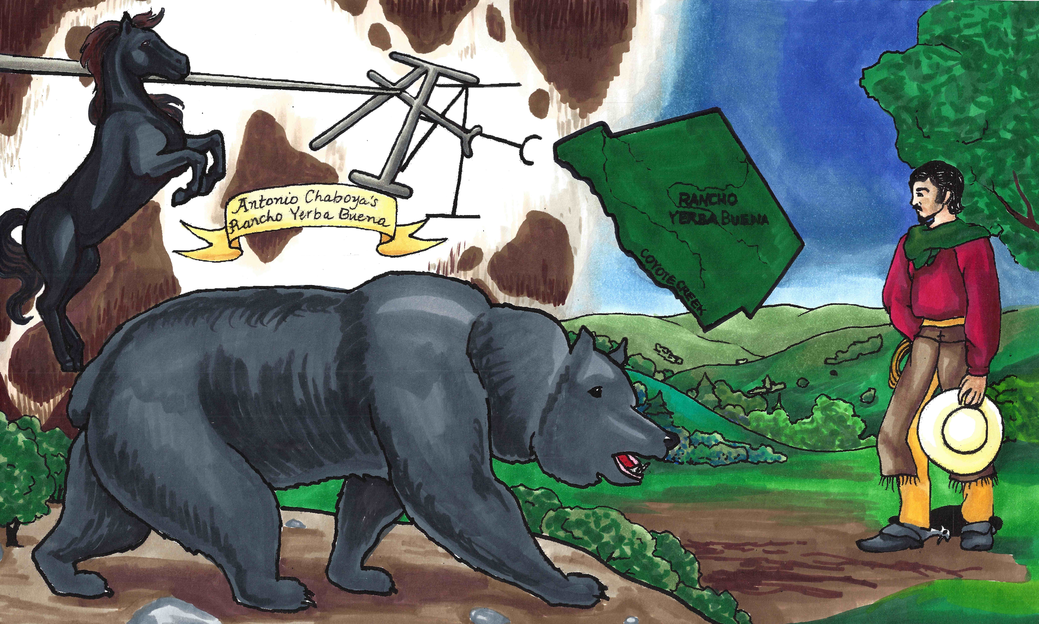
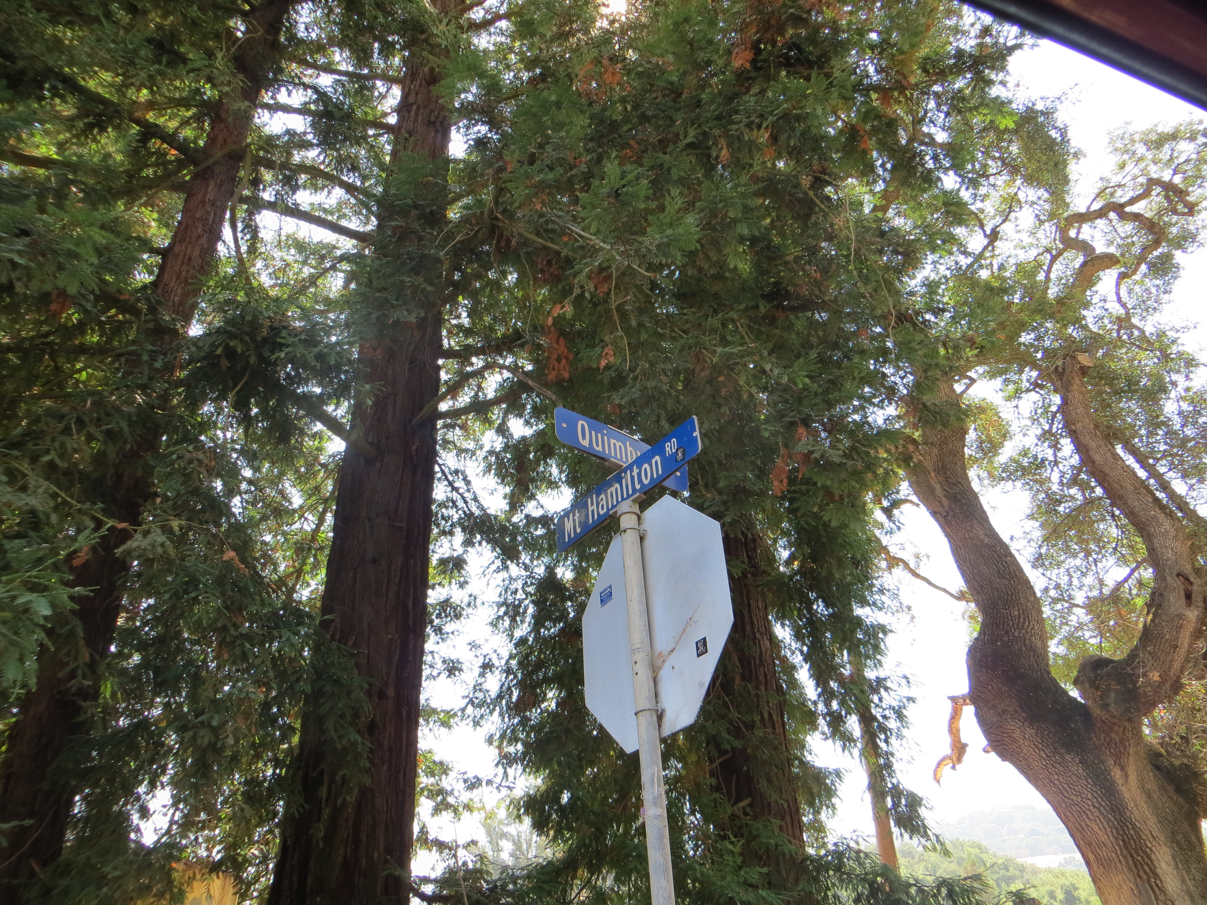
The Evergreen artery, Quimby Road, has had some updates.  I think there’s been two path changes in Quimby’s 150 year history.  The first is the part of Quimby Road that now runs through to Mt. Hamilton Road.  In 1876, it merely ran through Evergreen or up to “the Summit”.  That was the boundary for Rancho Yerba Buena and is the color change at the end of each Quimby Road.  This area simply didn’t exist before.  Mt. Hamilton Road’s path too has been softened over time.

IMG_0182
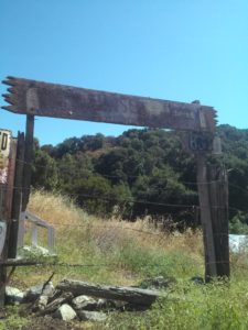
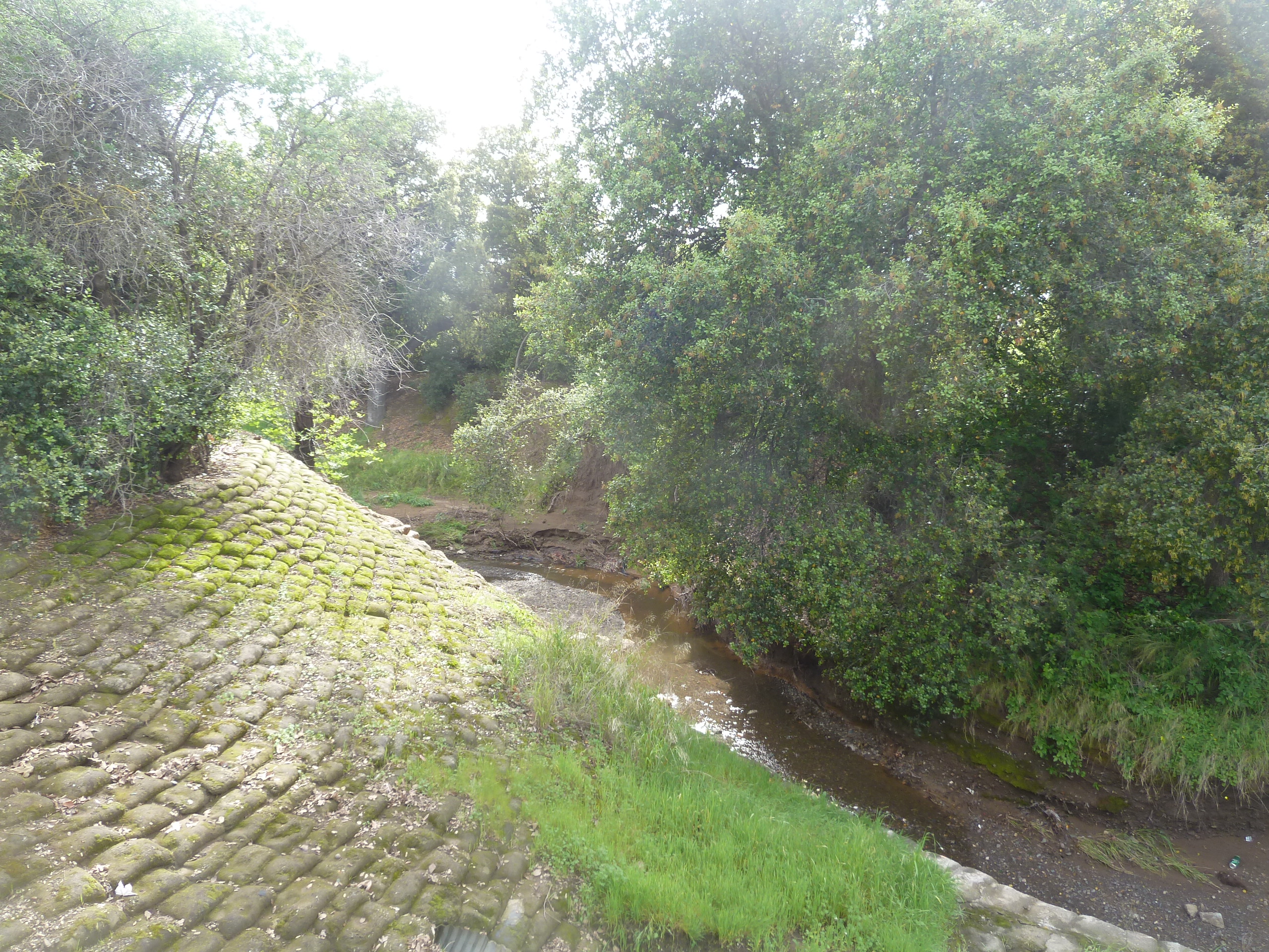
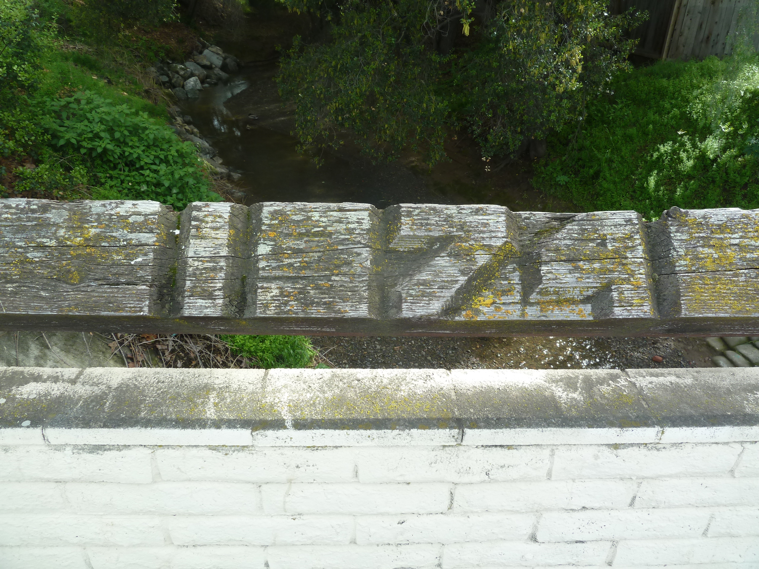
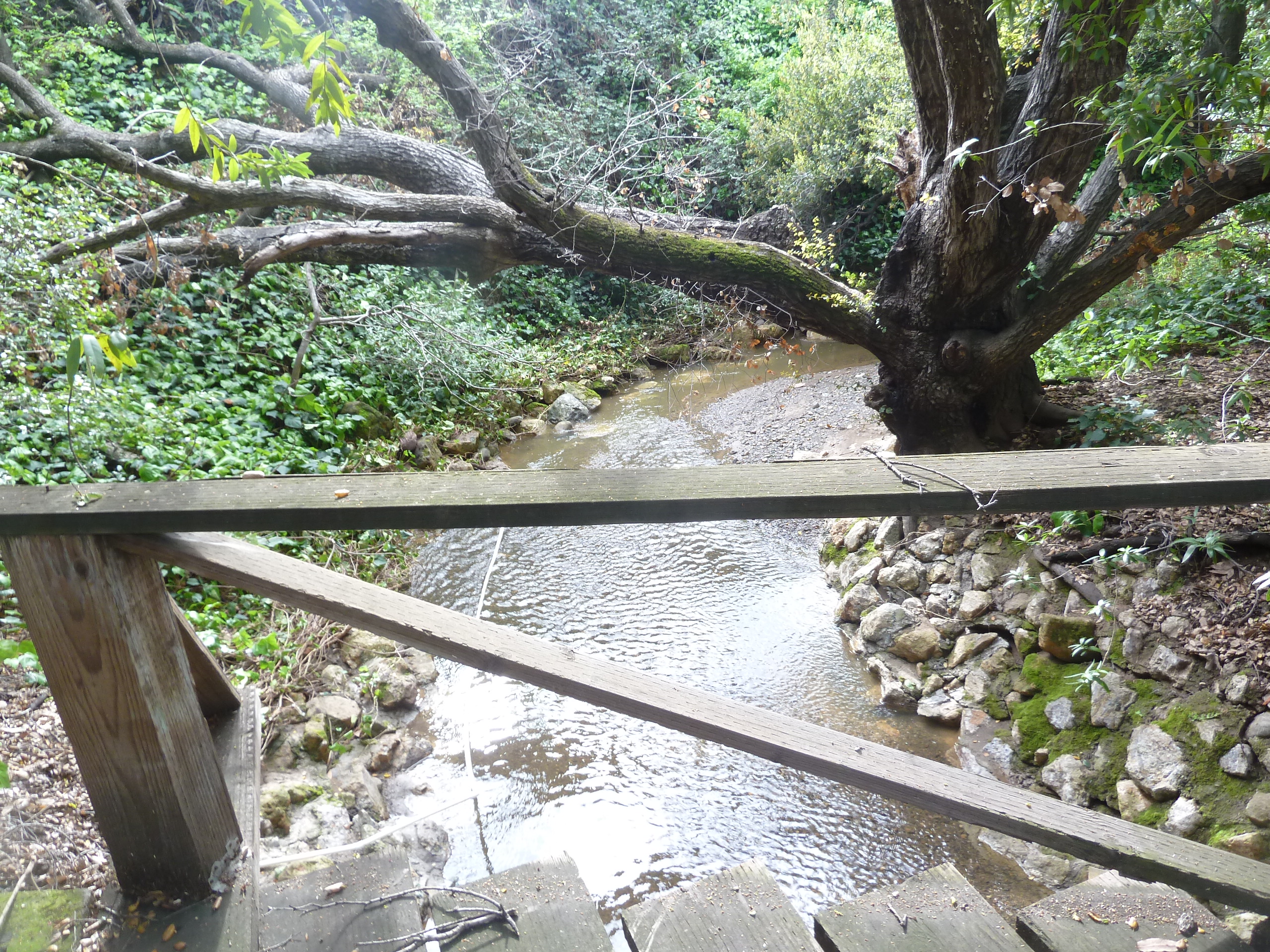
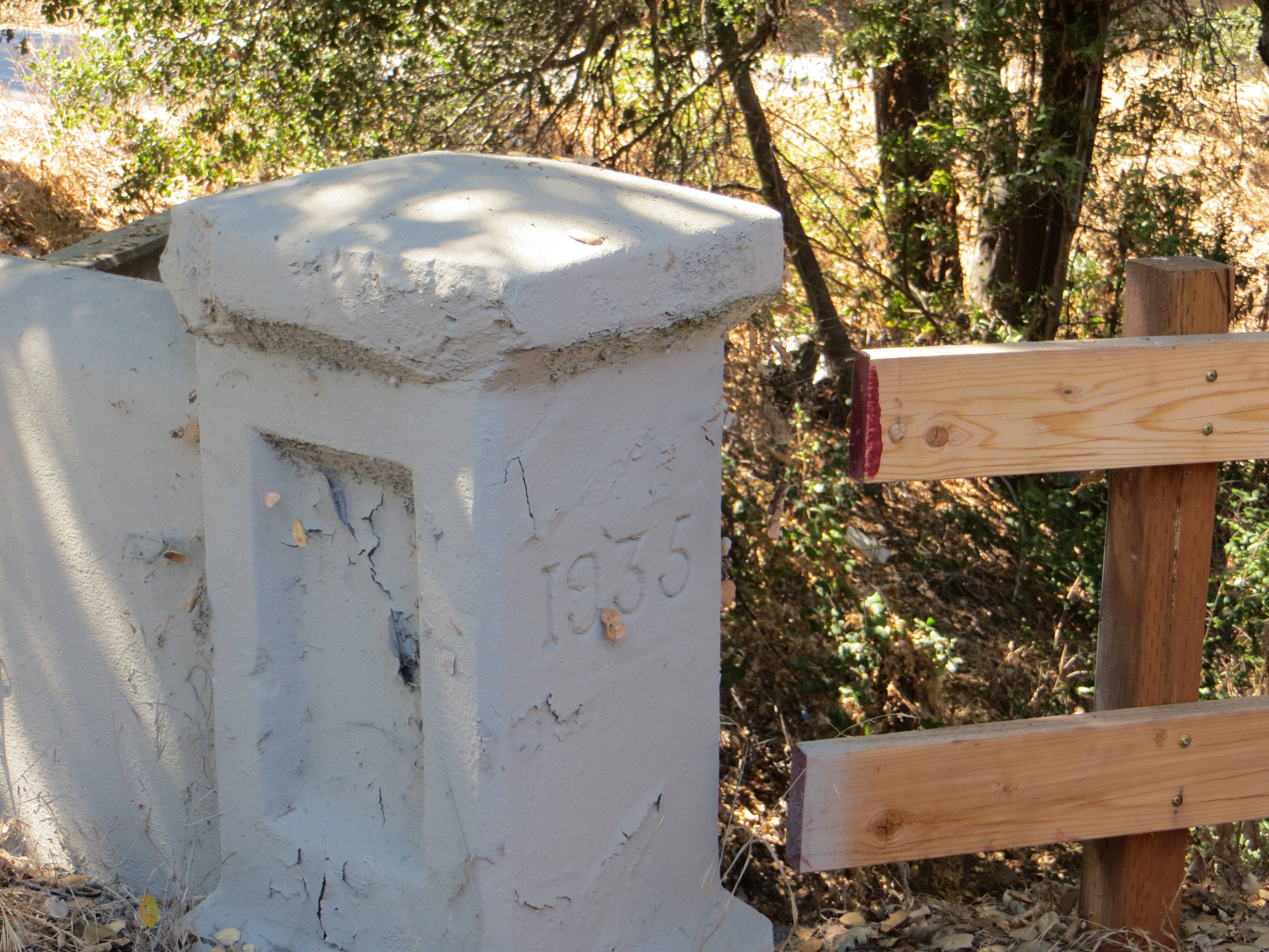
The second place updated is where I’m thinking is where I found evidence of it in a bridge. Quimby Road crosses creeks many times and therefore would’ve been washed out if unpaved or poorly maintained.  This update would’ve taken place adding a second and steeper hump between the J. A. Quimby and A. Chaboya in the 1876 map.  This was cleary updated in 1935.  I’ll have to find out when Quimby reached Highway 130 and see if they happened at the same time.

Evergreen’s Best Drives – Road Reviews

P1300723Evergreen’s rolling, green hills and stunning vistas do not only provide its suburban gold a splendorous backdrop.  These beautiful hillsides and over a hundred year old paths are endless entertainment for motorists, experienced and not, since their creation.  As a teen, I never had a mischievous side but rather an intense curiosity.  I would drive until I had to turn around in every direction.  I could get to San Francisco without hitting a single freeway, and only later did I find out I had taken a 200 year old path by California’s settlers.  I practiced on Quimby Road before driving over Highway 17 to Santa Cruz.  I’d rather be close to home and stuck than far away and stuck.  Today and throughout this research, I use these Evergreen roadways as pallet cleansers for the creativity and for a sense of what Evergreen is and was.  I review from a place of experience.

1876 MapUntil the 1880’s, these roadways were unpaved horse carriage and cattle driving passages.  King Road, Quimby Road, White Road, San Felipe Road, Chew Lane, Evergreen Road, Fowler Road, Cadwallader Avenue, Norwood Avenue and Silver Creek Road were the major roadways.  King Road would’ve taken you into Downtown San Jose.  Tully Road would’ve gotten you to Monterey Highway and either Downtown, Gilroy, San Francisco, or Oakland.  Norwood Avenue, Fowler Road and Quimby Road would’ve snaked into the hillside and provided passage for farmers.  When these weren’t direct enough, farmers were friendly enough to let others walk through their properties or boundary roads.

early_summitJames Lick Observatory’s necessary roadway through one of the most complicated stretches of mountain terrain made paving Evergreen’s rolling hills were no longer insurmountable tasks.  James Lick, philanthropist and business mogul, dedicated a Trust with the funds for the Observatory and Telescope in 1874.  The trip was made by horseback in 1875 to the summit of Mt. Hamilton, though no previous trail had been blazed, and won out against several Bay Area mountain peak options.  Alum Rock’s original roadway to the Observatory’s construction site was completed in 1876 for $70,000.00.  That was fairly astronomical in 1870’s dollars.  By 1879, the engineers and scientists worked the numbers and construction was underway.  The James Lick Observatory with its Alum Rock Avenue access was completed in 1881.  The early 1900’s saw plenty of paving of Evergreen roads, but it’s these roads which have not been altered in route or direction that make the best driving today.

03OVER-master675Since we’re talking about it and it’s so close to Evergreen, Alum Rock Avenue is not for the car sick.  Do not blindfold your best friend and try to bring her closer to the stars.  Do not be surprised if one or both of the following happen if you do this – she vomits in your car or she gets really upset with you and convinces herself that you’re not her friend and this isn’t fun.  Alum Rock Avenue connects San Jose to Mount Hamilton most directly through the curvaceous mountainside.  The Mt. Diablo Mountain Range, for which Evergreen is a foothill, is aptly named and deviously windy.  Now also known as Highway 130, this roadway leads over the summit and into Livermore eventually, this little time to have a good time.  It’s conditions for driving aren’t always great.  There’s sometimes snow on the summit and black ice making it  dangerous.  On a good day, the constant turning roadway isn’t one of the ones I remember super fondly.  You worked to get to the Observatory, where views are spectacular.  Heavily wooded areas make photos along the way difficult, but if you can look back towards San Jose, it can be stunning.  Sunsets are beautiful.

CAM10919P1300635San Felipe Road has the keys to my heart and its been well documented.  Sunsets over oak trees and grazing land are spectacular.  Reports of haunting and phantom hand prints are reported at night on the windy drive.  Do not, I report, do not do anything silly on this roadway.  Just watch it on youtube and laugh.  This stretch of road is a photographer’s dream complete with indigenous wildlife and awesome sunsets.  The curves, speed limits and turn offs are clearly marked making it a driver’s heartthrob eventually turning into Metcalf Road.  The turns and inconsistencies of elevation and scenery make it a delight for the casual driver, but think about your ambitious bikers along the way.  Deer also frequently cross.  Be careful, but enjoy.

P1320017IMG_4183Tully Road is not a great drive.  Steep inclines make it awesome fireworks views and Santa Clara Valley vistas, but it doesn’t go on long enough for any decent ride.  Recent development also delays scenic gratification for photographers searching antique views.  These are great vantages of Downtown San Jose.  Similar reviews can be had of Fowler Road, as its route has been so heavily revised and cut short.  Oh, what those hills could say if we could them from up there.

night tourDeer Valley - Joseph D. Grant County ParkQuimby Road is windy but enjoyable.  This is the perfect casual drive with four wheel drive.  Turns are sharp, but the vistas are spectacular.  Farmers and Open Space still exist in Evergreen and this short vacation drive will prove it to you.  A few miles from civilization, you’ll have to decide if you’re blood is pumping enough for one joy ride or if you’re ready to endure more.  This road meets Mt. Hamilton Road and continues into Joseph Grant Park just outside of Evergreen.  This is a place where you can appreciate the natural beauty of what was here before all of us were.  There are also ghost stories of Joseph Grant Park and easily persuaded Park Rangers with a fascination for the macabre.

CAM09485CAM09492Those were long drives to sink your tires into.  Little known and fun-sized rides through rustic glory can be taken in following Aborn Road to the end and Chaboya Road by the Sikh Gurdwara.   These are awkward U-turns but worth the trouble.  These nearby and awesome drives host fantastic, antique barns, spotted horses, and thunderous oak trees.  Wildlife also make this a photographer’s haven.  It’s seen deer, quail, owls, turkeys and bobcats on these drives.  It’s superb.

The corner of Yerba Buena Road and Edenwood Drive where 24-year-old Kiran Pabla was killed in an accident is blocked off from traffic in San Jose, Calif., on Tuesday, Jan. 27, 2015. Pabla, a bystander, was killed in an accident involving two speeding cars thought to be racing. (LiPo Ching/Bay Area News Group)I only have one truly negative driving review from Evergreen.  Yerba Buena Road has luscious turns that drivers enjoy but it dissects the Silver Creek Community.  Pedestrians,  students, bikers and motorists alike share these windy inclines and declines.  Sadly, fatal accidents occur on Yerba Buena Road due to reckless or careless driving.  It’s happened to someone near to me.  Don’t take this everyday Evergreen roadway lightly.  There is nowhere to pull over and photograph until you pass the college.  It’s reasonable scenery but nothing to write home about.  These walls across from Silver Creek Linear Park and Fire Station may be a second project once the Evergreen Mural Walk become profitable.


Fowler Road and Creek

P1330025I work a lot at Chaboya Middle School, in fact its the first school I ever painted at.  People often ask, “Chaboya On Fowler Road?”  And I always say yes, but I know its address is on a different street.  Fowler Road is indeed very close by, but Chaboya is on Cortona Drive.  What’s the confusion?  It’s been redundant for me throughout my career, so I checked it out on behalf of the Evergreen Mural Walk.

1876 MapFowler Creek was named after Andrew Fowler, whom I’m enjoying getting to know.  The street was one of the first in Evergreen, as was the man.  We’ll discuss him in further detail later.  This road was built before Chew Lane/Aborn Road’s eastward section.  This 1876 map hasn’t put a name to the street, but you can see A. J. Fowler’s property along the south side of the road.  This was William Matthew’s portion of the attorneys fees paid out by Chaboya in his lengthy court battle.

In 1899, Fowler’s name finally appears on the road.  This Fowler Road runs all the way through.  It did when I was a kid.  What happened?  This is Fowler Road’s modern path below.

Microsoft Edge

By 1956 however, Fowler is the straight thing I remembered it being as a child.  It ran east of Ruby Avenue.  This map cuts off the windy portion but it was a solid straight line.

Below, Fowler Road is broken up into two parts and straightened out in portions.  There are switchbacks indicated on Fowler Road in 1899 on the Eastern zig zag which appear true on the modern map, but the road also ends sooner in the modern map.  It ends even sooner if you’re driving.  It ends at the straight spot.  This road kept going in 1899.  What gives?

fowler road san jose - Google Search

fowler road 2Here’s what gives.  New homes plans were put in place back in 1991 to get this area built out.  Before that point, in was rolling Mirassou vineyards and orchards.  Chaboya was built on Fowler Road in 1991, but the road’s path would change names as homes were built.  The new bend in the western part of the road came with the build out of the  the Classico neighborhood.  Historic homes still line the straight entrance, but then Fowler Road takes a turn towards the development and later becomes Cortona Drive.  Fowler Road would be built straight during the before 1956 but between proposal in 1991 and build out, something changed.  A portion of the existing Fowler roadway, which clung to Fowler Creek, would become Cortona Drive.  That’s the portion of Fowler which ran through P. Kelliher’s ranch in 1899.  Fowler Road then picks up on the other side of a small park on Chaboya Middle School’s East corner, where the road turns in the Western most part of H. W. Pierce’s acreage.  That’s where the arrow lands.  Today, Fowler Road straightens out, drops again and is private roadway after that.  You can see the windy road, but it appears to be shorter today.

CAM11655 Gemellos, why did you think about that?  Cobble Stone.  Now that I’ve investigated Cottle’s Cobble Stone and now Cadwallader Avenue’s fallen cobble stone bridge, I know there’s something up in areas where I find it in volume.  It’s too heavy to clear and it was clearly a favorite of late 1800’s farmers marking their homesteads.  I was in between appointments around Evergreen and I stopped when I saw it in volumes all over this area.  In fact, I traced Fowler Road’s old path following the stone.  I started at the most eastern section I could legally get to.  I soaked up some rustic Evergreen treasures then saw this row of cobble stone.

CAM11651It feels like trail markers hikers make to let you know you’re headed in the right direction.  When I found this kind of cobble stone along Keaton Loop, I knew it was roadway markers.  This was something.  I wasn’t sure this was Fowler’s original roadway, though.  It’s not lining up with my understanding of the historic maps I’ve found.

CAM11670I found it again on Yerba Buena Road.  Nothing creates perpendicular intersections up here in old Evergreen.  What am I seeing?   Every time I see this kind of rock, I know something is going on.  Just before I turned right and westward looking for Fowler Road again, I looked left and bang.

P1320018This water station was built out prior to 1956, and improved in 2000.  It controls flooding in Fowler Creek.  Fowler Creek now trickles in the winter but the homes are safe and the groundwater is saved for less than rainy days.  This is at the intersection of Altia Avenue and Yerba Buena Road.  This road looks like old Silver Creek Road, and would’ve been paved around the same time, being the same age.  This is a little better maintained and a little less traveled as a City of San Jose Water Station.   I think the stones were rolled over when the ranches turned into farms before they turned into home development.  This undeveloped area shows us what it used to look like.  That straight section of marker and present day Fowler Road is possibly the boundary of M. P. Ramus and Kellihore’s ranches in 1899.

CAM11678CAM11690So, I met up with Fowler Road at Chaboya Middle School and the marker continued.  Heading West, the Cobble Stone reoccurred at Fowler Creek Park.  Makes sense.  Evergreen used Cobble Stone to protect from flooding.  Fowler Creek would be dammed up by cobble stone in several sections.  Today, Fowler Creek only trickles in the rainy season.  That makes sense, too, because the Creek is captured by a water tower at its most eastern and uphill point.

CAM11692And then I started feeling silly because I’m excited about rocks.  I followed it all the way to Ruby Avenue and Cortona Drive, once Fowler Road.  So, what part of Cortona is old Fowler Road?

Let me get nerdy for a second, find north on each map and scale them.  There.  So, what happened?

fowler road san jose - Google Search

Maybe a little clearer still, with the paths traced on one map….

scan0167-1Fowler Road’s path was straightened through the early 1900’s then altered by the schools built to service this growing Community.  Evergreen School would have a horse tie up instead of a parking lot for a long time.  The District Office was originally located there along with the school but as time went on, a larger school was needed and the office moved.  Many District services still operate out of this office, though.  Matsumoto Elementary School was also built on the Fowler Road path.  When people ask me about Chaboya on Fowler Road, they mean built on top of Fowler Road itself.  They were more correct than I ever realized.  The cobble stone I observed was in the Yerba Buena Road portion of one time Fowler Road.  The changes that occurred over time were fairly straight forward and made the road more useable.  It’s cobble stone roots are still showing on both Cortona Drive and Fowler Road today.


Silver Creek – the Creek

P1100107 (2)How else do we learn about our creek beds and their healthy or climate than taking a look at them up close and personally?  I ventured into our creek beds which gave me an awesome understanding of our fair Evergreen.  Today, we’re going to discuss a creek bed which is the namesake for the Western region of Evergreen between its namesake and Coyote Creek.

a 1876 map

watershedThat’s right.  I’m talking about Silver Creek.  I went to Silver Creek High School, built in 1969, and never once wondered why the name.  When I first started this project, it appeared that Silver Creek was an important part of Evergreen’s story.  Farmers with land attached to creeks had the upper hand.  Before Silver Creek, the area, was an idea, the creek was there and Cunningham Lake was named Silver Lake.  This creek must’ve been so large, it contributed to the naming of the region.  In fact, the whole network of creeks through Evergreen contribute to the Lower Silver Creek Watershed.

mapSilver Creek, as in the neighborhood and Evergreen’s first high school, has beenlocated on maps at least into the 1860’s.  Silver Creek, the area and the Creek, are historic.  This 1867 Altas shows it off predominantly.  It’s 2 miles outside of Downtown Evergreen, located off San Felipe Road and Evergreen Road.  It might’ve grown up as a town had stores not opened in nearby Township of Evergreen.  Because of its closeness to Edenvale and Downtown San Jose, it was incorporated into the City Limits earlier than Downtown Evergreen.  Evergreen is the entire Rancho Yerba Buena.  This area too being so far West would’ve been settled pretty early on by squatters.  Some of the defendants in the Chaboya case from these area specifically were the Cottle Family.

13415435_10206847123792679_6986196633091196421_oEvergreen was a haven for farmers because of its creeks and natural water delivery system in gravity, hillsides and natural springs throughout Evergreen.  Springs will appear whenever seismic activity is taking place, like Silver Creek and the Silver Creek Mines behind Silver Creek Valley Country Club.  Oak Trees and wild berries line the creek bed, with poppies, wild lupin and grasses around the surrounding hills.  These Oaks are Coastal Live Oak for the most part, even though Evergreen hosts a wide variety of oak trees.  An illness makes oak trees white like this.  It’s called root canker.  Amongst the spectrum of oak diseases, Silver Creek’s oaks are really looking pretty good.

P1300931Silver Creek’s ecosystem is fairly healthy, as indigenous birds and wildlife still call it home.  Silver Creek’s existing water formations are very clean and free from pollutants.  When I examine this Creek, the only littering I see is on road ways nearby – not in the water itself.  Here, by Silver Creek Linear Park where Silver Creek appears to end, the Cottle’s cobble stone walls along the Dove Hill border are still evident.

P1310192Silver Creek Road, King Road, White Road, Quimby Road and Evergreen Road back in those days were the huge arteries into Evergreen.  You can see in this enlargement to the left that Silver Creek Road and the Creek intertwined through modern day “the Ranch” development over Hassler Parkway.  Below you can view the entire length of the creek and roads.  Where Silver Creek Road straightens out has always transitioned to King Road.  King Road would’ve been the way to get to Downtown.  Kinda still is.

P1310197

CAM09459Silver Creek had its own grammar school at one point too.  I couldn’t find it on an atlas map, but Evergreen historian and trusted source, Colleen Cortese, has it closer to Coyote Creek than Silver Creek, but hey.  It served this whole area.

Silver Creek Road picks up again today near a Spring that contributes to Silver Creek’s Watershed.  Springs are created by the geology in the surrounding areas, not the gathering of water heading down the slope like lots of Evergreen’s creeks.

CAM10914

Drawing by Colleen Cortese

Silver Creek Mines are also located off of this portion of Silver Creek Road.  You can see North Almaden Mines here in this 1890 map above.  This same road used to connect over the hillside before its development.  Bradford Investment was involved with the Mining Industry in those days, establishing Silver Creek Mines, and would’ve built this road through to his jobsite.    You can see the entrance off San Felipe Road.  The Hellyers and Piercys too would’ve mined in Silver Creek region.  Brothers George and Daniel would choose opposite sides of Coyote Creek along the border with Edenvale, another small township.  Coyote Creek creates the western most point of Silver Creek and therefore Evergreen.  There’s a wicked rumor that someone accidently contaminated the Creek with quicksilver and their orchard turned to silver.  This may or may not have happen to oak trees in the area.

silver creek mapUntil Silver Creek High School opened, students had to travel outside of Evergreen to go to school.  The Creek would’ve existed where 101 lies now near the school.  Many sections of Silver Creek, the Creek and the Road, have been paved over for the 101 Freeway in the 1930-40’s and built on top of for Silver Creek Valley Country Club’s construction in the 1990’s.  Silver Creek Road which once followed the creek’s path also met up with San Felipe Road in the early 1900’s.

Silver Creek is a giant chunk of Evergreen, like a third.  It’s presence influenced people to settle in and raise their farms and families here.  Silver Creek is older than any Country Club, Park, or School.   All this time, I thought it just described nearby Dry Creek / Thomspon Creek when this was the larger watershed hooked up to Silver Lake or now Cunningham.  Here’s the Artwork featuring Silver Creek.

18951969


Have you hugged an Oak today?

Deer Valley - Joseph D. Grant County ParkP1310568When you think of “evergreen” and trees in general, chances are you would think of Christmas trees or redwoods.  Evergreen’s trees are not this connotation of evergreen.  In our dear Evergreen, this couldn’t be further from the truth.  In fact, our indigenous trees would inspire the name of the township, the communities surrounding it and many of its public schools today and not of them are coniferous.  The natural beauties of Evergreen would inspire poets and artists throughout its history.  These trees too are evergreen but the kind we generally think of.

P1310885image001Misnomer: Evergreen School District’s old logo may be Evergreen trees, but that might have come from the commemorative redwoods planted for the Evergreen School’s first teachers, like Markham and KR Smith.  Evergreen was named for its lush, green hills covered in oak trees.  I think if the name Oakland wasn’t taken in California, Evergreen might have been called Oakland.  It’s all rich oaky grasslands with natural creeks which made hills green year round before farming irrigation.

P13105995986045244_160c2c7376_oEvergreen definitely has some gigantic, wicked oak trees today in the oddest places amongst modern homes and along every creek, of which we have many.  There are different species of oak trees around Evergreen.  The oak grove along the Quimby Creek would give the name to Quimby Oak Middle School, built in 1968.  It was built before Millbrook Elementary, built in 1985, which was named after a mill along this brook some 150 years old.  Millbrook was built on the property owned by Henry Lambert Stephens, Evergreen pioneer since 1866.  In fact, There’s a haunting oak tree in front of the former mill owner’s house today.  Don’t worry.  I’ll get you a better photo.  This oak grove made way for houses and orchards.  Quimby Oak Middle School is more likely the Victoria Chaboya property, not Mayor J. A. Quimby’s.  He would’ve lived above Ruby Avenue.

CAM11117The Honorable Judge Jerry Kettmann would show me oak trees in Evergreen that were over 200 years old.  These would’ve been well grown in before the Judge would tend the Kettmann Family Ranch.  These oak trees served the purpose of landmarks, deciphering the locations along the Kettmann ranch in a developed neighborhood of Evergreen.  The neighborhood grew up around Kettmann Ranch in surrounding Cadwallader and Smith Subdivisions.  This was once a large farm, actually two adjoined farms, in Downtown Evergreen.  The town of Evergreen must have looked very different back then.  These space oaks would be unchanged relics of a time before ours.

Silver%20OakEvergreen MoonSilver Oak Elementary School, built in 1994, was named for a particular tree that was silver in color up on the hill above the school in the 1990’s.  The discoloration ended up being an illness this picturesque oak would come down with.  Silver Creek Country Club removed the tree because it wouldn’t continue to be safe with the moving of earth around it that home building required.  Never underestimate the beauty of a single, stand alone oak, though.  This is such a common theme in photography from our community.  The motif continues to inspire people today.

P1310608P1310620Holly Oak Elementary School would be named for the trees found along Dry Creek, renamed Thomspon Creek in 1974.  Hollies wouldn’t grow all over Evergreen.  There’s also a Coastal Live Oak species, which looks more similar to holly, that grows along that creek specifically.  I’ve enjoyed many a bike ride through this area and have gotten scratched.  There’s also a shrub species, Heteromeles, which is also knicknamed  California Holly that I certain recognize around Evergreen.  Maybe these two tag teamed the Thompson Creek creating a Holly Oak grove.  Or it’s something completely different.  Holly would also have another meaning like Hollywood.  Holly would mean magical.  Either these were magical oaks or these were holly-like oaks.  John Aborn would’ve pioneered this neighborhood and raised his daughter here, advocating for the rights of homesteaders and a defendant of Chaboyas.

P1300673The varieties of oaks themselves are evergreen, so it’s only natural so the name is only natural.  Evergreen hosts a number of species.  “Blue Oak” Natural Reserve is tucked away beyond Joseph Grant Park to observe one of our species.  Valley Oak with distinctive leaves would prefer lower elevations of Evergreen.  Creeks and natural springs kept grass alive on the hillsides year round.  Chaboya’s cattle ranching business wouldn’t have changed a lot of Evergreen’s landscape.  With so many green trees, and rolling grasslands, the place begged the name.  The word “evergreen” simply meant green all year round.  In fact, Antonio Chaboya would mark Rancho Yerba Buena boundaries using cattle brand and the oak trees.

1421300_242476552761125_6880580855870102685_oMap 006, San Jose, Evergreen, Silver Creek, Mount Pleasant, PalThe Norwood neighborhood would get its name from Northern woods in the township of Evergreen.  The map to the left predates the avenue, however the avenue exists along this Green border.  It’s no coincidence.  The Norwood and Quimby Creeks would keep this area heavily wooded, and that element can still be felt there today.  This hillside would’ve been cleared for orchards or vineyards in the mid 1800’s.  I’ve gone on many drives to connect with Evergreen, one of them through this neighborhood, and our oak groves are a continued point of inspiration.

Calocedrus_decurrens_PAN_2hb896nb4gd-FID3Cedar Grove Elementary was named for a natural grove of cedar trees.  California Cedar, or Incense Cedar, could have been indigenous to Evergreen and this Northern wooded area.  That’s this one on the right.  This coniferous cedar grove would’ve been a part of this larger forest known as Norwood.  If it’s indigenous, it was a natural boundary for cattle herding and for the Ranch of Yerba Buena, you can see it on the Chaboya map.

Screen Shot 2015-10-27 at 4.01.24 PMCedars could’ve been planted along San Felipe Road to provide shade through this area when Spanish settlers founded Mission San Jose in 1797 and possible when Mission Santa Clara was founded in 1777.   You can see them on the San Felipe route in the old map here and ought to be this area with doubled up trees.  Cedar Grove may have been planted as early as 1821 by the Chaboya family to reinforce the border between Yerba Buena and neighboring ranchos or pueblo lands that eventually turned into East San Jose.  In the 1800’s, this would have been a popular source of lumber for building.  Norwood Avenue would be established between 1876 and 1899.

1876 MapJ.E. Brown, Theodore Lenzen Residence, Geo. H. Briggs, J.E. RucCedar Grove Elementary appears to be located in this John Tully property, once jointly owned in partnership with Wallace engaged in the lumber business in 1876 found at the top corner of this map.  It’s quite possible the Tully & Wallace company cut the grove down, build their homes and made way for orchards fed by the natural creek nearby.  These are cedars seen is Alfred Chew’s front yard.

118206-004-C50E9F7BHowever, looking at all the varieties of cedar trees to find the origin of Cedar Grove’s name, there’s cedar all around us in Evergreen.  I never realized how often it pops up now that I know the difference.  I think this is a cedar in my own front yard.  Seen here to the left, this cedar tree is a staple of Evergreen today.   Cedrela or Cigar Box Cedar species is all over the Evergreen Community today as a decorative tree, especially this neighborhood surrounding the school.  This species was native to Mexico, so it is not beyond the realm of imagination that these trees came with the Mexican or Spanish Empires.  They’re drought resistant so they’re widely used in landscaping today.

P131069617265953-Laurel-wreath-Decorative-element-at-engraving-style--Stock-VectorLaurelwood Elementary School would be named after a natural bed of Laurel trees. Coastal Bay Laurel, Umbellularia californica, would be prevalent in the Santa Cruz Mountains, but huge laurel groves would cover this area too thousands of years ago.  A climate change would shift that evolution and laurels would recede and make way for our oak groves.  This event took place all over the world in laurel forests in Mediterranean and subtropical climates.  Laurels are most notably the leafy thing behind the ears of many Greek and Roman statues.  I hadn’t realized laurel trees and the avocado were relative plants.  If a wood or forest of laurels existed in Evergreen in the 1800’s, it would certainly be notable.  Today, laurel shrubs and trees can be found on the school’s campus.  Some of these shrubs around Thompson Creek behind the school would appear to be flowering, blossoming laurel bushes.

197812780Beyond that, trees and varieties continue to inspire the naming of streets and neighborhoods.  “Glen” and “dale” all refer to clusters of trees.  That’s right.  Willow Glen was named for a cluster of Willow trees, also a township founded approximately the same time as Evergreen.  Evergreen was named for its out of world beauty and would draw tourists to its trees.  The Creeks created these groves, but would later empty into the orchards’ and farms’ irrigation systems.  Before that, Lake Cunningham, then Silver Lake, would flood into creek beds.  This would continue to be a problem for the Evergreen Township, but a win fall for the trees.  If you’re ever curious about the name “Evergreen”, just take a drive through the hills.  You’ll get lost in the natural wonder in your backyard.  To say our roots are Evergreen is an understatement.

Evergreen postcard graffiti evergreen

5985404833_eb2e904b36_bRecommended Routes for unspoiled beauty:

Silver Creek Valley Road, park at the shopping center and take a little walk.

San Felipe Road, make a right on Silver Creek Road, notice the awesome Silver Creek and its wicked silvery oaks

Follow Quimby Road until its windy, it quickly becomes stunning and natural

From Murrillo Avenue, make a right onto Chaboya Road, the Sikh Temple is beautiful but just beyond are rustic barns shaded by hundreds year old oaks

Follow Tully Road until its windy, it quickly becomes stunning and natural with excellent farms and oak land to see

P1300699


Evergreen’s Own Mayor Quimby

mayor quimbyWould you believe me if I told you that Evergreen and the City of San Jose had a Mayor Quimby over 125 years before the Simpsons?  Matt Groening’s portrait of the Mayor couldn’t contrast our factual character more.  I’m going to try to provide you with an accurate portrait of our fair-minded Mayor, John Alonzo Quimby.  I was lucky enough to find a contemporary family source in a Genealogical History for the Quimby Family from 1915, though newspapers and political publications didn’t say much..

quimby-coat-of-armsQuimby as a name is fairly popular in England, where its origins are traced back to the 11th century.  Though probably Germanic in origin and possibly Hebrew in its roots, the Quimby name, its variations (Quinby, Quinbee, Quenby, possibly Quincy, etc.) and its coat of arms are found all over England.  It dates back to an ancient Welsh King,  The Quimby Family came from a long line of Colonialists and Quakers.  The ancient family would come to Salem, then Massachussetts colony as early as 1640, seeking freedom from the religious persecution that brought so many people to America at the time.  They were not rumored in Salem Witch Hunts, but one relative died in heated fights with the Native Americans there.  His ancestors would’ve fought to create this country.

thumb200John A. Quimby would be born in Parsippany, New Jersey in 1818 to affluent, well respected parents.  His father would be a politician in New England.  Quimby’s father originally ran the lucrative family shoe making business before running for judge and serving the County court system 25-30 years in New Jersey.  His brother, Isaac, would be a General for the Union Army during the Civil War.  This is his famous brother from Back East to the right who eventually became a US Marshall.  My historian’s note here would be that photographs through the 1800’s would only be taken by the rich and famous or very large groups.  It was an infant of an art and a science as well as expensive to do.  Strangely enough, the politically minded family were Democrats for the most part, with the exception of our Mayor.  This may be the reason the Republican pioneer came to California in 1846.  Regardless, this photograph from the mid 1800’s should prove how well respected John Alonzo Quimby was.

Mayor Quimby first studied law and practiced with a Judge in New Jersey.  John Alonzo Quimby would come to California as early as 1846 with his father, but definitely arrived in Santa Clara County by 1849 with his first wife, Minerva Moody of New York.  It was said before leaving New Jersey that J. A. Quimby was one of Morristown, New Jersey’s best orators and they had a few.

drinksJohn Alonzo Quimby would become entangled with California’s State Affairs early on, even running for US Senator at one point.  Quimby was present, along with delegate Charles White, at the “Legislature of A Thousand Drinks”, held in San Jose in 1849.  This Assembly would create California’s State Constitution and the creation of its Capitol, in San Jose.  In 1850, Quimby would see the need and build the first roadway from Santa Cruz to San Jose, laying the groundwork for Highway 17 today.  John would engage in the lumber business there as a City developed in the Valley.  The Captiol would move to Vallejo in 1851, and to Sacramento.  Even still, the site of the Capitol would become a second epicenter for the City of San Jose.  Quimby would be in the California legislature from 1855 to 1858 and be San Jose’s Mayor for two terms from 1863-1869.  J. A. Quimby would later be on the Board of County Supervisors for two terms.

hb8r29p1tf-FID4scuThe well-respected lawmaker would become the creator of the Downtown San Jose we know nowadays.  For the sake of contract, the map to the right is San Jose in 1847.  It has a single road, the El Camino Real, today’s Alameda turning into Santa Clara beyond this point.  It’s layout is logical, like the numbered street we know, and it has well known San Jose founders sprinkled in.  The Guadalupe River creates a border for the small city.  At this point a lot of today’s Downtown isn’t even a thought.   In 1847, an acre of land downtown like these would cost $50.00.  Through his initiatives, crucial issues that arose in San Jose at California’s birth were solved through Mayor Quimby’s terms in office.

san_jose_2The Market Square was always a meeting place for the Pueblo of San Jose and so it only seemed fitting to hold California’s first meeting in California’s first civic meeting place.  In 1797, the Spanish would raise a Town Hall at the site for parades and City meetings.  There would be reports of ill maintained hotels and flooding at Market Square, which encouraged the Capitol’s relocation to Vallejo.  A dam would need to be built for the Guadalupe River to keep the Capitol dry.  This building still used in 1851 for San Jose’s administration, John A. Quimby would inherit San Jose with its run down buildings and infrastructure.  The Fire Department had no firehouse and broken down engines.  City Hall’s walls were crumbing.  After all, it was over 65 years old by the time he got to City Hall.  Furthermore, in 1863, the disputes created by settlement were still creating tensions.

1876 MapRancho Yerba Buena wasn’t up for dispute anymore.  John Alonzo Quimby himself legally purchased a large ranch 3 miles from Downtown Evergreen, next door to the Pellier Family, near where the Middle School stands today but up the road a little ways.  Victoria Chaboya’s property is more likely where the Quimby Oak Middle School stands today.  Oak trees are a main feature of Evergreen, not pine trees.  Quimby Oak rather rathers to the bed of Oak trees gathering along the Quimby Creek, running though Quimby and Pellier’s properties.  Quimby Road would always run past his Evergreen hills property.  J. A. Quimby was able to purchase a Creekside property near where the Chaboyas themselves called home.  The California Government didn’t uphold all of the Mexican land grants like the Chaboyas.  In fact, Rancho Yerba Buena was the exception to the rule in Santa Clara County.

83f041e62c3569668922074fec6eb474Many were stripped of their holdings and left tiny portions of their former farms, including Antonio Chaboya’s brothers, by US Surveyors.  The railroad into San Jose was completed in 1863, when Quimby first became Mayor.  The land grab created room for new immigrants and U.S. citizens in early San Jose, which there were plenty arriving and on their way.  The first secular development in California, established in 1777, had been growing from the epicenter of Mission de Santa Clara de Asis, today’s Santa Clara University.  These homes, though close, were large and had adequate yards.  If these people were also farmers, though, their farms or vacation homes would be elsewhere, in modern day suburban communities surrounding San Jose’s Downtown.  To the right is Downtown San Jose looking towards the Mission in 1866, when J. A. Quimby was Mayor.

old_state_capitol_plaque_thumbMission Santa Clara feels like the outskirts of Downtown today.  You’re totally right.  What we feel like is Downtown today, First and Santa Clara Streets, would be John Alonzo Quimby’s impact on San Jose.    The one time Capitol, brought by delegates White and Reed and witnessed by Quimby no doubt, would be today’s Cesar Chavez Square on Market Street.  This would become a second burst of growth in San Jose’s adolescence.  Downtown is something different because of this second epicenter.  The bustling City would then center around Market and Santa Clara Streets, adding to the numbered streets and narrowing their lots.

SVHO2004-0812Then, during his Mayoral office, Quimby would bring together both parties to handle the disputes, fill San Jose’s Treasury by selling small “pueblo” lots Downtown and create services for the growing population.  Contemporaries would explain that the Cities of San Jose and Santa Clara were already touching and growing denser down the Alameda.  Plots were being sold for $50.00 an acre or city block around the Alameda and St. James Park.  Once Quimby took office, an acre cost $200.00.  US Surveyors would bring into question some of the $50.00 acres, allowing farms downtown to be broken up into subdivisions.  $50.00 plots were still being developed, however.  The City of San Jose would be considered as far east as Coyote Creek, as far south as Bird Avenue, as far west as Meridian Avenue and as far north as Hedding Street.  Quimby would improve the roadway system and rejuvenate San Jose’s infrastructure with the raising of funds, replacing rundown equipment and buildings.  Many of San Jose’s oldest standing buildings come from the Quimby era.  With a focus shifted away from the Mission and towards developing outward from the City Plaza, Cesar Chavez Park, Downtown San Jose’s small lots still exist today.  The numbered streets are a result of many of Quimby’s decisions.  He killed two very big birds with one very awesome stone that still can be felt today.  To the left is a map of San Jose shortly after he left City Hall.

San Jose 2nd ward. - David Rumsey Historical Map CollectioncaThis is a map of San Jose while John Alonzo Quimby was on the Board of County Supervisors.  The rapid growth was prolific.  In 4 years, San Jose would need to be broken up into huge portions.  This is our modern downtown.  The First Ward is the old downtown.  Also notice that our Norths between the previous 2 maps are different.  That was just to make this one look pretty.  It’s ok.  Our 1847 Map had Guadalupe through then San Jose’s west on the bottom of the map.  Only a couple of those original rectangle bought for $50.00 still existed.  Most were these tiny boxes in 1876.  The colored portiosn are additions onto San Jose made during Quimby’s term.

Courthouse1895Courthouse2007In 1860, San Jose would have 1000 residents.  By 1868, that had been multiplied to 7000 residents.  Having great leadership at the helm of a storm like that allows the transition to go smoothly.  John A. Quimby found a way to make room, make jobs, and revive an aging city.  He was also there at igniting of the Santa Clara County’s Fruit Industry.  Quimby would create the foundation for the large city with a dense downtown we enjoy today.   The San Jose Water Company was incorporated in 1866.  Gas services was introduced to San Jose in 1861, but the need for expanding those pipe systems were crucial.  The Normal School, today’s San Jose State University, would become State run in 1862.  The courthouse was built in 1867, now the St. James Post Office though its down was burned down some time ago.  The first public transit systems were in place in 1868, running down First Street to the domed courthouse.  The lightrail stops there today.  Does that make is a nearly 150 year old tradition to ride the modern trolley through Downtown?  The Canning Industry would be underway in San Jose in 1871.  Though Quimby gets the bulk of credit for the way he settled Downtown land disputes, he’s often overlooked during this crucial time in San Jose’s development.  Why he’s overlooked in unknown, because he seems to be well-respected by his contemporaries and loved ones.

CAM11091John and Minerva would have four kids, while maintaining his political life.  Minerva Moody would pass away in 1866, while he was Mayor, and John Alonzo Quimby would remarry the following year.  Irene Kamp, the new Mrs. Quimby, and John would have another two children who were also raised in Evergreen.  After serving the County for a number of years, John Quimby would become sick for a number of years starting in 1886.  Following the illness, Quimby retired from public life to his Evergreen farm.  It was said that he too raised vineyards in the Evergreen hills and Quimby Creek runs along the back side of Millbrook Elementary School today.  Quimby Road would be one of the third or fourth roads built in Evergreen, after San Felipe Road and Evergreen Road.  In fact, Quimby once ran Tully Road’s modern course into town after the turn at Eastridge Mall.  The Mall’s creation there was formed by Quimby’s 150 year old route.

P1310216 (2)The large Evergreen estate passed to Irene and his family when John Alonzo Quimby passed in 1891.  This 1903 map shows a portion of the Quimby Ranch, 55 acres, still held by his daughter, Mrs. R. M. Wright.  One of his sons, Fred Alonzo Quimby, carried on the tradition of civic service into the 20th century, though sadly not in Santa Clara County.

vinfiz_harriet58643d6960f486d90ad75b3a2f41f657Oh, and the awesome Harriet Quimby, first woman to have a pilot’s license, wouldn’t be from Evergreen or San Jose.  Instead, she probably heard about the road’s name on a flight to San Jose then lie ruthlessly about it, creating fairytales and misinformation about her early life.  Harriet was born in Michigan.  She was quite a character, but none of John Alonzo’s sons would marry a woman having a daughter Harriet.  She also freely lied about her age.  Don’t worry.  The Quimby’s are a huge family.  She probably wasn’t lying about the name, but could so easily weave misinformation into interviews because of the name’s popularity around the United States.

I think the obituaries for John A. Quimby about the most eloquent summarizations and indications of how he was received by his contemporaries, Democrat or Republican.  His was admired for both his political achievements and undertakings, as well as for his kindness and hospitality.

“Death of a Pioneer of San Jose – A Public Spirited Citizen – One who has served faithfully in various Public Offices and did much as a Private Citizen” said one local newspaper.  Another states “His life here since pioneer days was an active one until a few years ago… made him prominent amount residents of the county.”  It goes on, “The pioneer residents of this county will bear willing testimony to the deep regard entertained for the departed [Quimby] by all who had the pleasure and profit of an intimate acquaintance…”

1833The Artwork which features J. A. Quimby also features possible inspiration Charles White.  After writing this, I’m wondering if we’ve given John Alonzo enough credit either.  His leadership created the City we enjoy today, which modern people from Evergreen continue to develop it and serve the same offices.  The Simpson’s bumbling Mayor couldn’t be further away from our Mayor Quimby.

After doing this article, here’s the updated White and Quimby Piece.

1833


Haunted Evergreen

When asking friends what they want to know about Evergreen, they wanted to know about old haunted places around town.  When I started looking, I found lots of haunting in Evergreen.  Whether it had been a tragic event on a campus or a scary old house, Evergreen has plenty of scary stories to accompany its beautiful tales.  Here’s what I found out and investigated myself.

Mandatory Credit: Photo by Jon Santa Cruz / Rex Features (582062k) Ouija board with pointer VARIOUS - 2006

First of all, I should say I have a fair amount of physical, experiential research on this topic.  When we were kids, and my older brother’s friend got the first license in the bunch, we did this.  I found kids still doing this and chronicling it on youtube.  Ghost hunting in Evergreen is a teenage rite of passage that is alive and well.  Let’s talk about some of the ghostbusting.

P1310652San Felipe Road appears to have the concentration of spirits in Evergreen.  I’ll explain what the sensation is and then why.  I would do my own paranormal investigation, with buddies, in high school 1999-2003 when we didn’t care who’s house it was and we didn’t know why we felt strange things in certain places.  The first time, we ended up at the Smith’s residences thinking it was the school house.  Back then, too, many of the new homes weren’t there yet and this stretch of road was fairly heavily wooded along Thompson Creek.  The Smith family homes are still privated by orange groves today.  It once looked like this with San Felipe Road running through these front yards today.

Charles C. Smith, F.J. Smith Store and Residence, Adam Herman,

P1310650That connection is Katherine Smith and the school house is across the street from her house.  These Victorian houses are occupied today, so don’t sneak up at night, okay?  What everyone thought was the haunted schoolhouse back in the day was not.  It’s the right spot, but across the street, renovated some time ago and totally not haunted.  The two story schoolhouse still stands, and is also inhibited.  The old one story school was torn down in the 1890’s.  Reports from San Felipe Road long time residents would also confirm the absences of a haunted schoolhouse, and the lack of any known massacres, murders or suicides that result in spirits.  We, Evergreenians, do, however, have an unusual number of haunted school rumors, just none on San Felipe Road.  Unfortunately, I won’t be disclosing them here either, because students still attend school there today.

5986045244_160c2c7376_oThe looking haunted house on White Road and Stevens Lane isn’t haunted.  I would be too chicken to Treat or Treat here as a child, though I can see its jagged oak tree from my own backyard.  I’ve come to find that it is owned by the nicest, long time Evergreen family.  Again, don’t sneak up on these guys – there are no paranormal activities here.  The family purchased it generations ago directly from H. L. Stephens, its original owner, orchardist and flour mill operator.  The mill would be near Millbrook School today on Quimby Creek.  Again, not haunted.  Very original in its construction and preservation, very discrete owners, spooky oak tree and daunting gate.  What you don’t get to see if the stunning wisteria and wrap around porch.  The only spirits here are warm and friendly.

P1300592Headed south on San Felipe,  beyond Farnsworth, the road gets scary and dark.   It’s a beautiful daytime bike ride, not for novice riders, but a nighttime fright.  You will see old, rundown barns appear out of black oak trees and abyss.  This can seems scary.  Your cell reception will drop at the top of the hill.  Don’t worry.  Evergreen’s reception in general is spotty, but especially toward Metcalf Road.  You can either turn around or  go straight until you hit Highway 101 or Monterey Road.  The only need to worry is if your car breaks down.  There are too many reports of phantom cars and haunting along the roadway itself, so maybe we should spend a moment on that.

Historian’s note: Keep in mind that the invention of the printing press and its rapid improvement through the 1800’s means tragedies and crime would be recorded in newspapers at the very least.  These have not been streaming in from Evergreen or San Felipe Road or San Jose.  I’ve looked everywhere I can thing of.  I’m obsessed, too.  I can track every local news article, person, property development, purchase, division, dispute, etc.  Evergreen was downright peaceful after land disputes.

Screen Shot 2015-10-27 at 4.01.24 PMThough no haunted schoolhouse exists there, San Felipe Road may in fact be haunted.  Plenty of car accidents occur here every year, whether ordinary or foolhardy.  The haunting I like to speculate about is much older.  San Felipe Road itself can be dated back 200 years.

Microsoft EdgeDon Pedro Chaboya, Antonio Chaboya’s brother, would drive a band of cattle ranchers from Santa Clara and Monterey Ranchos after Native American horse bandits and most likely took the trip over San Felipe Road, furthest East and most central to the gang of ranchers.  The thieves would steal 600 head of horses, slaughter some of the animals senselessly and take flight towards Merced County.  The Bay Area ranchers would finally catch up with the bandits in Tehachapi, so probably not Ohlone Natives.  Laguna Tachi, where the capture occurred, here shown to the left, is on the border of Tulare County, Southern California.  The ranchers would return home with their horses and captured thieves.  I speculate this southeastern route is haunted because of the horses and natives who lost their lives in this event.  As a result, phantom cars can be felt.  Not phantom cars – phantom horses.  People also report hands appearing on the windshield while driving down San Felipe Road.  That’s probably our Native Americans being brought back for their punishment.

P1300635Or there’s a totally logical explanation.  Something like the coastal winds combining with low pressure systems to the South driving a wind Northward.  If you catch a gust of wind, could feel like phantom cars or horses.  If you can’t see the trees also fluctuating with the headwind, you’d be psychologically misguided and therefore spooked.  Your hands I can’t explain away.  This may be strong contrasts in heat in very specific places on your windshield from such a strong, cold headwind so sporadic in occurrence.

CAM10931Also on San Felipe Road but further towards Metcalf Road, you can get another scare.  If you didn’t know these awesome rusted pieces of antique farming equipment was out here, you might be frightened by their sight and traveling shadows.  With the lights on, or rather in the daytime, this old pieces of equipment are brilliant relics and roadway decorations.  At night, this looks like a creepy crawly nightmare.  Now, it your car won’t start for some reason on San Felipe Road, then you’re in trouble.

5985404833_eb2e904b36_b 6287362602_ddc1498c1c_o When I was a kid, there were so many more barns and abandoned structures.  I say kid.  About 15-20 years ago.  I’ve been on this ride several times throughout the research of this project. Things I intimately remember creeping into at night and being spooked by are gone.  They’re not there.  These structures have been documented, torn down and made room for more homes.  I find them again in archives and records.

spring2012.pdf
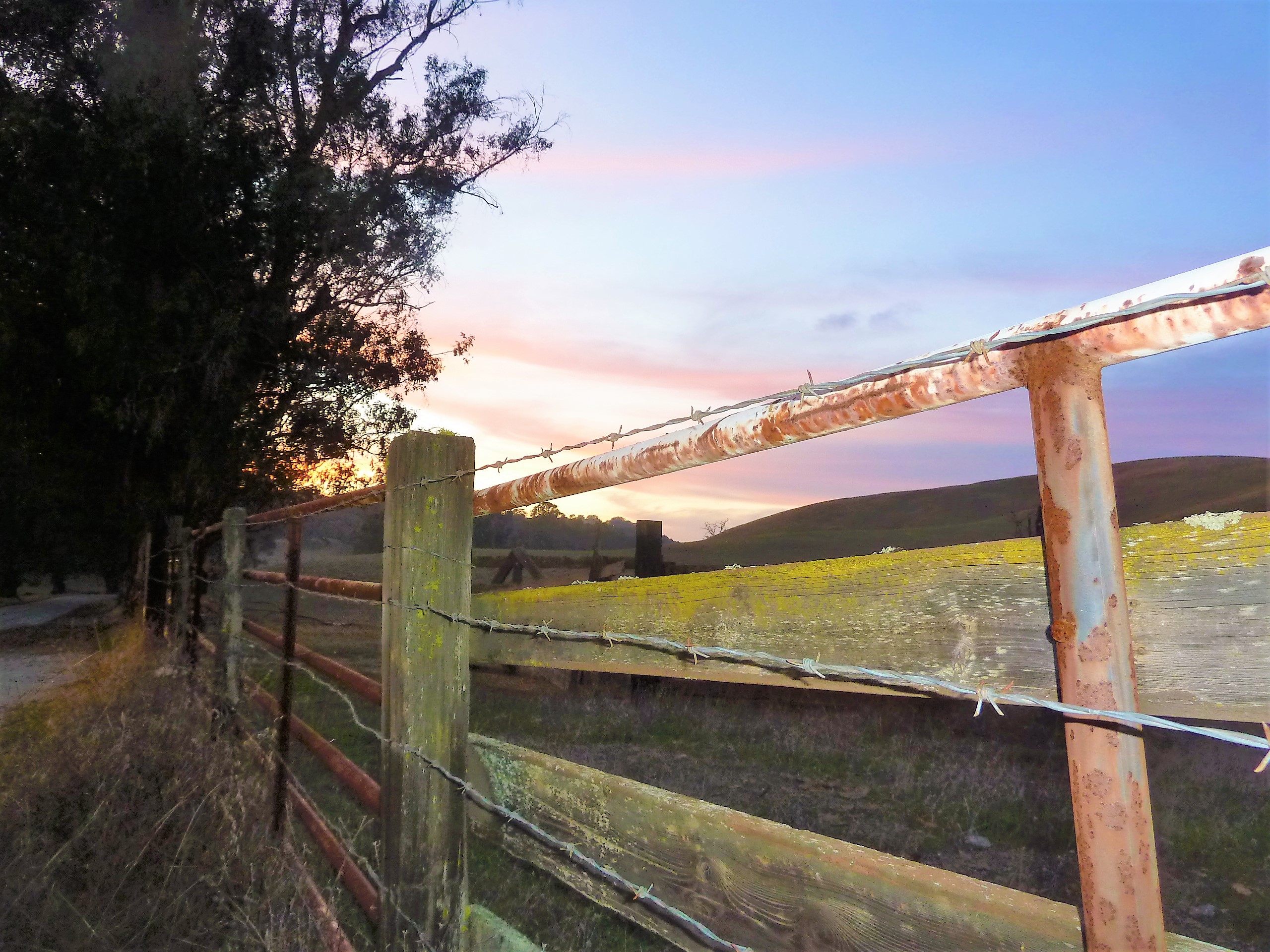
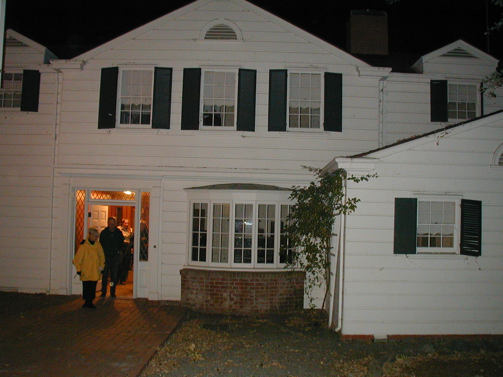
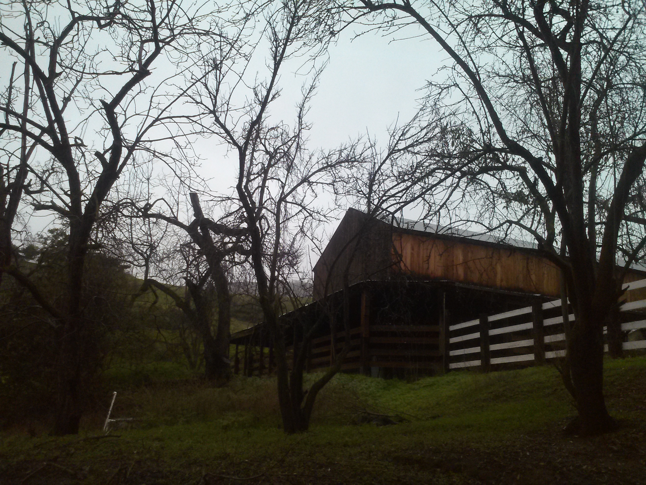
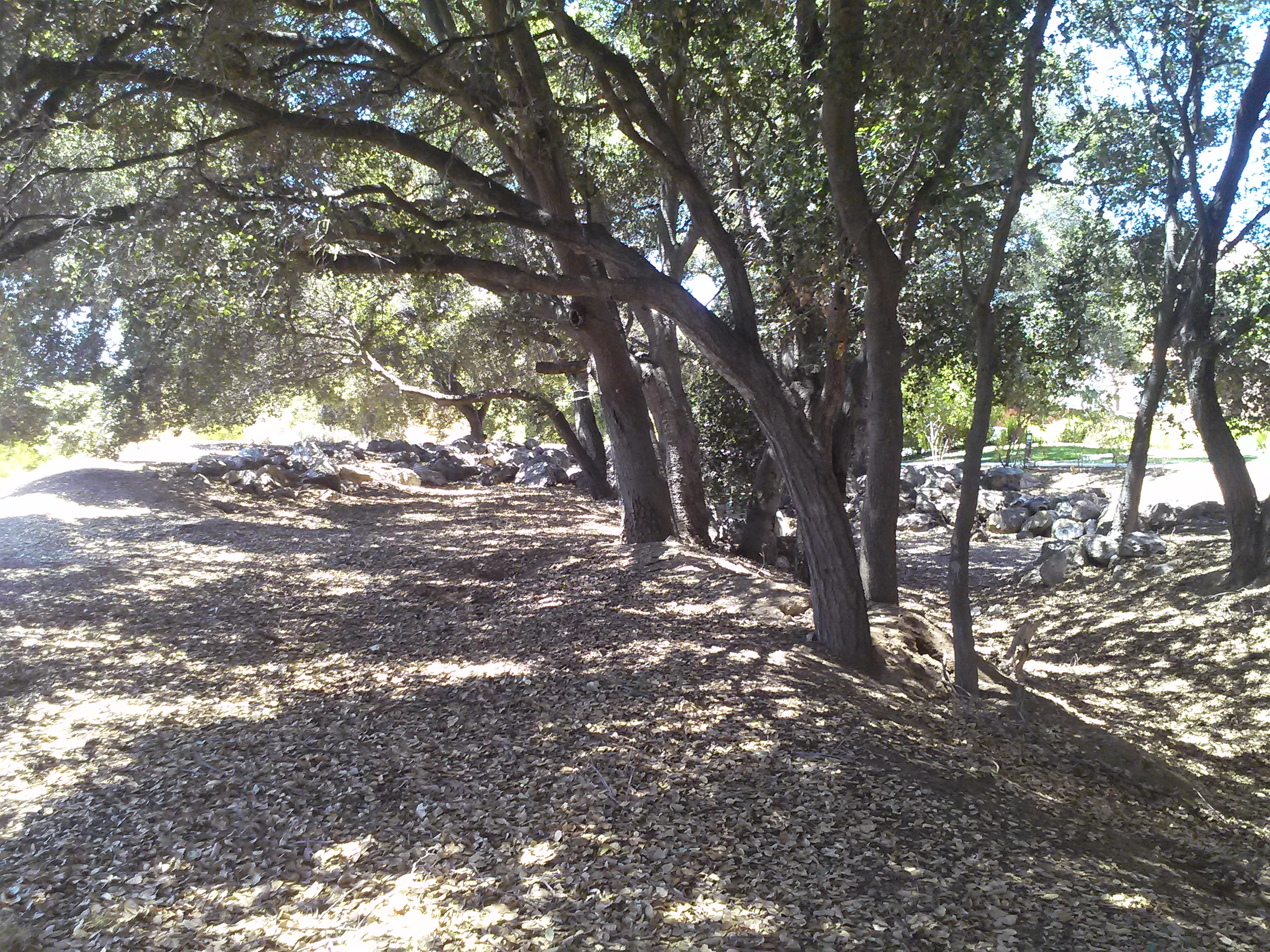
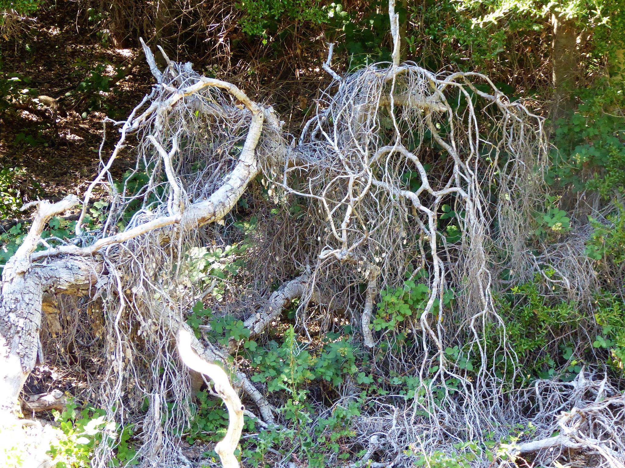
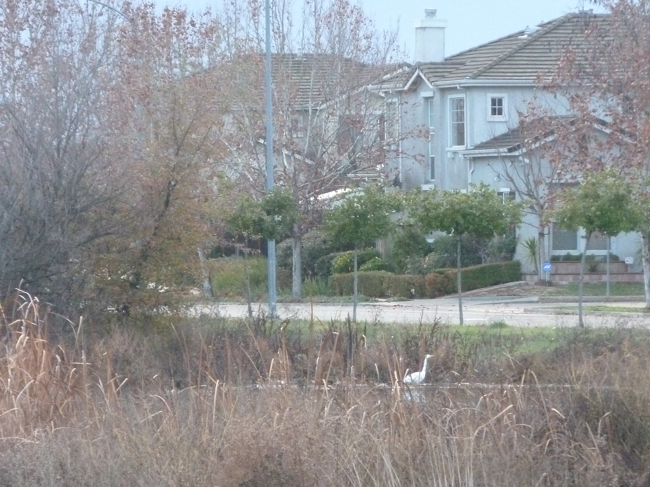
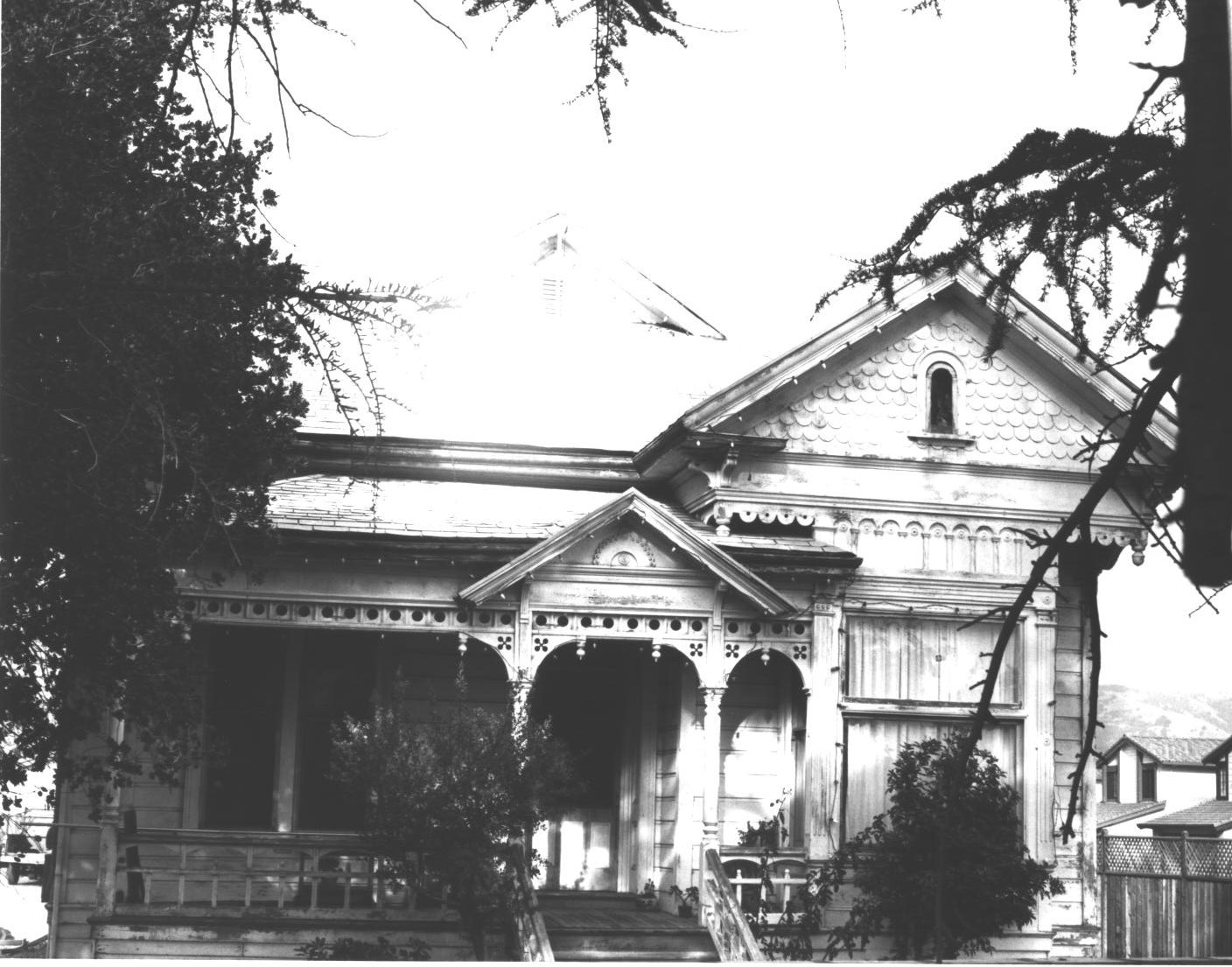
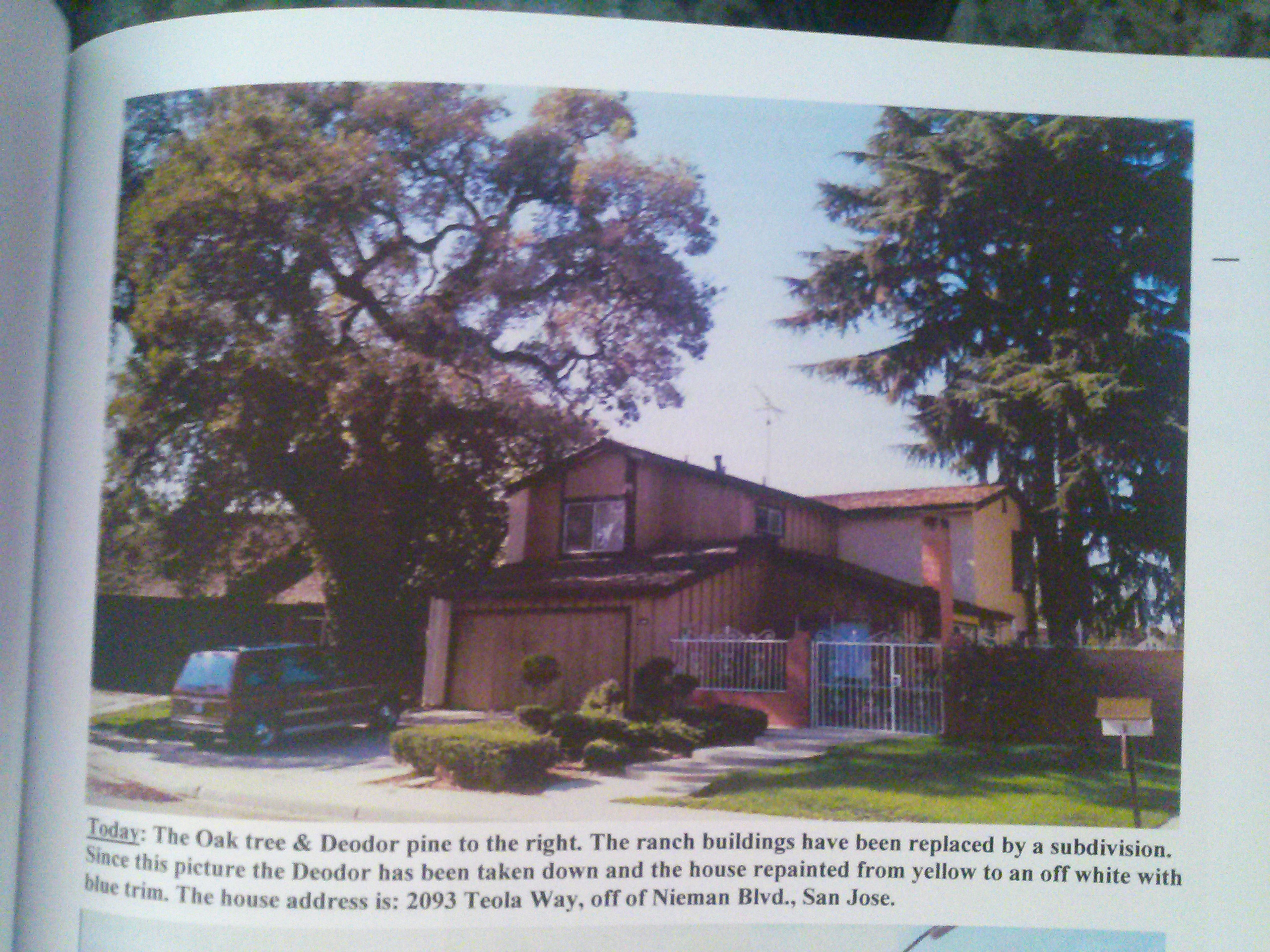
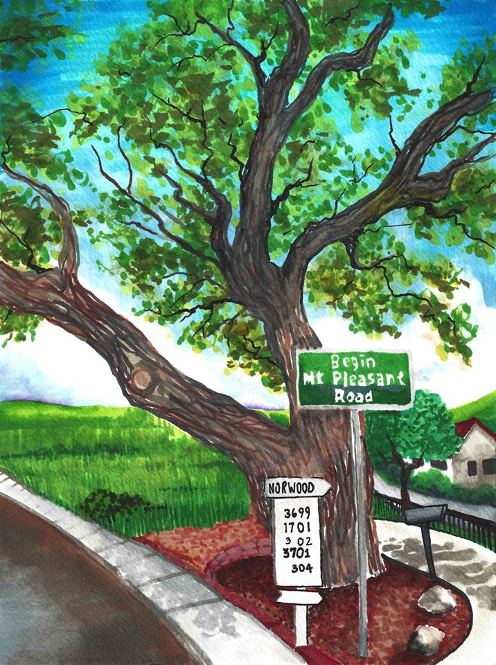
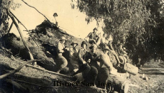
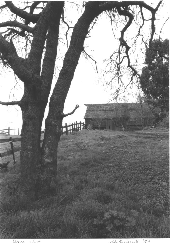
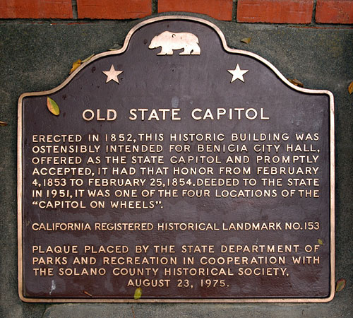
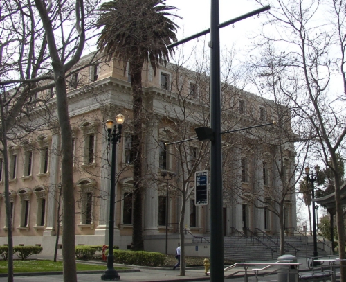
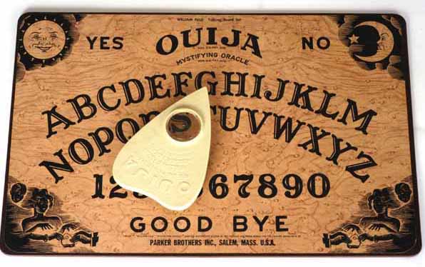
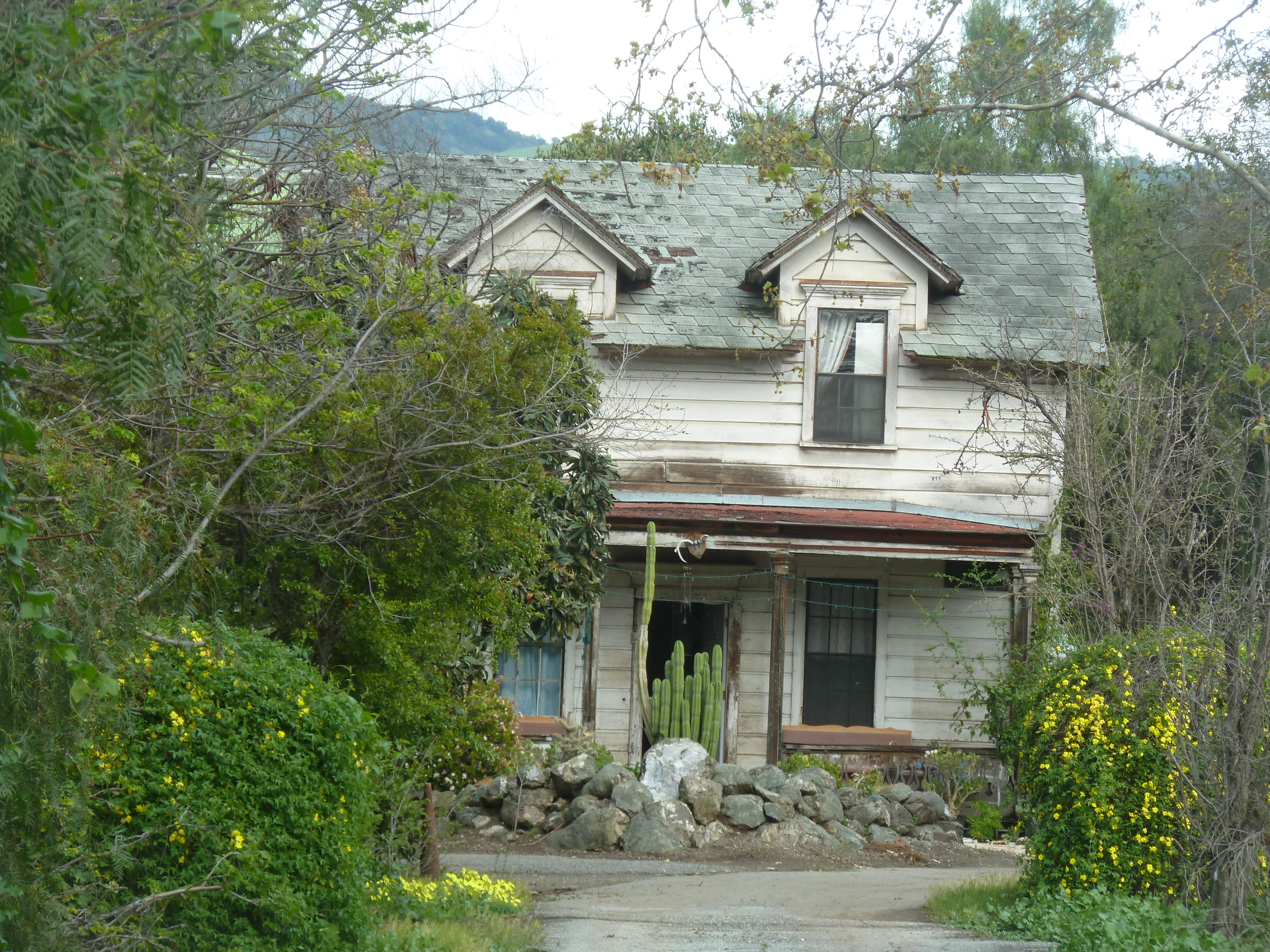
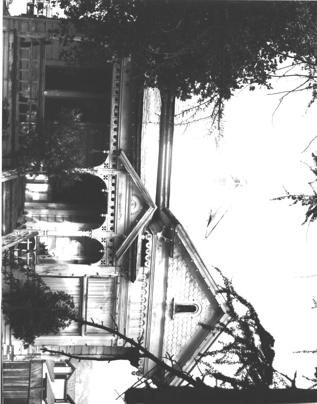
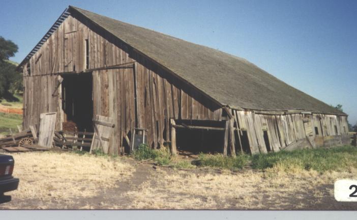
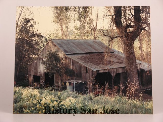
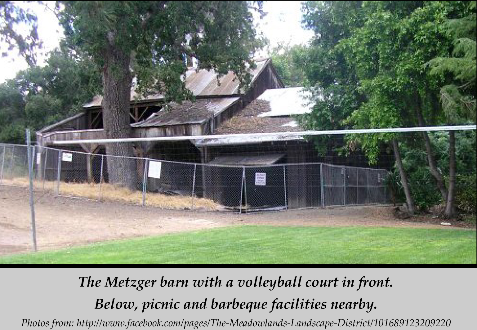
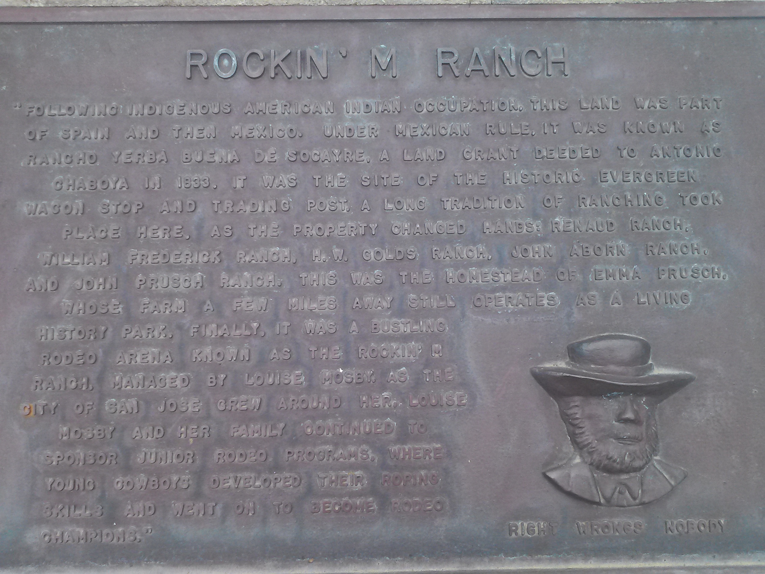
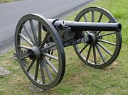
Somewhere we would enjoy screams before it was enveloped by home development is a place others also report as having been haunted.  I can’t find much of this online, but the experiential data yielded positive results.  I know I was spooked enough  once or twice to bolt out of there.  Today, it’s a historical landmark that needs some love.  Reminds me of the Wehner Mansion, also with historic designation but no preservation.  (There were no reports of spirits from Wehner Mansion except wine.)  This is how I remembered the relic.

2012234

spring2012.pdfToday, the Metzger Barn still gets haunting reports but serves a dual purpose as a quasi-park.  Though secreted away, it’s open to the public.  The complex even has picnic tables and a volleyball court.  At night, there are reports of phantom rattling chains and ghostly crying observed.  I’ve also read about an experience with hanging animals from the rafters.  I’ve personally observed the heeby geebies.  I’ll not spoil this haunted tale for you.  Since I’ve ruined other perfectly good ghost stories, I won’t ruin anymore for you.

Joseph Grant Residenceuntitled2121Joseph D. Grant Park, very nearby Evergreen in neighboring Ranch Canada de la Pala, has a historical complex of structures and gives tours of the haunted main house.  If you want a frightful experience, you’ll have to sweet talk rangers or historians into coming back to work on their time off but it’s been done before.  Built in 1882, ghosts can be witnessed in mirrors, along with loud noises and footsteps were observed.   Other strange paranormal feelings would be reported by guests and park rangers alike.  Ghost hunters have enough evidence to confirm their own superstitions.

Evergreen has haunts you can see and some you can pass up on.  Metzger Farm and Joseph Grant Park seem to be your best bet for spirits.  A night drive over San Felipe Road and a misadventure up Las Animas Road are certainly spooky if that’s your thing.


The Man with a Hoe

Charles Edward Anson P1310885Markham (1852-1940) is characterized as a minor American poet.  Since he has Evergreen roots, we’ll designate him a major Evergreen poet.  Edwin Markham was a teacher at the Evergreen Schoolhouse from 1869-1889.  During those twenty years, he would write from the East Foothills and inspire and educate students from the Chaboya family, Kettmann family, Smith Family, certainly one day principal and superintendent, Katie R. Smith, Aborn Family , Chew Family and others.  He was so cherished by the community, a redwood tree would be planted in his honor.
markhamThough not published until 1899, ten years after Edwin Markham left the employment of the Evergreen School, I like to speculate about his inspirations.  The Oregon native wrote poetry about the working class life in the late 1800’s.  He would’ve worked on the family farm as a child, like most children at the time, in the north bay area.  He would finish his teaching credential at San Jose State, then known as the Normal School, and fall in love with Evergreen.  From 1921-1931, Edwin Markham would be Poet Laureate of Oregon.
manhoe1Edwin Markham incites emotion through his metaphors and that familiar sense of earning.  It is often said that Markham’s “The Man with the Hoe” was inspired by Jean-Francios Millet’s painting of the same subject, shown here to the left.  That may have been a contemporary pop culture influence, however, Markham would get to see this activity quite regularly during his twenty year teaching stint in the town of Evergreen.
P1320557I have specific details about the farm adjacent to the schoolhouse using hoes, pitchforks and sickles, archaic equipment the immigrant family would’ve used in the old country.  The farmers in Evergreen during this time would have front row seats to the Industrial Revolution and watch their equipment mechanize before their own eyes.  Poorer farmers would have to work by hand until Evergreen’s labor force combined and circulated large rigs to harvest everyone’s fields.
Markham’s poetry would very much parallel the hardworking farmer’s plight during this time in history.  Evergreen was farm country, first appearing in the Altas in 1867.  Markham would move into Evergreen in 1869, as one time squatters became legal land owners and brand new farms were being raised all over town.  It would be harder to imagine Markham’s work not being inspired by his time in the little farming town 8 miles outside the City.
Here’s Markham’s poem.  If you enjoy this, read on.  His poetry is quite lovely.

The Man with the Hoe

Bowed by the weight of centuries he leans 
Upon his hoe and gazes on the ground, 
The emptiness of ages in his face, 
And on his back the burden of the world. 
Who made him dead to rapture and despair, 
A thing that grieves not and that never hopes. 
Stolid and stunned, a brother to the ox? 
Who loosened and let down this brutal jaw? 
Whose was the hand that slanted back this brow? 
Whose breath blew out the light within this brain? 
Is this the Thing the Lord God made and gave 
To have dominion over sea and land; 
To trace the stars and search the heavens for power; 
To feel the passion of Eternity? 
Is this the Dream He dreamed who shaped the suns 
And marked their ways upon the ancient deep? 
Down all the stretch of Hell to its last gulf 
There is no shape more terrible than this — 
More tongued with censure of the world’s blind greed — 
More filled with signs and portents for the soul — 
More fraught with menace to the universe. 
What gulfs between him and the seraphim! 
Slave of the wheel of labor, what to him 
Are Plato and the swing of Pleiades? 
What the long reaches of the peaks of song, 
The rift of dawn, the reddening of the rose? 
Through this dread shape the suffering ages look; 
Time’s tragedy is in the aching stoop; 
Through this dread shape humanity betrayed, 
Plundered, profaned, and disinherited, 
Cries protest to the Powers that made the world. 
A protest that is also a prophecy. 
O masters, lords and rulers in all lands, 
Is this the handiwork you give to God, 
This monstrous thing distorted and soul-quenched? 
How will you ever straighten up this shape; 
Touch it again with immortality; 
Give back the upward looking and the light; 
Rebuild in it the music and the dream, 
Make right the immemorial infamies, 
Perfidious wrongs, immedicable woes? 
O masters, lords and rulers in all lands 
How will the Future reckon with this Man? 
How answer his brute question in that hour 
When whirlwinds of rebellion shake all shores? 
How will it be with kingdoms and with kings — 
With those who shaped him to the thing he is — 
When this dumb Terror shall rise to judge the world. 
After the silence of the centuries?

Evergreen School House Rocks

image001 The Evergreen Schoolhouse opened in 1860.  There were enough Chaboyas, both European and American homesteaders and rancheros families to open up a school in Rancho Yerba Buena.  It would be incorporated into the Santa Clara County Education system in 1866 as the township became more established.

markhamFamed author Edwin Markham (1852-1940) would come to Evergreen Schoolhouse to teach in its early days after attending San Jose State University.  Teaching in Evergreen from 1969-89, he would recall the days of a single story school house, replaced by a larger two-story one.  A nearby redwood tree was planted in his honor after teaching there for twenty years, which I intend to find if it’s still around.  The Redwood would be over 100 years old now.  It is said the Evergreen helps inspire some of Markham’s work.  The commemorative redwood tree also might be the inspiration of the Evergreen trees in the School District’s logo.

P1310885In general, the School’s schedule would sync up with the fruit picking seasons and operate 10 months a year.  They insisted on keeping the school free to the public and secular from its inception.  My old time interviewees would recall the school house at the corner or San Felipe/White Road and Aborn Road, then Evergreen Road.  That may seem odd now, but it would’ve been located there the shopping center and Valero gas station stands today.  The land was donated by Mr. Nirum Cadwallader, who also donated the same amount of land to the WCR some years later, and upheld the donation by William Matthews in the transaction to Geo. Kettmann.  Education has been something Evergreen residents have felt strongly about since the town began.  The Schoolhouse had been there on Evergreen Road, now Aborn, since the 1860.  I think it’s so cool that today’s well-known creek crossings would’ve been somebody else’s path to school 150 years ago.

165) Kathrine Smithls1Katherine R. Smith (1870-1973), daughter of town leader and postmaster Francis J. Smith, would come back to Evergreen schoolhouse after being one of the first women to graduate from San Jose State University and teach down the street from her house.  The school house would remain there for a long time.  Katie is huge part of Evergreen History.

Charles C. Smith, F.J. Smith Store and Residence, Adam Herman,The two-story school house would be moved by rolling it over logs down the street on San Felipe Road and Yerba Buena Ave. during the 1950’s.  This is when San Felipe would’ve changed directions and Keaton Loop created.  Post World War and new City Planning developing in effect, Evergreen’s update began with this major move.  It also helps explain why this view of the Smith homes feels incorrect. From the drawing, the road now runs between the houses and business, and this driveway between them is essentially Yerba Buena Avenue.  Directly next to this road would’ve been Dry Creek, now known as Thompson Creek.  The Schoolhouse would come to stand where the General Store and Winery are.

P1310652That’s right, the schoolhouse moved across the street from Katherine’s House.  How rad is that?  Katherine, Katie, would become Superintendent of the Evergreen Elementary School District, watch the school outgrow this two-story facility and move to Fowler Road before expanding with new schools.  The Evergreen School is where Evergreen Elementary School is today.  Katie would live to be 103 years old and known as the Daughter of Evergreen.  As a staple of the Evergreen Community and a beloved educator, it only seems appropriate to name Evergreen’s second school in her honor in 1962.

P1310650This two-story school house still stands today, or at least that’s what I had heard from fellow Evergreenians.  I did some digging.  I found what stands where the schoolhouse was last seen.  There is this odd, adobe looking, older apartment building, called the Chaboya Apartments, standing there now at the intersection of San Felipe Road and Yerba Buena Avenue.

P1310647What I was not understanding or seeing before was that the Evergreen Schoolhouse does still stand, but with the addition to the original building disguising it.  I took a closer look at what was there and found the Schoolhouse I was looking for hidden in plain sight!  I find it here farthest to the right in the picture to the right.  It would be naturally to extend evenly in each direction, but you’re pretty limited in repurposing a building with a creek in your backyard.  To say it’s gotten some body work would be an understatement, but that’s it with the stairs leading up to it.  Only the front got the more modern adobe facelift.

It’s an incredible finding as the Evergreen Elementary School District is an ally of The Evergreen Mural Walk project, as well as a source of its inspiration.  Education is something we’d like to focus on here in Evergreen and that strength came from within in many instances.  Katie is one of those inner strengths.  The students still living having used this facility are still a connected family here in Evergreen.  Here’s some of the artwork inspired by the early days of the Evergreen Elementary School District.

18701860


Pioneering Squatter’s Rights

Screen Shot 2015-11-02 at 5.59.57 PMCalifornia would be fast tracked as a State and the Village of Evergreen would become a town where immigrants could find the American dream coming true.  The same could be said of Willow Glen, Saratoga, Berryessa, Santa Clara, Alviso and other towns surrounding the Pueblo of San Jose during the 1850’s being turned into highly profitable orchards and vineyards.  Many would find new homes in early Evergreen from back East, the Midwest and even Europe.  This did, however, create stiff tensions between newcomers and the Mexican Rancho owners across Santa Clara Valley.  These tensions would come to a head in Evergreen with a “Settlers’ War”, culminating in a fight over Squatters’ and Homesteaders’ Rights.  Rancho Yerba Buena Socraye is the boundary of Evergreen, so its stories are our stories.

1821Marcos Chaboya and his family, as Californios, would come to the Santa Clara Valley in the 1820’s to settle the area with vast herds of cattle.  I have varying sources as to whom sponsored Chaboya’s trip, the Spanish or the Mexican Governments.  Antonio Chaboya would be granted over 24,000 acres of Rancho Yerba Buena in 1833 by the Governer of Alta California when California was a new Mexican territory.  The boundaries of his rancho create the modern boundaries of the Evergreen Community.  Antonio’s brothers would also be granted land nearby in Santa Clara County.

california-vaquero-granger24,000 acres is really hard to survey and keep an eye on on horseback.  The Chaboya family and their ranch hands wouldn’t be able to ward off all of the Ohlone Natives, American settlers and European newcomers who would make a home at Rancho Yerba Buena.  Don Pedro Chaboya would lead the charge to run off returning indigenous people from the ranchos in the 1820’s.  Antonio Chaboya’s brothers, owning ranchos nearby, would suffer a similar fate.   California was recently accepted into the Union as a full fledged State, and these events were some of those growing pains.

So, what’s the United States Government to do about a Mexican land grant it upheld in court in the new State of California and the American Dream it promised to new Californians?

CAM09418John Aborn would immigrate from England to California through San Francisco as early as 1833.  Aborn, for which Aborn Road is named for, would be a veteran of the Mexican American War and the Civil War.  He would also be named as a defendant by the Chaboya family for illegally homesteading on his property, or “squatting”.  People liked this defendant so much, they named a road in Evergreen after him!  He married a Donner Party survivor.  The word on the street, rather the plaque, is that he held a popular rodeo back in the day off Neiman Boulevard and Capitol Expressway.  How are you gonna deny this man his rights after fighting for your liberties?

1876 Map6955a6b8-abad-4f8f-989b-b1f73be4336fLet’s back up.  What brought on the hostilities in Evergreen?Antonio Chaboya would first appear in court in front of Justice McKee to evict farmer John Tully, an Irish immigrant, from Rancho Yerba Buena in 1856.  This decision was a compromise.  Chaboya would have to sell his land for a fair price.  John Tully wouldn’t be evicted and paid $900.00 for the fine in 1858.  In 1861, John Tully would come up with $4,400.00 for the real estate having gone through proper channels.  After this point, Homestead Laws would dictate that a farmer would need to live and work on the property for 5 years and that only 160 acres could be obtain through this avenue.  Judging by this map in 1866, this was probably the John Tully property being fought over.

Chaboya’s land grant was patented by the US Government and upheld in 1858.  Did John Tully’s case create a poor precedent for Chaboya’s grant or did it provide opportunity to pursue monetary damages?

113) Louis Frederick Farnsworth, circa 1910In 1858, Rancho Yerba Buena would be defended again from newcomers.  These named defendants were Chauncey C. Barbour, Truman Andrews, William Raymond, Thomas J. Baxter, Benjamin Kenny, John Aborn, Andrew Gheringer, Thomas Farnsworth, George Osteck, Jacob Newhouse, Patterson Barnard, William McClay and James M. Bottsford.  Antonio Chaboya would name these thirteen families even though approximately 500 people occupied Rancho Yerba Buena illegally.  These Evergreen residents would have just be looking for their space in a growing country, finding their way to one of the prettiest, most inspiring places.  I would try to hold on to my home, too.

hb896nb4gd-FID3In 1860, Antonio Chaboya would be successful in court and be  granted his eviction of the homesteaders, but there were riots as Sheriff John Murphy tried to enforce the law.

The Sheriff of San Jose made several attempts to evict the new farmers from Evergreen.  Here’s the thing.  It’s hard not to empathize with the newcomers.  Antonio Chaboya had one of the largest ranchos in all of California then upheld by the United States.  Other ranch owners were loosing their court battles and their ranchos, including Antonio Chaboya’s brothers.  Chaboya couldn’t even have it surveyed often enough to keep people from setting up shop long term.

180px-CW_Arty_10lb_Parrott_frontIn 1861, Evergreen residents would have the support of the rest of Santa Clara County.  Sherriff’s officers didn’t want to arm themselves and serve the eviction notices and force farmers to quit their property.  Of 600 Officers, none wanted to perform the duties asked of them so Sheriff Murphy excused them for their duty.  Evergreen residents would march the 8 miles into downtown San Jose to St. James Park and the footsteps of the court to contest the eviction.  During another attempt, the towns of Saratoga, Berryessa and Santa Clara sent over 2000 troops in support of the new residents.  Saratoga even brought a cannon to hold off the eviction papers.  People in and around the City of San Jose would come to Evergreen’s aid and empathize with their struggles.  The Sheriff Murphy must have supported Evergreen farmers in some way, because he later married the daughter of John Aborn, Miss Maddie.

Map 004, Saratoga, Evergreen, Santa Clara, San Antonio, MountaiRancho Yerba Buena and Antonio Chaboya was now saddled with a ton of debt mounting from his legal cases against squatters.  The Chaboya family was land rich but cash poor.  He couldn’t also continue to pursue this eviction and hold on to his property.  Antonio Chaboya pursued the peaceful solution which would change Evergreen forever.  First, Antonio and his family settled debts to his team of attorneys by parting away the asset he had in abundance, land.  Lawyers J.B. Hart, Hiatt R. Hepburn, Henry Wilkins and William Matthews would be the first legal residents, along with John Tully, of the Evergreen are.  The lawyers would be compensated for their legal fees in the sale of these large properties.  After portions of Hart’s property and Matthews’s property were sold to farmers like the Smith Family, James McCarley and the Stevens Family, the Village of Evergreen was born, with an epicenter of Evergreen Road and San Felipe and White Roads.

6254416259_78f082522aAntonio Chaboya’s family would finally profit off of the sale of their own real estate in 1875 with the sale of John Hassler and George Kettmann acquisition off of then Evergreen Road.  From this transaction, life long friendships would be made between the Kettmann and Chaboya clans.  The Chaboyas would come to grips with the changing times and downsize their lands considerably.  The Chaboya family would continue to own farms up and down Quimby Road for another 50+ years.

P1310192In Evergreen, this was huge news at the time.  It would soon be an event everyone wanted to forget quickly.  Evergreen farmers like John Aborn, Thomas Baxter, Thomas Farnsworth, George Osterk and William McClay would stay in town and raise their families in Evergreen even after the court cases and eviction situation.  Though not a non-violent protest, luckily this was settled without bloodshed.  It must have been so hard to part with the big, beautiful Rancho Yerba Buena, but what the Chaboyas made room for was for new neighbors and a developing California.  Soon after, Evergreen would be planted with orchards, vineyards and hayfields.  Here’s some of the artwork that incorporates these players, even if we omit the event for the most part.  1821 1833 185518771885 1895