Tag Archives: Rancho Yerba Buena

Silver Creek – the Creek

P1100107 (2)
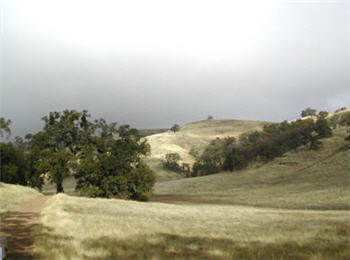
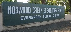
How else do we learn about our creek beds and their healthy or climate than taking a look at them up close and personally?  I ventured into our creek beds which gave me an awesome understanding of our fair Evergreen.  Today, we’re going to discuss a creek bed which is the namesake for the Western region of Evergreen between its namesake and Coyote Creek.

a 1876 map

watershed
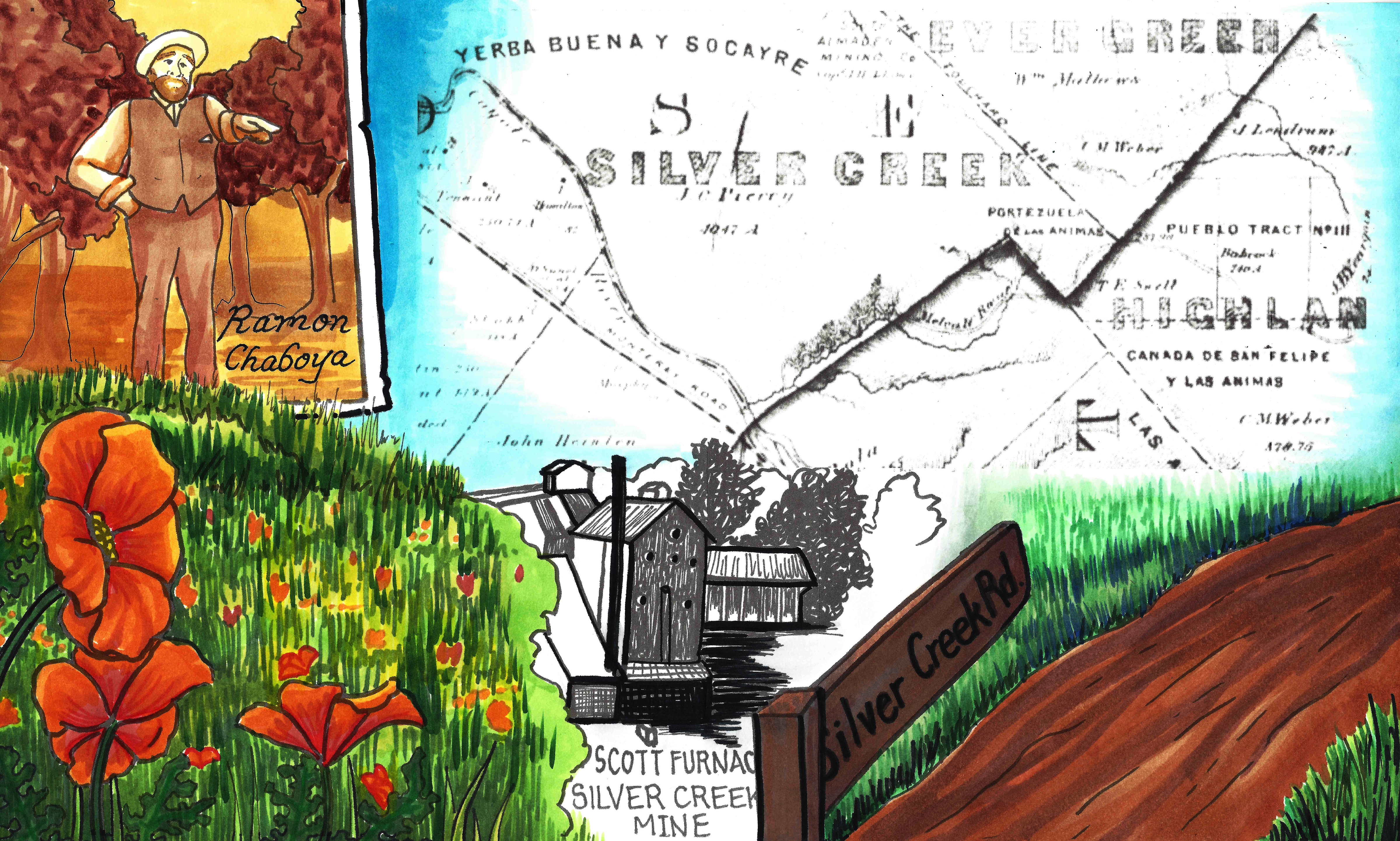
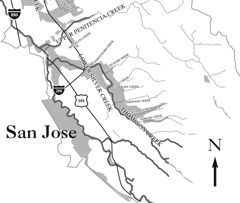
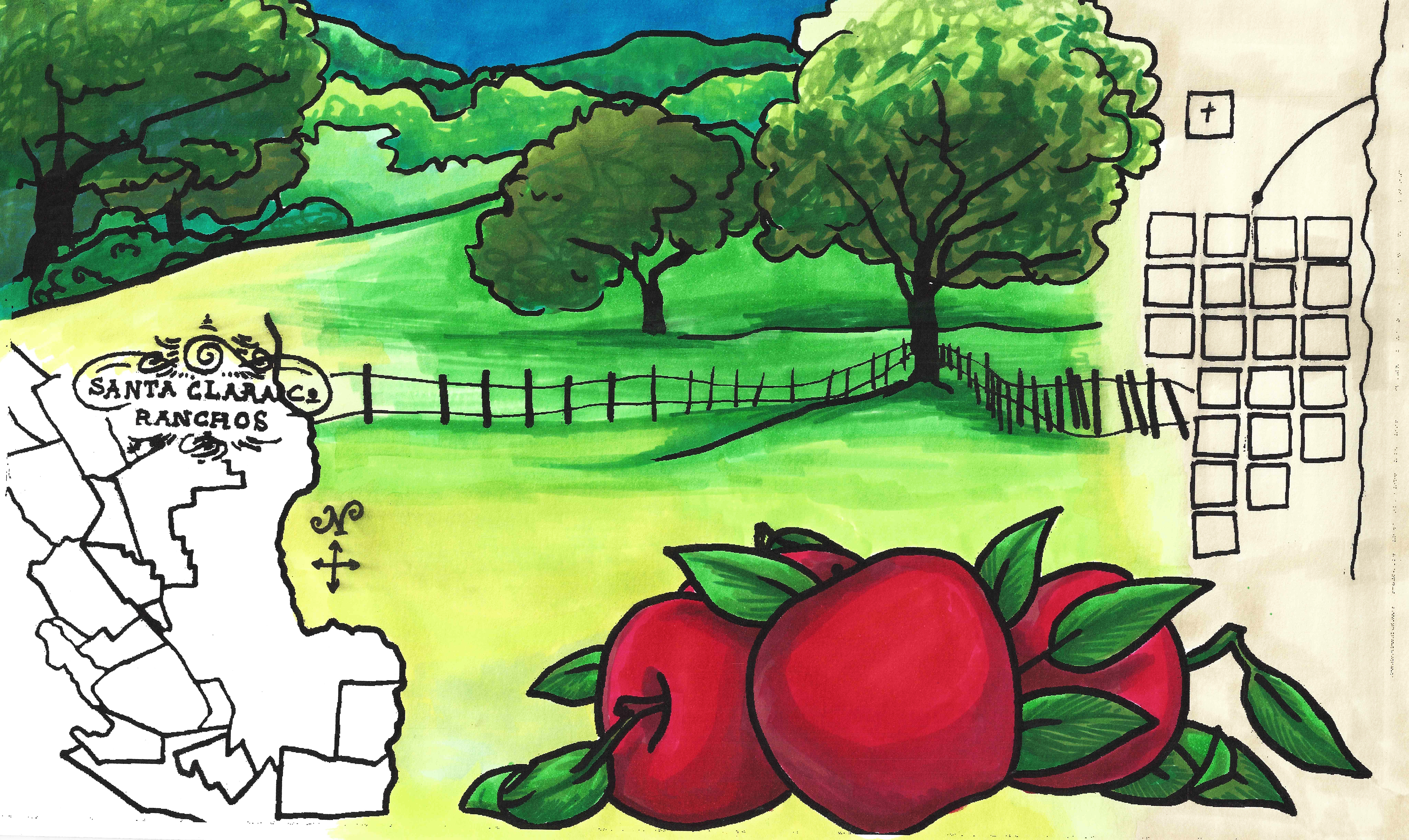
That’s right.  I’m talking about Silver Creek.  I went to Silver Creek High School, built in 1969, and never once wondered why the name.  When I first started this project, it appeared that Silver Creek was an important part of Evergreen’s story.  Farmers with land attached to creeks had the upper hand.  Before Silver Creek, the area, was an idea, the creek was there and Cunningham Lake was named Silver Lake.  This creek must’ve been so large, it contributed to the naming of the region.  In fact, the whole network of creeks through Evergreen contribute to the Lower Silver Creek Watershed.

map
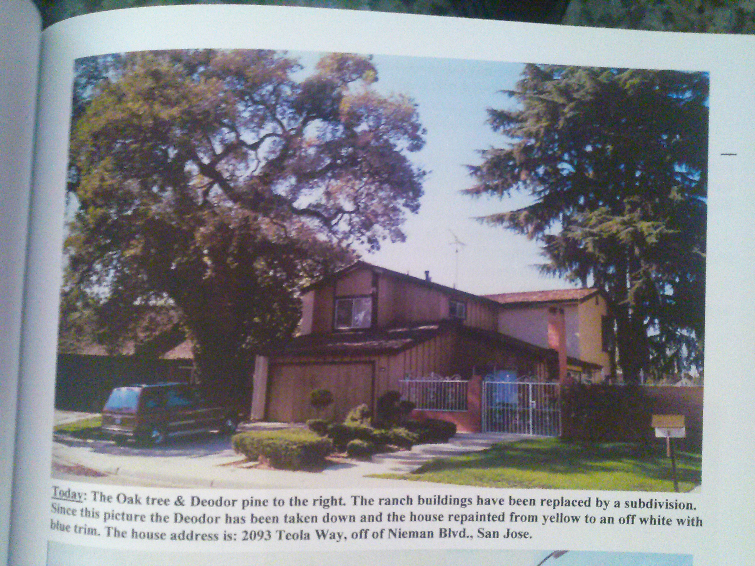
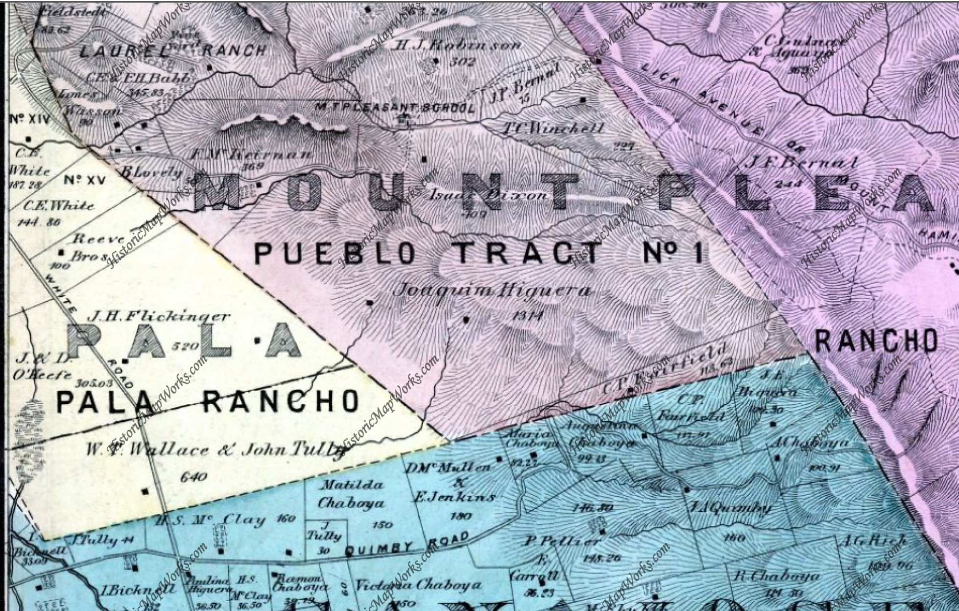
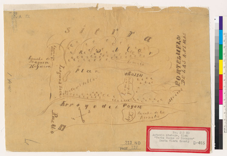
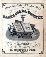
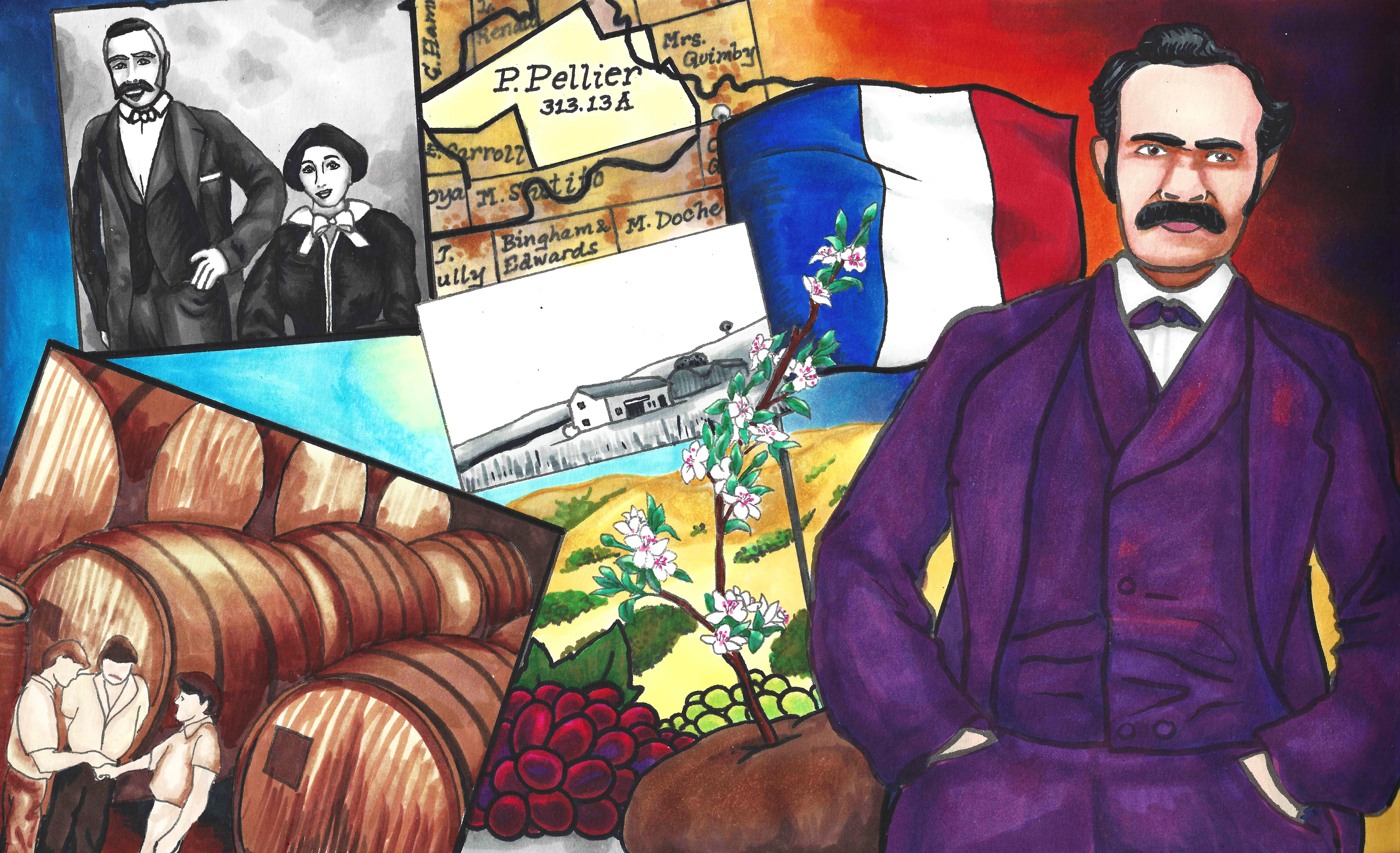
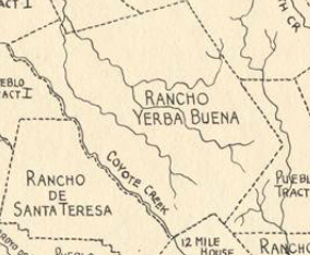
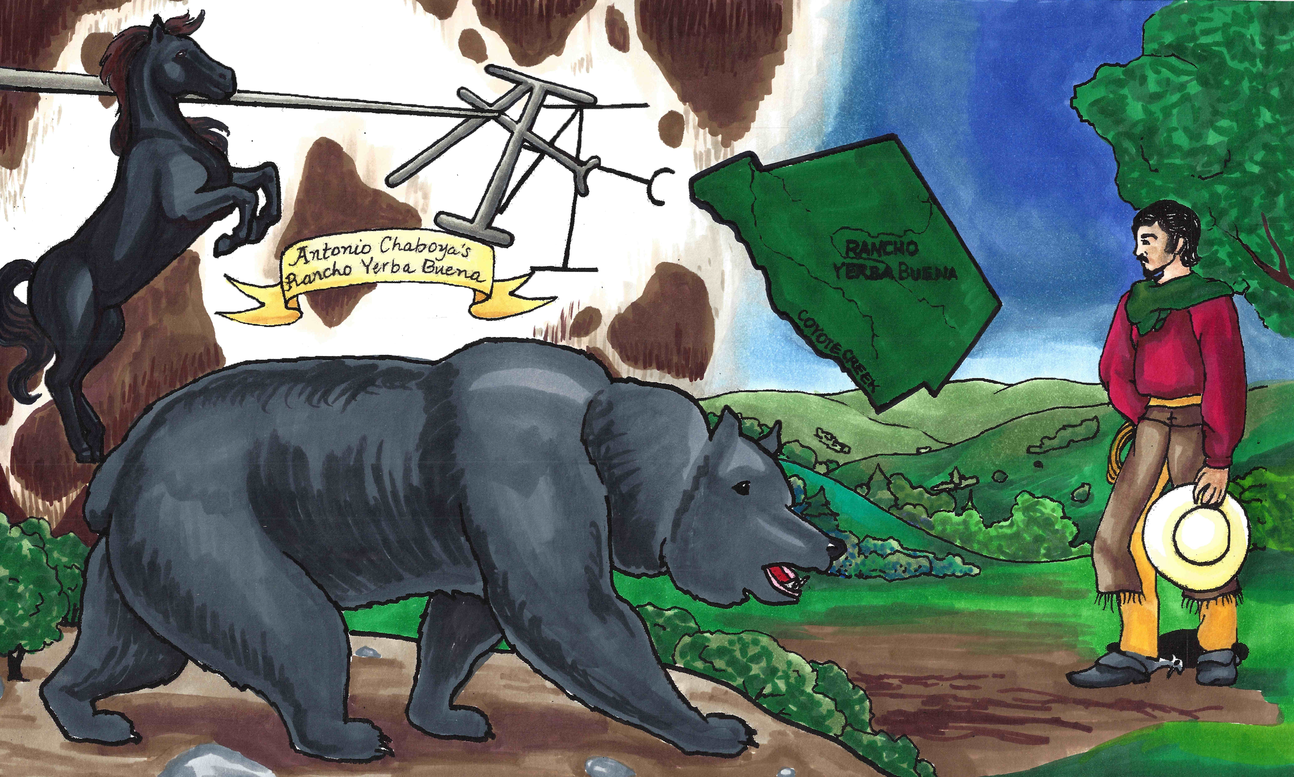
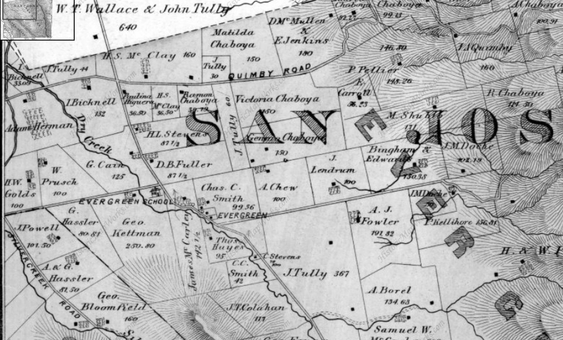
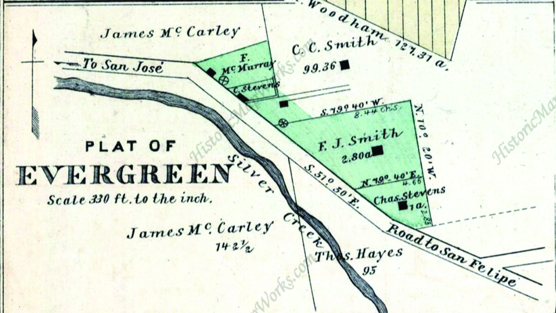
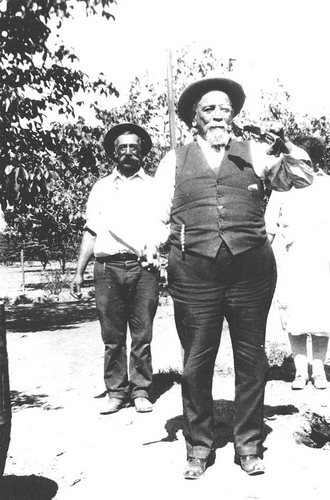
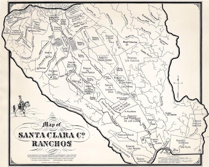
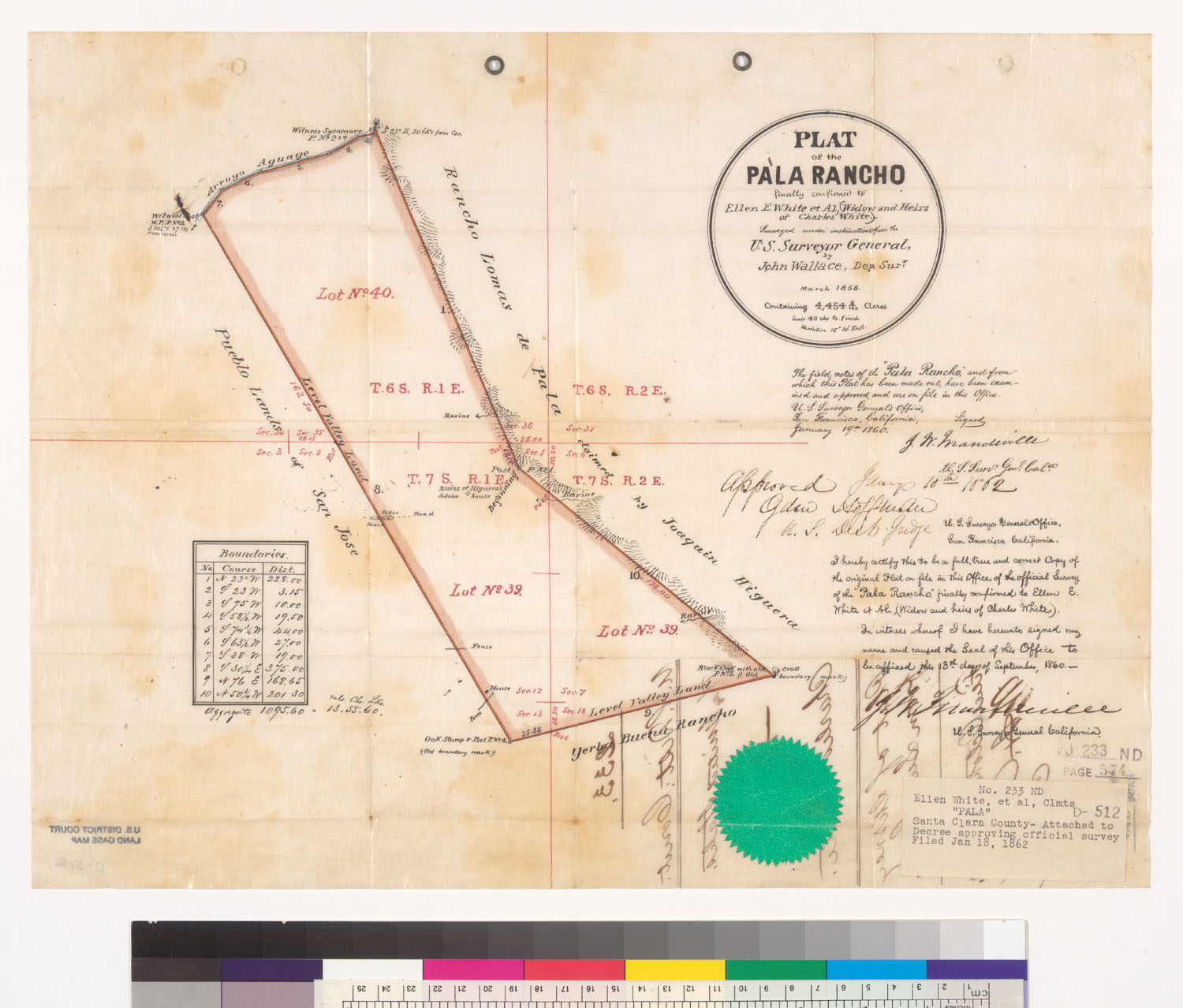
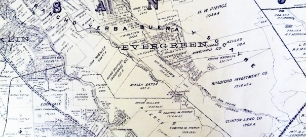
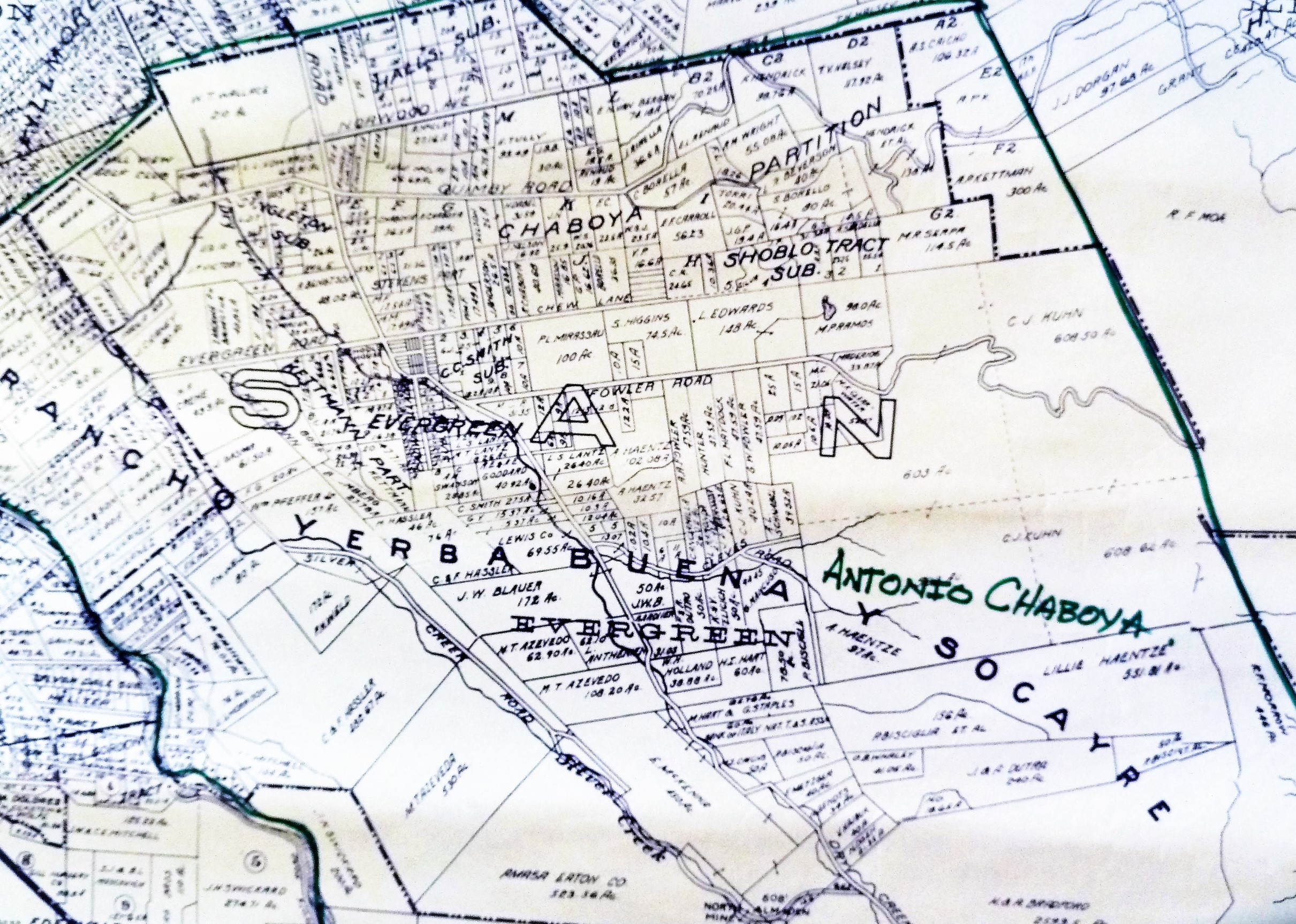
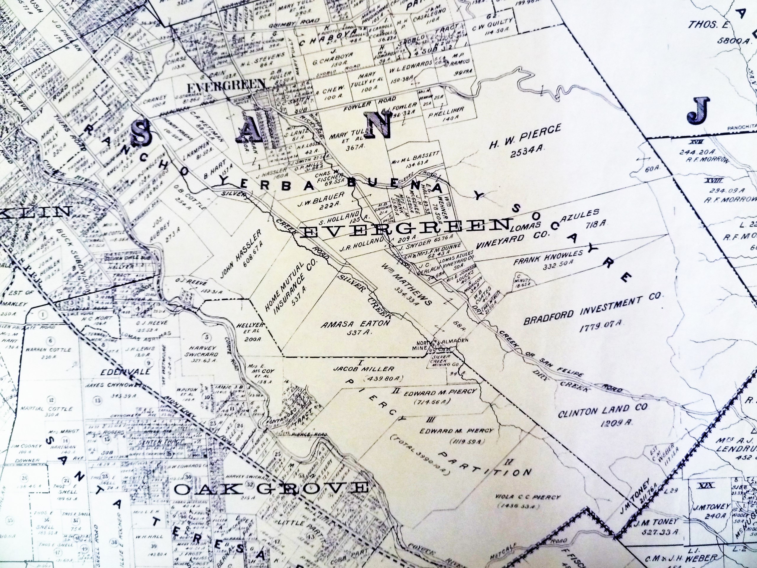
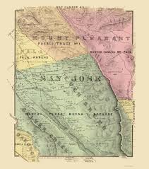
Silver Creek, as in the neighborhood and Evergreen’s first high school, has beenlocated on maps at least into the 1860’s.  Silver Creek, the area and the Creek, are historic.  This 1867 Altas shows it off predominantly.  It’s 2 miles outside of Downtown Evergreen, located off San Felipe Road and Evergreen Road.  It might’ve grown up as a town had stores not opened in nearby Township of Evergreen.  Because of its closeness to Edenvale and Downtown San Jose, it was incorporated into the City Limits earlier than Downtown Evergreen.  Evergreen is the entire Rancho Yerba Buena.  This area too being so far West would’ve been settled pretty early on by squatters.  Some of the defendants in the Chaboya case from these area specifically were the Cottle Family.

13415435_10206847123792679_6986196633091196421_o
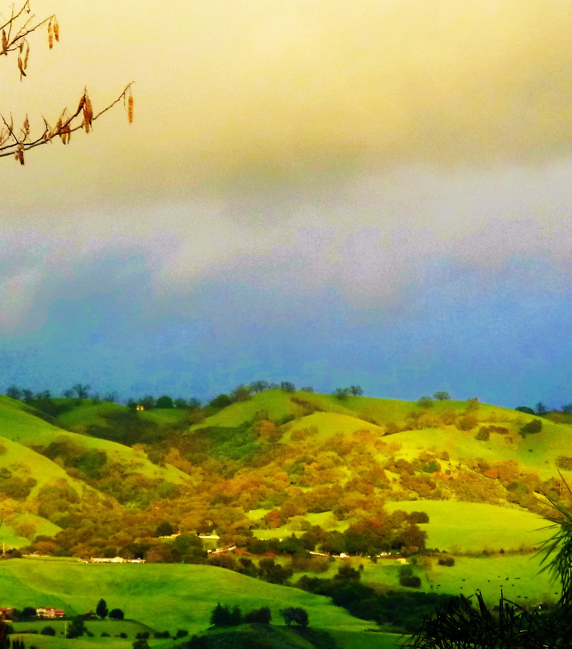
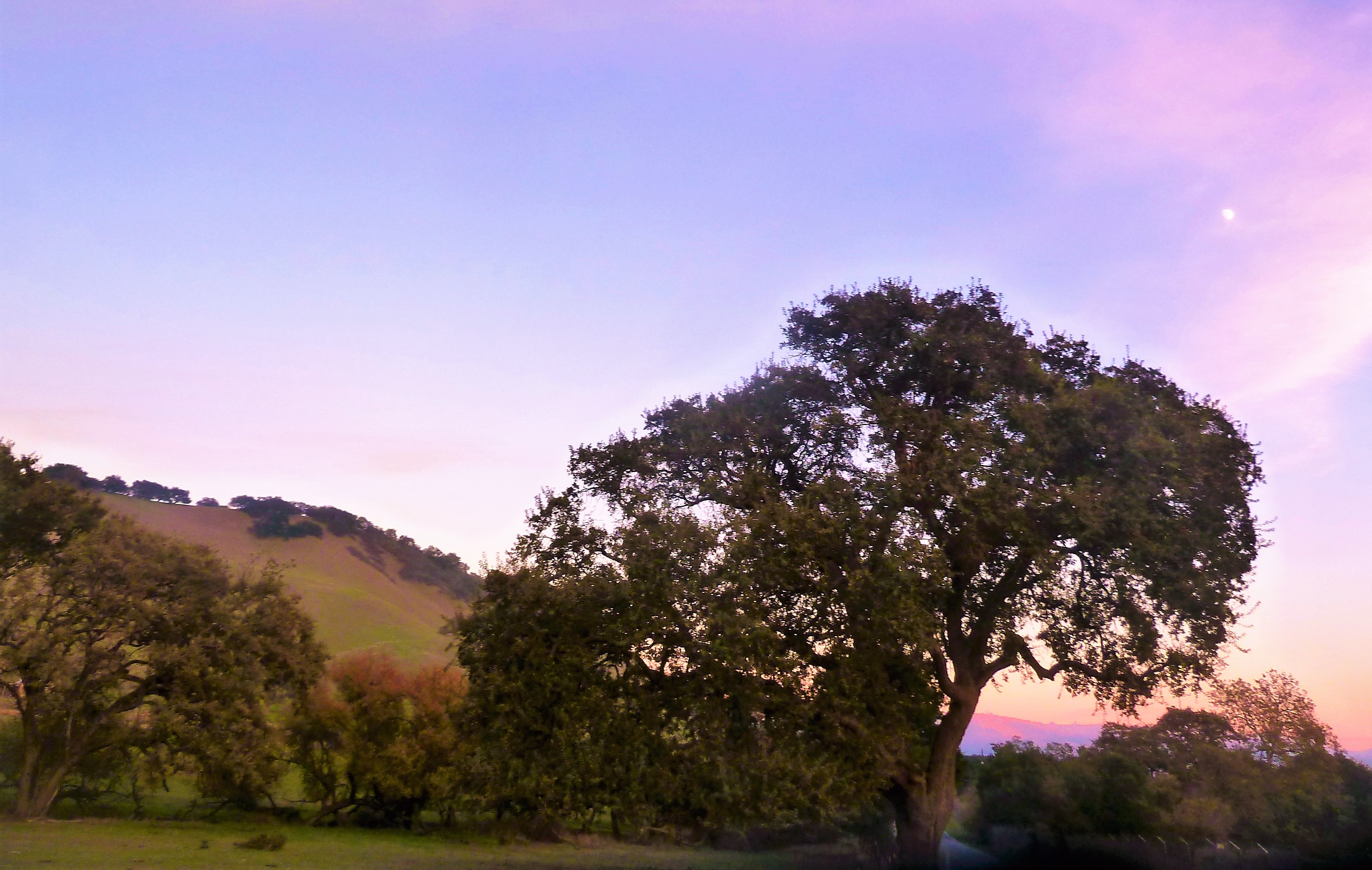
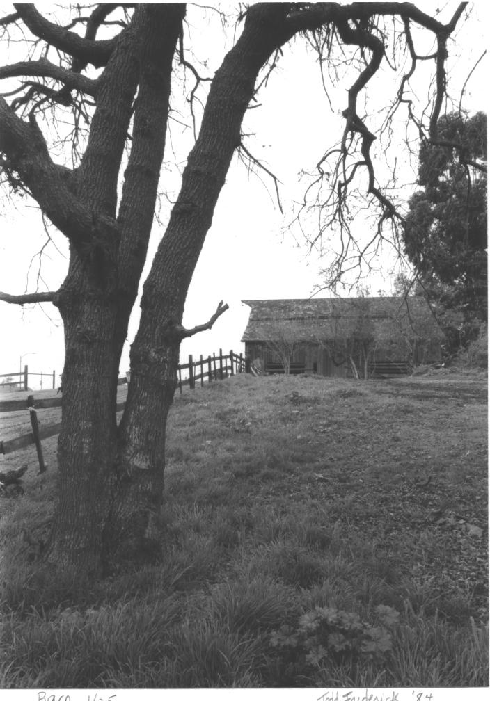
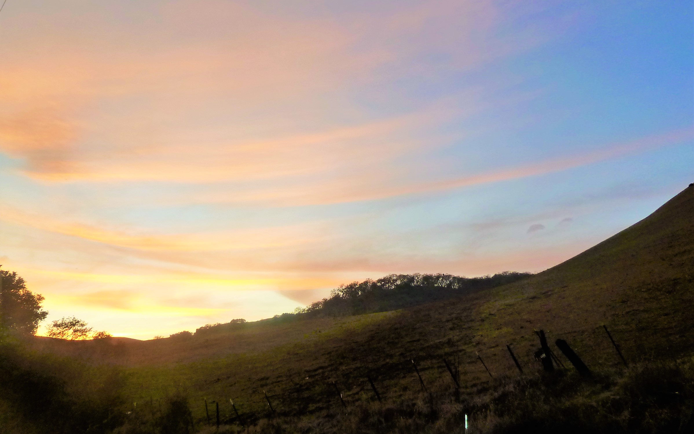
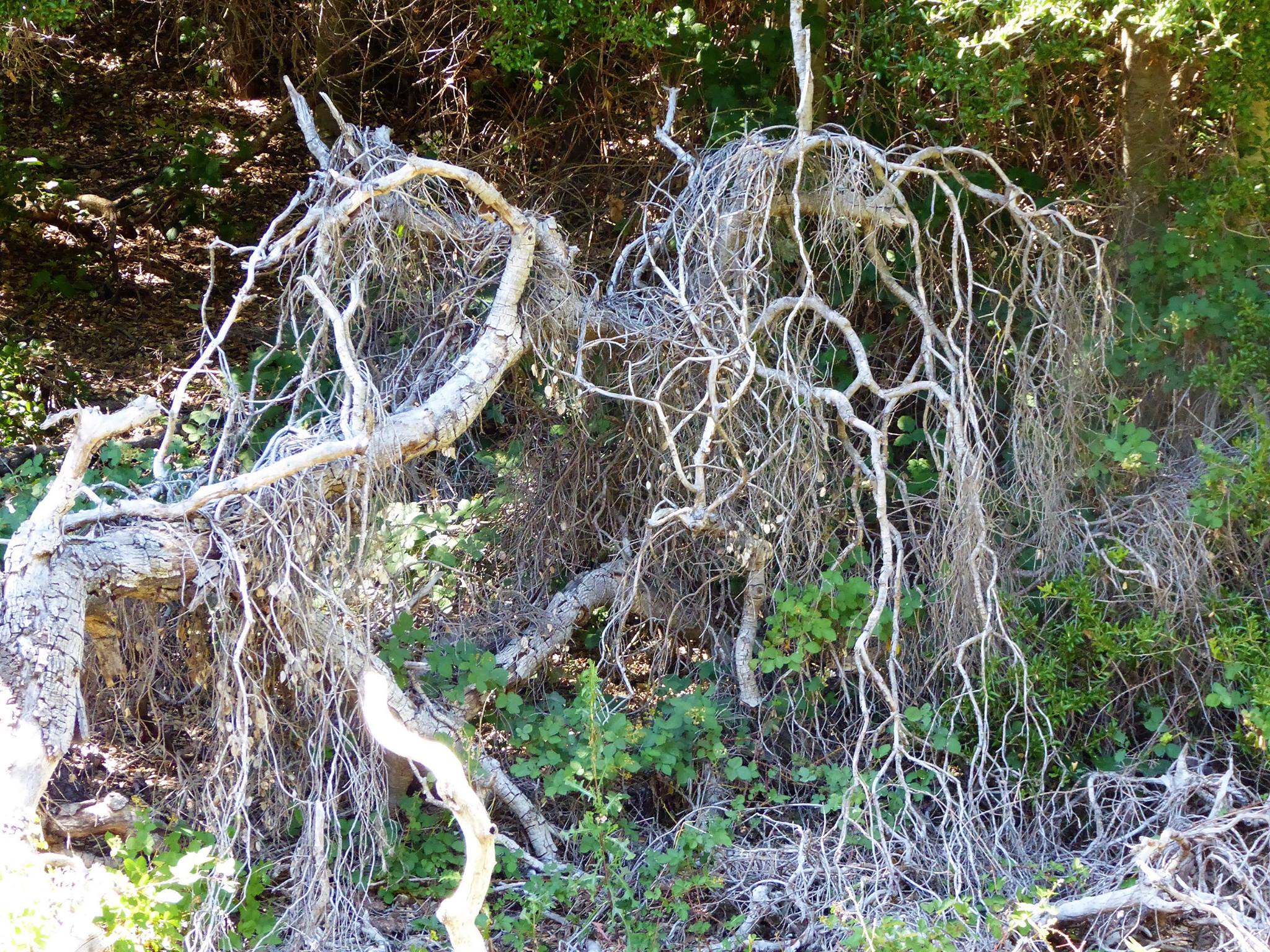
Evergreen was a haven for farmers because of its creeks and natural water delivery system in gravity, hillsides and natural springs throughout Evergreen.  Springs will appear whenever seismic activity is taking place, like Silver Creek and the Silver Creek Mines behind Silver Creek Valley Country Club.  Oak Trees and wild berries line the creek bed, with poppies, wild lupin and grasses around the surrounding hills.  These Oaks are Coastal Live Oak for the most part, even though Evergreen hosts a wide variety of oak trees.  An illness makes oak trees white like this.  It’s called root canker.  Amongst the spectrum of oak diseases, Silver Creek’s oaks are really looking pretty good.

P1300931
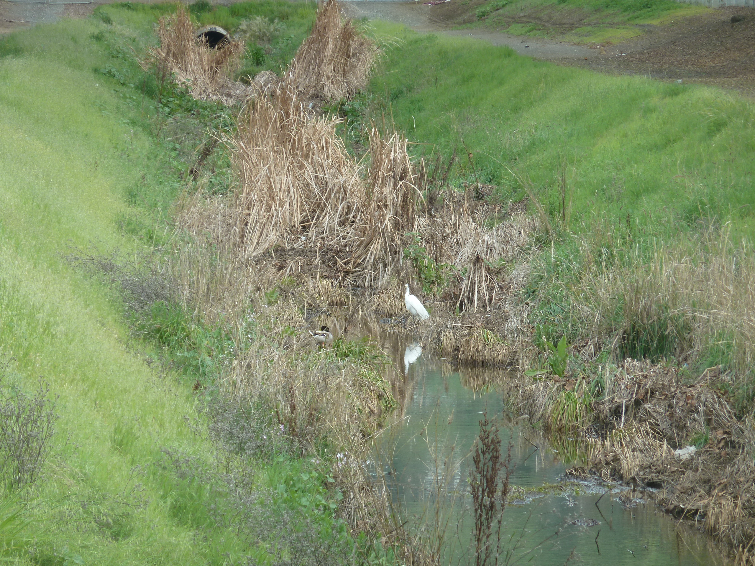
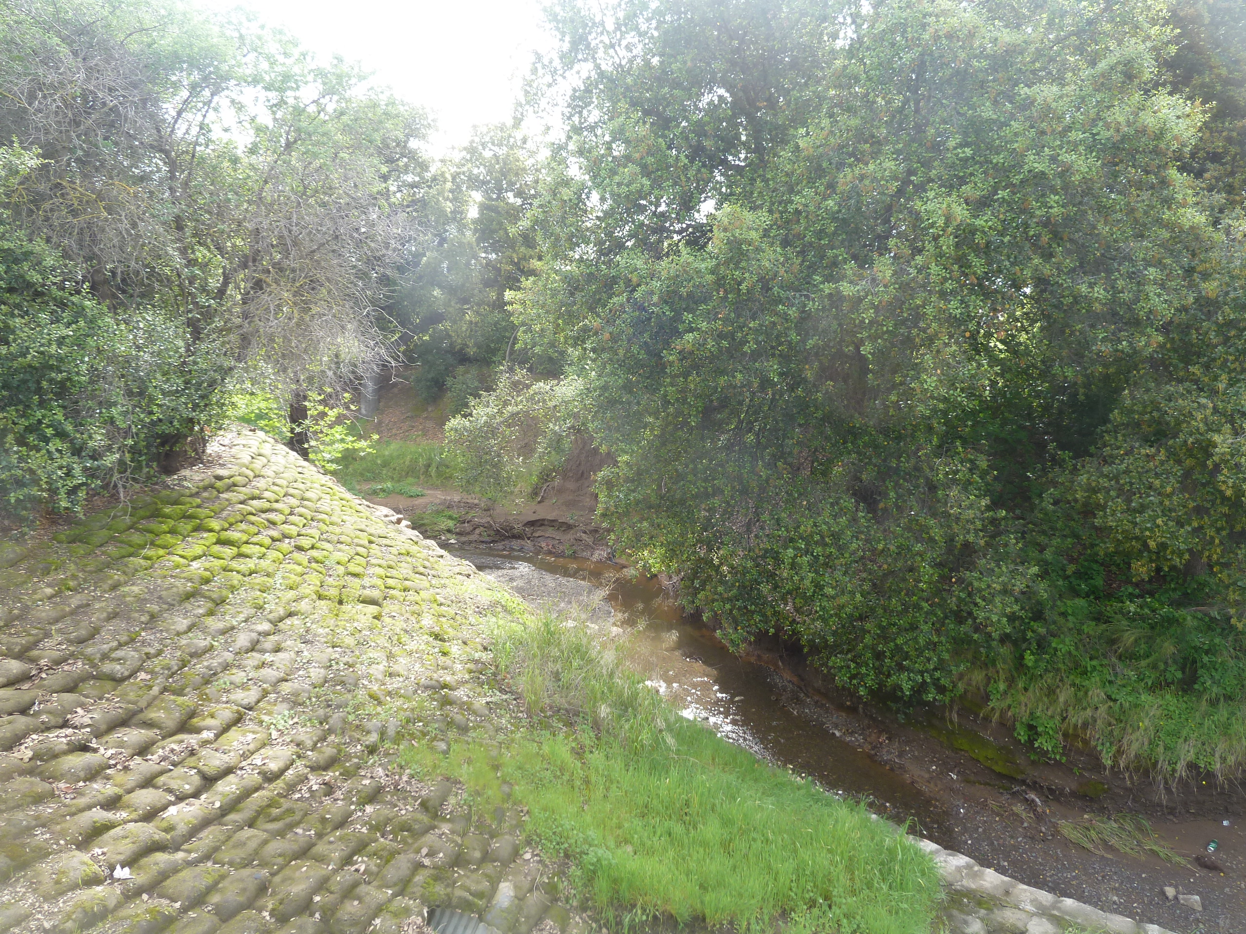
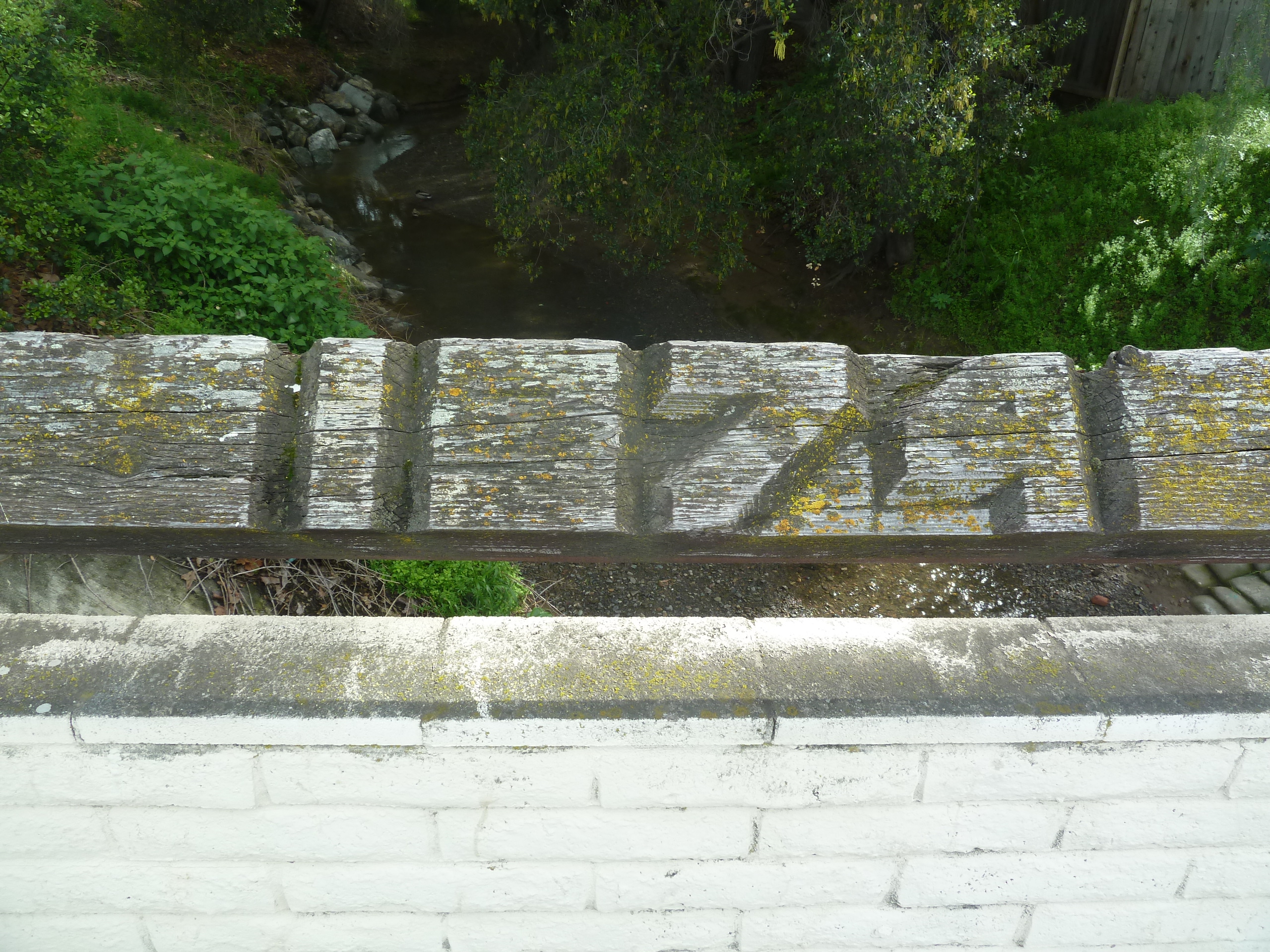
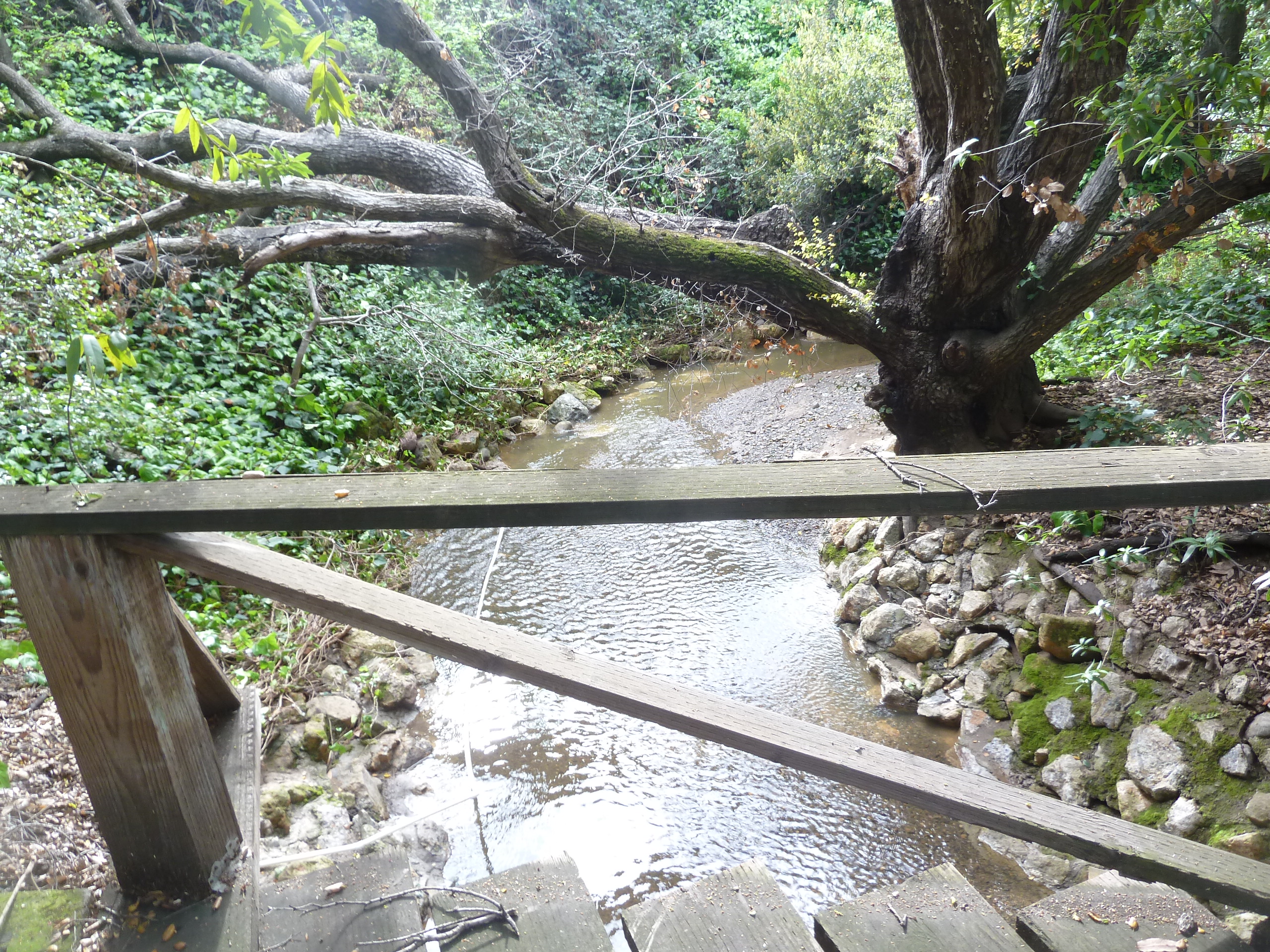
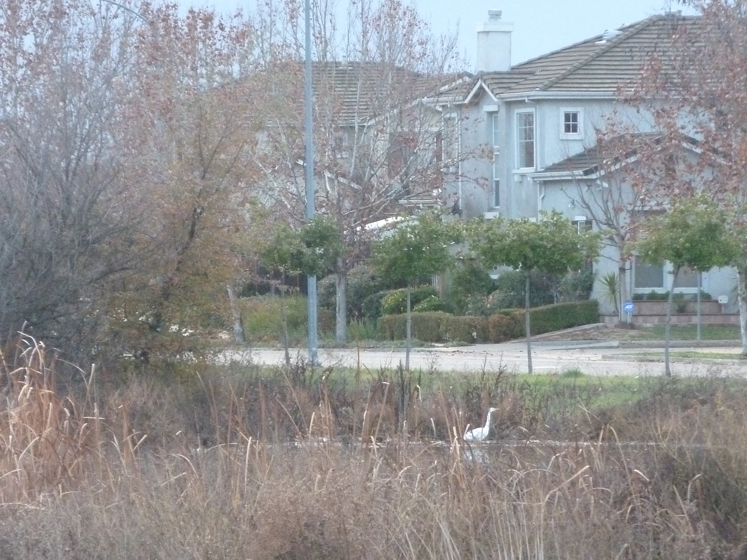
Silver Creek’s ecosystem is fairly healthy, as indigenous birds and wildlife still call it home.  Silver Creek’s existing water formations are very clean and free from pollutants.  When I examine this Creek, the only littering I see is on road ways nearby – not in the water itself.  Here, by Silver Creek Linear Park where Silver Creek appears to end, the Cottle’s cobble stone walls along the Dove Hill border are still evident.

P1310192
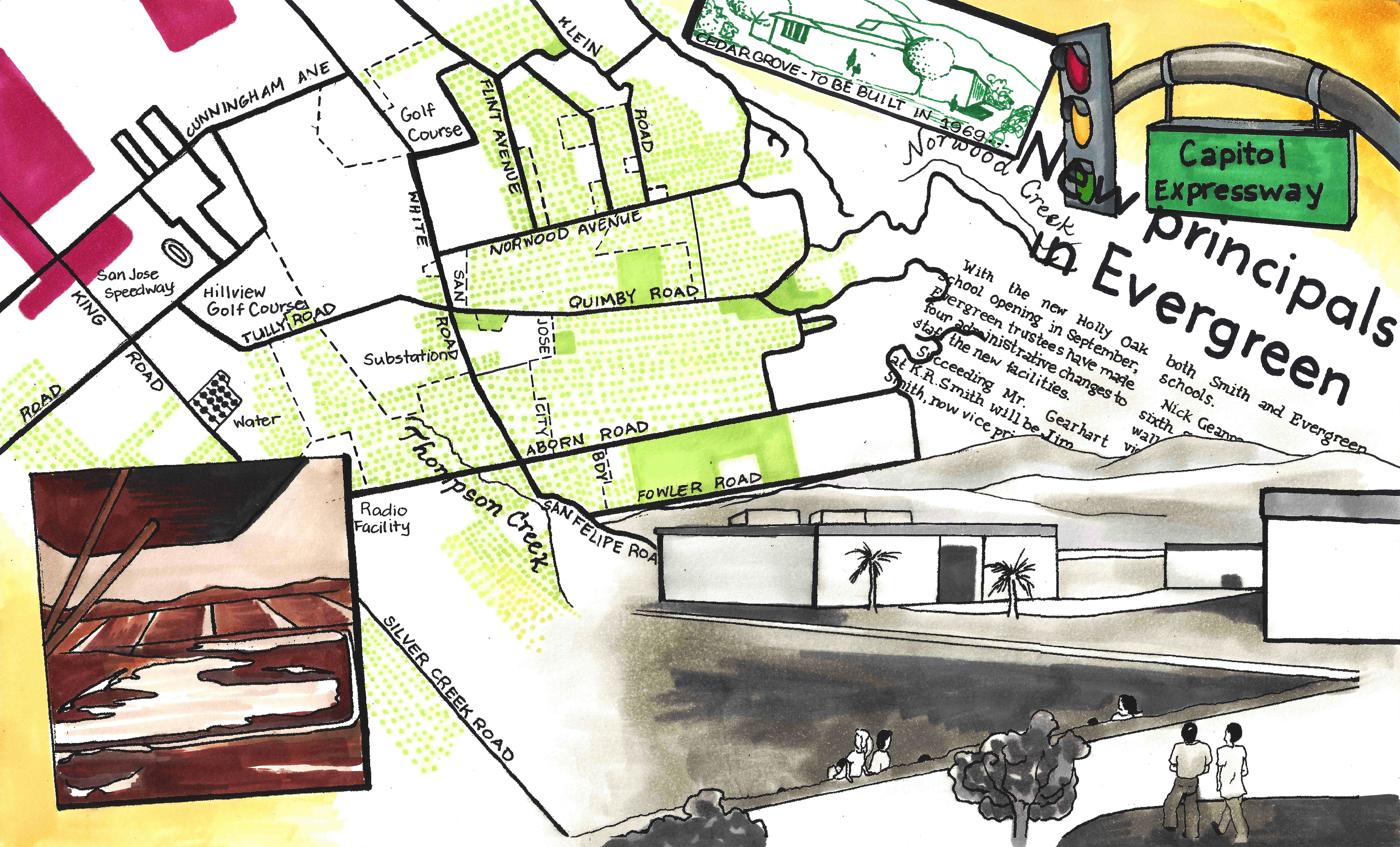
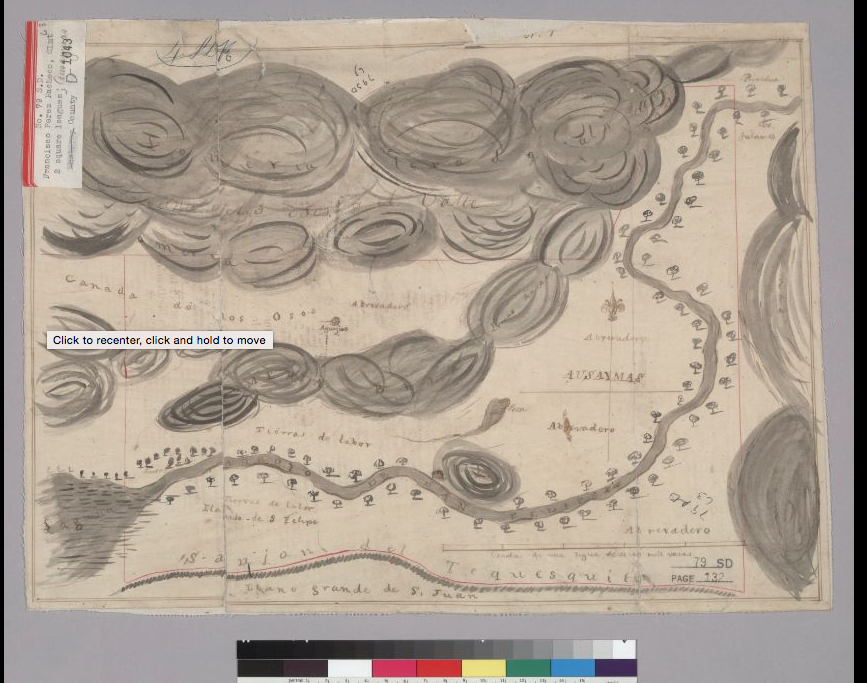
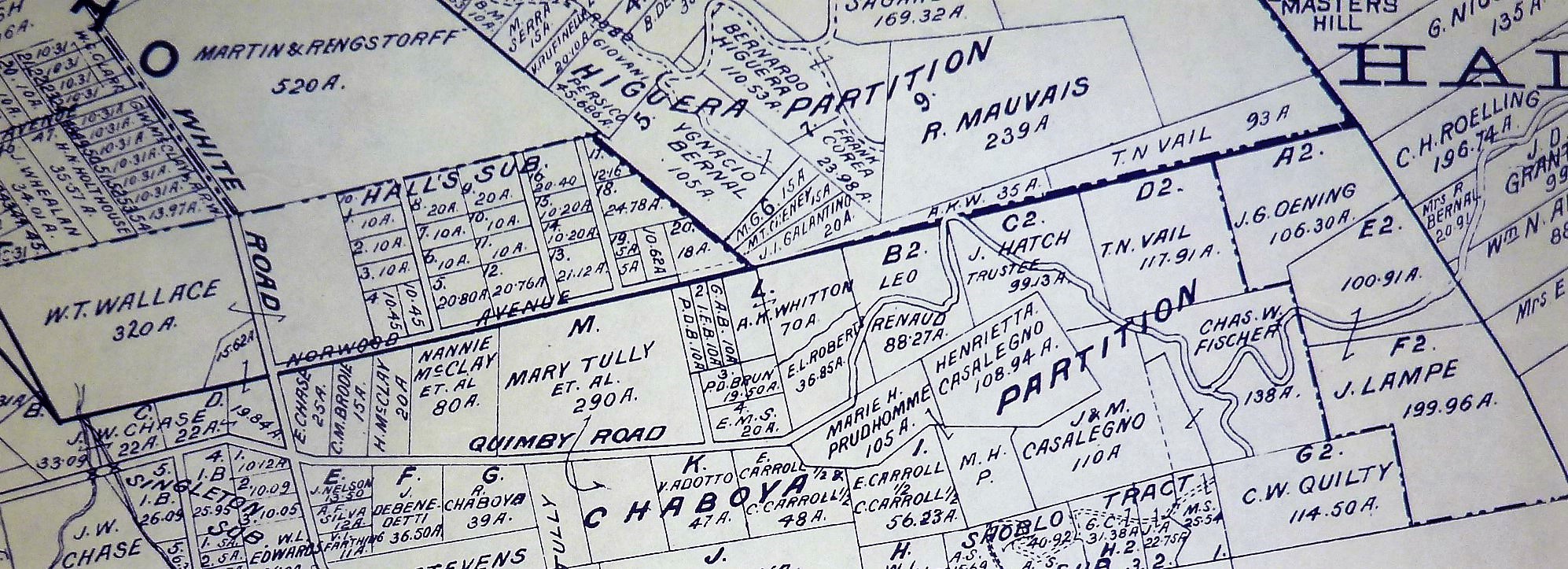
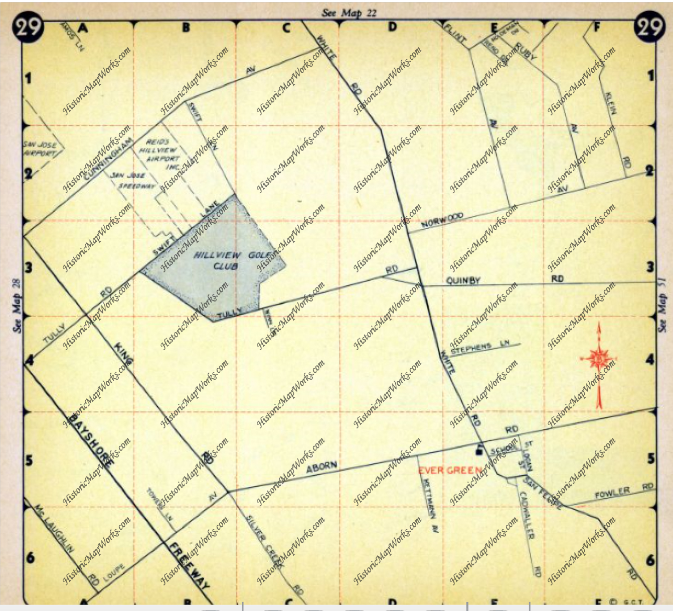
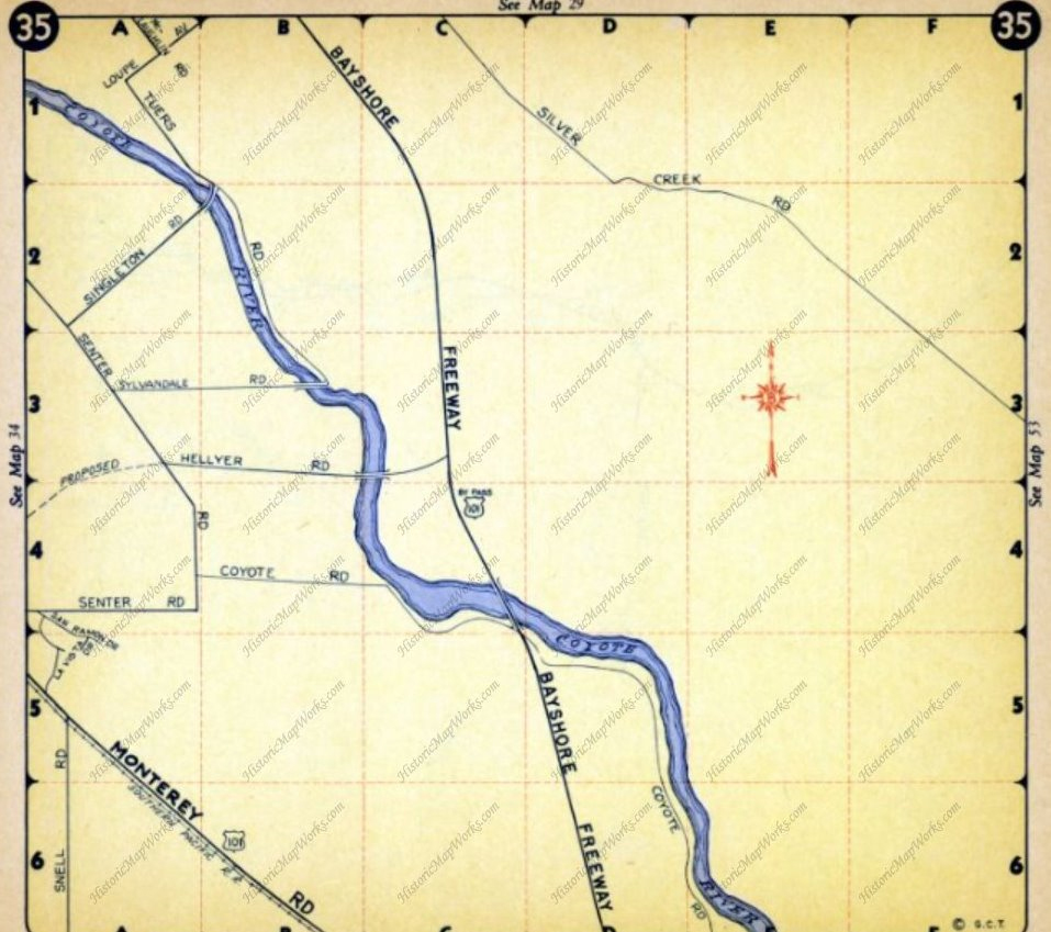
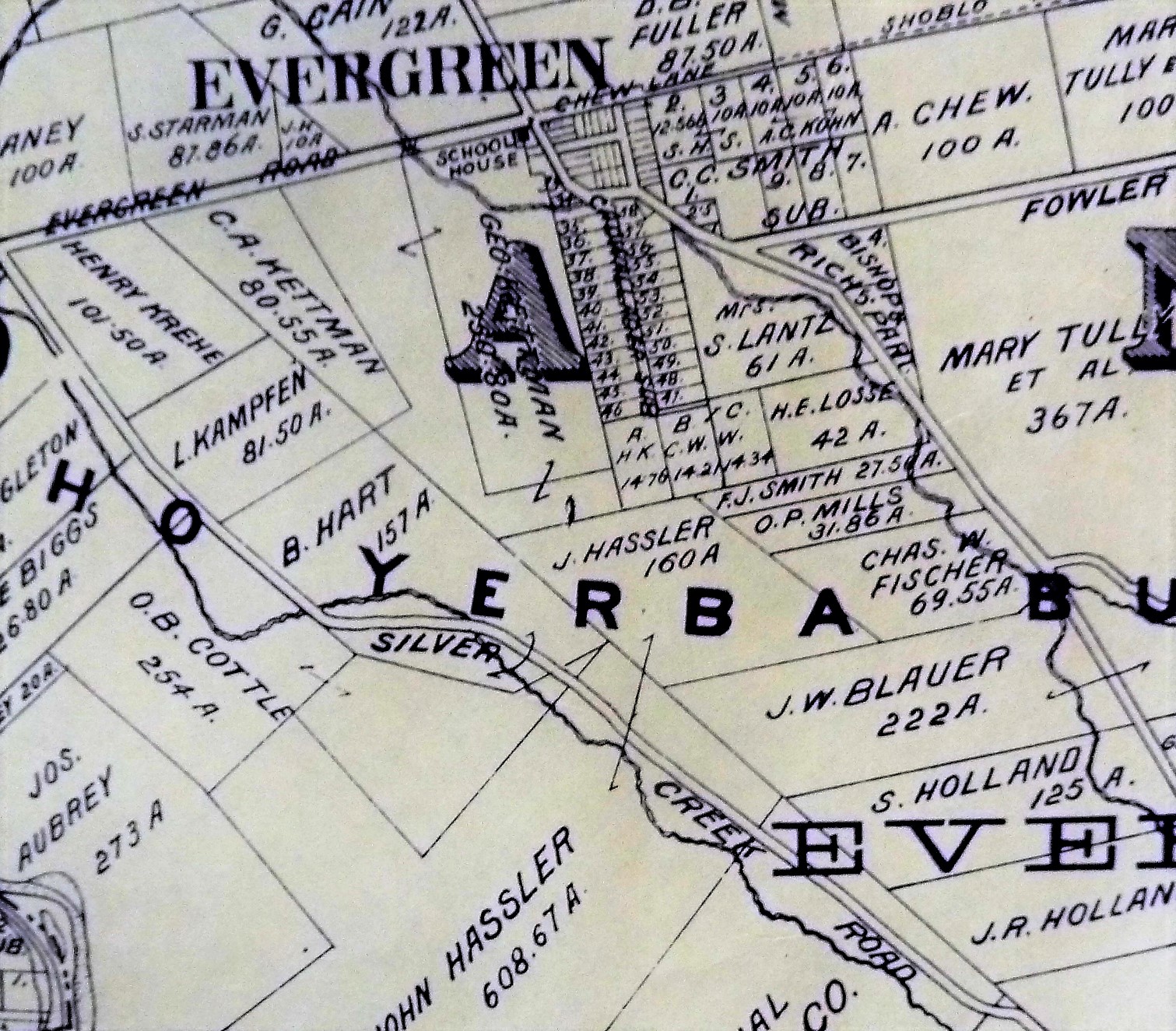
Silver Creek Road, King Road, White Road, Quimby Road and Evergreen Road back in those days were the huge arteries into Evergreen.  You can see in this enlargement to the left that Silver Creek Road and the Creek intertwined through modern day “the Ranch” development over Hassler Parkway.  Below you can view the entire length of the creek and roads.  Where Silver Creek Road straightens out has always transitioned to King Road.  King Road would’ve been the way to get to Downtown.  Kinda still is.

P1310197

CAM09459
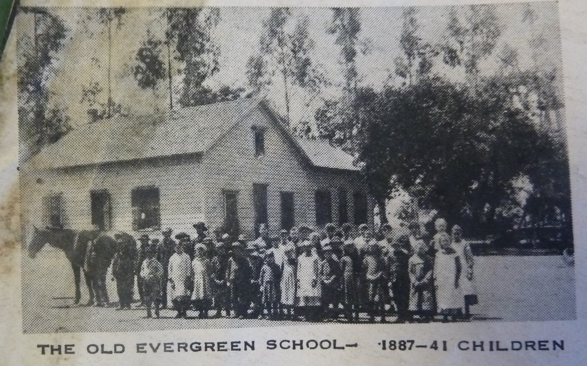
Silver Creek had its own grammar school at one point too.  I couldn’t find it on an atlas map, but Evergreen historian and trusted source, Colleen Cortese, has it closer to Coyote Creek than Silver Creek, but hey.  It served this whole area.

Silver Creek Road picks up again today near a Spring that contributes to Silver Creek’s Watershed.  Springs are created by the geology in the surrounding areas, not the gathering of water heading down the slope like lots of Evergreen’s creeks.

CAM10914

Drawing by Colleen Cortese

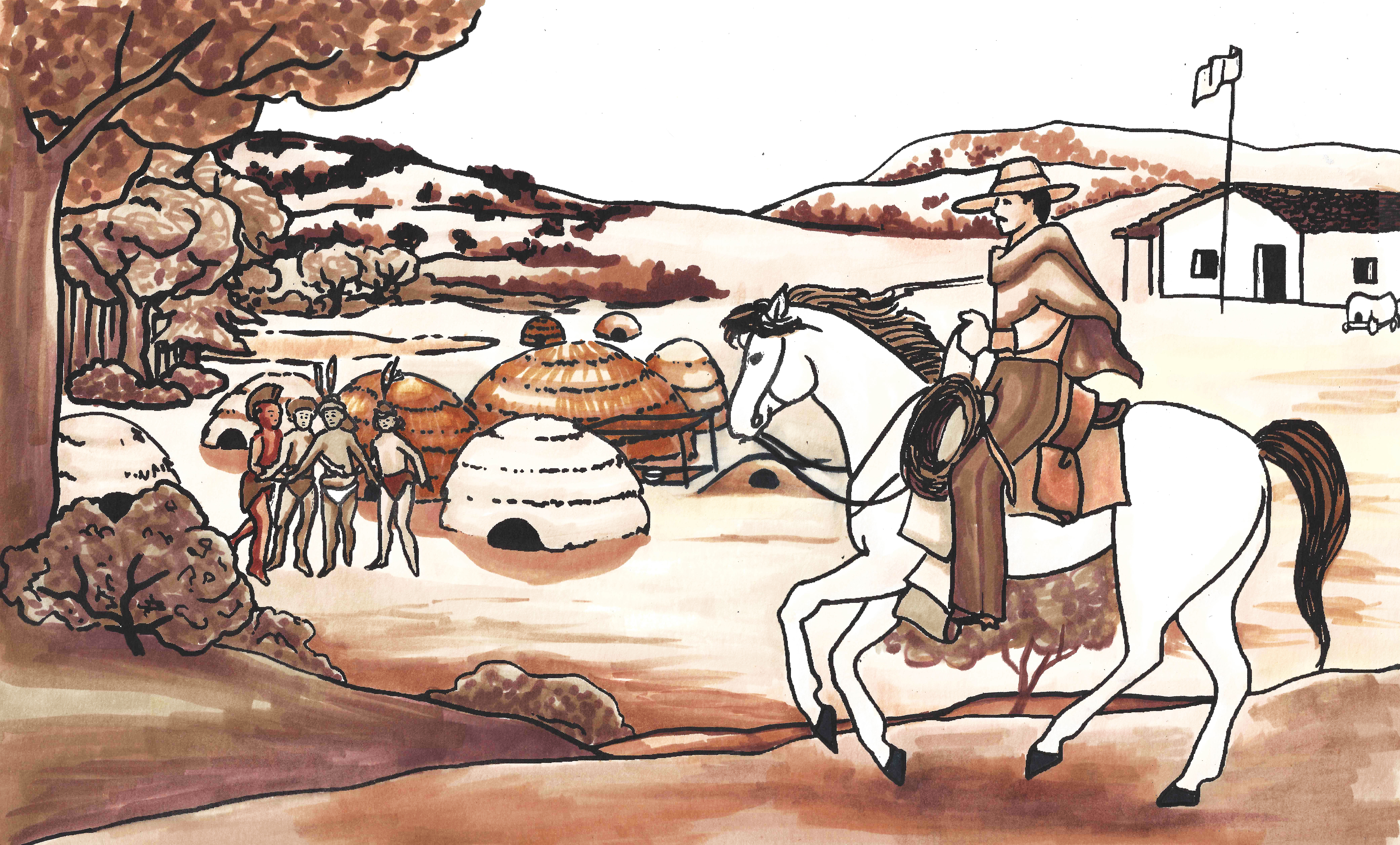
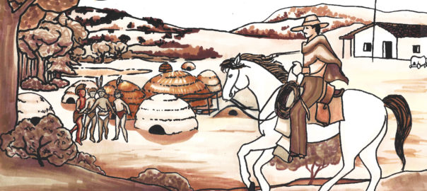
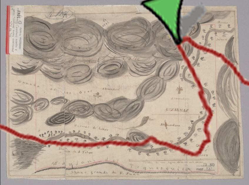
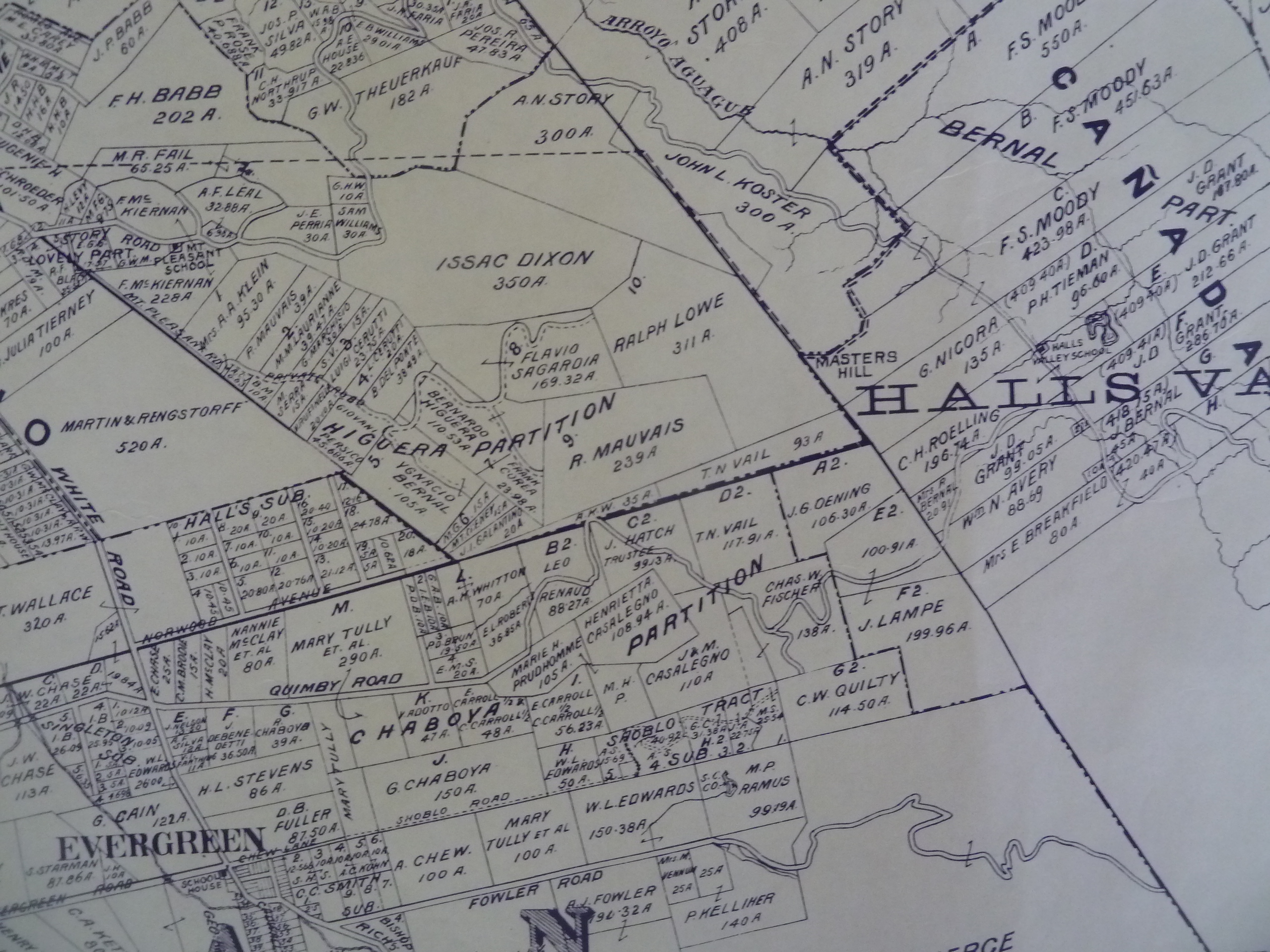
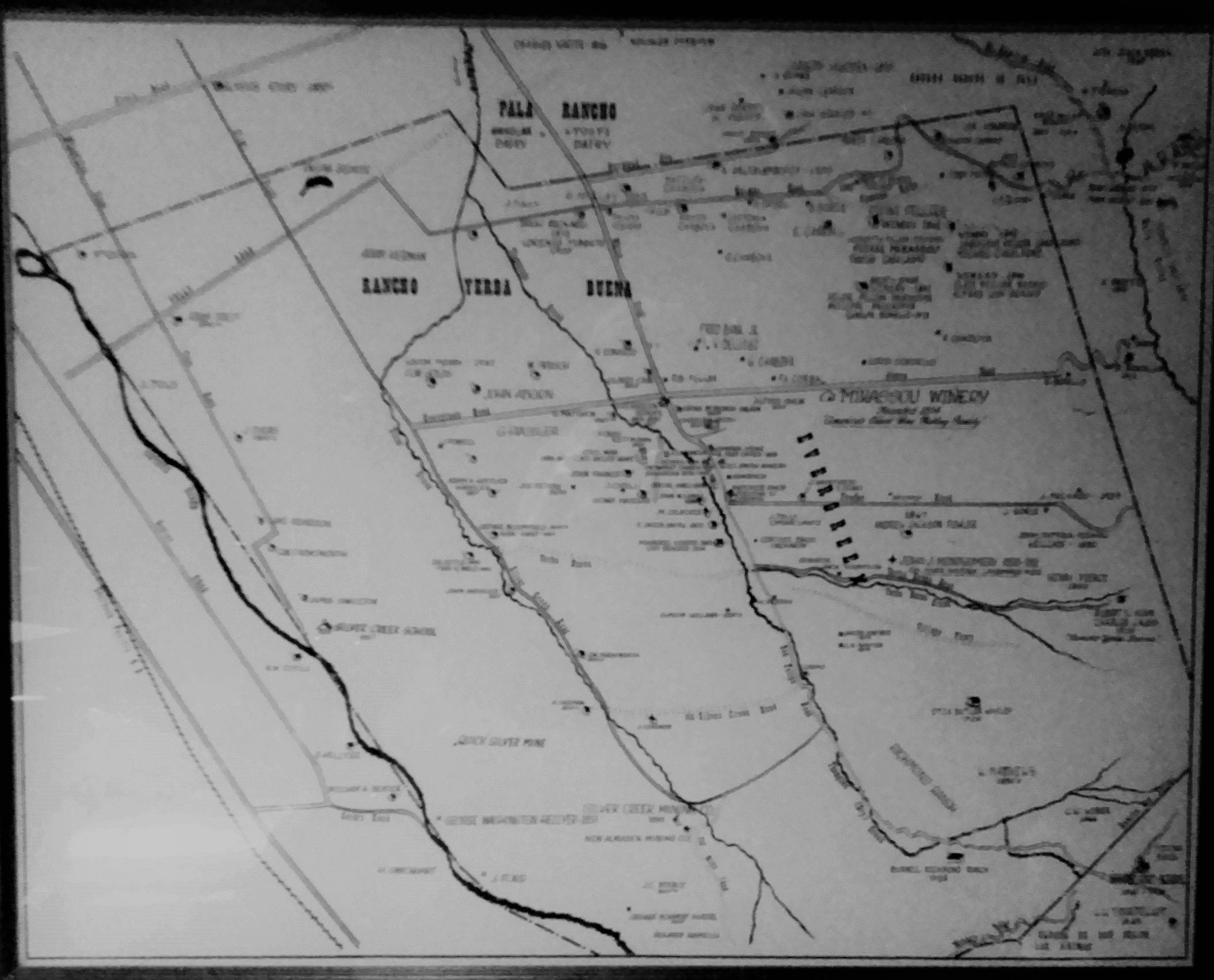
Silver Creek Mines are also located off of this portion of Silver Creek Road.  You can see North Almaden Mines here in this 1890 map above.  This same road used to connect over the hillside before its development.  Bradford Investment was involved with the Mining Industry in those days, establishing Silver Creek Mines, and would’ve built this road through to his jobsite.    You can see the entrance off San Felipe Road.  The Hellyers and Piercys too would’ve mined in Silver Creek region.  Brothers George and Daniel would choose opposite sides of Coyote Creek along the border with Edenvale, another small township.  Coyote Creek creates the western most point of Silver Creek and therefore Evergreen.  There’s a wicked rumor that someone accidently contaminated the Creek with quicksilver and their orchard turned to silver.  This may or may not have happen to oak trees in the area.

silver creek map
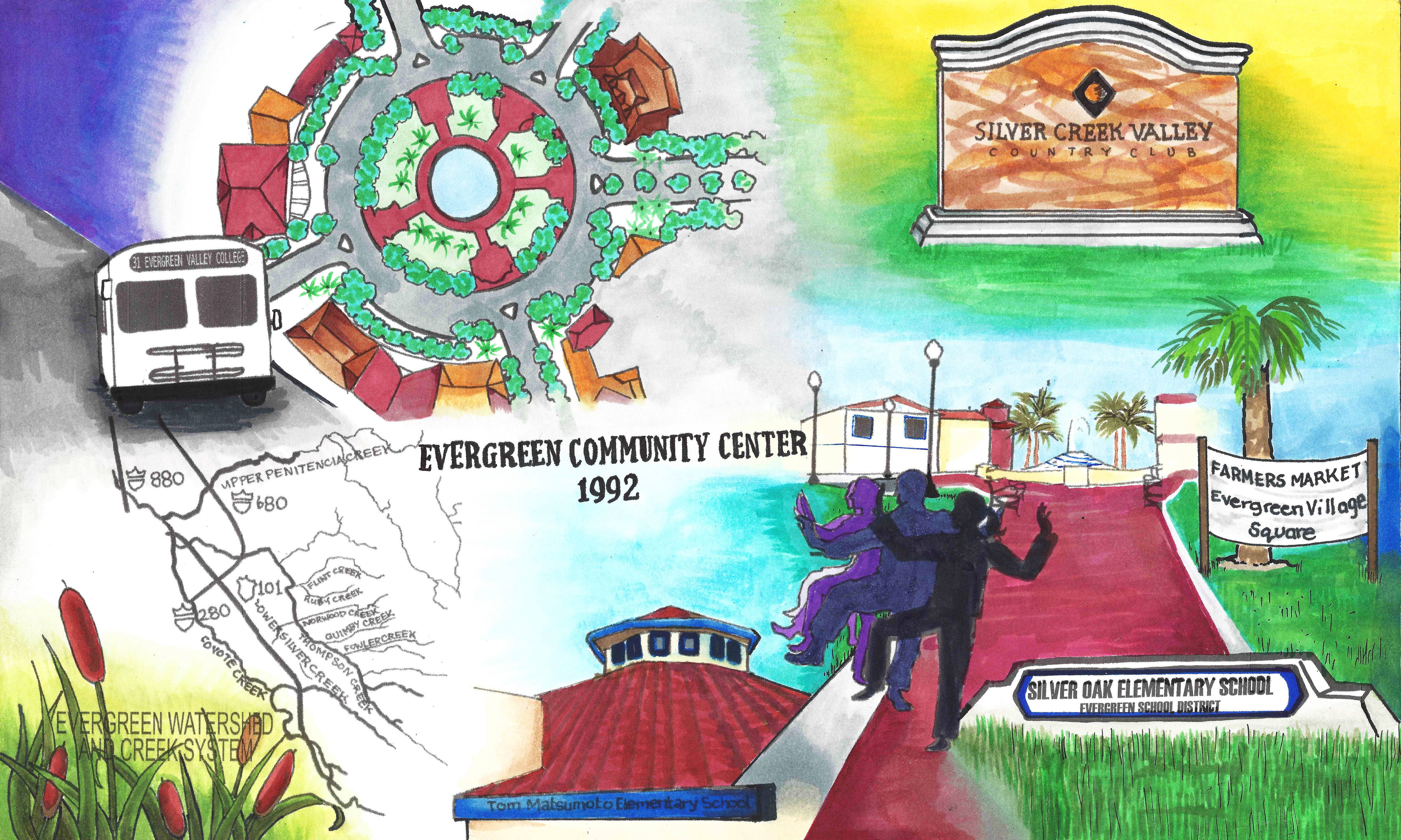
Until Silver Creek High School opened, students had to travel outside of Evergreen to go to school.  The Creek would’ve existed where 101 lies now near the school.  Many sections of Silver Creek, the Creek and the Road, have been paved over for the 101 Freeway in the 1930-40’s and built on top of for Silver Creek Valley Country Club’s construction in the 1990’s.  Silver Creek Road which once followed the creek’s path also met up with San Felipe Road in the early 1900’s.

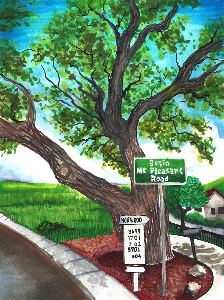
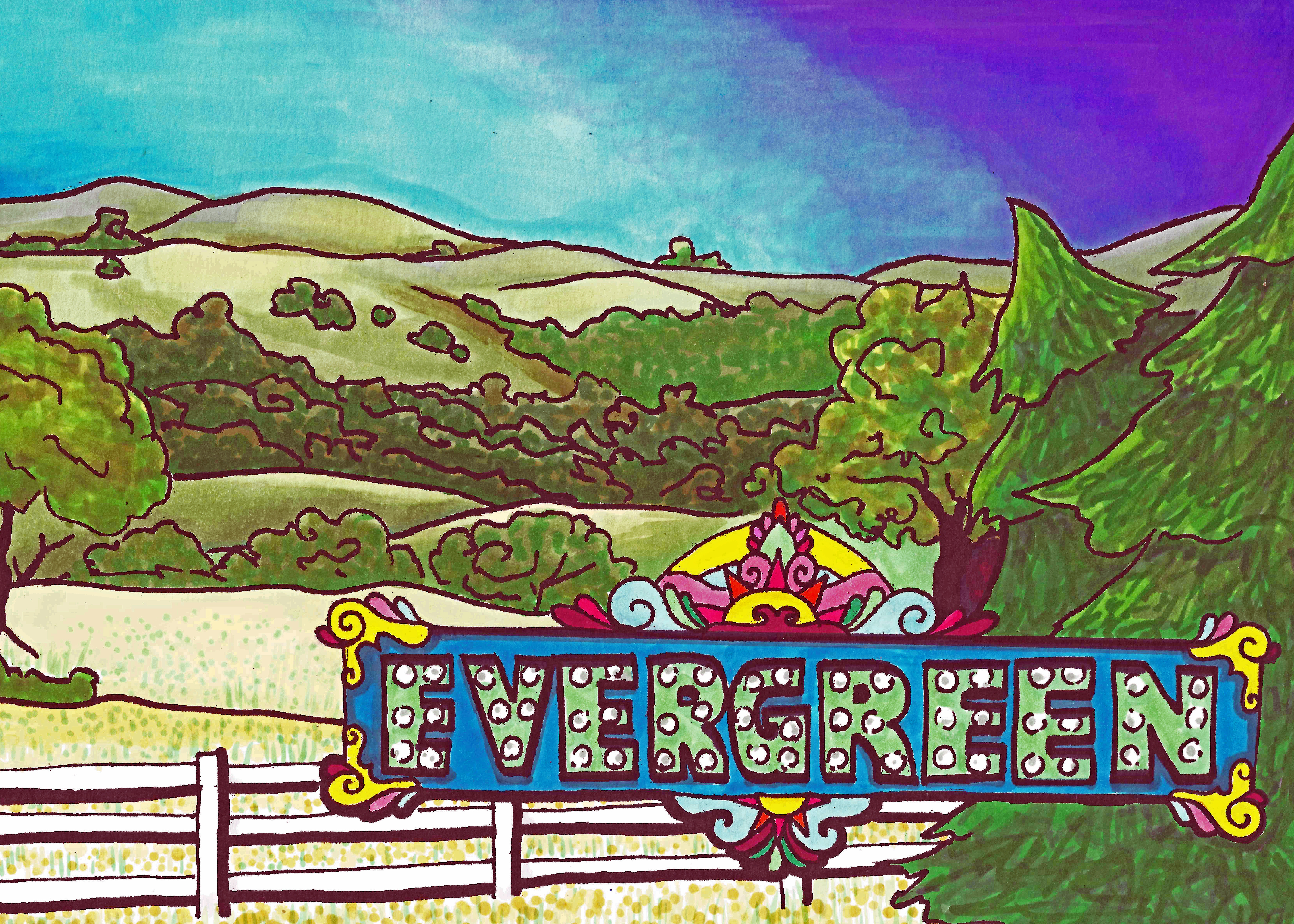
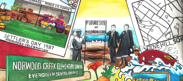
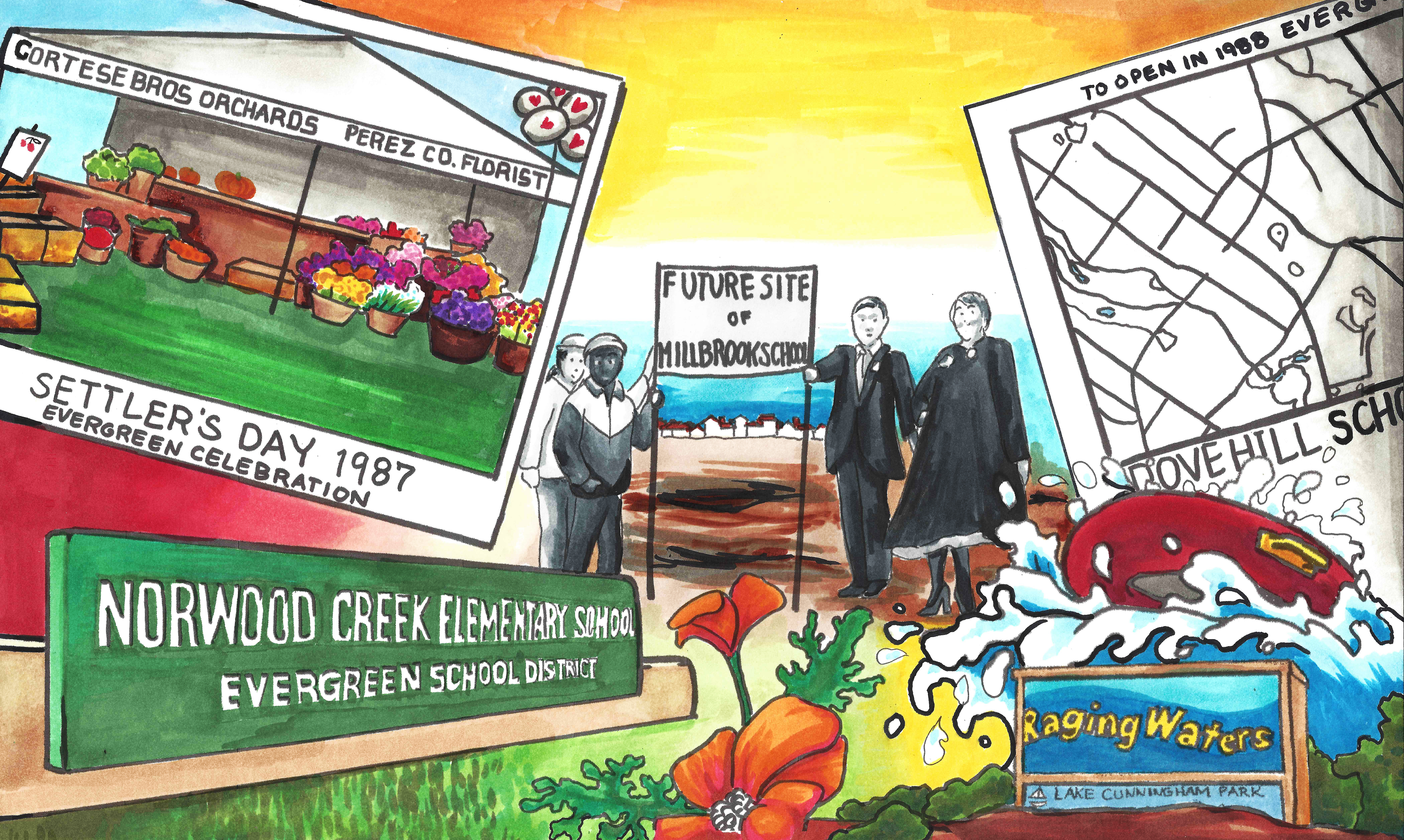
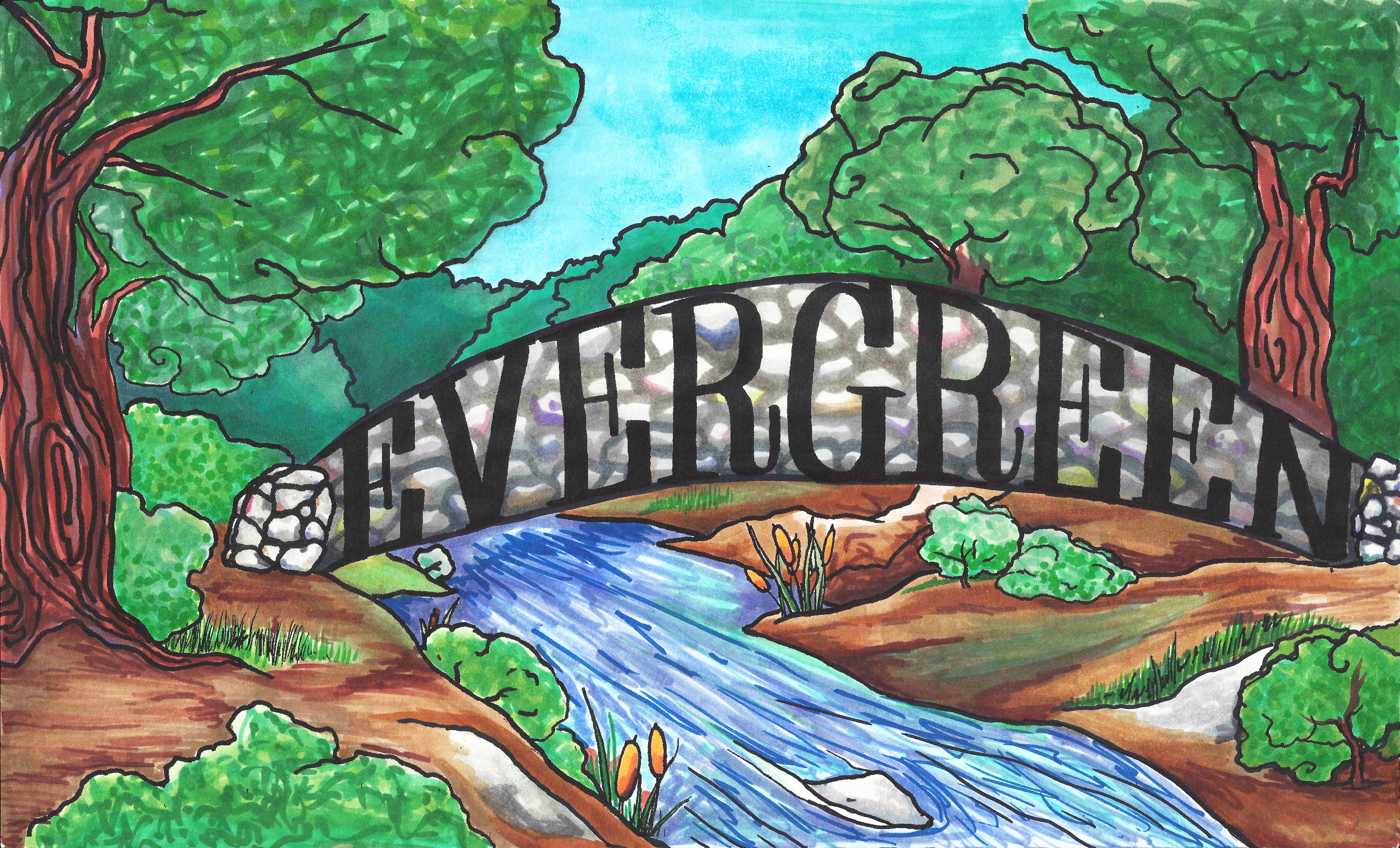
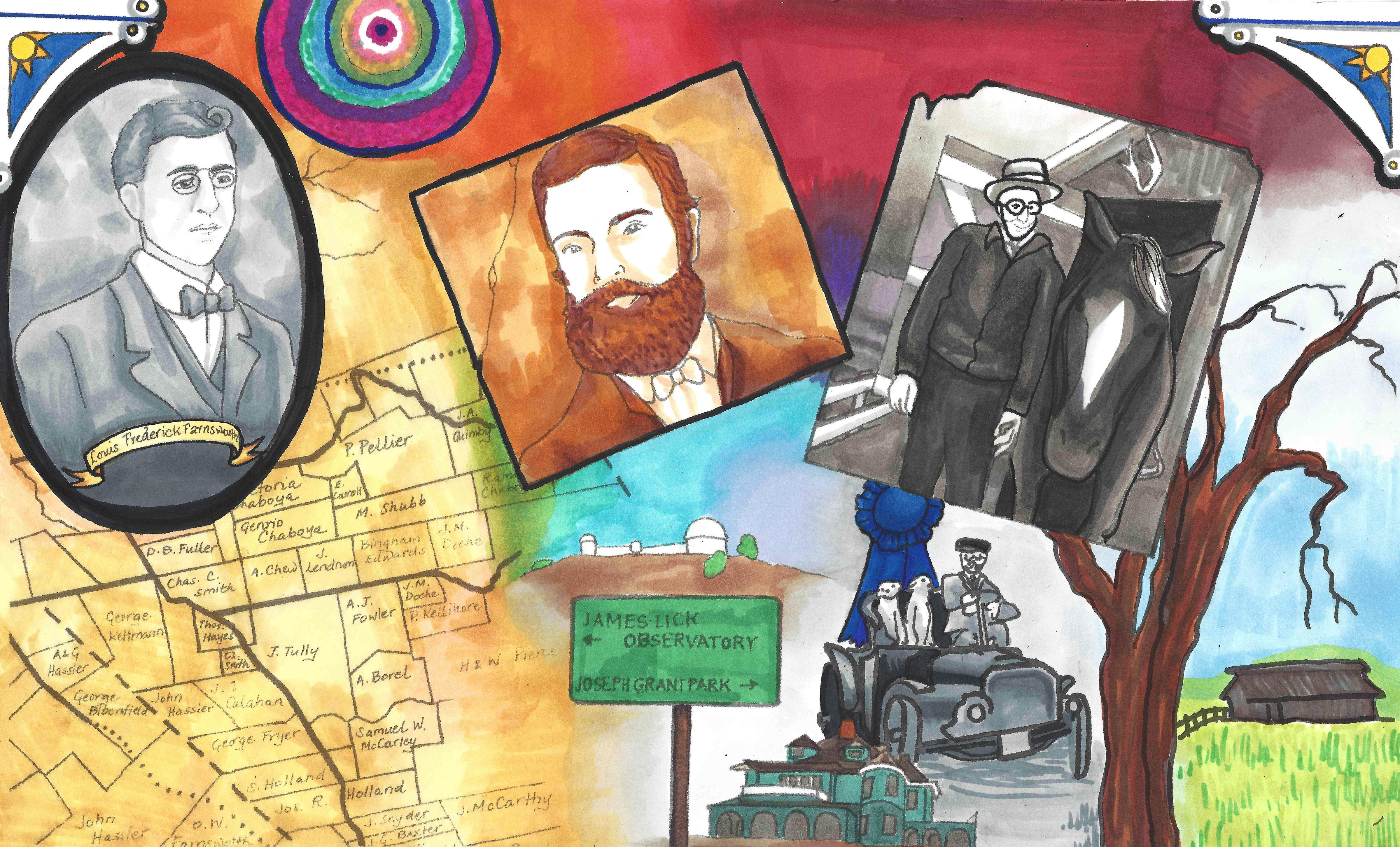
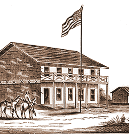
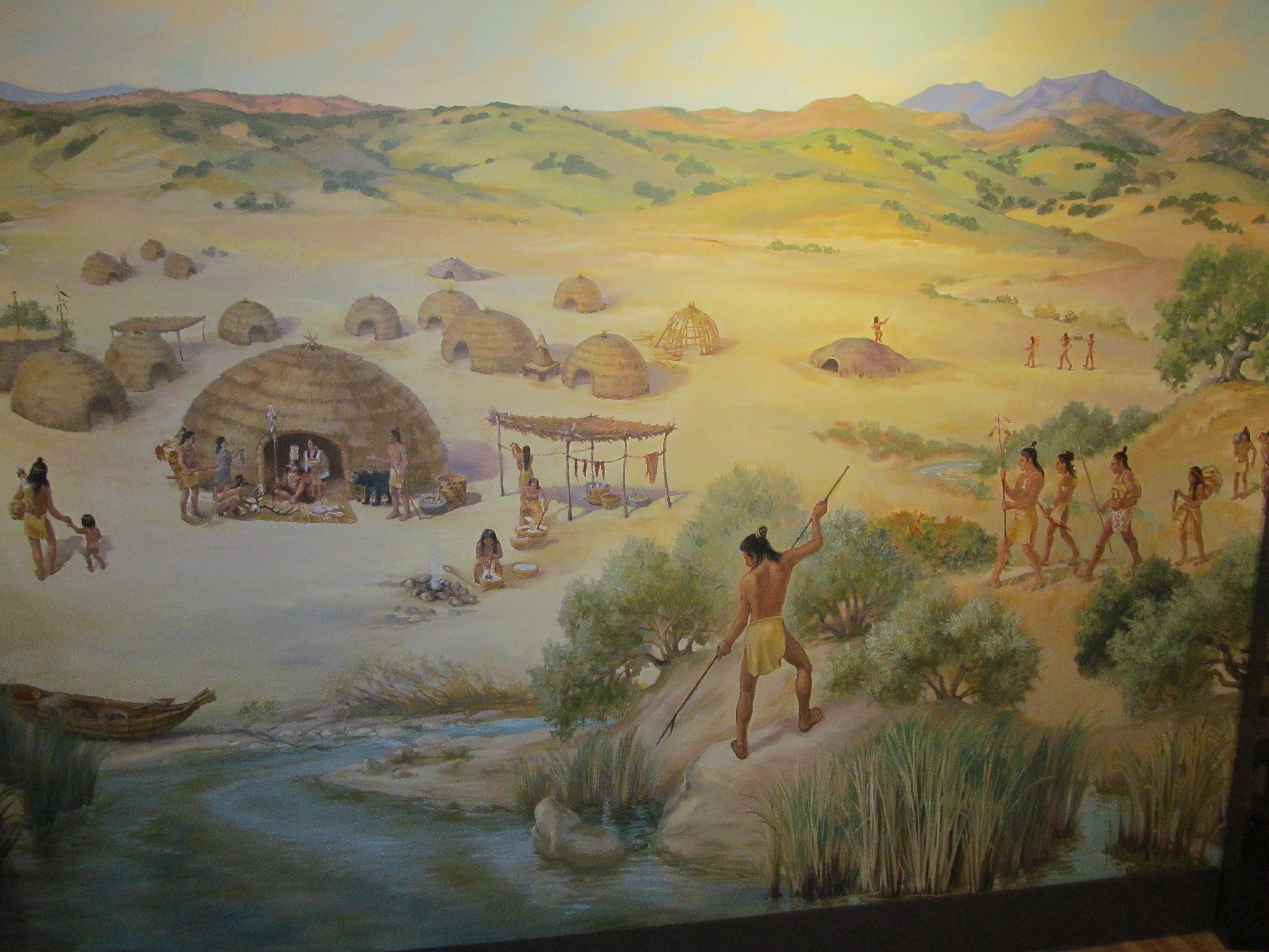
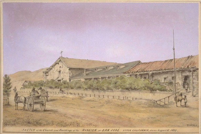
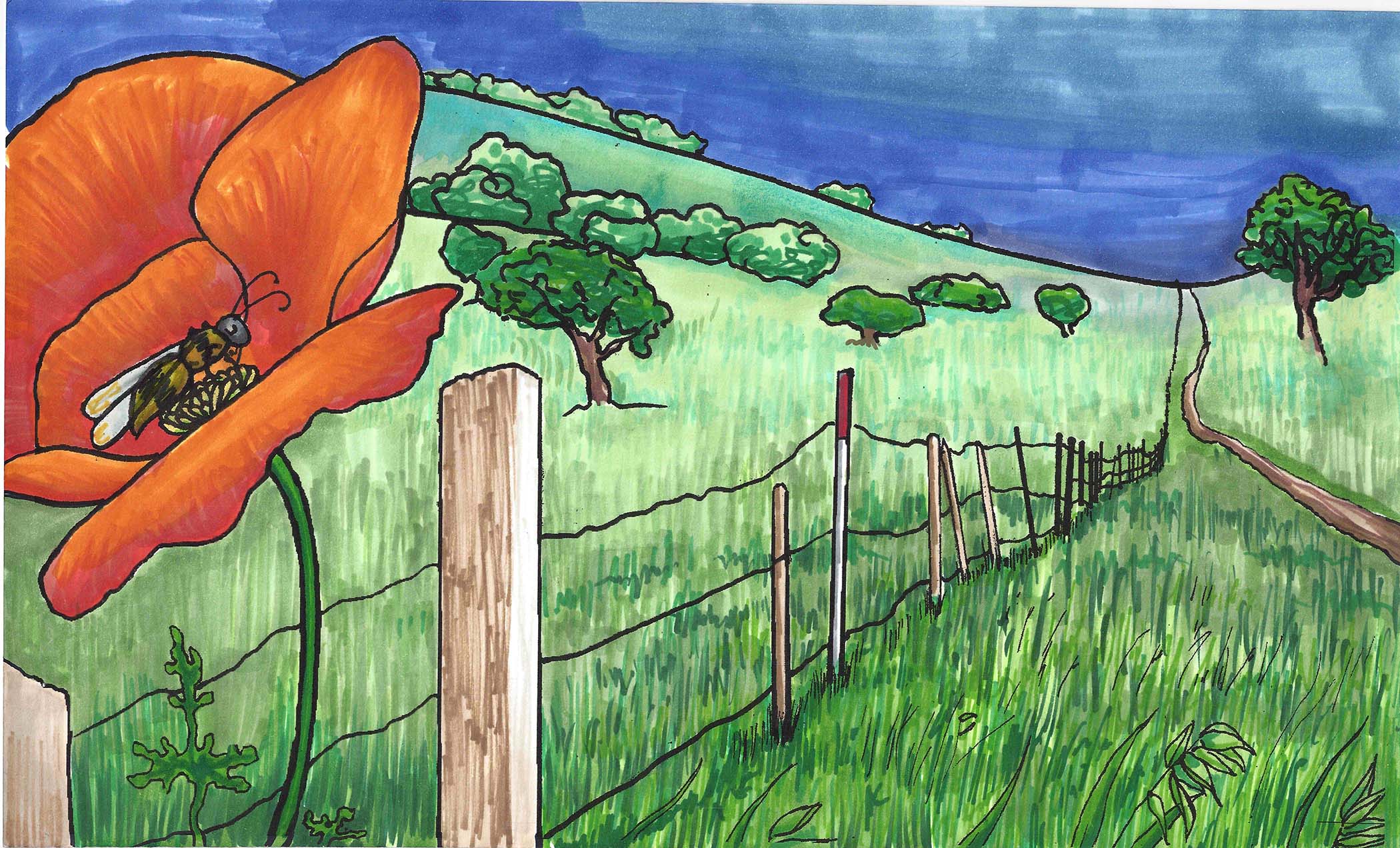
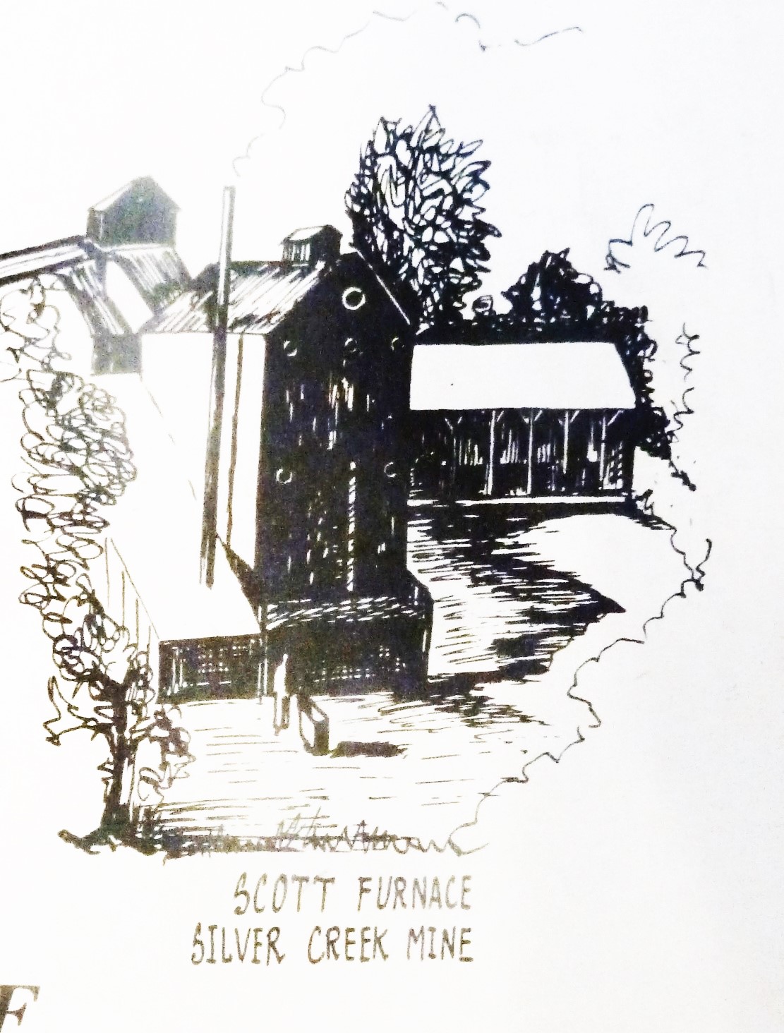
Silver Creek is a giant chunk of Evergreen, like a third.  It’s presence influenced people to settle in and raise their farms and families here.  Silver Creek is older than any Country Club, Park, or School.   All this time, I thought it just described nearby Dry Creek / Thomspon Creek when this was the larger watershed hooked up to Silver Lake or now Cunningham.  Here’s the Artwork featuring Silver Creek.

18951969


Have you hugged an Oak today?

Deer Valley - Joseph D. Grant County ParkP1310568When you think of “evergreen” and trees in general, chances are you would think of Christmas trees or redwoods.  Evergreen’s trees are not this connotation of evergreen.  In our dear Evergreen, this couldn’t be further from the truth.  In fact, our indigenous trees would inspire the name of the township, the communities surrounding it and many of its public schools today and not of them are coniferous.  The natural beauties of Evergreen would inspire poets and artists throughout its history.  These trees too are evergreen but the kind we generally think of.

P1310885image001Misnomer: Evergreen School District’s old logo may be Evergreen trees, but that might have come from the commemorative redwoods planted for the Evergreen School’s first teachers, like Markham and KR Smith.  Evergreen was named for its lush, green hills covered in oak trees.  I think if the name Oakland wasn’t taken in California, Evergreen might have been called Oakland.  It’s all rich oaky grasslands with natural creeks which made hills green year round before farming irrigation.

P13105995986045244_160c2c7376_oEvergreen definitely has some gigantic, wicked oak trees today in the oddest places amongst modern homes and along every creek, of which we have many.  There are different species of oak trees around Evergreen.  The oak grove along the Quimby Creek would give the name to Quimby Oak Middle School, built in 1968.  It was built before Millbrook Elementary, built in 1985, which was named after a mill along this brook some 150 years old.  Millbrook was built on the property owned by Henry Lambert Stephens, Evergreen pioneer since 1866.  In fact, There’s a haunting oak tree in front of the former mill owner’s house today.  Don’t worry.  I’ll get you a better photo.  This oak grove made way for houses and orchards.  Quimby Oak Middle School is more likely the Victoria Chaboya property, not Mayor J. A. Quimby’s.  He would’ve lived above Ruby Avenue.

CAM11117The Honorable Judge Jerry Kettmann would show me oak trees in Evergreen that were over 200 years old.  These would’ve been well grown in before the Judge would tend the Kettmann Family Ranch.  These oak trees served the purpose of landmarks, deciphering the locations along the Kettmann ranch in a developed neighborhood of Evergreen.  The neighborhood grew up around Kettmann Ranch in surrounding Cadwallader and Smith Subdivisions.  This was once a large farm, actually two adjoined farms, in Downtown Evergreen.  The town of Evergreen must have looked very different back then.  These space oaks would be unchanged relics of a time before ours.

Silver%20OakEvergreen MoonSilver Oak Elementary School, built in 1994, was named for a particular tree that was silver in color up on the hill above the school in the 1990’s.  The discoloration ended up being an illness this picturesque oak would come down with.  Silver Creek Country Club removed the tree because it wouldn’t continue to be safe with the moving of earth around it that home building required.  Never underestimate the beauty of a single, stand alone oak, though.  This is such a common theme in photography from our community.  The motif continues to inspire people today.

P1310608P1310620Holly Oak Elementary School would be named for the trees found along Dry Creek, renamed Thomspon Creek in 1974.  Hollies wouldn’t grow all over Evergreen.  There’s also a Coastal Live Oak species, which looks more similar to holly, that grows along that creek specifically.  I’ve enjoyed many a bike ride through this area and have gotten scratched.  There’s also a shrub species, Heteromeles, which is also knicknamed  California Holly that I certain recognize around Evergreen.  Maybe these two tag teamed the Thompson Creek creating a Holly Oak grove.  Or it’s something completely different.  Holly would also have another meaning like Hollywood.  Holly would mean magical.  Either these were magical oaks or these were holly-like oaks.  John Aborn would’ve pioneered this neighborhood and raised his daughter here, advocating for the rights of homesteaders and a defendant of Chaboyas.

P1300673The varieties of oaks themselves are evergreen, so it’s only natural so the name is only natural.  Evergreen hosts a number of species.  “Blue Oak” Natural Reserve is tucked away beyond Joseph Grant Park to observe one of our species.  Valley Oak with distinctive leaves would prefer lower elevations of Evergreen.  Creeks and natural springs kept grass alive on the hillsides year round.  Chaboya’s cattle ranching business wouldn’t have changed a lot of Evergreen’s landscape.  With so many green trees, and rolling grasslands, the place begged the name.  The word “evergreen” simply meant green all year round.  In fact, Antonio Chaboya would mark Rancho Yerba Buena boundaries using cattle brand and the oak trees.

1421300_242476552761125_6880580855870102685_oMap 006, San Jose, Evergreen, Silver Creek, Mount Pleasant, PalThe Norwood neighborhood would get its name from Northern woods in the township of Evergreen.  The map to the left predates the avenue, however the avenue exists along this Green border.  It’s no coincidence.  The Norwood and Quimby Creeks would keep this area heavily wooded, and that element can still be felt there today.  This hillside would’ve been cleared for orchards or vineyards in the mid 1800’s.  I’ve gone on many drives to connect with Evergreen, one of them through this neighborhood, and our oak groves are a continued point of inspiration.

Calocedrus_decurrens_PAN_2hb896nb4gd-FID3Cedar Grove Elementary was named for a natural grove of cedar trees.  California Cedar, or Incense Cedar, could have been indigenous to Evergreen and this Northern wooded area.  That’s this one on the right.  This coniferous cedar grove would’ve been a part of this larger forest known as Norwood.  If it’s indigenous, it was a natural boundary for cattle herding and for the Ranch of Yerba Buena, you can see it on the Chaboya map.

Screen Shot 2015-10-27 at 4.01.24 PMCedars could’ve been planted along San Felipe Road to provide shade through this area when Spanish settlers founded Mission San Jose in 1797 and possible when Mission Santa Clara was founded in 1777.   You can see them on the San Felipe route in the old map here and ought to be this area with doubled up trees.  Cedar Grove may have been planted as early as 1821 by the Chaboya family to reinforce the border between Yerba Buena and neighboring ranchos or pueblo lands that eventually turned into East San Jose.  In the 1800’s, this would have been a popular source of lumber for building.  Norwood Avenue would be established between 1876 and 1899.

1876 MapJ.E. Brown, Theodore Lenzen Residence, Geo. H. Briggs, J.E. RucCedar Grove Elementary appears to be located in this John Tully property, once jointly owned in partnership with Wallace engaged in the lumber business in 1876 found at the top corner of this map.  It’s quite possible the Tully & Wallace company cut the grove down, build their homes and made way for orchards fed by the natural creek nearby.  These are cedars seen is Alfred Chew’s front yard.

118206-004-C50E9F7BHowever, looking at all the varieties of cedar trees to find the origin of Cedar Grove’s name, there’s cedar all around us in Evergreen.  I never realized how often it pops up now that I know the difference.  I think this is a cedar in my own front yard.  Seen here to the left, this cedar tree is a staple of Evergreen today.   Cedrela or Cigar Box Cedar species is all over the Evergreen Community today as a decorative tree, especially this neighborhood surrounding the school.  This species was native to Mexico, so it is not beyond the realm of imagination that these trees came with the Mexican or Spanish Empires.  They’re drought resistant so they’re widely used in landscaping today.

P131069617265953-Laurel-wreath-Decorative-element-at-engraving-style--Stock-VectorLaurelwood Elementary School would be named after a natural bed of Laurel trees. Coastal Bay Laurel, Umbellularia californica, would be prevalent in the Santa Cruz Mountains, but huge laurel groves would cover this area too thousands of years ago.  A climate change would shift that evolution and laurels would recede and make way for our oak groves.  This event took place all over the world in laurel forests in Mediterranean and subtropical climates.  Laurels are most notably the leafy thing behind the ears of many Greek and Roman statues.  I hadn’t realized laurel trees and the avocado were relative plants.  If a wood or forest of laurels existed in Evergreen in the 1800’s, it would certainly be notable.  Today, laurel shrubs and trees can be found on the school’s campus.  Some of these shrubs around Thompson Creek behind the school would appear to be flowering, blossoming laurel bushes.

197812780Beyond that, trees and varieties continue to inspire the naming of streets and neighborhoods.  “Glen” and “dale” all refer to clusters of trees.  That’s right.  Willow Glen was named for a cluster of Willow trees, also a township founded approximately the same time as Evergreen.  Evergreen was named for its out of world beauty and would draw tourists to its trees.  The Creeks created these groves, but would later empty into the orchards’ and farms’ irrigation systems.  Before that, Lake Cunningham, then Silver Lake, would flood into creek beds.  This would continue to be a problem for the Evergreen Township, but a win fall for the trees.  If you’re ever curious about the name “Evergreen”, just take a drive through the hills.  You’ll get lost in the natural wonder in your backyard.  To say our roots are Evergreen is an understatement.

Evergreen postcard graffiti evergreen

5985404833_eb2e904b36_bRecommended Routes for unspoiled beauty:

Silver Creek Valley Road, park at the shopping center and take a little walk.

San Felipe Road, make a right on Silver Creek Road, notice the awesome Silver Creek and its wicked silvery oaks

Follow Quimby Road until its windy, it quickly becomes stunning and natural

From Murrillo Avenue, make a right onto Chaboya Road, the Sikh Temple is beautiful but just beyond are rustic barns shaded by hundreds year old oaks

Follow Tully Road until its windy, it quickly becomes stunning and natural with excellent farms and oak land to see

P1300699


“Nor-wood”

mapThe lead for Norwood is a real stumper.  As a name, its quite popular.  Norwood Avenue dates back to the mid 1800’s.  So, what was it named after?  There were fabulous people named Norwood who would settle into Santa Clara County in 1849, but Mr. Joseph Gould Norwood would make his home in the Alviso/Santa Clara township, nowhere near Evergreen.  So, that’s not our Norwood.  I reviewed historical maps and grant records throughout Evergreen’s history looking for a Norwood family to tie this name to.  I couldn’t find one.

watershed1421300_242476552761125_6880580855870102685_oNorwood’s Creek is definitely a geographic feature of Evergreen and has been for a long time.  Today, the creek exists beyond the private road at the end of Norwood, but is diverted through housing developments through water tanks and pumping stations.  There’s probably a sizable water pipe under the street that later empties as Norwood Avenue ends on White Road.  That’s why the current path is a straight line at points.  This pipe system is necessary because Evergreen has had a long history of flooding with its sometimes unpredictable waterways.  Frank Cunningham lost his large property with a huge lake on it because the City of San Jose needed to be able to better control the watershed.

Map 006, San Jose, Evergreen, Silver Creek, Mount Pleasant, Pal000000Looking into Norwood, the Avenue itself in between Quimby Road and Tully Road came about between two maps.  In 1876, a County wide Atlas was created and there’s no mention of Norwood Avenue.  It runs along the line between these yellow, orange and the lower green section.  We are looking at once corners of Ranchos Pala and Rancho Yerba Buena, and the adjacent Pueblo Tract.  Tully Road isn’t a thing yet, but it will be located on the strong black line noting his and partner Wallace’s property.

Interior-FirstGeneration-PierrePellierThe Norwood Creek would feed into the farms, vineyards and orchards of Joaquin Higuera, Tully & Wallace, Pierre Pellier, and J. A. Quimby possibly at the time.  The creek would’ve provided a natural irrigation.  The Pellier Ranch was one of the largest in Evergreen with Norwood Creek traveling through it.  John Tully would own property all over Evergreen.  In fact, John Tully’s lawsuit from Antonio Chaboya opened up the conversation for other European farmers homesteading on Rancho Yerba Buena.

P1310185 (4)Fourteen years later, in 1890, Norwood Avenue runs through to present day Flint Avenue.  At its creation, it’s spelt Flindt Avenue.  Here, you see John Tully’s partnership with Wallace desolve with his passing and the family sold his half of the property away in small 10 acre lots.

6254426015_f091ee3233_bLarger farms like the McClay family’s, shown here to the left, and Leo Renaud on the South side of Norwood Avenue.  On the South corner of White Road and Norwood Avenue was Elmer Chase, Richmond Chase and Valley of Heart’s Delight Fruit Packing Co. owner.  With the elder Pelliers passing, the property passed to Pierre’s daughter Henrietta, who married Mr. Mirassou, then Mr. Casalegno.  One of her daughters would marry Mr. Renaud on Norwood Avenue.  The creekbed isn’t show here in this picture, but the properties are growing smaller.  The map would be impossible to read with all of Evergreen’s creeks also noted.  This area was awesome for vineyards.

norwood-creek-elementaryRemington Drive where Norwood Creek Elementary School is located is most likely this beginning stretch of road off of Quimby Road which doesn’t quite connect but is very near the school’s location along Mr. Tully’s widow’s property.  The Hall’s Subdivision along Norwood Avenue would be one of the first in the area, along with the Cadwallader Subdivision.

Evergreen - Page 029, Atlas: Santa Clara County 1956, Californi

This map in 1956 shows Norwood Avenue in the center.  Remington hasn’t become a major paved road yet.  Notice how Evergreen written in red is so much lower.  Its not that the Norwood area or the creek is outside Evergreen or Rancho Yerba Buena.

Norwood is the relationship it has with downtown Evergreen and its placement within the Rancho.  When broken into two parts its North Woods.  It is farthest North of the along the Rancho Yerba Buena border.  In all likelihood, the Creek was named Norwood long before the avenue.  It was a popular family name for people from northern lying woodlands.  This was the woods to the North of Evergreen along a main artery of White Road.  The Norwood area as the Rancho had streams trickling through it and densely populated with trees, with nearby farmhands houses on the North side.  The woods provided the Chaboyas a little buffer with their ranches along Quimby Road.  The forested area would create a natural boundary for the cattle as well.  John Tully would plant eucalyptus trees along Tully Road which still grow today in the heavily wooded area.  This would also refer to the area where Cedar Grove Elementary School is located, but we’ll talk about “Cedar” in Evergreen at another time.

Here’s the artwork with references to Norwood Creek.

19851969

1850 - bridge19921847

Pioneering Squatter’s Rights

Screen Shot 2015-11-02 at 5.59.57 PMCalifornia would be fast tracked as a State and the Village of Evergreen would become a town where immigrants could find the American dream coming true.  The same could be said of Willow Glen, Saratoga, Berryessa, Santa Clara, Alviso and other towns surrounding the Pueblo of San Jose during the 1850’s being turned into highly profitable orchards and vineyards.  Many would find new homes in early Evergreen from back East, the Midwest and even Europe.  This did, however, create stiff tensions between newcomers and the Mexican Rancho owners across Santa Clara Valley.  These tensions would come to a head in Evergreen with a “Settlers’ War”, culminating in a fight over Squatters’ and Homesteaders’ Rights.  Rancho Yerba Buena Socraye is the boundary of Evergreen, so its stories are our stories.

1821Marcos Chaboya and his family, as Californios, would come to the Santa Clara Valley in the 1820’s to settle the area with vast herds of cattle.  I have varying sources as to whom sponsored Chaboya’s trip, the Spanish or the Mexican Governments.  Antonio Chaboya would be granted over 24,000 acres of Rancho Yerba Buena in 1833 by the Governer of Alta California when California was a new Mexican territory.  The boundaries of his rancho create the modern boundaries of the Evergreen Community.  Antonio’s brothers would also be granted land nearby in Santa Clara County.

california-vaquero-granger24,000 acres is really hard to survey and keep an eye on on horseback.  The Chaboya family and their ranch hands wouldn’t be able to ward off all of the Ohlone Natives, American settlers and European newcomers who would make a home at Rancho Yerba Buena.  Don Pedro Chaboya would lead the charge to run off returning indigenous people from the ranchos in the 1820’s.  Antonio Chaboya’s brothers, owning ranchos nearby, would suffer a similar fate.   California was recently accepted into the Union as a full fledged State, and these events were some of those growing pains.

So, what’s the United States Government to do about a Mexican land grant it upheld in court in the new State of California and the American Dream it promised to new Californians?

CAM09418John Aborn would immigrate from England to California through San Francisco as early as 1833.  Aborn, for which Aborn Road is named for, would be a veteran of the Mexican American War and the Civil War.  He would also be named as a defendant by the Chaboya family for illegally homesteading on his property, or “squatting”.  People liked this defendant so much, they named a road in Evergreen after him!  He married a Donner Party survivor.  The word on the street, rather the plaque, is that he held a popular rodeo back in the day off Neiman Boulevard and Capitol Expressway.  How are you gonna deny this man his rights after fighting for your liberties?

1876 Map6955a6b8-abad-4f8f-989b-b1f73be4336fLet’s back up.  What brought on the hostilities in Evergreen?Antonio Chaboya would first appear in court in front of Justice McKee to evict farmer John Tully, an Irish immigrant, from Rancho Yerba Buena in 1856.  This decision was a compromise.  Chaboya would have to sell his land for a fair price.  John Tully wouldn’t be evicted and paid $900.00 for the fine in 1858.  In 1861, John Tully would come up with $4,400.00 for the real estate having gone through proper channels.  After this point, Homestead Laws would dictate that a farmer would need to live and work on the property for 5 years and that only 160 acres could be obtain through this avenue.  Judging by this map in 1866, this was probably the John Tully property being fought over.

Chaboya’s land grant was patented by the US Government and upheld in 1858.  Did John Tully’s case create a poor precedent for Chaboya’s grant or did it provide opportunity to pursue monetary damages?

113) Louis Frederick Farnsworth, circa 1910In 1858, Rancho Yerba Buena would be defended again from newcomers.  These named defendants were Chauncey C. Barbour, Truman Andrews, William Raymond, Thomas J. Baxter, Benjamin Kenny, John Aborn, Andrew Gheringer, Thomas Farnsworth, George Osteck, Jacob Newhouse, Patterson Barnard, William McClay and James M. Bottsford.  Antonio Chaboya would name these thirteen families even though approximately 500 people occupied Rancho Yerba Buena illegally.  These Evergreen residents would have just be looking for their space in a growing country, finding their way to one of the prettiest, most inspiring places.  I would try to hold on to my home, too.

hb896nb4gd-FID3In 1860, Antonio Chaboya would be successful in court and be  granted his eviction of the homesteaders, but there were riots as Sheriff John Murphy tried to enforce the law.

The Sheriff of San Jose made several attempts to evict the new farmers from Evergreen.  Here’s the thing.  It’s hard not to empathize with the newcomers.  Antonio Chaboya had one of the largest ranchos in all of California then upheld by the United States.  Other ranch owners were loosing their court battles and their ranchos, including Antonio Chaboya’s brothers.  Chaboya couldn’t even have it surveyed often enough to keep people from setting up shop long term.

180px-CW_Arty_10lb_Parrott_frontIn 1861, Evergreen residents would have the support of the rest of Santa Clara County.  Sherriff’s officers didn’t want to arm themselves and serve the eviction notices and force farmers to quit their property.  Of 600 Officers, none wanted to perform the duties asked of them so Sheriff Murphy excused them for their duty.  Evergreen residents would march the 8 miles into downtown San Jose to St. James Park and the footsteps of the court to contest the eviction.  During another attempt, the towns of Saratoga, Berryessa and Santa Clara sent over 2000 troops in support of the new residents.  Saratoga even brought a cannon to hold off the eviction papers.  People in and around the City of San Jose would come to Evergreen’s aid and empathize with their struggles.  The Sheriff Murphy must have supported Evergreen farmers in some way, because he later married the daughter of John Aborn, Miss Maddie.

Map 004, Saratoga, Evergreen, Santa Clara, San Antonio, MountaiRancho Yerba Buena and Antonio Chaboya was now saddled with a ton of debt mounting from his legal cases against squatters.  The Chaboya family was land rich but cash poor.  He couldn’t also continue to pursue this eviction and hold on to his property.  Antonio Chaboya pursued the peaceful solution which would change Evergreen forever.  First, Antonio and his family settled debts to his team of attorneys by parting away the asset he had in abundance, land.  Lawyers J.B. Hart, Hiatt R. Hepburn, Henry Wilkins and William Matthews would be the first legal residents, along with John Tully, of the Evergreen are.  The lawyers would be compensated for their legal fees in the sale of these large properties.  After portions of Hart’s property and Matthews’s property were sold to farmers like the Smith Family, James McCarley and the Stevens Family, the Village of Evergreen was born, with an epicenter of Evergreen Road and San Felipe and White Roads.

6254416259_78f082522aAntonio Chaboya’s family would finally profit off of the sale of their own real estate in 1875 with the sale of John Hassler and George Kettmann acquisition off of then Evergreen Road.  From this transaction, life long friendships would be made between the Kettmann and Chaboya clans.  The Chaboyas would come to grips with the changing times and downsize their lands considerably.  The Chaboya family would continue to own farms up and down Quimby Road for another 50+ years.

P1310192In Evergreen, this was huge news at the time.  It would soon be an event everyone wanted to forget quickly.  Evergreen farmers like John Aborn, Thomas Baxter, Thomas Farnsworth, George Osterk and William McClay would stay in town and raise their families in Evergreen even after the court cases and eviction situation.  Though not a non-violent protest, luckily this was settled without bloodshed.  It must have been so hard to part with the big, beautiful Rancho Yerba Buena, but what the Chaboyas made room for was for new neighbors and a developing California.  Soon after, Evergreen would be planted with orchards, vineyards and hayfields.  Here’s some of the artwork that incorporates these players, even if we omit the event for the most part.  1821 1833 185518771885 1895


Evergreen of the Mexican Period

1750Evergreen was home to Ohlone Natives before Franciscan Missions would disassociate them from their lands.  This vacuum created room for new residents without hesitation.

The first explorers of Northern California, or Alta California, were the Spanish.  In 1542, less than a year after Columbus’s voyage, exploration of California would begin.  Spanish would explore and conquer Mexico and an explorer and conquistador would pass the “Baja Point” into uncharted waters.  Cortes sent Francisco de Ulloa to explored the coastline in 1539.  In 1542, Juan Rodriguez Cabrillo would do some more extensive investigation and like Monterey for a naval base and well-suited to sustain itself.

300px-Franciscan_missionaries_in_CaliforniaSpanish and English vessels would reach the Coast of California but only the Spanish would begin colonization from a Mexican base.  It was believed that Baja California was an island.  California was named after a mythical Amazonian island.

cabrillo_mapIn 1602, Spain would begin developing naval forts at Monterey and San Diego.  Serious colonization would begin as missionaries and soldiers explored California over land.  This route would become the El Camino Real, Monterey Road and the Alameda through modern San Jose, marked with Mission Bells.  Missions would begin to appear in Modern Day Mexico in 1519, however the threat of Russian settlements would hasten the efforts to colonize New Spain.  The Spanish Empire would control the coastline for over 300 years.

New Spain would be separated into two parts, Alta California, modern day California, and Baja, modern day Mexico.  Gaspar de Portola, in 1768, would lead settlers of New Spain with a land and naval campaign, looking for Monterey but establishing Southern California Missions.

anza_mapJuan Bautista DeAnza would lead two expeditions into California.  New Spain and the Spanish Empire expanded into New Mexico and Arizona, naturally.  DeAnza left Tucson on this first journey and encountered agitated native populations.  This made for a short trip to LA and home.  Another expedition into Alta California in 1768 established the port at San Francisco and would introduce the Spanish intimately with the Santa Clara Valley as the route to San Francisco from Monterey over land.  The chain of Missions would lengthen through the 19th century but not in order.  It would not extend in the a numerical, chronological order.  Santa Clara de Asis would be the 8th Mission opened and the Pueblo of San Jose would be founded in 1777.  Mission de San Jose wouldn’t open until 1797 and the latest Mission would open in the Mexican Period.

tf0w1007sn-FID3Mexican Independence would be won in 1819, and include all territories of New Spain.  A couple of things brought on the revolt.  Napoleon would conquer France and invade Spain.  The Spanish Empire didn’t want to be ruled by another monarchy.  New Spain had Old Rome’s, the Roman Catholic Church, approval to break away from the Spain crown.  The War for Mexican Independence would end with the signing of the Treaty of Hidalgo in 1821.  Mexico would set up its own monarchy, but opt for a republic constitution less than 2 years later.  With 3,200 settlers at the time California, Alta and Baja, would need settlement to create growth.

bay%20drawingIt’s this California that Antonio Chaboya would move to in 1821.  Native Americans coming to Missions would make up a lot of the economy in the Spanish Period of California’s History.  Mexico would inherit these struggles.  Mexico had a lot of problems in the upcoming years stabilizing the government and economy.  Alta California wasn’t well settled and had no tax revenue coming in.  Mexico was able to step up trade out of California by 25%, doing business with Russian on the West Coast for the most part.  Monterey was the only port at the time and the capital of the Alta California Territoy.  The Mexican Government applied at 100% tariff to pay for the Territory’s expenses.  What does that look like?  One for trade and one for the government.  Tariffs like these made up approximately 90% of government income at the time, no matter where you lived.  In 1827, the Mexican Government would dismiss their Spanish born residents.  The Government would change formats too many time to really stabilize the area.

7314695aa182d79feff3ee9377d8dca3So California, as we know it today, was expensive to operate without the strength in numbers to hold it steady. 87,000 indigenous people would be baptized by the Missions in 1800.  Outbreak of disease in 1805-6 would decimate Native populations across California’s Missions.   The Native American coverts would be treated like free labor, though they were promised land after a certain amount of service.  Soldiers would retrieve people who fled the Missions.  Those who hadn’t died due to new diseases were difficult to contain.  In 1826, the Governor of Alta California would release the indigenous people of their commitment to the Missions, working the land for food and shelter.  The Mexican Government would find lessening Native populations also making the Missions a burden also now that they had to provide them land like other citizens and no one stayed to operate the Mission farmlands.  The indigenous people would leave and assimilate to their new surroundings.  The emancipation would make California a sympathizer and welcome member of the Union Army during the Civil War, 1861-1865.  In 1833, the Missions would be secularized by the Government.  In 1832, less than 18,000 survived.  Mexico couldn’t afford to fund the churches.  Acres of Mission lands would be sold off and granted to others.

ranchosMapThere were thirty preexisting ranchos granted by the Crown of Spain to friends and families of Government leaders, but none in Santa Clara County by Mexico’s Independence.  Land Regulations would open up in 1824, allowing Mexican citizens to petition for land pretty easily and inviting Catholic immigrants to create new homesteads.  In 1827, Spanish born citizens, including priests, would have to leave the Mexican Territory.  This is when Mexican born Antonio Chaboya would’ve begun making his way to the Santa Clara Valley and eyeing the land.

hb896nb4gd-FID3In order to obtain your land grant in California of the 1820’s-30’s, you would need to work your land for 5 years so you had a claim to it.  The grants were often untracked with conflicting boundaries.  The disorganized manner in which grants were issued is the reason why this land grant to the right has a rectangular shape like the paper and no outlines.  The land was cheap and there was practically no tax or dues on the property.  Ranch owners would enjoy a barony type status, providing work and limited land to rand workers.  Without the Missions farming the land, Ranch owners would step in, fill in that gap and reap the profits.  Through the Mexican Period, forty-one grants would be made in Santa Clara County alone.

Screen Shot 2015-11-02 at 5.59.57 PMIn 1831, the Missions would record over 24,000 inhabitants of California- native, immigrant and Mexican.  Rancho Yerba Buena would be granted to Chaboya in 1833.  Santa Clara County’s first Ranchos would be granted in present day Gilroy, closer to Monterey.  Chaboya’s would be the first recorded in present day San Jose.

hb267nb0kh-FID7Neighboring Rancho Santa Teresa would be granted to the Bernal Family in 1834.  The Higuera Family would be granted Rancho Pala in 1835, selling it shortly afterwards to Englishman, Mr. Charles White.  Rancho Milpitas would be sold to the Alviso Family.  The Berryessa Family would be granted land in East San Jose in 1842.  Are we recognizing any of these names?

Screen Shot 2015-11-02 at 6.06.18 PMAntonio Chaboya would’ve heard about cinnabar in the hills, but probably didn’t mine even after hearing about nearby Almaden quicksilver mines.  The Chaboyas enjoyed vast grazing lands on Rancho Yerba Buena.  The largest of Santa Clara Ranchos, Rancho Yerba Buena was over 24,000 acres.  The Mexican Period was an awesome time to be Mexican landowner in Santa Clara Valley.

The beginning of the end of the Mexican Period was a land grant made to a Catholic American immigrant, John Sutter, in 1839.  Colonization is what Alta California needed and asked for.  However, American immigrants to California would begin making their dissatisfaction with the Mexican Government known by 1840, staging various incidents.  By 1844, Californios, native born Mexican citizens, would also revolt against disorganized Mexican Rule.  By 1846, California as we know it has approximately 12,000 inhabitants.

Gold Rush - Public DomainCalifornia’s Statehood would get underway a little before that discovery of gold, but the Gold Rush allowed California to become a State from a Territory very quickly.  Before Gold, Texas broke away from Mexico in 1836 and didn’t want to be a part of the United States until 1846.  War between Mexico and the United States would ensue over these territories with Americans, Catholics invited by the Roman Church, living in them.  That same year, California would rise under the Bear Republic, neutralizing Mexican garrisons without violence or bloodshed.  Less than a month later with the capture of Mexican Presidios, Alta California would succumb to US governance.  John Sutter’s grant near present day Sacramento would discover gold in 1848.

san_jose_2The end of the Mexican American War in 1848 would see the United States paying $15,000,000.00 for the territories of Alta California – present day California, Arizona, Nevada, Colorado, New Mexico and Texas.  This would essentially wipe out the Mexican Government’s debts with the colonization costs.  The Compromise of 1850 would see California to Statehood.  The Pueblo of San Jose, New Spain’s first non-secular settlement, would become the first State Capital with the help of some Evergreen players.  Other Evergreen notables like the Pellier Family and Coe Family would move into Evergreen shortly thereafter.  By 1850, there would be over 100,000 people living in California.  That’s quite a boom.  Here’s our artwork discussing this period of time.

1777179718211810 18331855

Before the Rancho

IMG_0503Our fair Evergreen certainly has seen so many changes since Europeans first came.  Our City, or Pueblo, of San Jose was founded the year after the Revolutionary War, 1777.  Pueblo de San Jose was the first city in “New Spain” and the first non-religious settlement.  Back then, it was Spanish Territory.  In 1822, Mexico would win their independence and Alta California would become Mexican Territory.  Evergreen was Rancho Yerba Buena through the Mexican Period.  In 1848, the Bear Republic would revolt, and Statehood was inevitable in 1850 after Gold was found.  Evergreen would be flooded with European newcomers, looking for the American Dream.  All that having been said, and having been written down, Evergreen was around before the written record.

California was estimated to have had 13,000-15,000 natives before Spanish colonization.  Modern Day Evergreen would be home to Native American several tribes.  Hundreds of campsites would be evident in Silver Creek Valley Country Club alone before its construction in the early 1990’s.  Artifacts would be found over by the Villages and what would’ve been the Blauer Ranch in the 1960’s.  Arrowheads and mortars would be found all over Evergreen.

snjose-06-patwin-earth-lodgesI have been told to be delicate in how I label the Evergreen Native people.  For sure, Ohlone is an appropriate title, but that’s most Natives in Santa Clara Valley.  The larger umbrella is Costanoan, all over the South Bay Area to Monterey.  As this narrows, the labels become less sure without first person confirmation.  An anthropologist might lump them in with the larger Muwekma Ohlone group.  Let’s peek under the smaller umbrella.

snjose-05-Ohlone-indians-dancingTamien or Tamyen were Muwekma and refers to the Native Americans near the Guadalupe River and the Pueblo of San Jose.  They would’ve come to Mission de Santa Clara first.  That’s not our indigenous Evergreen bunch.  Pala or Palenos refers to the Native Americans in and around nearby Rancho Canada dela Pala and Rancho Pala, both being named after a famed Ohlone leader to the.  The Werwersen tribe is nearer to Halls Valley and Mt. Hamilton to the Northeast.  Native people along Coyote Creek, the western boundary of Rancho Yerba Buena, were called the Aulintac tribe.  These are opposite corners of the 25000+ acres of Rancho Yerba Buena and present day Evergreen.  Who was in the middle?  Who was there at Silver Creek Valley Country Club from 350 years ago?  These people had a name and I would hate to misquote.  I will get the official tribe name from the people themselves.  I want to find our Evergreen Natives, especially since we have so much evidence of them.

Evergren wildlifeFrom all accounts, our Evergreen indigenous people lived a hunter gatherer lifestyle and a nomadic one at that.  Tribes wouldn’t stick around in one place for long and live off the abundant land.  Berries, roots, seeds, acorns, and natural grains would take up a large part of their diets.  The Ohlone would hunt from a rich, diverse wildlife.  A nomadic way of life kept the environment healthy.  Ritual dances would be a huge part of their Kuksu Religion.  Dance would be incorporated into rain, fertility, hunting, harvest and other sorts of ceremonies.  I think Evergreen is gorgeous today.  Could you imagine how stunning it was back then?  Alum Rock Park is a great resource to get in touch with our Ohlone Natives.  Alum Rock Park also has springs similar to Evergreen, along with artifacts and guides to engage with.  It’s a popular field trip destination.

300px-Franciscan_missionaries_in_CaliforniaIn the 19th century, where did they all go?

57d3909ce50e64350ed1a1daa92afca0The Spanish would enter California in the 1760’s.  The DeAnza Expedition and Spanish colonization would eventually wipe out the indigenous people across Santa Clara Valley.  The Pueblo de San Jose would be established by the Spanish in 1777 and the Mission de Santa Clara de Asis would open right alongside it.

tf0w1007sn-FID3Mission de San Jose opened in June 11, 1797 by Father Fermiin Francisco de Lasuén.  It’s located in present day Fremont, on Fremont Boulevard.  The Native Americans baptized at Mission de Santa Clara de Asis, near present day Downtown San Jose, would go back home to their land miles away until Mission de San Jose opened nearby.  Early days of Mission de Santa Clara and the adjoining Pueblo would see Winter flooding of Guadalupe River, so you couldn’t blame anyone for not wanting to stick around.

The Franciscan Missions along the El Camino Real would be hubs of agriculture at the time.  Naval Bases at both San Francisco and Monterey would rely on the Santa Clara Valley to feed themselves.  Olive orchards, mission grapes and livestock would be handled by a workforce made up of the Native American converts.  After ten years of service, a worker would own a plot of land with a couple of location restrictions.

MissSJLoThe Mission of San Jose  would open up its doors to 33 people in 1797.  Small pox and disease introduced by the Spanish would decimate populations at the Mission around 1805.  An earthquake brought down the bell tower in 1808.  Nonetheless, the population of Native Americans at the Mission de San Jose would grow steadily through the 1810’s-1820’s.  A permanent church was constructed in 1809, only to be struck by an earthquake in 1868.  A reconstruction stands there today on Fremont Boulevard.  The indigenous people from the San Joaquin Valley at Mission San Jose would revolt in 1928-29.  Even still, in 1831, the Mission housed over 1800 Native Americans from across the Bay Area and Central Valley.

ranchosMapAfter a decade of civil war, Mexican Independence from Spain would be realized in 1822.  The Territory of New Spain, or present day Mexico and California, would rule itself with the Roman Catholic Church’s protection.  A few years later in 1834, the Franciscan Missions would be secularized by the Mexican Government and the Native Peoples would leave the Missions.  By the 1840’s, the Native peoples were clumped together in Communities around the Silicon Valley, finding work on ranches where they could.  It must’ve been hard to be an indigenous person letting go of your way of life then be turned out of your new home at Mission.  Native Americans would return to their land which was granted to Mexican ranchers, like Antonio Chaboya, in the meantime, therefore have no place to return to.  They would’ve been understandably upset.  This is where we again encounter our Native Evergreen people.

2-indans-with-bow-and-arrow-brk00001577_24aThe Chaboyas would also defended their lands from returning indigenous peoples.  The Evening News in 1916 would record an event before it faded in time and memory.  Don Pedro Chaboya, brother of Evergreen’s Antonio and alcade or mayor of Pueblo de San Jose, held off a Native revolt in the 1840’s with a band of ranchers and defending the Mexican Rancheros.  The returning indigenous people, 300 members strong, would steal over 600 horses and squat on various ranchos.  The Ohlone Natives were nomadic originally.  The indigenous peoples would lived off the land, leaving little trace.  They had the carbon footprint we all want.  The Ranchers probably wouldn’t have fought at all unless the theft of horses and cattle happened.

In Antonio Chaboya’s Rancho Yerba Buena, who couldn’t possibly oversee every acre at all time, they were difficult to locate.  Rancho Yerba Buena found homesteaders setting up shop after years on Rancho Yerba Buena.

Ranch hands and Ranchers alike, Californios, would come together to defend their way of life.  Several of Pedro’s brothers, Jose Berryessa, Sebastian Peralta, Augustine and Jose Bernal, Balentin Higuerra and Augustine Narvaez were just a couple notably ranchers in Pedro’s militia.  The Mexican Band of Ranchers would run the Natives off as far as Pacheco Pass, lead by Pedro Chaboya.  The Californios would overpower the Ohlones while they took refuge at Lake Tachi.

7314695aa182d79feff3ee9377d8dca3The Franciscan Missions would become Catholic Churches again in 1868 but the Ohlone Natives would not return in full force.  By 1935, the Evergreen Native people were almost extinct.  Of course they married into other families and assimilated to their new surroundings.  Tracking them down has been really hard, but I have some leads to follow with the Missions themselves.  The Ohlone peoples of Santa Clara County and beyond still haven’t been recognized by the Federal Government due to lack of knowledge about them.  Their peaceful way of life should be praised, as everyone else who came to Evergreen enjoyed the bounty of the land too.  Again, I like to wonder what the Evergreen area looked like before the Spanish colonialists came.  Here’s the artwork that features our indigenous Evergreen populations.


1750 1777 1797 1810


Follow up – The Way to San Felipe

The Way to San Felipe, our previous article , talked all about this old Spanish Road and what it connected.  I got a little more clarity from an Evergreen Native who knows it from experience.

hb267nb0kh-FID7White Road changes to San Felipe as it crosses Aborn Road.  It cut in half Rancho Pala, which was purchased by Charles White, who arrived in town in 1833.  Only a sliver of this Rancho makes it into our Evergreen borders.  Rancho Pala ends at Norwood Avenue.

Further down the road, present day Aborn Road has had many names, Evergreen Road, Chew Lane and Aborn Road.  That inconsistency makes orienting yourself on different maps a little difficult.  It is at the intersection of Evergreen Road and White/San Felipe Road where the town of Evergreen really developed.  You’d never know it by the looks of it today.

Quimby and Tully Roads have switched spots and Capitol Expressway is a fairly new roadway.  This makes it rough, too, but it’s okay.  We’re talking about San Felipe Road here.

san felipe roadsPreviously, I worked the current Google map of San Felipe Road against an old Spanish Survey to Rancho San Felipe.  They were close enough for me to feel like I was looking at the same roads.  I accounted for some inaccuracies because it’s so old.  The lake is Lake Cunningham, but ought to point North and doesn’t.  The compass notes rather where water flows down from.

1876 MapAlso, in 1800’s versions of Evergreen maps, San Felipe Road travels next to a creek bed and I couldn’t think of where that would be.  The Creek is closer to Kettmann Road and the Evergreen Library Branch.  But when I sat down with Evergreen’s Judge Jerry Kettmann, he brought a little more light to the subject and old geography.  This is a 1876 Map of Evergreen.

P1310197Judge Kettmann’s uncle, Andy Kettmann owned a Saloon located on San Felipe Road.  There are some pretty awesome tales out of the Saloon, but I won’t be spoiling those or Jerry’s interview for you at this time.  His Honor comes from a long line of colorful characters, though.  He took me for a little drive and helped me get an understanding for what “Downtown” Evergreen was.  This is a Map from 1902, true to North.

Map 004, Saratoga, Evergreen, Santa Clara, San Antonio, MountaiThe Smiths were the first family to have moved into town in 1866.  Charles C. Smith and his brother, born in Germany in the 1840’s, bought large tracts of land from the Yerba Buena land grant, with Evergreen Road dead ending at White/San Felipe Road originally.  The Stephens/Stevens family were next, making up the original Plat of Evergreen.  Francis Joe Smith owned and operated the General Store and was postmaster.  His brother was the town blacksmith, and the blacksmith shop is where Hinman’s Garage is today.  His daughter Katherine, for which there’s a school named, was a beloved teacher.  L. C. Smith’s house still stands today.  Their homes and businesses were right off San Felipe Road between Aborn Road and Yerba Buena Avenue.

P1310192Speaking of teachers, the location of the school house was a mystery to me.  From Barry Swenson’s describing of it, I still couldn’t place it.  I have photos of it, but there’s no evidence of it anywhere.  It’s here at the intersection directly adjacent to the Kettmann property.  There’s a reason.  Where the Valero Gas Station and shopping center currently sit, the Evergreen School House once stood.  The odd curvy street behind the Wells Fargo, Keaton Loop, was once San Felipe Road.  And the bridge over the Creek between Keaton Loop and the Cadwallader neighborhood was a busy path into town.  The Cadwallader Subdivisions was once of the first concentrations of developments in Evergreen.

The reason the maps didn’t line up perfectly was because this path had been revised for a more direct route with better flood control.

The Legacy of Antonio Chaboya

Screen Shot 2015-11-02 at 5.59.57 PMAntonio Chaboya’s name isn’t really well known throughout San Jose but his land holdings certainly are today.  Rancho Yerba Buena, parts at least, stayed in the Chaboya family for over a hundred years.  From all accounts, they were exemplary citizens predating the European or American immigrants.

hb896nb4gd-FID3Antonio Chaboya, born in Mexico in 1803, obtained one of the first land patents from the Mexican Government, post-Spanish rule.  Antonio and family probably came to the Santa Clara Valley with father, Marcos Chaboya, to colonize the area during the late Spanish Period.  With Mexican Independence shortly after, the Spanish Missions were decommissioned and their large land tracts were up for grabs.  The Missions once were the source of agriculture for the Spanish.  Antonio Chaboya enjoyed one of the largest tracts of land afterwards.

Screen Shot 2015-10-29 at 11.30.55 AMRancho Yerba Buena raised a huge herd of cattle, hundreds horses and various crops.  Antonio Chaboya and his family enjoyed a fairly untouched version of Evergreen, not being able to cultivate it all.  Rancho Yerba Buena’s rolling hills were populated with grasslands, creek beds, spearmint and oak trees.  Yerba Buena translates to spearmint in Spanish.  Rancho Yerba Buena was over 25,000 acres, making it a high maintenance property.

P1310223Antonio Chaboya was granted the land originally in 1833 by the Mexican Rule, but had to fight to keep it through the 1860’s in the United States.  The Chaboyas and their ranch hands even fought and killed bears on their property.  The family hosted an annual rodeo at Rancho Yerba Buena for the young horsemen they employ and of the pueblo.  The Chaboyas traded a lot of cowhides with Americans and enjoyed a wealthy lifestyle.  The property was left to Antonio’s descendants in his passing in 1865.

Screen Shot 2015-11-02 at 6.06.18 PMAfter the Mexican American War, Antonio Chaboya again was granted Rancho Yerba Buena by the US Government in 1858, one of the first real estate cases heard over “squatters’ rights”.

Antonio’s brother, Pedro Chaboya, served as one of the first lawmen in the area under Mexican Independence.  Pedro Chaboya lead the fight when under Spanish rule to defend the ranchos of the Santa Clara Valley from Native Americans and create some peace for the ranchers.  He would maintain a much smaller land patent west of Rancho Yerba Buena, near the present day fairgrounds.

1855We will discuss Evergreen’s land fights, though we didn’t focus much on it within the artwork itself.  Rancho Yerba Buena was over 25,000 acres and hard to scout and watch at all times.  As cattle grazed throughout Evergreen, it might have been years until someone came upon a new farm or Native camp popping up.  The Chaboyas had to part with Rancho Yerba Buena in sections to provide newcomers the opportunity of the American Dream.  With this realization, Downtown Evergreen on San Felipe Road and Aborn Road was the first area densely populated with new farmers.

P1310198The Chaboya family would maintain homesteads off of Quimby Road in the center of the former Rancho.  Chaboyas would have the last names Shobolo, Shabolla, Chabolla and Chaboya, all being pronounced the same way.  Chaboya orchards were a source of pride.  The family would marry into other prosperous Mexican and American families.  They were a well-liked, hard working bunch in Evergreen into the 1940’s.  Then, the trail goes cold.

Evergreen PoppyLittle trivia: Yerba Buena and Evergreen are trying to communicate the same things about our community and land.   Spearmint is super green, and again  the forever green inspires the same.  If you get a little mint in your yard, watch out.  It’s a nuisance and a weed after a while.  Spearmint will make itself quite comfortable in your Evergreen flowerbed, as I know from experience.

The Chaboya/Chabolla story is a crucial one in our timeline because it spans our Native American Evergreen to early California Statehood Evergreen into the 20th century.  It wasn’t until the late 1800’s that Americans started purchasing large lots of land from Rancho Yerba Buena.  We find them so important, we’ve featured them several times in the Mural Walk.  Here’s what I’ve designed to honor the Chaboya Legacy.

Scan0095-copy