Tag Archives: creeks

Who was Cunningham?

P1310197
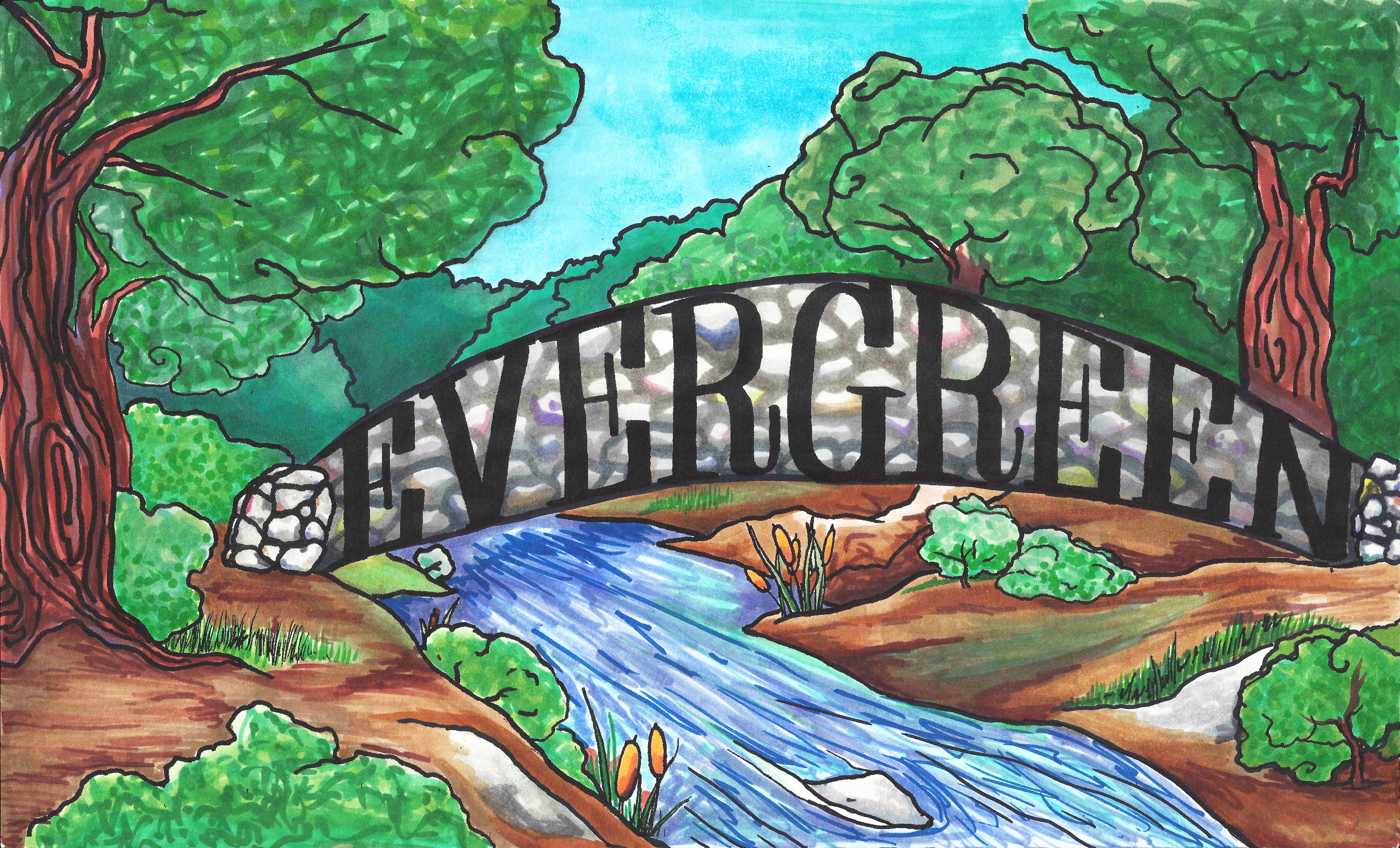
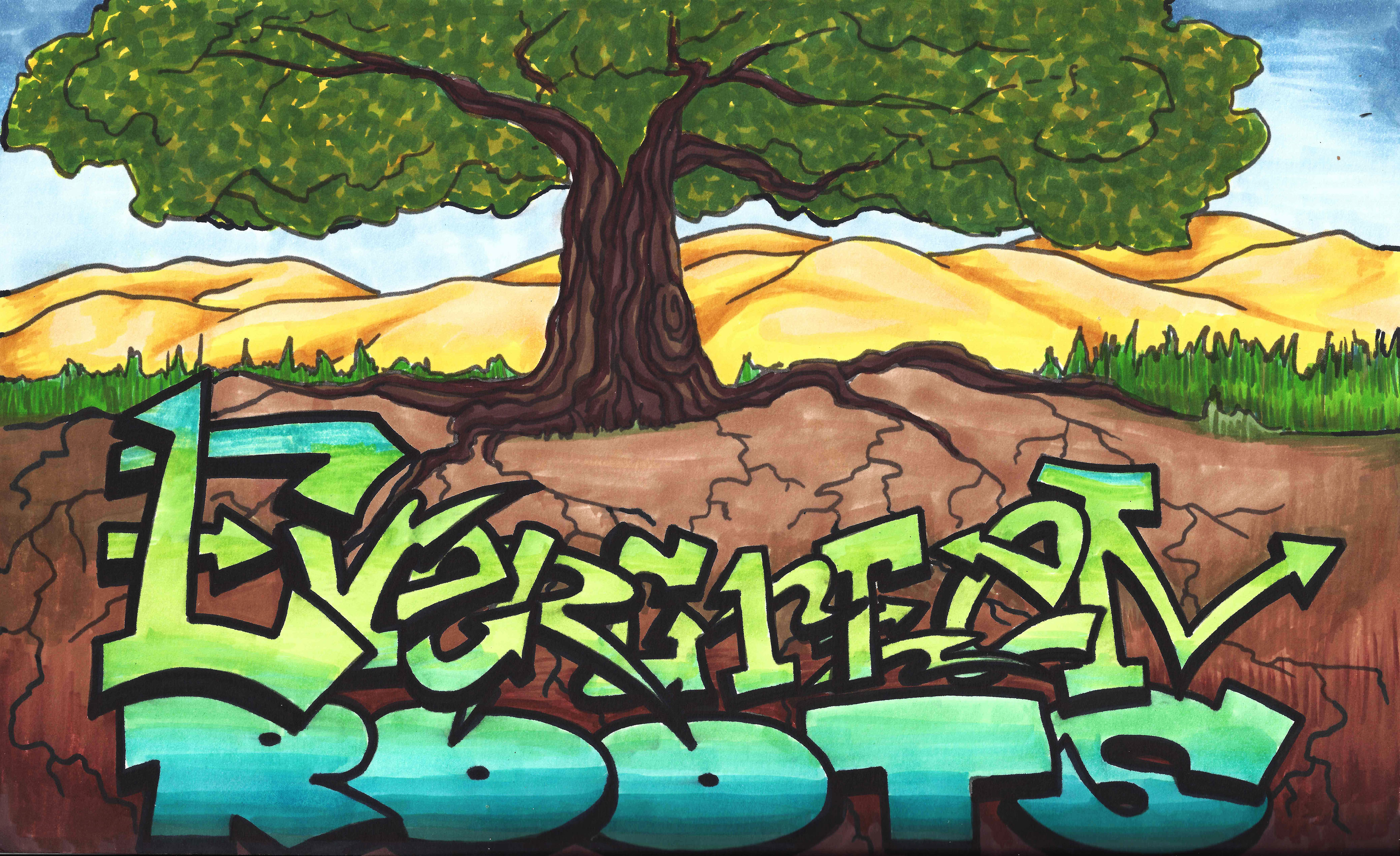
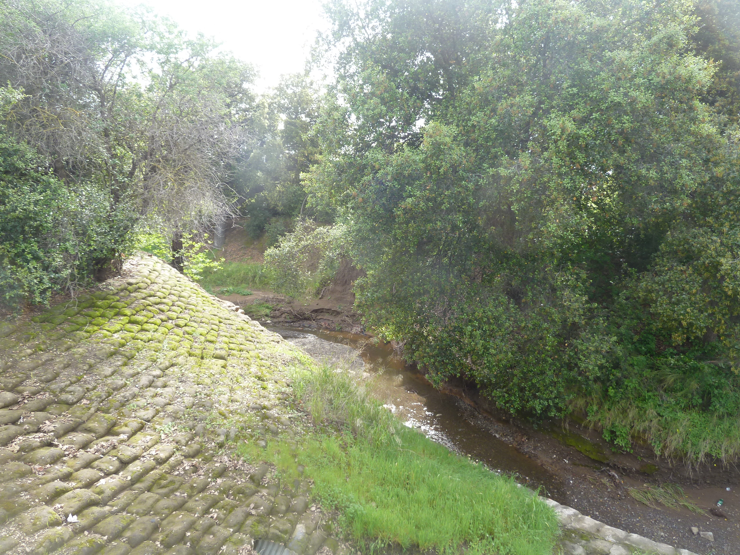
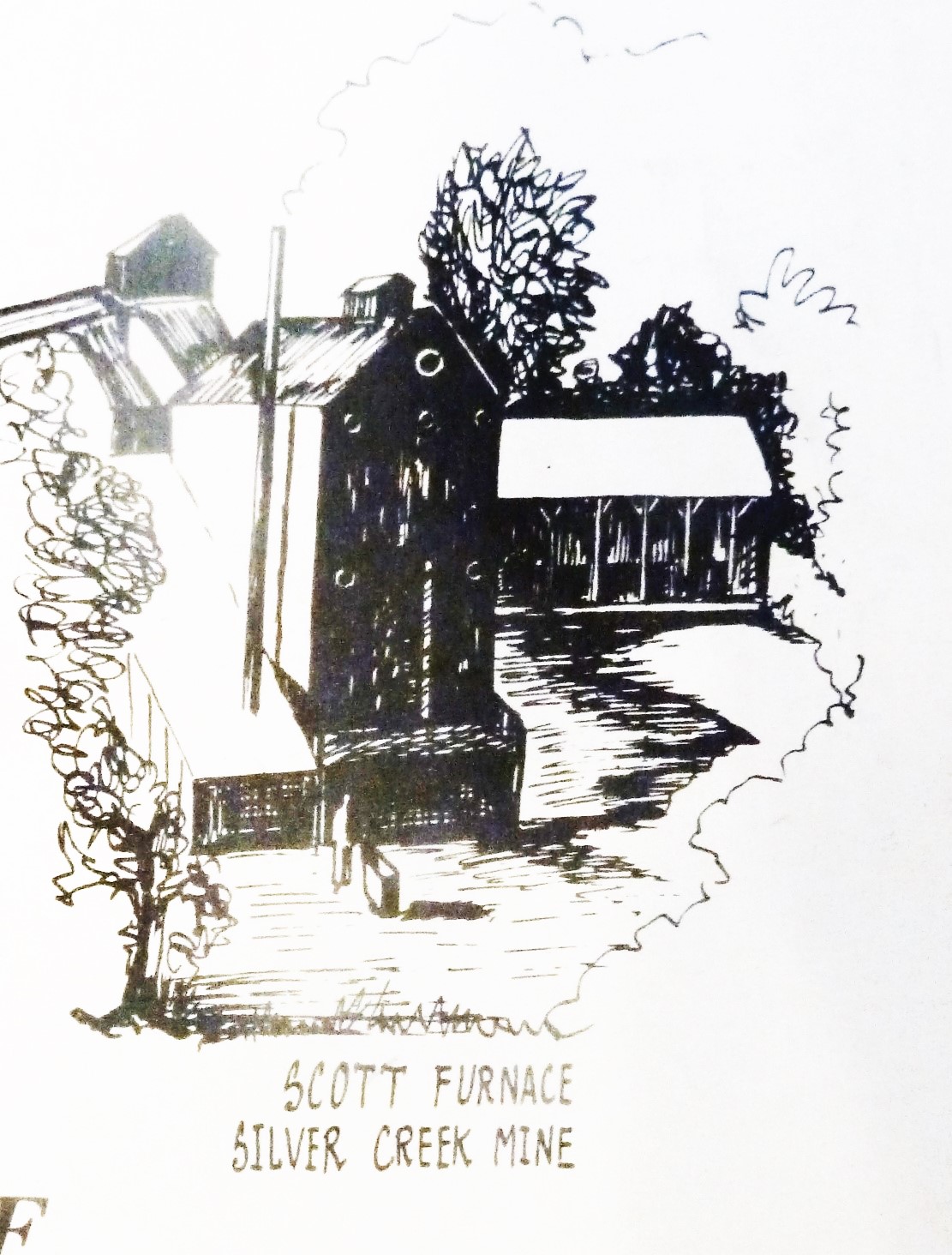
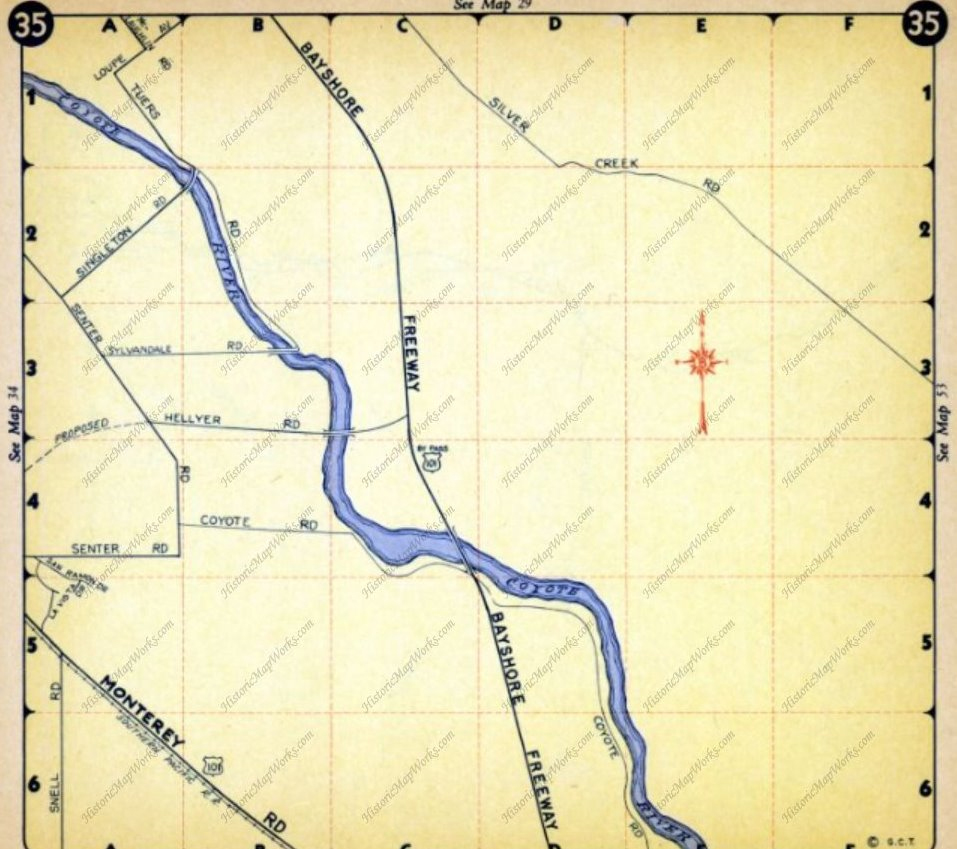
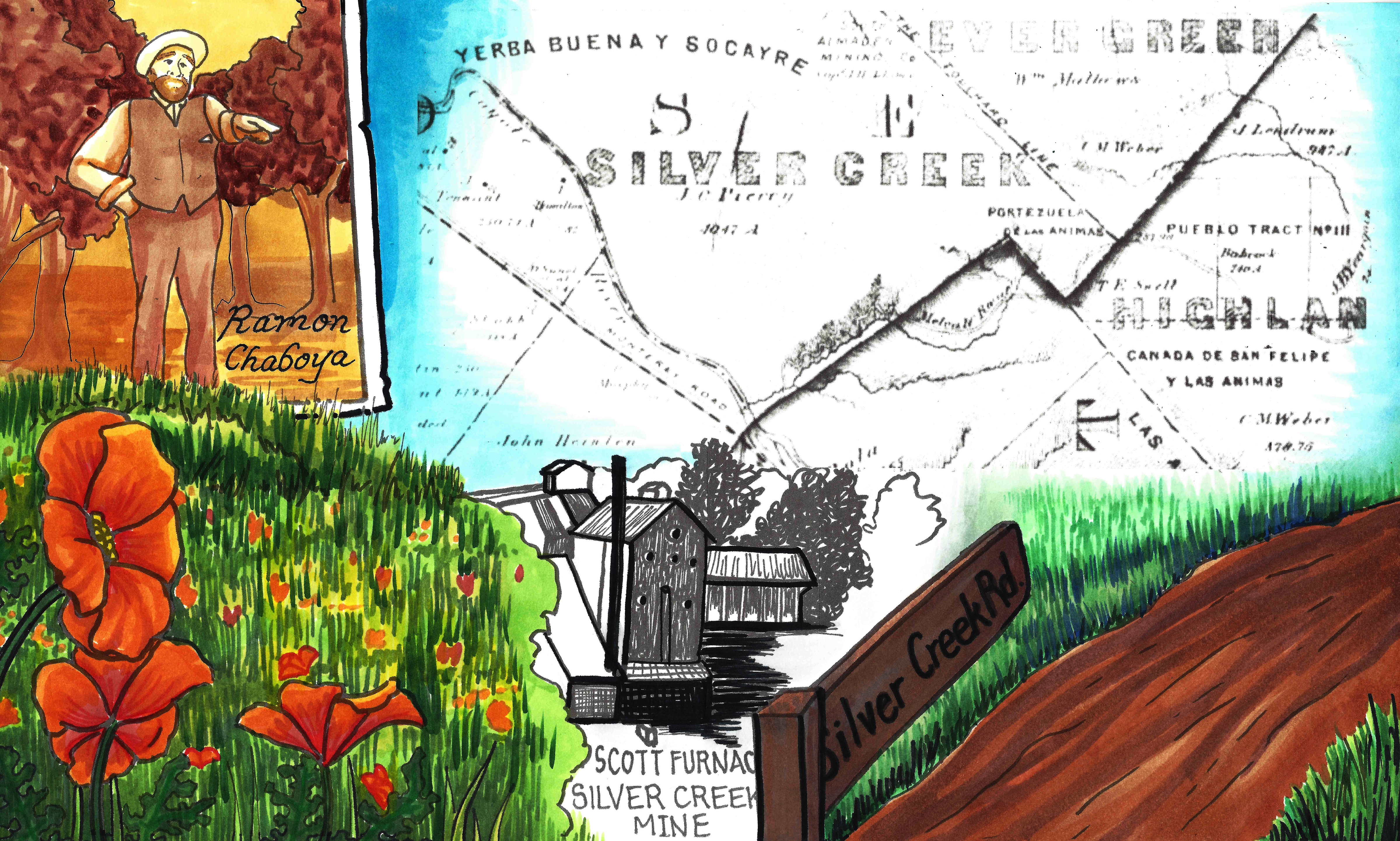
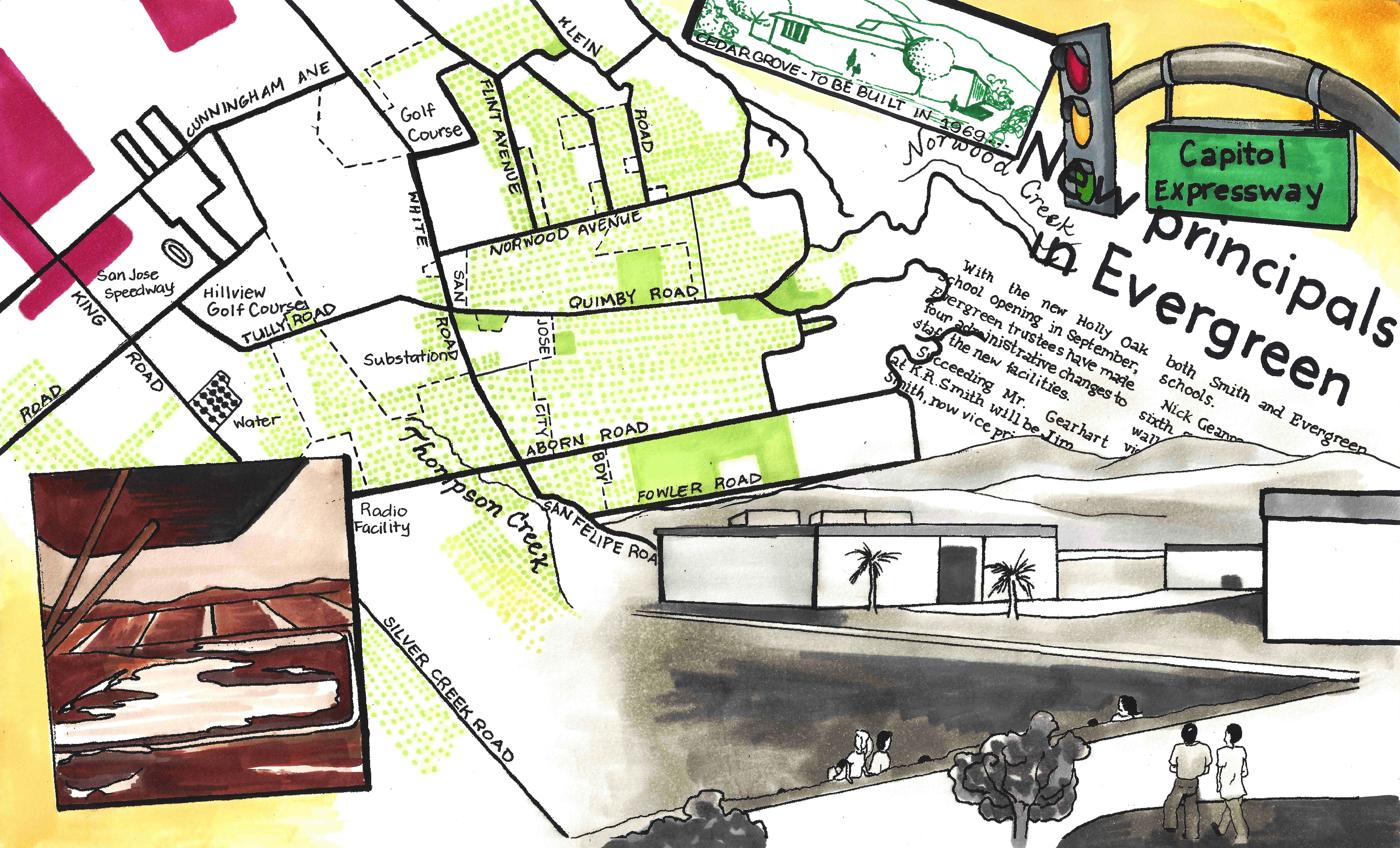
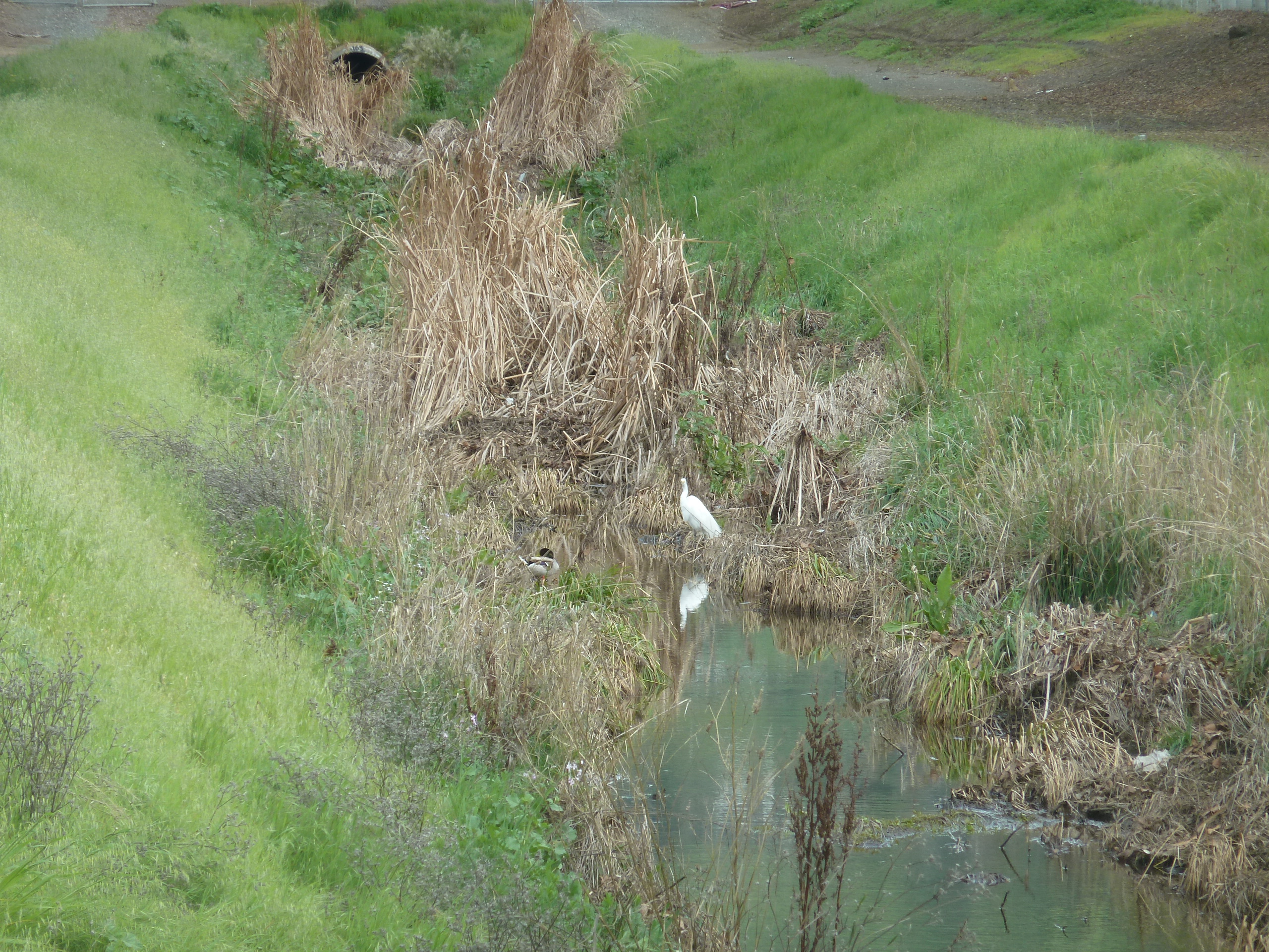
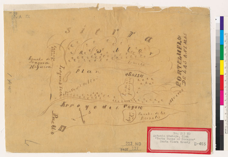
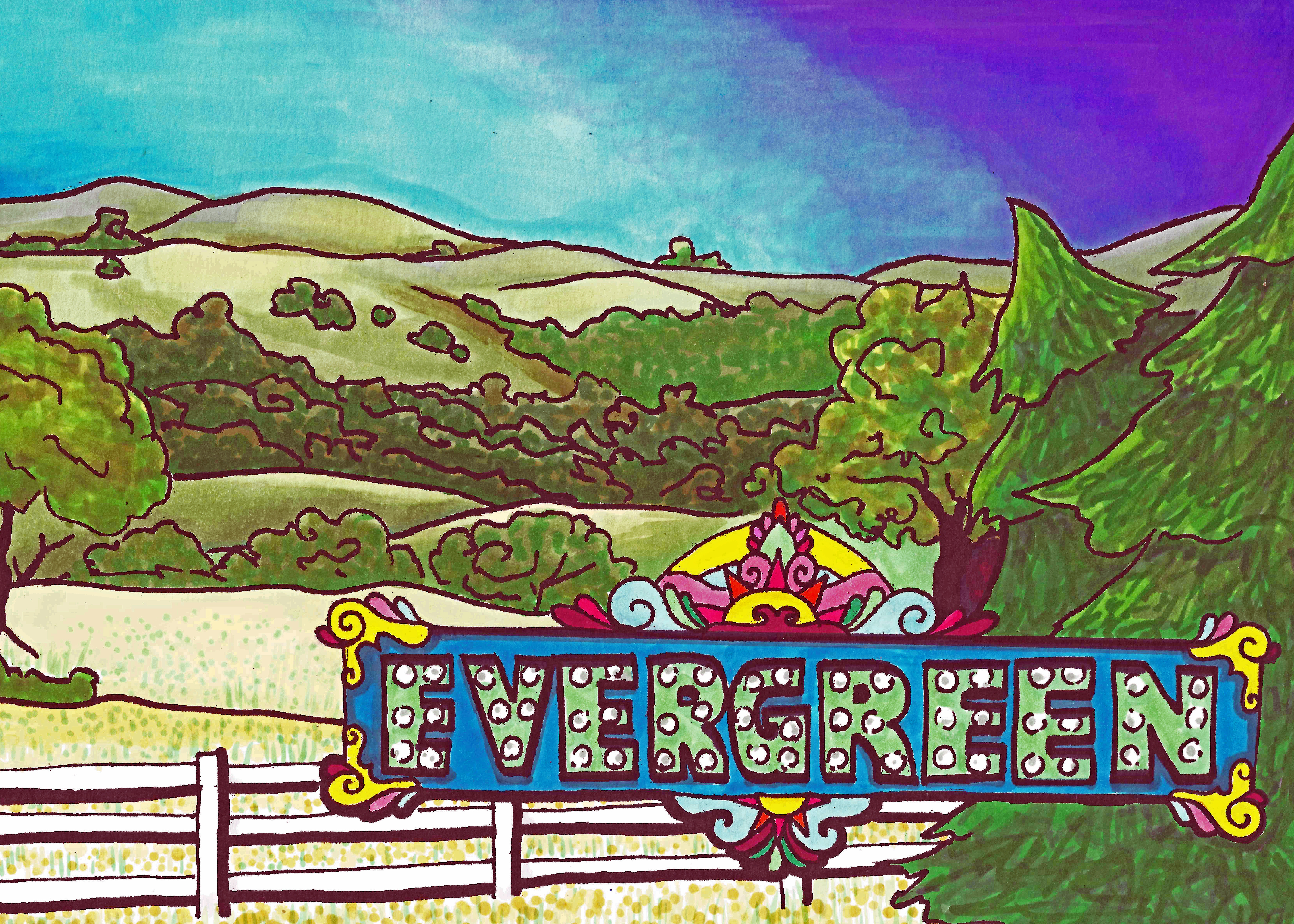
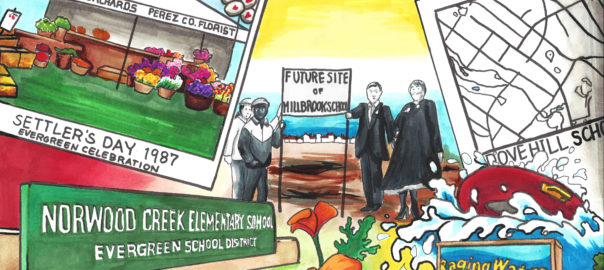
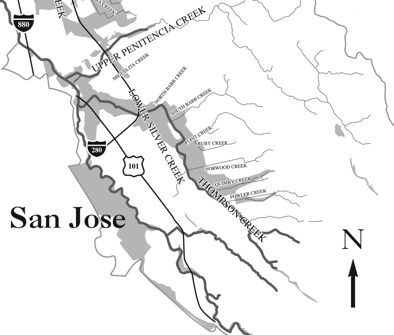
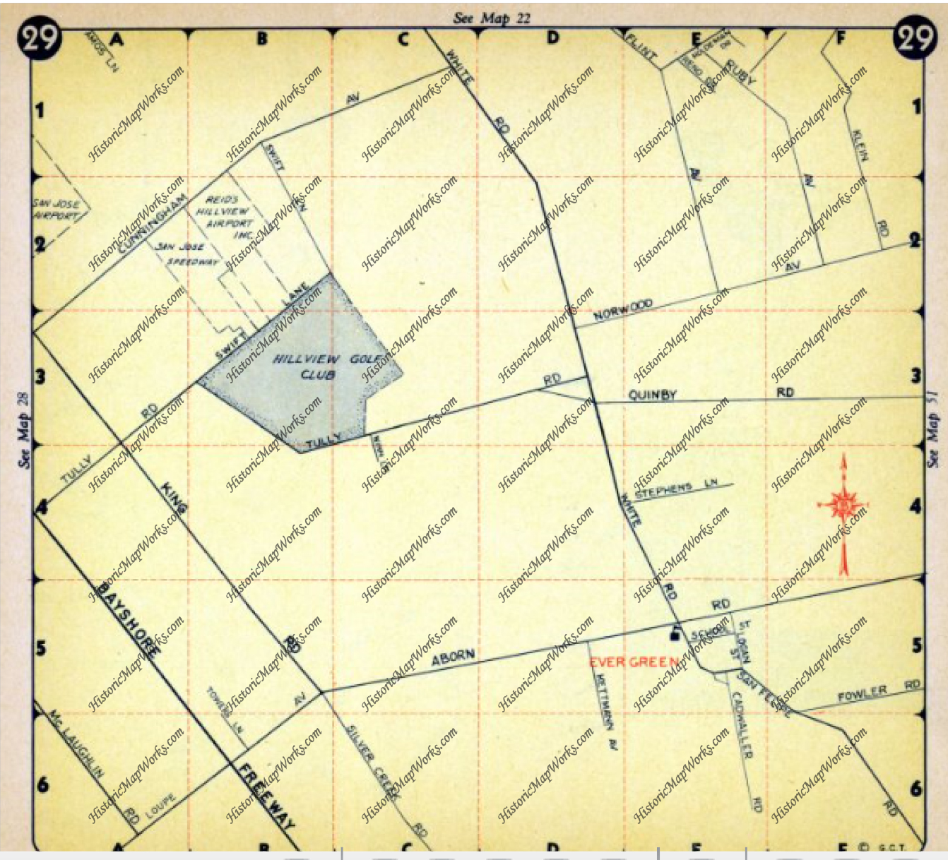
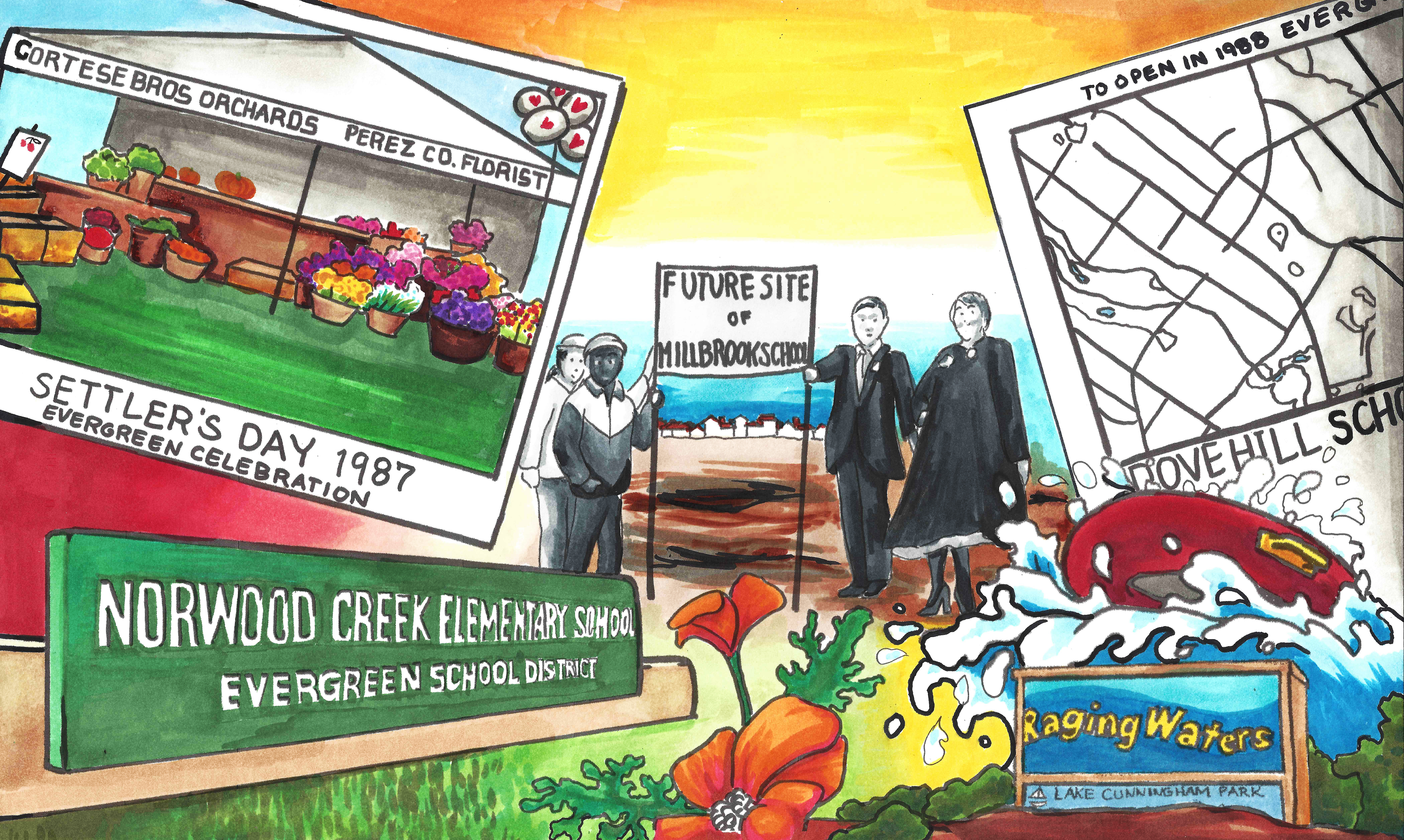
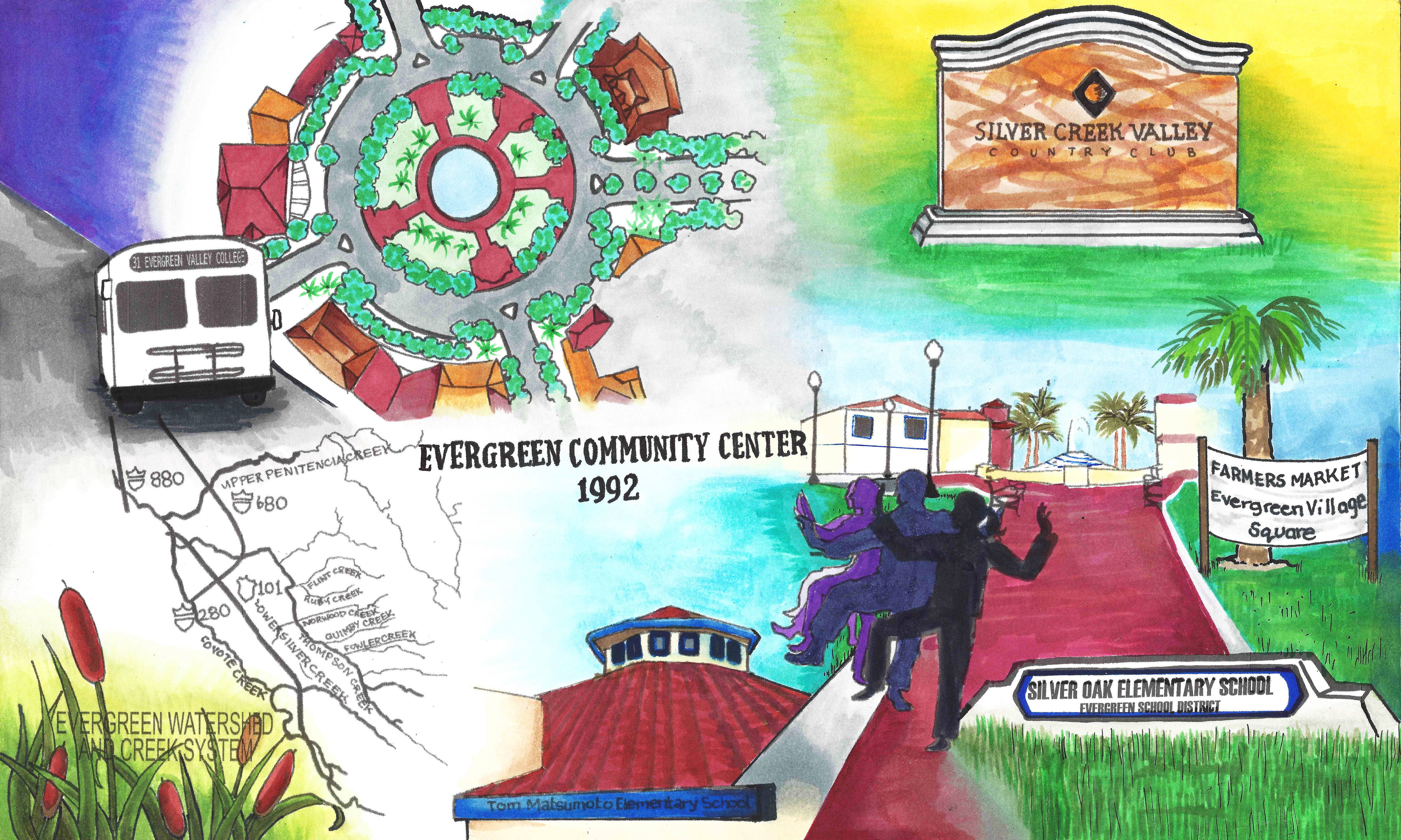
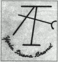
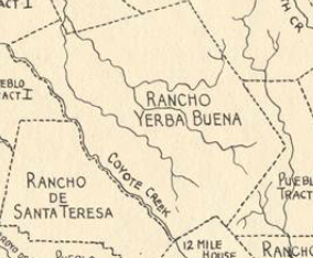
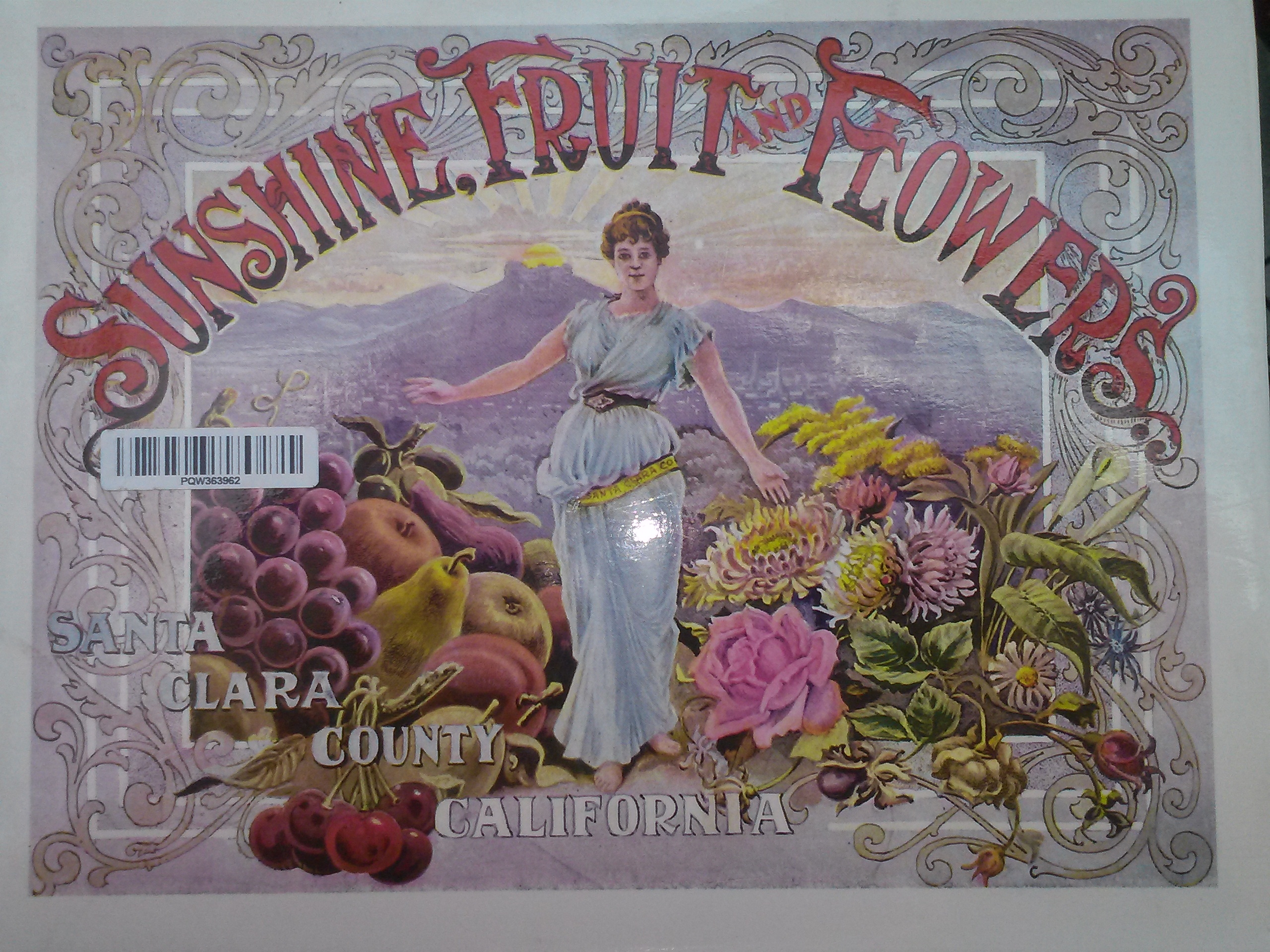
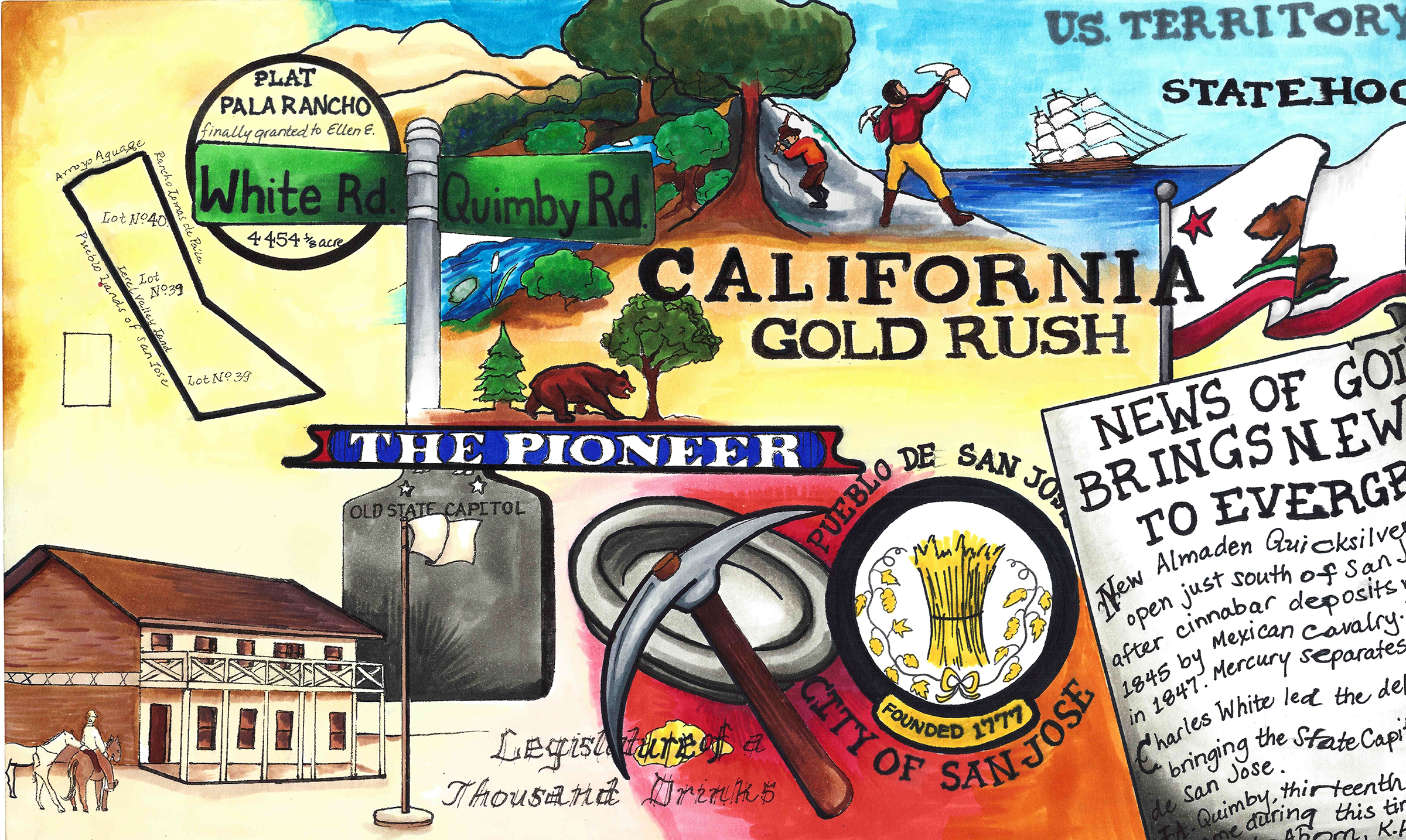
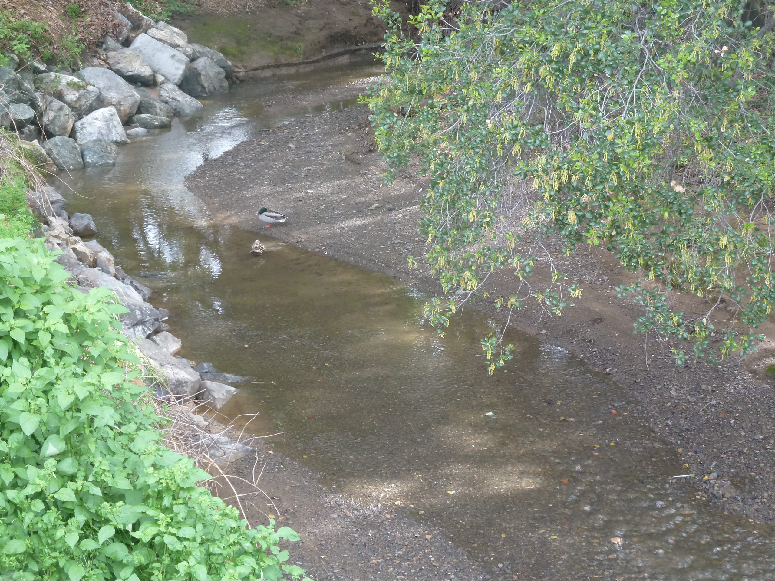
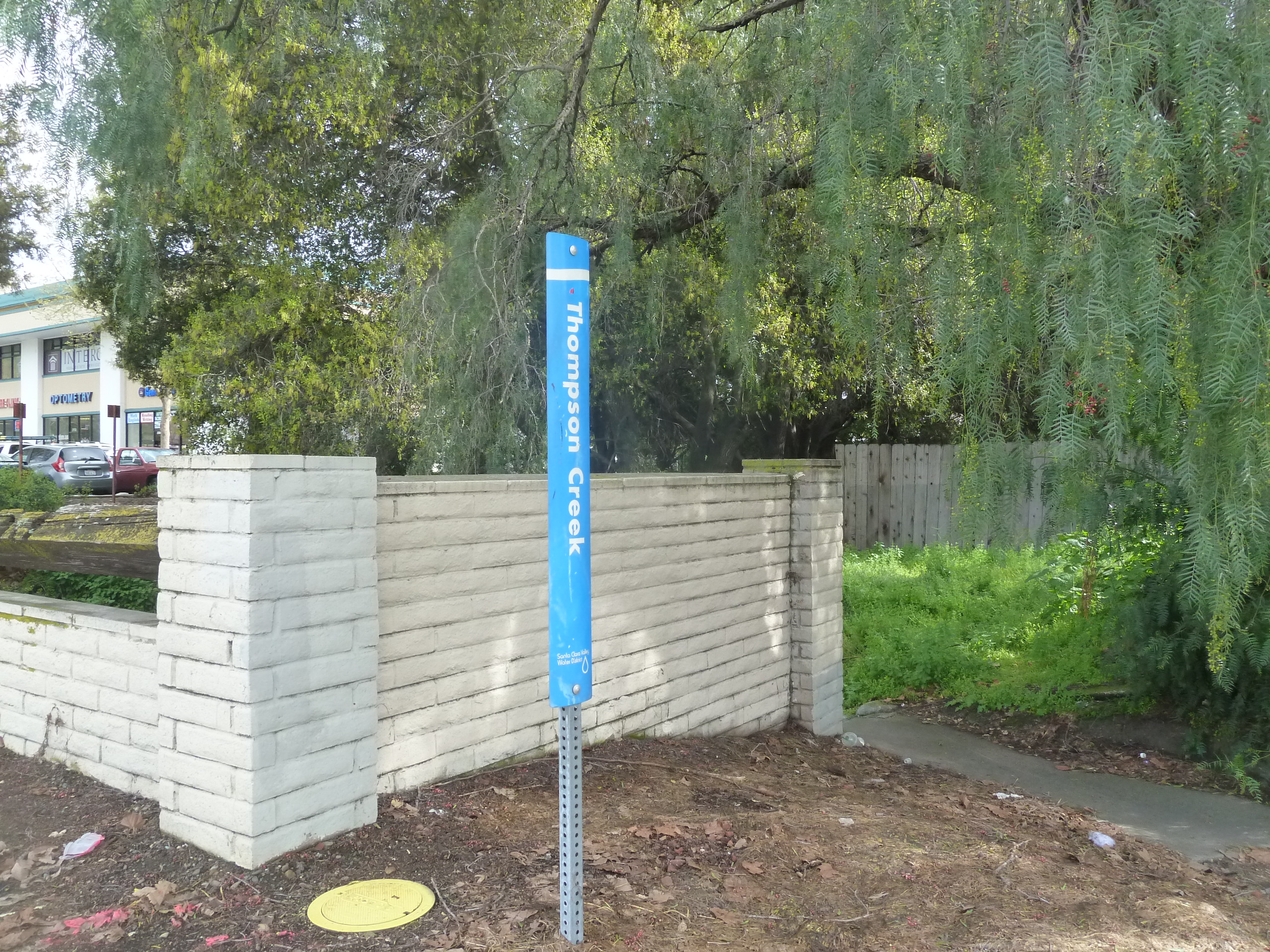
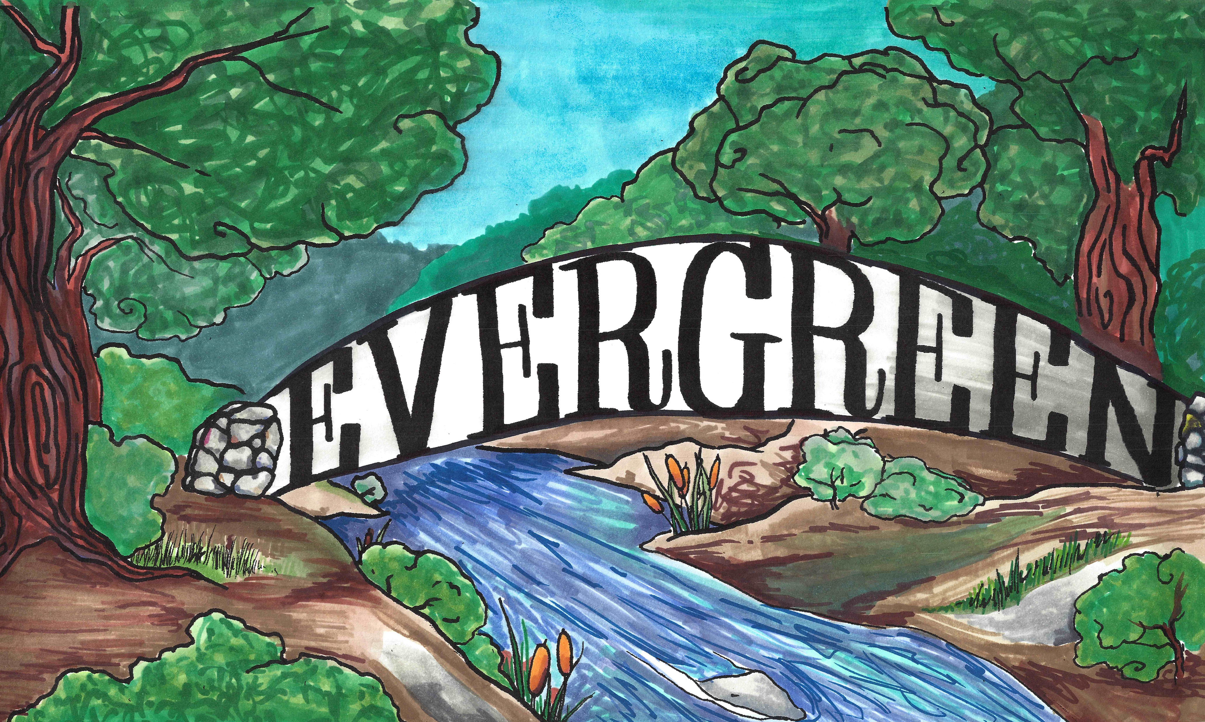
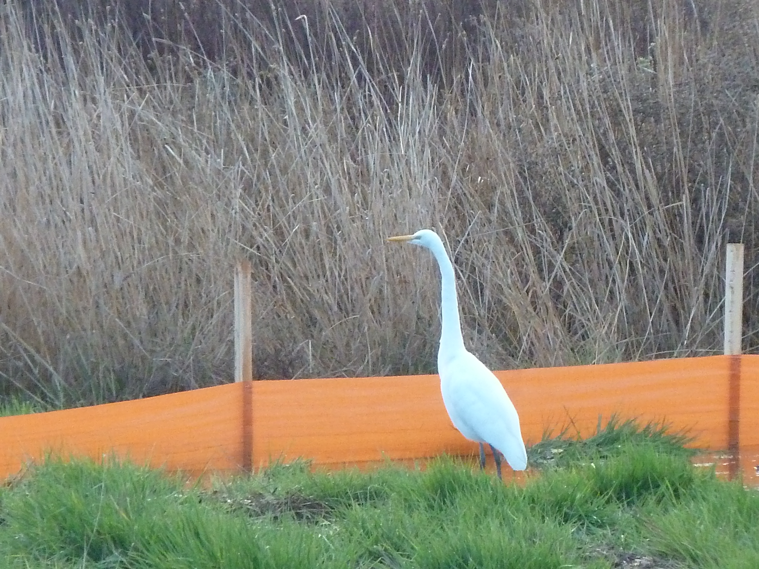
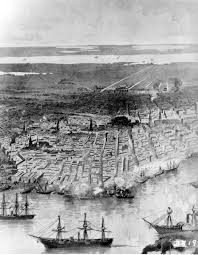
We have a giant Lake in Evergreen, showing up in every map throughout time.  Lake Cunningham wasn’t always a lake but rather a large marshland.  This was where Silver Creek, Ruby Creek, Flint Creek and Thompson Creek emptied into.  Also remember that many other creeks empty into Thompson, like Fowler and Norwood Creeks.  Our Evergreen area was also known as the Lagunitas for the multiple creeks and run off steams in Evergreen.  The Lake was initially called Laguna Seca or Socayre.  In the late 1800’s would become known as Silver Lake.  Velma Million would initiate the campaign and follow through on her passion to create Lake Cunningham.  So, who was Cunningham?

CAM09068velma_interiorLake Cunningham’s Champion, Velma Million, explained to me that the name of the park was the person who owned the property last before seized by the City of San Jose for flood control measures that would stabilize and help the entire Evergreen watershed known as lower Silver Creek.  James F. Cunningham wouldn’t be a pioneer or impressively long term resident of Evergreen, but he was quite a remarkable character on his own.  Truth is Cunningham would only come to Evergreen and San Jose in the later years of his life.

new orleansjf cunninghamBorn in Canada, Queens County, New Brunswick, in 1844, James F. Cunningham worked on the family farm before apprenticing for a merchandise store when he was thirteen.  Cunningham would then travel to Maine and enlisted in the United States Army to fight in the Civil War when he was seventeen.  James “Jim” Cunningham would be apart of the battle taking back New Orleans.  He saw battle quite a few times and was a well decorated soldier, serving in the GAR as a veteran.  After serving in the Gulf of Mexico through the Civil War, Cunningham would go to Brooklyn, New York, and open up shop.  If you can’t make it there…. Make it, Cunningham would.

]Jim Cunningham was wounded in while serving twice, and as a result, his health suffered even at the age of 25.  A young James Cunningham would close down his New York merchandise store and move South.  Cunningham would open another store in Missouri looking for warmer weather at the behest of his doctors.

james_f_cunninghamJames F. Cunningham then traveled in San Francisco in 1869 again for his health and again engaged in the merchandising business.  Cunningham would deposit all of his money from the Army, New York and Missouri into the bank and shortly after the San Francisco bank collapsed.  In 1870, Cunningham would loose all of his savings and need to be creative in his endeavors.  James Cunningham would get knocked down a couple times and manage to get back on his feet.

Cunningham Mill - Staff Posing
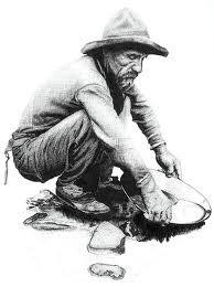
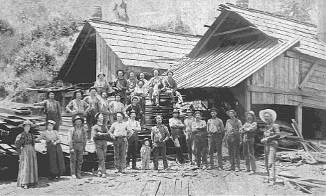
James’ brother would live in Santa Cruz County and be the closest family penniless James had.  Jim Cunningham would take advantage of homesteading laws and open government land in Santa Cruz County, in the Felton and Boulder Creek area.  James Cunningham would get his start making tanbark and shingles for roofs.  In just a few months, Jim cut and sold lumber, saving up $1,000.00 to open another store with a partner, H. W. McCoy.  Cunningham would become a part of many successful business ventures in Santa Cruz County between the multiple lumber mills and general stores.

Cunningham Mill - 1892 Sanborn Map
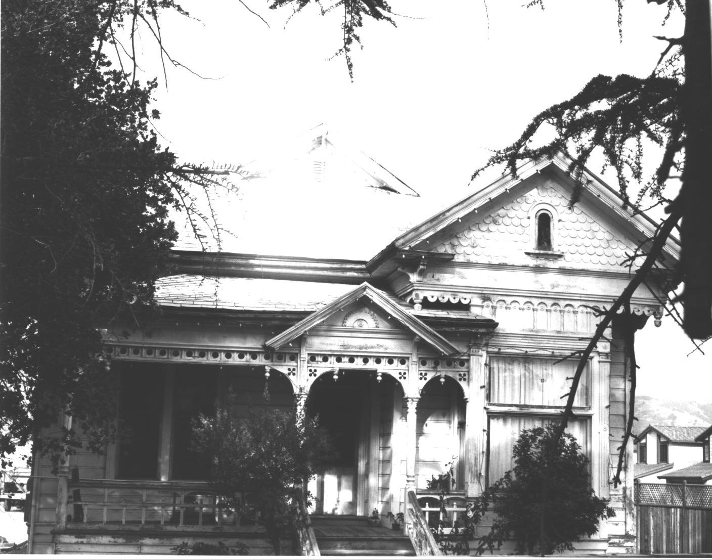
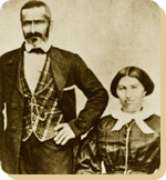
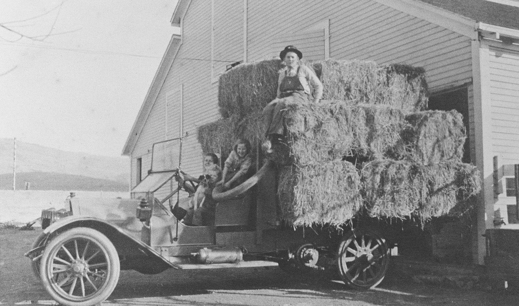
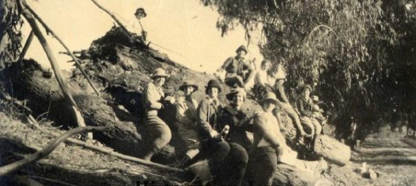
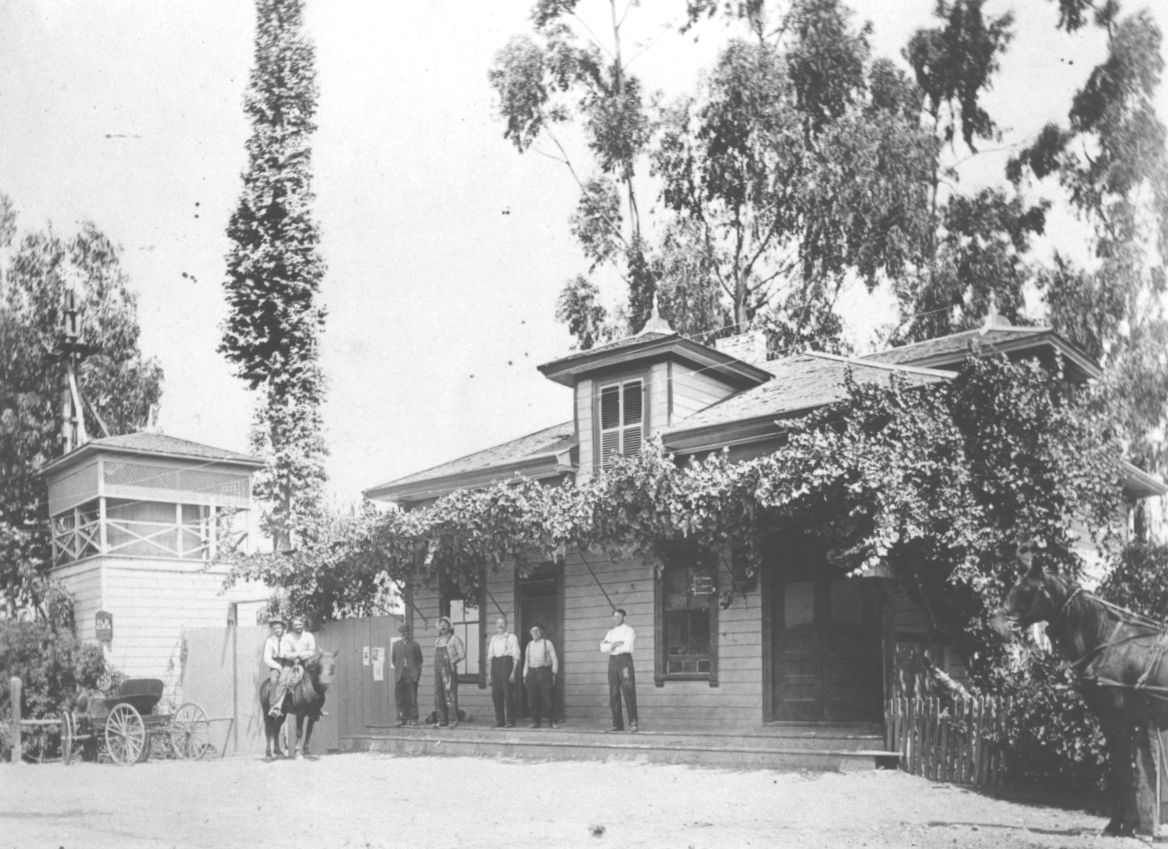
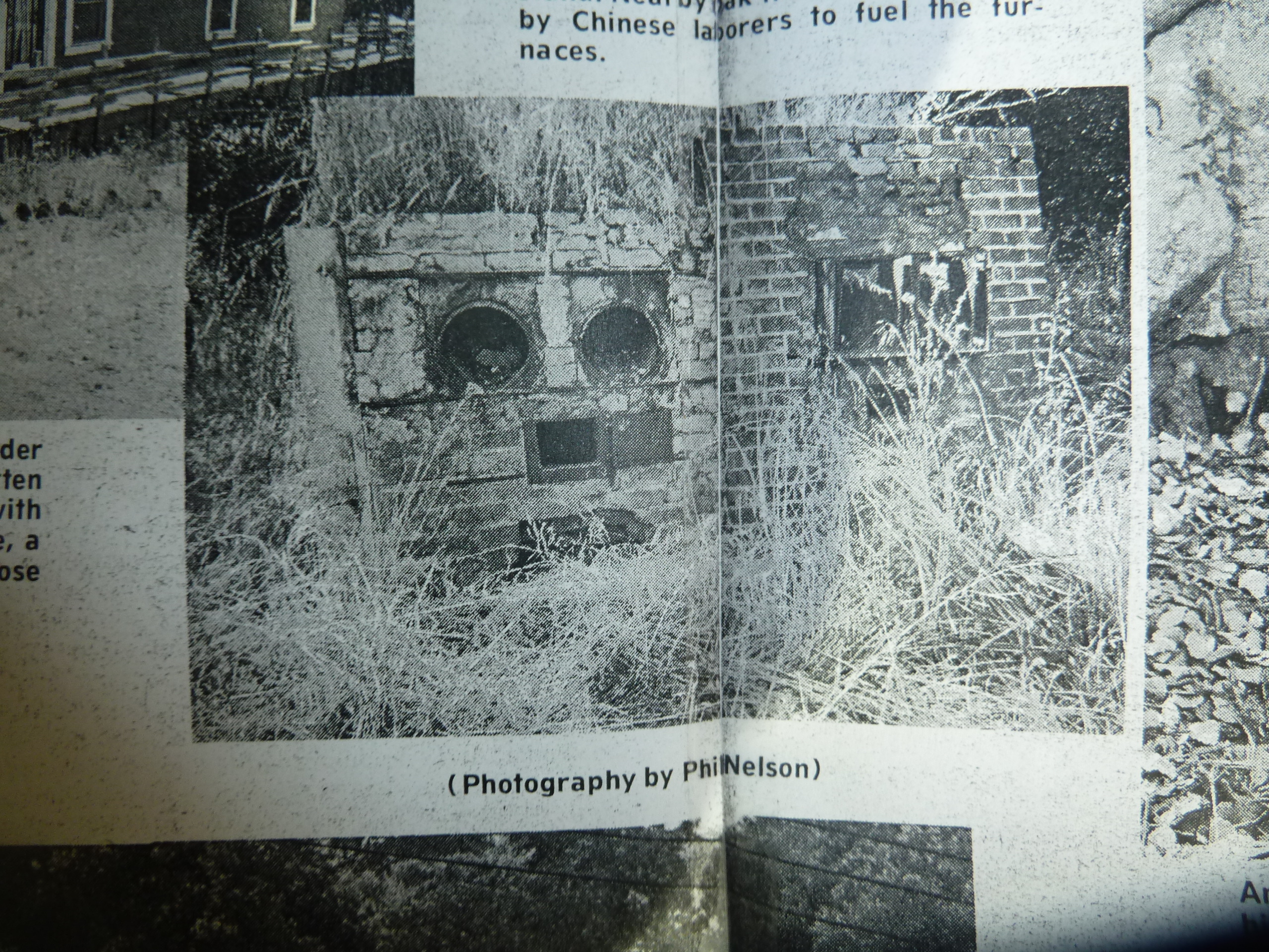
In 1873, James would marry Sarah Glynn but the couple never had children.  James Cunningham would later be elected to Santa Cruz County office and represent Santa Cruz in the State Assembly in 1878.  The lumber business became very competitive in the 1880’s and Cunningham, being away so often, allowed himself to be bought out by partners.  He was too old to work on the Mill anymore, although Jeremiah may have managed for sometime after.  This print from the Lumber Mill is from 1901.

books cunninghamP1310186 (4)
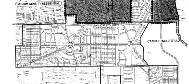
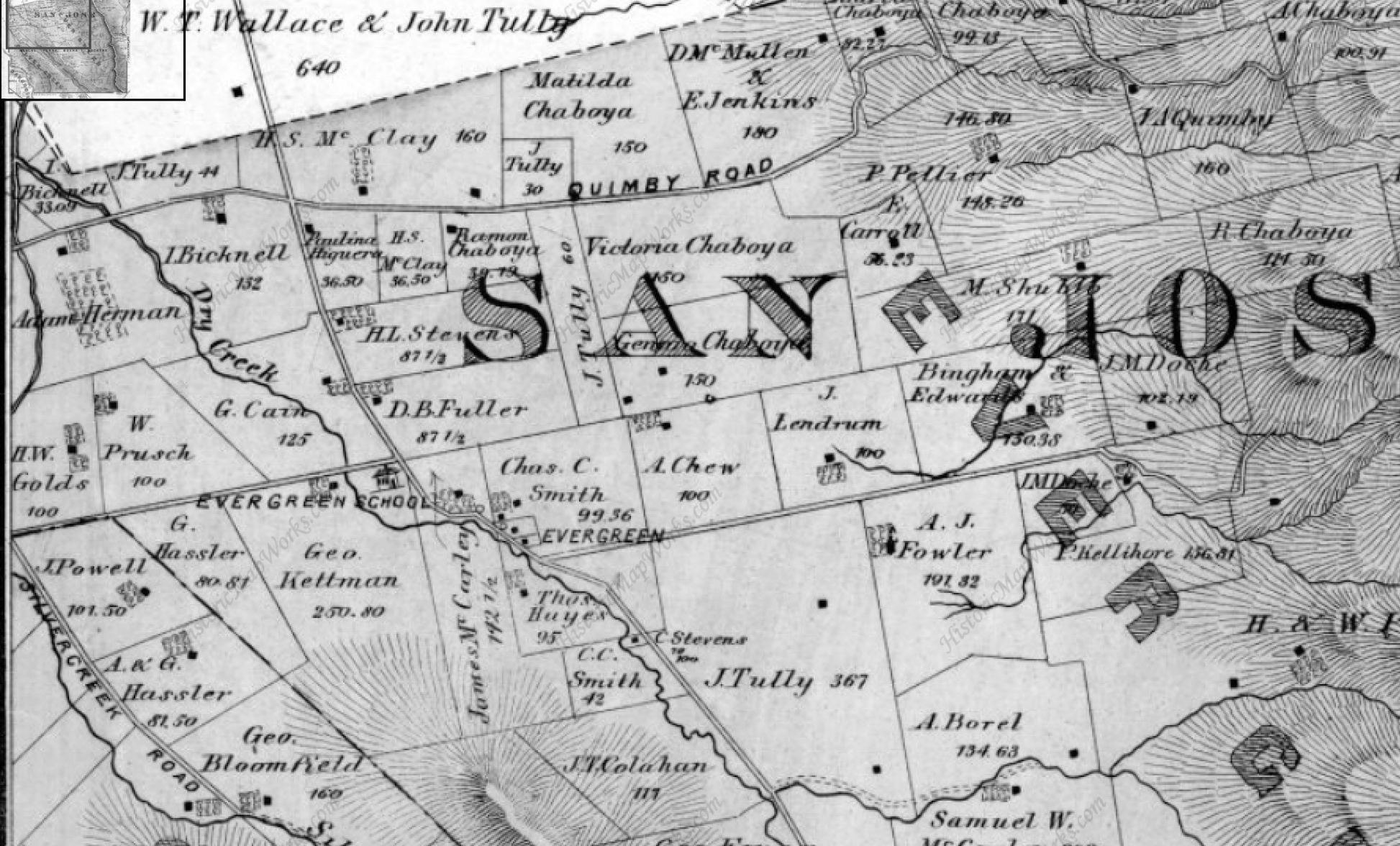
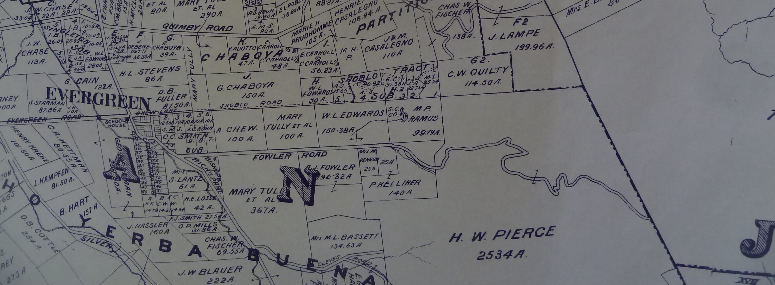
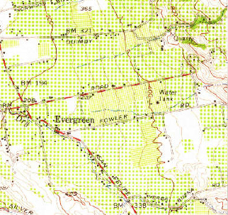
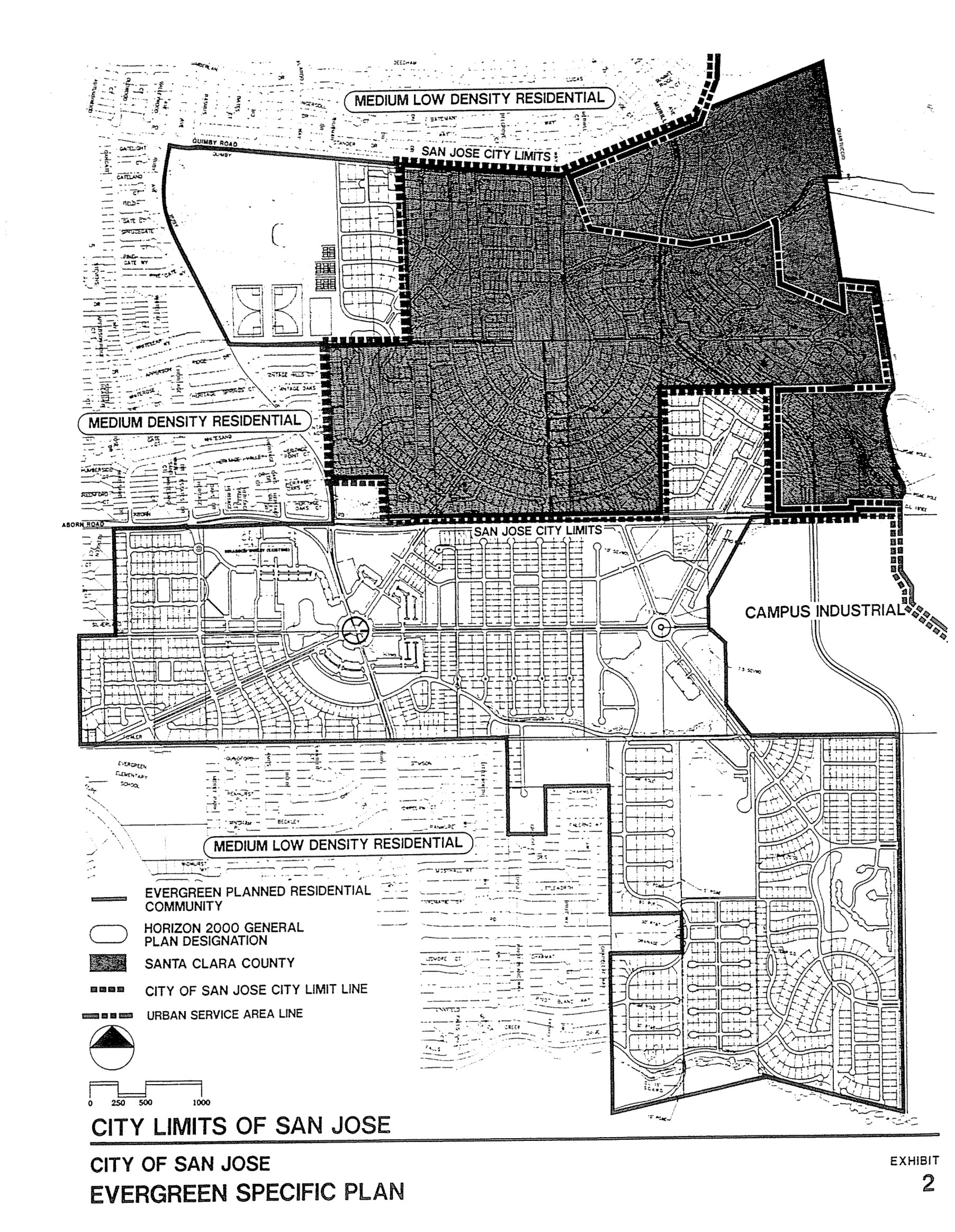
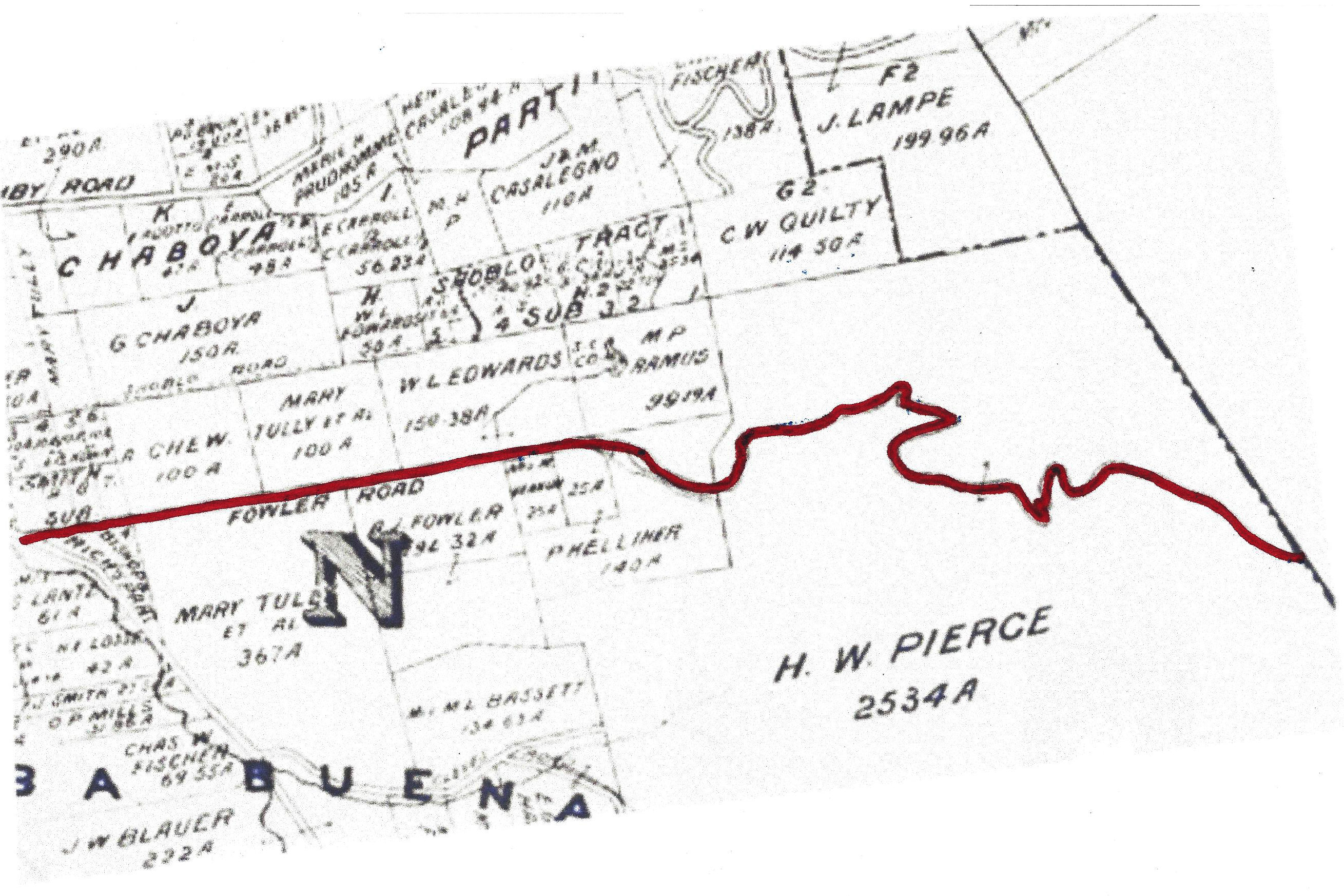
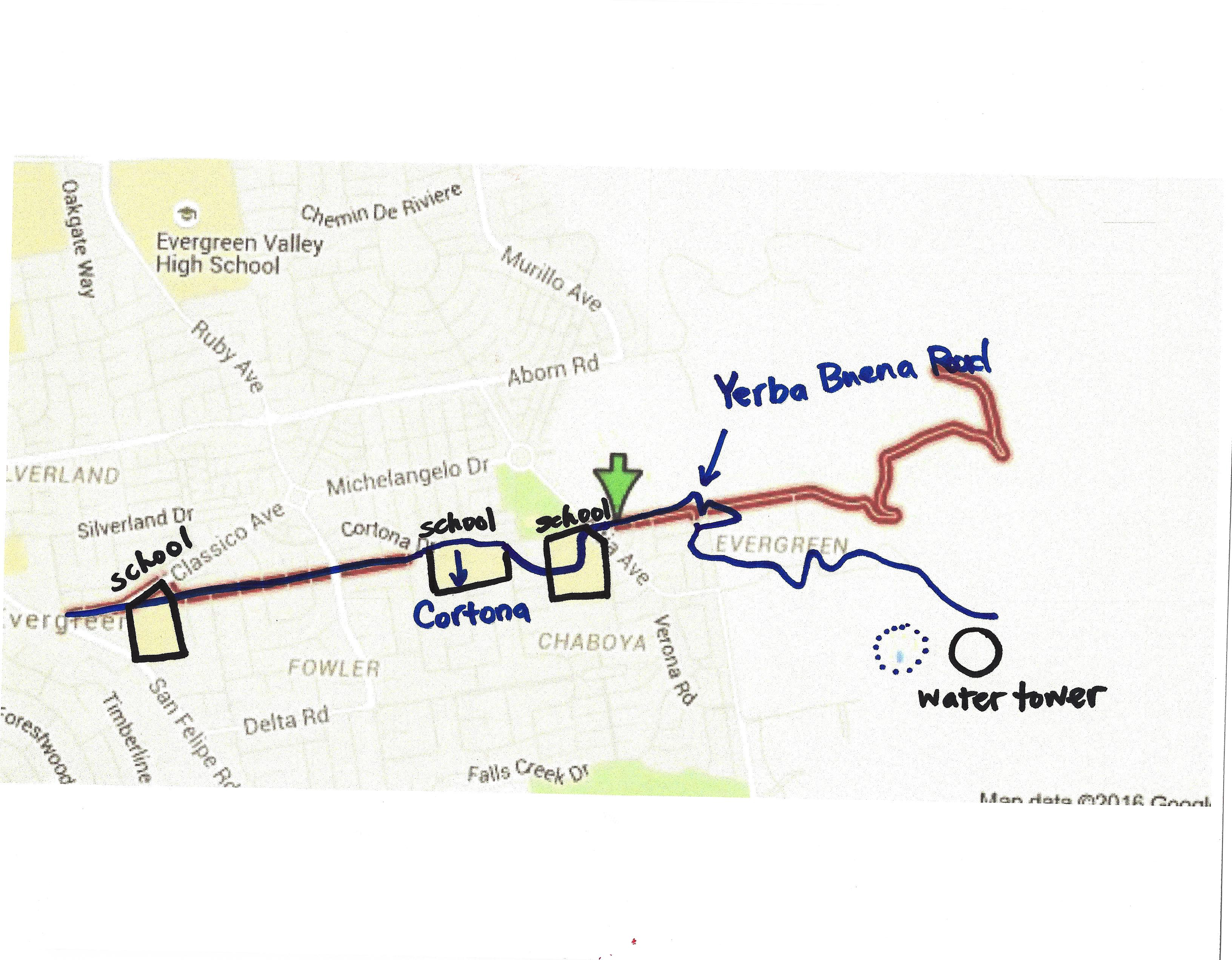
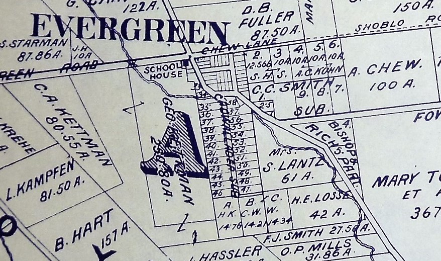
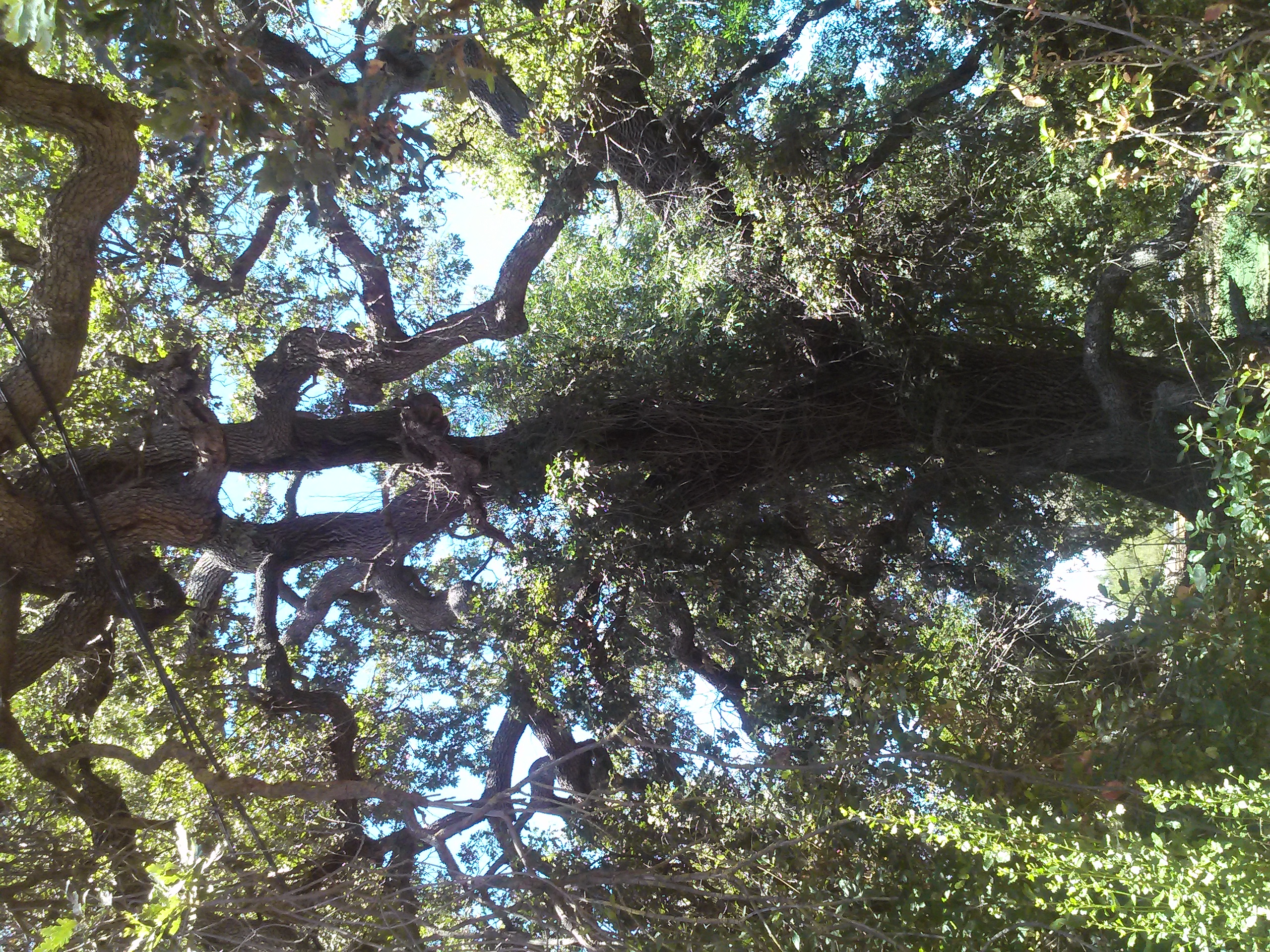
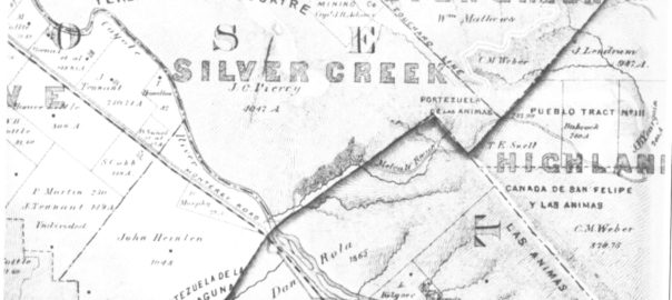
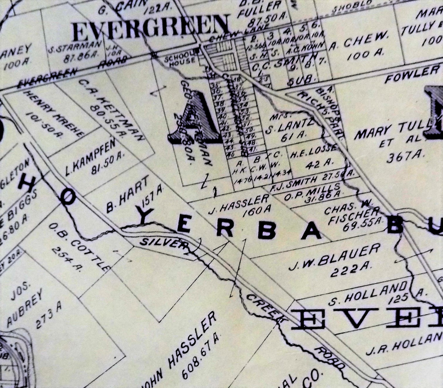
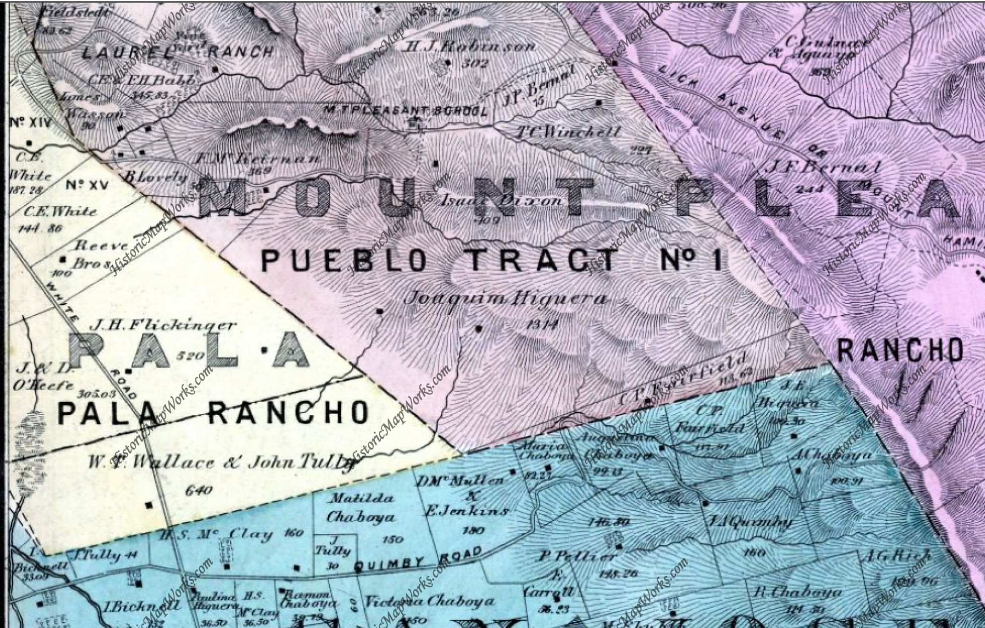
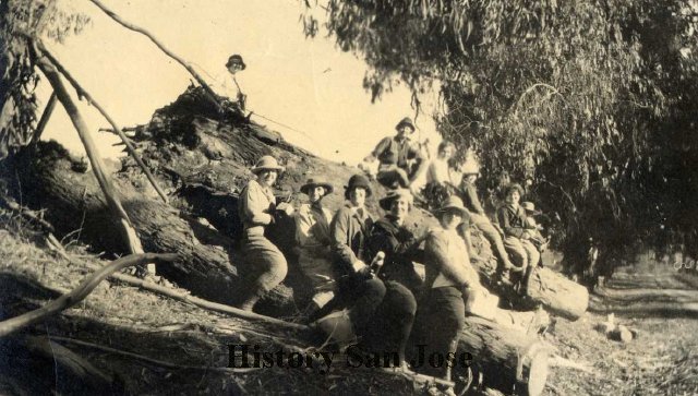
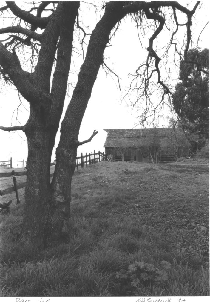
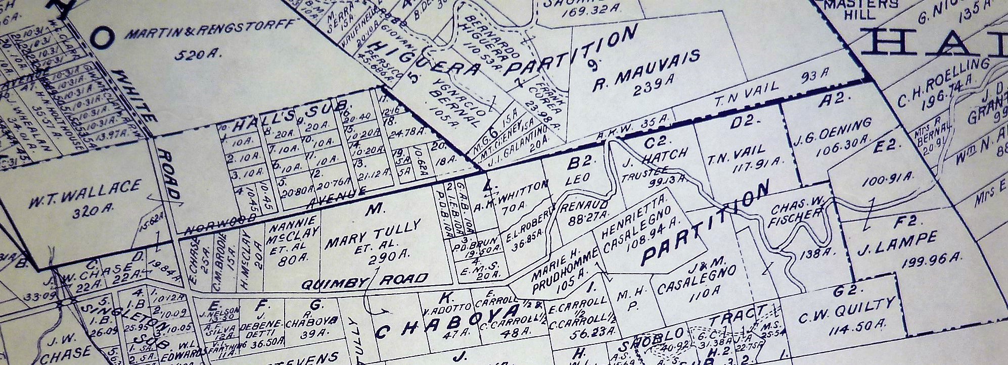
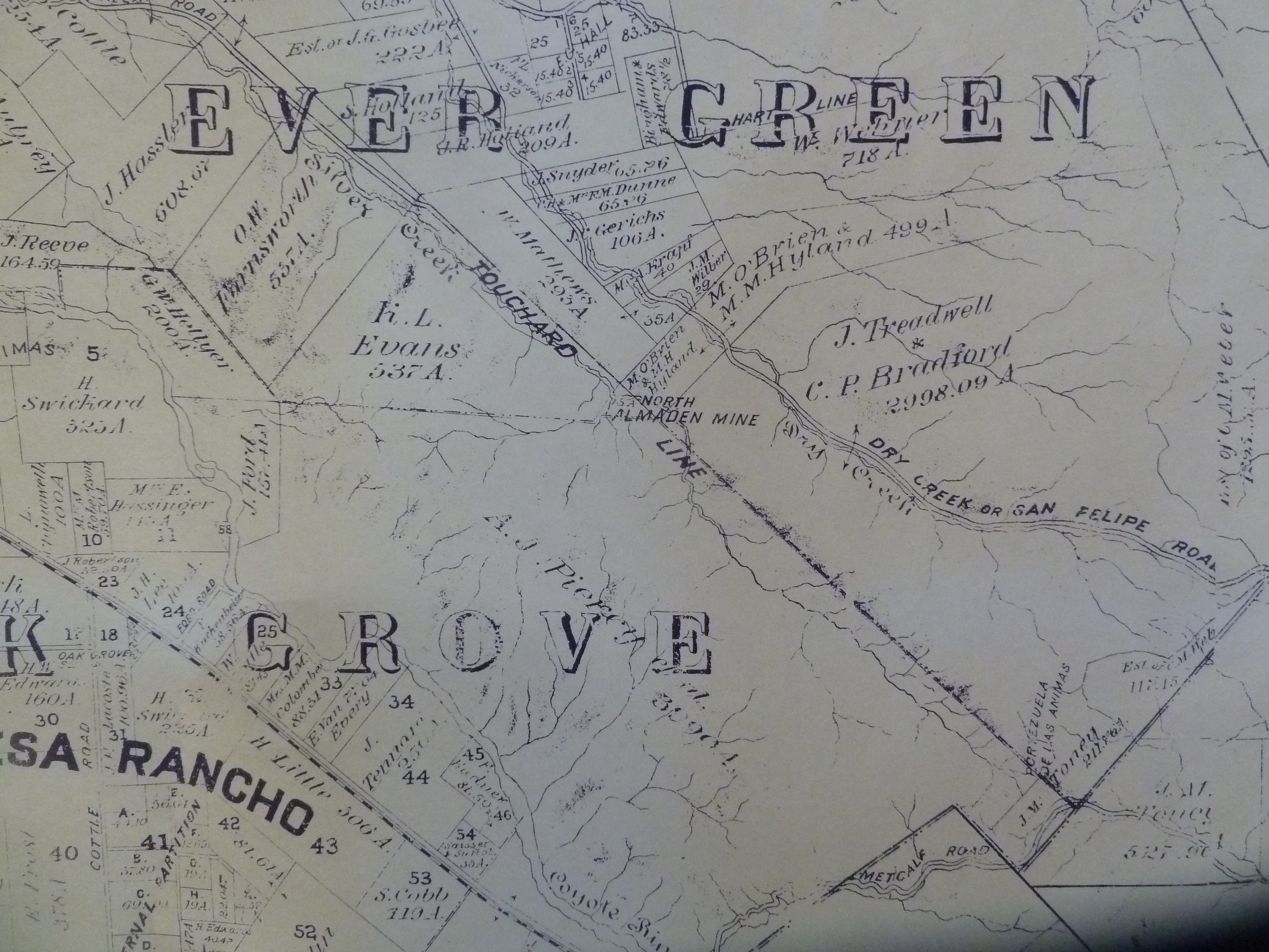
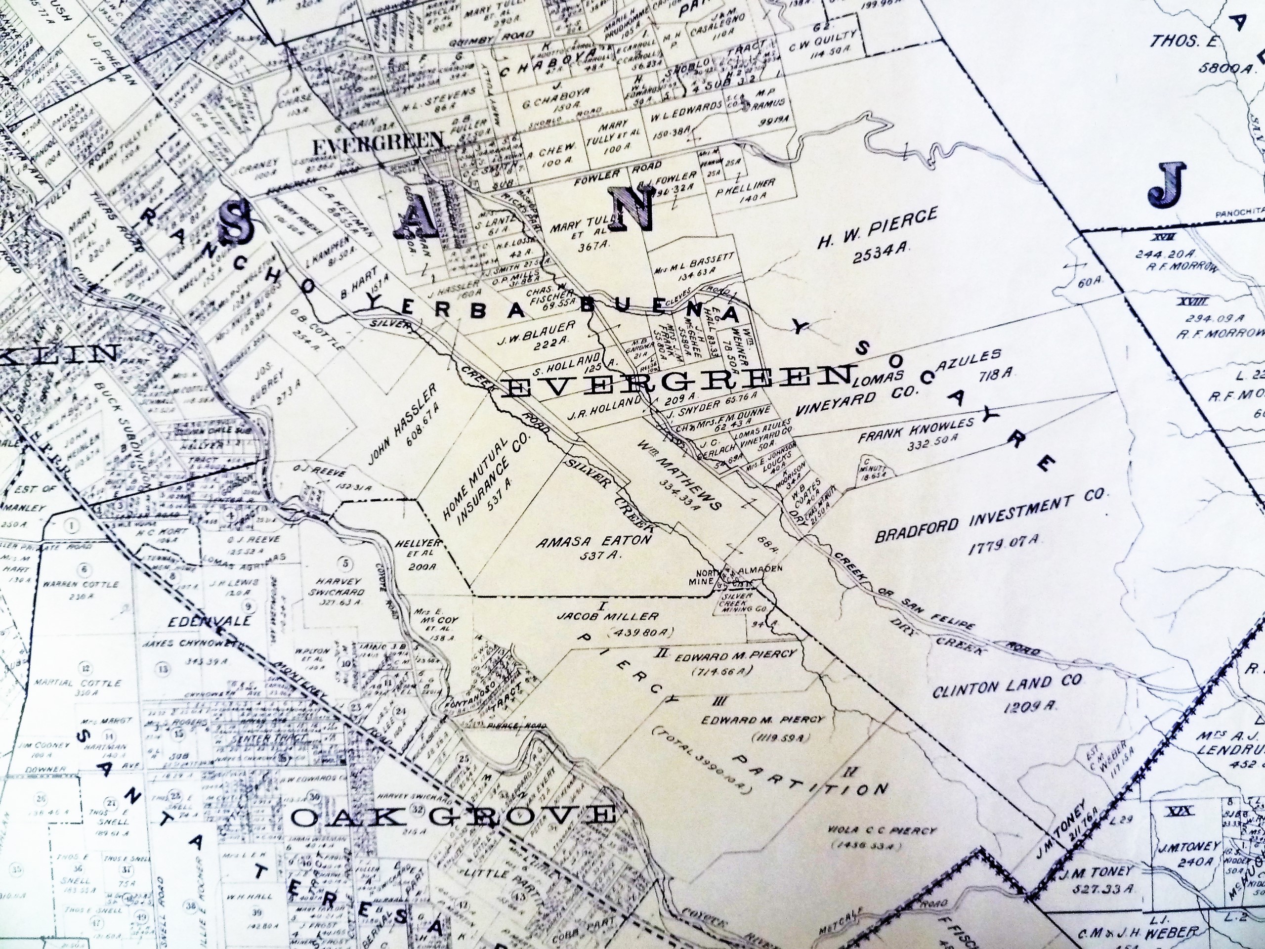
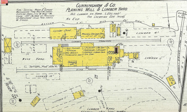
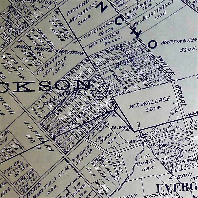
Don’t worry.  The force of nature that was James F. Cunningham never gave up even though he had enough money to retire into the sunset.  Cunningham’s sunset was the East San Jose farm and it wasn’t retirement.  The Cunningham’s ranch would be off of Cunningham Avenue and King Road, extending into Evergreen.  Cunningham may have hunted at the Lake named in his honor.  I found James F. Cunningham in the 1890 edition of Polk’s San Jose City Listing with his brother, Jeremiah.  Cunningham & Co. owned a general store off Market Street.  James would develop this land and sell a portion to his brother as seen in this 1902 map.  Jeremiah’s residence would be labeled JWC here.

James Cunningham would also known a large ranch in Mountain View, located at present day Moffett Field.

80492586_133783552796
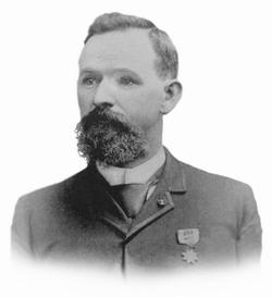
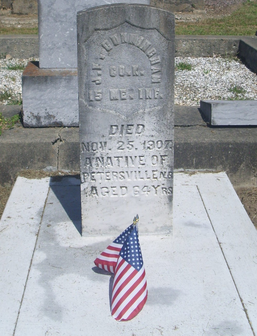
James F. Cunningham would pass away in 1907 at the age of 63, having a military honor at his burial.  His East San Jose farm would be worked by his brother for another twenty years after.  His brother, James F. Cunningham, was a warm, well-liked guy from many sources.  The Santa Cruz Surf said on November 25, 1907:

“For one who had made his way in the world from the bottom up by personal force and aggressiveness, ‘Jim’ Cunningham was a remarkably lovable man, and to him the people in his employ and of his neighborhood were notably loyal.”

Fowler Road and Creek

P1330025I work a lot at Chaboya Middle School, in fact its the first school I ever painted at.  People often ask, “Chaboya On Fowler Road?”  And I always say yes, but I know its address is on a different street.  Fowler Road is indeed very close by, but Chaboya is on Cortona Drive.  What’s the confusion?  It’s been redundant for me throughout my career, so I checked it out on behalf of the Evergreen Mural Walk.

1876 MapFowler Creek was named after Andrew Fowler, whom I’m enjoying getting to know.  The street was one of the first in Evergreen, as was the man.  We’ll discuss him in further detail later.  This road was built before Chew Lane/Aborn Road’s eastward section.  This 1876 map hasn’t put a name to the street, but you can see A. J. Fowler’s property along the south side of the road.  This was William Matthew’s portion of the attorneys fees paid out by Chaboya in his lengthy court battle.

In 1899, Fowler’s name finally appears on the road.  This Fowler Road runs all the way through.  It did when I was a kid.  What happened?  This is Fowler Road’s modern path below.

Microsoft Edge

By 1956 however, Fowler is the straight thing I remembered it being as a child.  It ran east of Ruby Avenue.  This map cuts off the windy portion but it was a solid straight line.

Below, Fowler Road is broken up into two parts and straightened out in portions.  There are switchbacks indicated on Fowler Road in 1899 on the Eastern zig zag which appear true on the modern map, but the road also ends sooner in the modern map.  It ends even sooner if you’re driving.  It ends at the straight spot.  This road kept going in 1899.  What gives?

fowler road san jose - Google Search

fowler road 2Here’s what gives.  New homes plans were put in place back in 1991 to get this area built out.  Before that point, in was rolling Mirassou vineyards and orchards.  Chaboya was built on Fowler Road in 1991, but the road’s path would change names as homes were built.  The new bend in the western part of the road came with the build out of the  the Classico neighborhood.  Historic homes still line the straight entrance, but then Fowler Road takes a turn towards the development and later becomes Cortona Drive.  Fowler Road would be built straight during the before 1956 but between proposal in 1991 and build out, something changed.  A portion of the existing Fowler roadway, which clung to Fowler Creek, would become Cortona Drive.  That’s the portion of Fowler which ran through P. Kelliher’s ranch in 1899.  Fowler Road then picks up on the other side of a small park on Chaboya Middle School’s East corner, where the road turns in the Western most part of H. W. Pierce’s acreage.  That’s where the arrow lands.  Today, Fowler Road straightens out, drops again and is private roadway after that.  You can see the windy road, but it appears to be shorter today.

CAM11655 Gemellos, why did you think about that?  Cobble Stone.  Now that I’ve investigated Cottle’s Cobble Stone and now Cadwallader Avenue’s fallen cobble stone bridge, I know there’s something up in areas where I find it in volume.  It’s too heavy to clear and it was clearly a favorite of late 1800’s farmers marking their homesteads.  I was in between appointments around Evergreen and I stopped when I saw it in volumes all over this area.  In fact, I traced Fowler Road’s old path following the stone.  I started at the most eastern section I could legally get to.  I soaked up some rustic Evergreen treasures then saw this row of cobble stone.

CAM11651It feels like trail markers hikers make to let you know you’re headed in the right direction.  When I found this kind of cobble stone along Keaton Loop, I knew it was roadway markers.  This was something.  I wasn’t sure this was Fowler’s original roadway, though.  It’s not lining up with my understanding of the historic maps I’ve found.

CAM11670I found it again on Yerba Buena Road.  Nothing creates perpendicular intersections up here in old Evergreen.  What am I seeing?   Every time I see this kind of rock, I know something is going on.  Just before I turned right and westward looking for Fowler Road again, I looked left and bang.

P1320018This water station was built out prior to 1956, and improved in 2000.  It controls flooding in Fowler Creek.  Fowler Creek now trickles in the winter but the homes are safe and the groundwater is saved for less than rainy days.  This is at the intersection of Altia Avenue and Yerba Buena Road.  This road looks like old Silver Creek Road, and would’ve been paved around the same time, being the same age.  This is a little better maintained and a little less traveled as a City of San Jose Water Station.   I think the stones were rolled over when the ranches turned into farms before they turned into home development.  This undeveloped area shows us what it used to look like.  That straight section of marker and present day Fowler Road is possibly the boundary of M. P. Ramus and Kellihore’s ranches in 1899.

CAM11678CAM11690So, I met up with Fowler Road at Chaboya Middle School and the marker continued.  Heading West, the Cobble Stone reoccurred at Fowler Creek Park.  Makes sense.  Evergreen used Cobble Stone to protect from flooding.  Fowler Creek would be dammed up by cobble stone in several sections.  Today, Fowler Creek only trickles in the rainy season.  That makes sense, too, because the Creek is captured by a water tower at its most eastern and uphill point.

CAM11692And then I started feeling silly because I’m excited about rocks.  I followed it all the way to Ruby Avenue and Cortona Drive, once Fowler Road.  So, what part of Cortona is old Fowler Road?

Let me get nerdy for a second, find north on each map and scale them.  There.  So, what happened?

fowler road san jose - Google Search

Maybe a little clearer still, with the paths traced on one map….

scan0167-1Fowler Road’s path was straightened through the early 1900’s then altered by the schools built to service this growing Community.  Evergreen School would have a horse tie up instead of a parking lot for a long time.  The District Office was originally located there along with the school but as time went on, a larger school was needed and the office moved.  Many District services still operate out of this office, though.  Matsumoto Elementary School was also built on the Fowler Road path.  When people ask me about Chaboya on Fowler Road, they mean built on top of Fowler Road itself.  They were more correct than I ever realized.  The cobble stone I observed was in the Yerba Buena Road portion of one time Fowler Road.  The changes that occurred over time were fairly straight forward and made the road more useable.  It’s cobble stone roots are still showing on both Cortona Drive and Fowler Road today.


Cadwallader Avenue Bridge

IMG_0007signpostPat Loomis once wrote about Cadwallader Avenue’s driving bridge over Thompson Creek that had been washed away in a flood in January 1893 in her series of Sign Posts published in the San Jose News Newspaper in the 1970’s.  Today, we all remember the walking paths connecting these neighborhoods.  We rode our bikes over wooden planks and metal rails with lush creek beds beneath us as children.  I went poking around in the old Dry Creek looking for remnants of the Cadwallader Avenue bridge because I’d been there recently researching San Felipe Road with Judge Jerry Kettmann.  Maybe he assumed I knew about the bridge, but I couldn’t envision a bridge in this “S” curved portion of Dry Creek.

P1310185 (2)The intersection here at Cadwallader Avenue and San Felipe Road is really ground zero for Evergreen.  This was downtown Evergreen.  The first residents’ homes still stand near ground zero.  Keaton Loop, cuddled up next to Thompson Creek, was once part of San Felipe Road. Cadwallader Avenue, however, once met San Felipe Road before 1893.  Here, in the map to the right, you can see the “C” of Cadwallader on top of San Felipe Road as it crosses Dry Creek, known as Thompson Creek today.

Here, the Women’s Relief Corps, Evergreen School house and Evergreen’s first dense home development grew off Cadwallader Aveunue.  Mr. Cadwallader is fascinating as well.  Though he never would call Evergreen home, he was certainly generous towards the Community of Evergreen.  Cadwallader Avenue’s lost bridge was a new revelation along the research.  It’s neat now when I learn brand new things about Evergreen.  This Cadwallader Community seems so secreted away when it used to be at the heart of everything.  It’s certainly the second smallest parcels on the map above, a precursor to what Evergreen would eventually become.

IMG_0021Here, I found deer frolicking.  I found sun ripened wild berries.  I found really old trees.  I found the end of Fowler Creek here now under San Felipe Road and graffiti.  There is a foot bridge now.  This new bridge is the straightest line down the Avenue itself.  Today’s foot crossing is certainly very permanent and wide, but a direct line down which didn’t feel true to my materials.  I wouldn’t be too sure that’s all it was or created from what was left of the old crossing.

IMG_0018These sand bags would have been from any number of floods through the 1900’s.  Sadly, I wouldn’t expect sandbags or burlap to stand up to 120 years of moisture, deterioration, rainfall and overflow.  I could be wrong, though.  These would’ve had to be treated with some sort of plastic to have survived this long.   These bags protect the creek’s fragile lining at this pipe’s opening.  Over saturation would result in things beginning to slip into the creek, like the old bridge did.  This area was prone to flooding with a huge events as recent as 1969.  I do however see lots of rock, thanks to all the unsightly graffiti highlighting them.

IMG_0013This large, metal pole is so random, and literally in the middle of the way creeks crossing.  Its placement is so odd that this must be evidence of some sort.  But what?  Also, observe all the rock around it.  That’s weird too.  It caught my eye as we were taking cute photos of me gathering research.  I took these in street clothes on a return visit because I just couldn’t stop thinking about this pole sticking out in the middle of the creek bed and that driving bridge.

P1100123 (2)1850 - bridgeCome to think of it, I was jumping over rocks taking those pictures that day; so much so, I forwent the heels on rocks concept because it was unsafe.    It felt like Cottle’s Cobble Stone all over again, starring me right in the face.  This pole would support a cobble stone bridge like the one my imagination conjured up.  Cadwallader Avenue began with a slight bend, when today’s Cadwallader Avenue crossing is flush with the avenue’s direction, as it reaches Keaton Loop.    What would convince me absolutely that this was the collapsed bridge?  Another support pole or more cobble stone would prove it to me.

IMG_0020Done and done.

Sadly, the second pole I found also epitomizes the great need for the Evergreen Mural Walk.  The general public doesn’t know the history of Evergreen and therefore doesn’t respect the land.  It’s so sad to see the vandalism and destruction on school campuses and private properly.  It’s a dang shame, but okay.  Second pole, in the right place to support the San Felipe Road side of the bridge.  Check.

IMG_0015Then as I was leaving, I stopped to admire some giant hundreds year old oaks and enormous 150+ year old eucalyptus trees when I noticed this congregation of rocks.  This would’ve outlined San Felipe Road, now Keaton Loop, and protect horses and vehicles from running too close to the creeks’ edge, which often flooded in the early days.  This cobble stone also though lines portions of San Felipe Road in from of L. C. Smith’s historic residence and several Cadwallader Avenue properties in the same pattern.  This was a connected network of well traveled streets in the heart of Evergreen as one point.  This bridge’s significance was bringing South Silver Creek to Downtown Evergreen and further connecting it with Norwood neighborhood and San Felipe Valley.  Nearby Fowler Road would’ve also been a popular turn for the interior of Evergreen, as would Quimby Road.

IMG_0022This cobble stone street lining would end where a pump station currently sits, accommodating the flows of the creeks so as not to flood Evergreen.  It is my belief this structure, not the current foot path from today’s Cadwallader Avenue, takes advantage of the previous Cadwallader Avenue bridge’s construction.  Or at least near the opening of the bridge on the southeast corner of the three way crossing with San Felipe Road.

Jerry Kettmann would explain to me that patrons of his uncle’s bar on San Felipe Road would kiss under the bridge.  That makes a lot more sense if the bridge in within view and reach of the watering hole.  Down in the creek bed would’ve been a perfect place to hideaway and canoodle.

The sandbags I found are probably a precaution from the bridge having been swept away and ongoing flooding.  Cobble Stone is definitely a thing in Evergreen, then and now.  It’s too heavy to really haul away and its so quaint.  Why bother?  I am so glad I took a second look at this crossing.  It was really starting to bother me.


Holly Oaks


graffiti evergreenEvergreen is densely packed with big, hundreds of years old trees that stay green year round.  That’s the whole reason for the name.  That and Oakland was already taken.  Oak trees are the majority of this wooded grassland we call home.  I’ve tried to think like an oak tree, be an oak tree and even worn my hair kinky like an oak tree.  Upon my research, it would seem so ordinary to have just one or two kinds of oak species in an area this large, not 5-10 like we actually have.  It’s why there’s a place just outside of Evergreen that UC Berkeley studies the oak trees.  Today, I’ve picked the most festive of the oaks to focus on.

holly

CAM11524CAM11520Holly Oak, the species, is named for its Holly-like leaves and branches, despite its other connotations.  Holly means magical, like Hollywood (with “wood” attached like Norwood).  It doesn’t have the regular oak leaves like to the right, but pointy ones.  The branches weren’t knotty and kinked like other oaks.  This is the leaf formation to the left, a typical Coastal Oak to the right, and a wide shot of the same young Holly Oak tree down below.  We see these in Evergreen all the time, especially along our creeks.

CAM11525P1310608This tree lines and shades the creek bed along Thompson Creek, also known as Dry Creek on historic maps, and around the school which is named for it.  I went to afterschool camp here as a youngster and thought this was what an oak tree was, with its pointy leaves and elongated acorns.  I also found it amongst other indigenous oaks and laurels by Silver Creek Linear Park and what is Silver Creek, the Creek.

CAM11530Neat trick and historian note: I can take a tape measure to trees and guesstimate an age, but I know any tree I can’t hug completely and touch my fingers is over 100 years old.  I have a wing span of 5.25 ft., I’m approximately a perfect Vitruvian Square like everyone else.  You too ought to be able to guesstimate the age of the trees.  Just give them a hug.


Silver Creek – the Creek

P1100107 (2)How else do we learn about our creek beds and their healthy or climate than taking a look at them up close and personally?  I ventured into our creek beds which gave me an awesome understanding of our fair Evergreen.  Today, we’re going to discuss a creek bed which is the namesake for the Western region of Evergreen between its namesake and Coyote Creek.

a 1876 map

watershedThat’s right.  I’m talking about Silver Creek.  I went to Silver Creek High School, built in 1969, and never once wondered why the name.  When I first started this project, it appeared that Silver Creek was an important part of Evergreen’s story.  Farmers with land attached to creeks had the upper hand.  Before Silver Creek, the area, was an idea, the creek was there and Cunningham Lake was named Silver Lake.  This creek must’ve been so large, it contributed to the naming of the region.  In fact, the whole network of creeks through Evergreen contribute to the Lower Silver Creek Watershed.

mapSilver Creek, as in the neighborhood and Evergreen’s first high school, has beenlocated on maps at least into the 1860’s.  Silver Creek, the area and the Creek, are historic.  This 1867 Altas shows it off predominantly.  It’s 2 miles outside of Downtown Evergreen, located off San Felipe Road and Evergreen Road.  It might’ve grown up as a town had stores not opened in nearby Township of Evergreen.  Because of its closeness to Edenvale and Downtown San Jose, it was incorporated into the City Limits earlier than Downtown Evergreen.  Evergreen is the entire Rancho Yerba Buena.  This area too being so far West would’ve been settled pretty early on by squatters.  Some of the defendants in the Chaboya case from these area specifically were the Cottle Family.

13415435_10206847123792679_6986196633091196421_oEvergreen was a haven for farmers because of its creeks and natural water delivery system in gravity, hillsides and natural springs throughout Evergreen.  Springs will appear whenever seismic activity is taking place, like Silver Creek and the Silver Creek Mines behind Silver Creek Valley Country Club.  Oak Trees and wild berries line the creek bed, with poppies, wild lupin and grasses around the surrounding hills.  These Oaks are Coastal Live Oak for the most part, even though Evergreen hosts a wide variety of oak trees.  An illness makes oak trees white like this.  It’s called root canker.  Amongst the spectrum of oak diseases, Silver Creek’s oaks are really looking pretty good.

P1300931Silver Creek’s ecosystem is fairly healthy, as indigenous birds and wildlife still call it home.  Silver Creek’s existing water formations are very clean and free from pollutants.  When I examine this Creek, the only littering I see is on road ways nearby – not in the water itself.  Here, by Silver Creek Linear Park where Silver Creek appears to end, the Cottle’s cobble stone walls along the Dove Hill border are still evident.

P1310192Silver Creek Road, King Road, White Road, Quimby Road and Evergreen Road back in those days were the huge arteries into Evergreen.  You can see in this enlargement to the left that Silver Creek Road and the Creek intertwined through modern day “the Ranch” development over Hassler Parkway.  Below you can view the entire length of the creek and roads.  Where Silver Creek Road straightens out has always transitioned to King Road.  King Road would’ve been the way to get to Downtown.  Kinda still is.

P1310197

CAM09459Silver Creek had its own grammar school at one point too.  I couldn’t find it on an atlas map, but Evergreen historian and trusted source, Colleen Cortese, has it closer to Coyote Creek than Silver Creek, but hey.  It served this whole area.

Silver Creek Road picks up again today near a Spring that contributes to Silver Creek’s Watershed.  Springs are created by the geology in the surrounding areas, not the gathering of water heading down the slope like lots of Evergreen’s creeks.

CAM10914

Drawing by Colleen Cortese

Silver Creek Mines are also located off of this portion of Silver Creek Road.  You can see North Almaden Mines here in this 1890 map above.  This same road used to connect over the hillside before its development.  Bradford Investment was involved with the Mining Industry in those days, establishing Silver Creek Mines, and would’ve built this road through to his jobsite.    You can see the entrance off San Felipe Road.  The Hellyers and Piercys too would’ve mined in Silver Creek region.  Brothers George and Daniel would choose opposite sides of Coyote Creek along the border with Edenvale, another small township.  Coyote Creek creates the western most point of Silver Creek and therefore Evergreen.  There’s a wicked rumor that someone accidently contaminated the Creek with quicksilver and their orchard turned to silver.  This may or may not have happen to oak trees in the area.

silver creek mapUntil Silver Creek High School opened, students had to travel outside of Evergreen to go to school.  The Creek would’ve existed where 101 lies now near the school.  Many sections of Silver Creek, the Creek and the Road, have been paved over for the 101 Freeway in the 1930-40’s and built on top of for Silver Creek Valley Country Club’s construction in the 1990’s.  Silver Creek Road which once followed the creek’s path also met up with San Felipe Road in the early 1900’s.

Silver Creek is a giant chunk of Evergreen, like a third.  It’s presence influenced people to settle in and raise their farms and families here.  Silver Creek is older than any Country Club, Park, or School.   All this time, I thought it just described nearby Dry Creek / Thomspon Creek when this was the larger watershed hooked up to Silver Lake or now Cunningham.  Here’s the Artwork featuring Silver Creek.

18951969


Have you hugged an Oak today?

Deer Valley - Joseph D. Grant County ParkP1310568When you think of “evergreen” and trees in general, chances are you would think of Christmas trees or redwoods.  Evergreen’s trees are not this connotation of evergreen.  In our dear Evergreen, this couldn’t be further from the truth.  In fact, our indigenous trees would inspire the name of the township, the communities surrounding it and many of its public schools today and not of them are coniferous.  The natural beauties of Evergreen would inspire poets and artists throughout its history.  These trees too are evergreen but the kind we generally think of.

P1310885image001Misnomer: Evergreen School District’s old logo may be Evergreen trees, but that might have come from the commemorative redwoods planted for the Evergreen School’s first teachers, like Markham and KR Smith.  Evergreen was named for its lush, green hills covered in oak trees.  I think if the name Oakland wasn’t taken in California, Evergreen might have been called Oakland.  It’s all rich oaky grasslands with natural creeks which made hills green year round before farming irrigation.

P13105995986045244_160c2c7376_oEvergreen definitely has some gigantic, wicked oak trees today in the oddest places amongst modern homes and along every creek, of which we have many.  There are different species of oak trees around Evergreen.  The oak grove along the Quimby Creek would give the name to Quimby Oak Middle School, built in 1968.  It was built before Millbrook Elementary, built in 1985, which was named after a mill along this brook some 150 years old.  Millbrook was built on the property owned by Henry Lambert Stephens, Evergreen pioneer since 1866.  In fact, There’s a haunting oak tree in front of the former mill owner’s house today.  Don’t worry.  I’ll get you a better photo.  This oak grove made way for houses and orchards.  Quimby Oak Middle School is more likely the Victoria Chaboya property, not Mayor J. A. Quimby’s.  He would’ve lived above Ruby Avenue.

CAM11117The Honorable Judge Jerry Kettmann would show me oak trees in Evergreen that were over 200 years old.  These would’ve been well grown in before the Judge would tend the Kettmann Family Ranch.  These oak trees served the purpose of landmarks, deciphering the locations along the Kettmann ranch in a developed neighborhood of Evergreen.  The neighborhood grew up around Kettmann Ranch in surrounding Cadwallader and Smith Subdivisions.  This was once a large farm, actually two adjoined farms, in Downtown Evergreen.  The town of Evergreen must have looked very different back then.  These space oaks would be unchanged relics of a time before ours.

Silver%20OakEvergreen MoonSilver Oak Elementary School, built in 1994, was named for a particular tree that was silver in color up on the hill above the school in the 1990’s.  The discoloration ended up being an illness this picturesque oak would come down with.  Silver Creek Country Club removed the tree because it wouldn’t continue to be safe with the moving of earth around it that home building required.  Never underestimate the beauty of a single, stand alone oak, though.  This is such a common theme in photography from our community.  The motif continues to inspire people today.

P1310608P1310620Holly Oak Elementary School would be named for the trees found along Dry Creek, renamed Thomspon Creek in 1974.  Hollies wouldn’t grow all over Evergreen.  There’s also a Coastal Live Oak species, which looks more similar to holly, that grows along that creek specifically.  I’ve enjoyed many a bike ride through this area and have gotten scratched.  There’s also a shrub species, Heteromeles, which is also knicknamed  California Holly that I certain recognize around Evergreen.  Maybe these two tag teamed the Thompson Creek creating a Holly Oak grove.  Or it’s something completely different.  Holly would also have another meaning like Hollywood.  Holly would mean magical.  Either these were magical oaks or these were holly-like oaks.  John Aborn would’ve pioneered this neighborhood and raised his daughter here, advocating for the rights of homesteaders and a defendant of Chaboyas.

P1300673The varieties of oaks themselves are evergreen, so it’s only natural so the name is only natural.  Evergreen hosts a number of species.  “Blue Oak” Natural Reserve is tucked away beyond Joseph Grant Park to observe one of our species.  Valley Oak with distinctive leaves would prefer lower elevations of Evergreen.  Creeks and natural springs kept grass alive on the hillsides year round.  Chaboya’s cattle ranching business wouldn’t have changed a lot of Evergreen’s landscape.  With so many green trees, and rolling grasslands, the place begged the name.  The word “evergreen” simply meant green all year round.  In fact, Antonio Chaboya would mark Rancho Yerba Buena boundaries using cattle brand and the oak trees.

1421300_242476552761125_6880580855870102685_oMap 006, San Jose, Evergreen, Silver Creek, Mount Pleasant, PalThe Norwood neighborhood would get its name from Northern woods in the township of Evergreen.  The map to the left predates the avenue, however the avenue exists along this Green border.  It’s no coincidence.  The Norwood and Quimby Creeks would keep this area heavily wooded, and that element can still be felt there today.  This hillside would’ve been cleared for orchards or vineyards in the mid 1800’s.  I’ve gone on many drives to connect with Evergreen, one of them through this neighborhood, and our oak groves are a continued point of inspiration.

Calocedrus_decurrens_PAN_2hb896nb4gd-FID3Cedar Grove Elementary was named for a natural grove of cedar trees.  California Cedar, or Incense Cedar, could have been indigenous to Evergreen and this Northern wooded area.  That’s this one on the right.  This coniferous cedar grove would’ve been a part of this larger forest known as Norwood.  If it’s indigenous, it was a natural boundary for cattle herding and for the Ranch of Yerba Buena, you can see it on the Chaboya map.

Screen Shot 2015-10-27 at 4.01.24 PMCedars could’ve been planted along San Felipe Road to provide shade through this area when Spanish settlers founded Mission San Jose in 1797 and possible when Mission Santa Clara was founded in 1777.   You can see them on the San Felipe route in the old map here and ought to be this area with doubled up trees.  Cedar Grove may have been planted as early as 1821 by the Chaboya family to reinforce the border between Yerba Buena and neighboring ranchos or pueblo lands that eventually turned into East San Jose.  In the 1800’s, this would have been a popular source of lumber for building.  Norwood Avenue would be established between 1876 and 1899.

1876 MapJ.E. Brown, Theodore Lenzen Residence, Geo. H. Briggs, J.E. RucCedar Grove Elementary appears to be located in this John Tully property, once jointly owned in partnership with Wallace engaged in the lumber business in 1876 found at the top corner of this map.  It’s quite possible the Tully & Wallace company cut the grove down, build their homes and made way for orchards fed by the natural creek nearby.  These are cedars seen is Alfred Chew’s front yard.

118206-004-C50E9F7BHowever, looking at all the varieties of cedar trees to find the origin of Cedar Grove’s name, there’s cedar all around us in Evergreen.  I never realized how often it pops up now that I know the difference.  I think this is a cedar in my own front yard.  Seen here to the left, this cedar tree is a staple of Evergreen today.   Cedrela or Cigar Box Cedar species is all over the Evergreen Community today as a decorative tree, especially this neighborhood surrounding the school.  This species was native to Mexico, so it is not beyond the realm of imagination that these trees came with the Mexican or Spanish Empires.  They’re drought resistant so they’re widely used in landscaping today.

P131069617265953-Laurel-wreath-Decorative-element-at-engraving-style--Stock-VectorLaurelwood Elementary School would be named after a natural bed of Laurel trees. Coastal Bay Laurel, Umbellularia californica, would be prevalent in the Santa Cruz Mountains, but huge laurel groves would cover this area too thousands of years ago.  A climate change would shift that evolution and laurels would recede and make way for our oak groves.  This event took place all over the world in laurel forests in Mediterranean and subtropical climates.  Laurels are most notably the leafy thing behind the ears of many Greek and Roman statues.  I hadn’t realized laurel trees and the avocado were relative plants.  If a wood or forest of laurels existed in Evergreen in the 1800’s, it would certainly be notable.  Today, laurel shrubs and trees can be found on the school’s campus.  Some of these shrubs around Thompson Creek behind the school would appear to be flowering, blossoming laurel bushes.

197812780Beyond that, trees and varieties continue to inspire the naming of streets and neighborhoods.  “Glen” and “dale” all refer to clusters of trees.  That’s right.  Willow Glen was named for a cluster of Willow trees, also a township founded approximately the same time as Evergreen.  Evergreen was named for its out of world beauty and would draw tourists to its trees.  The Creeks created these groves, but would later empty into the orchards’ and farms’ irrigation systems.  Before that, Lake Cunningham, then Silver Lake, would flood into creek beds.  This would continue to be a problem for the Evergreen Township, but a win fall for the trees.  If you’re ever curious about the name “Evergreen”, just take a drive through the hills.  You’ll get lost in the natural wonder in your backyard.  To say our roots are Evergreen is an understatement.

Evergreen postcard graffiti evergreen

5985404833_eb2e904b36_bRecommended Routes for unspoiled beauty:

Silver Creek Valley Road, park at the shopping center and take a little walk.

San Felipe Road, make a right on Silver Creek Road, notice the awesome Silver Creek and its wicked silvery oaks

Follow Quimby Road until its windy, it quickly becomes stunning and natural

From Murrillo Avenue, make a right onto Chaboya Road, the Sikh Temple is beautiful but just beyond are rustic barns shaded by hundreds year old oaks

Follow Tully Road until its windy, it quickly becomes stunning and natural with excellent farms and oak land to see

P1300699


“Nor-wood”

mapThe lead for Norwood is a real stumper.  As a name, its quite popular.  Norwood Avenue dates back to the mid 1800’s.  So, what was it named after?  There were fabulous people named Norwood who would settle into Santa Clara County in 1849, but Mr. Joseph Gould Norwood would make his home in the Alviso/Santa Clara township, nowhere near Evergreen.  So, that’s not our Norwood.  I reviewed historical maps and grant records throughout Evergreen’s history looking for a Norwood family to tie this name to.  I couldn’t find one.

watershed1421300_242476552761125_6880580855870102685_oNorwood’s Creek is definitely a geographic feature of Evergreen and has been for a long time.  Today, the creek exists beyond the private road at the end of Norwood, but is diverted through housing developments through water tanks and pumping stations.  There’s probably a sizable water pipe under the street that later empties as Norwood Avenue ends on White Road.  That’s why the current path is a straight line at points.  This pipe system is necessary because Evergreen has had a long history of flooding with its sometimes unpredictable waterways.  Frank Cunningham lost his large property with a huge lake on it because the City of San Jose needed to be able to better control the watershed.

Map 006, San Jose, Evergreen, Silver Creek, Mount Pleasant, Pal000000Looking into Norwood, the Avenue itself in between Quimby Road and Tully Road came about between two maps.  In 1876, a County wide Atlas was created and there’s no mention of Norwood Avenue.  It runs along the line between these yellow, orange and the lower green section.  We are looking at once corners of Ranchos Pala and Rancho Yerba Buena, and the adjacent Pueblo Tract.  Tully Road isn’t a thing yet, but it will be located on the strong black line noting his and partner Wallace’s property.

Interior-FirstGeneration-PierrePellierThe Norwood Creek would feed into the farms, vineyards and orchards of Joaquin Higuera, Tully & Wallace, Pierre Pellier, and J. A. Quimby possibly at the time.  The creek would’ve provided a natural irrigation.  The Pellier Ranch was one of the largest in Evergreen with Norwood Creek traveling through it.  John Tully would own property all over Evergreen.  In fact, John Tully’s lawsuit from Antonio Chaboya opened up the conversation for other European farmers homesteading on Rancho Yerba Buena.

P1310185 (4)Fourteen years later, in 1890, Norwood Avenue runs through to present day Flint Avenue.  At its creation, it’s spelt Flindt Avenue.  Here, you see John Tully’s partnership with Wallace desolve with his passing and the family sold his half of the property away in small 10 acre lots.

6254426015_f091ee3233_bLarger farms like the McClay family’s, shown here to the left, and Leo Renaud on the South side of Norwood Avenue.  On the South corner of White Road and Norwood Avenue was Elmer Chase, Richmond Chase and Valley of Heart’s Delight Fruit Packing Co. owner.  With the elder Pelliers passing, the property passed to Pierre’s daughter Henrietta, who married Mr. Mirassou, then Mr. Casalegno.  One of her daughters would marry Mr. Renaud on Norwood Avenue.  The creekbed isn’t show here in this picture, but the properties are growing smaller.  The map would be impossible to read with all of Evergreen’s creeks also noted.  This area was awesome for vineyards.

norwood-creek-elementaryRemington Drive where Norwood Creek Elementary School is located is most likely this beginning stretch of road off of Quimby Road which doesn’t quite connect but is very near the school’s location along Mr. Tully’s widow’s property.  The Hall’s Subdivision along Norwood Avenue would be one of the first in the area, along with the Cadwallader Subdivision.

Evergreen - Page 029, Atlas: Santa Clara County 1956, Californi

This map in 1956 shows Norwood Avenue in the center.  Remington hasn’t become a major paved road yet.  Notice how Evergreen written in red is so much lower.  Its not that the Norwood area or the creek is outside Evergreen or Rancho Yerba Buena.

Norwood is the relationship it has with downtown Evergreen and its placement within the Rancho.  When broken into two parts its North Woods.  It is farthest North of the along the Rancho Yerba Buena border.  In all likelihood, the Creek was named Norwood long before the avenue.  It was a popular family name for people from northern lying woodlands.  This was the woods to the North of Evergreen along a main artery of White Road.  The Norwood area as the Rancho had streams trickling through it and densely populated with trees, with nearby farmhands houses on the North side.  The woods provided the Chaboyas a little buffer with their ranches along Quimby Road.  The forested area would create a natural boundary for the cattle as well.  John Tully would plant eucalyptus trees along Tully Road which still grow today in the heavily wooded area.  This would also refer to the area where Cedar Grove Elementary School is located, but we’ll talk about “Cedar” in Evergreen at another time.

Here’s the artwork with references to Norwood Creek.

19851969

1850 - bridge19921847

Evergreen – A Vacation Destination?

1876 MapPart of the joy in this project has been trying to imagine Evergreen of yesteryear.  How I’ve initially ingested the information is through the visuals which develop throughout time.  The Pueblo de San Jose was established in 1777 as the first secular settlement in California’s infancy.  Small towns and communities would grow up around the city in order to feed and sustain it.  Evergreen was certainly one of these communities, with its first recorded landowners being the Chaboyas in 1821.

Screen Shot 2015-11-02 at 6.06.18 PMScreen Shot 2015-11-02 at 5.59.57 PMThe Chaboyas were cattle ranchers and orchardists.  This means much of the area was untouched in years that the cattle didn’t graze across certain acres.  Grazing in general is a natural grass mowing.  The land itself was scenic, beautiful hillsides drenched in trees and creeks in the 1800’s.  It was described at 8 miles outside of the Pueblo.

IMG_4183The relationship early landowners had with Evergreen into the 1850’s was very different than what we think of it today.  If you were a wealthy farmer, you had a house Downtown – or rather in the City of San Jose – and a vacation or second home in the town of Evergreen.  The Pueblo’s plots were close together and very similar to how it looks and feels today.  Victorian homes can be traced back to their original owners or builders.  The City spread from an epicenter at First Street and Santa Clara Street, being named after the Mission of Santa Clara founded in 1776.

1997300231This was certainly true of the Tullys, Quimbys, and Cadwalladers.  Shown here are the super trendy Tullys, Rose and John.  The Pelliers would own downtown then purchase one of Evergreen’s largest ranches off Quimby Road and Norwood Avenue.  Wealthy landowners would have large homes in Evergreen and a pueblo plot, or small lot, in the City.  John J. Montgomery would come to fly from Evergreen’s pastoral hillsides while teaching at Santa Clara University.  This was a several hour ride on horseback to the town Evergreen in the day, with limited roadways and no highways, at the time.

a 1945 - ApricotsPeople from elsewhere would travel to Evergreen for a slower paced lifestyle, as well as to tend their lucrative farms.  Farmhands would stay on site and the owners would travel back and forth to their downtown stores and homes.  Evergreen’s farming community and nature would also bring tourism to a young Evergreen Village.  If you were visiting San Jose, you had to make the drive.

CAM10475Quick history lesson, Gutenberg’s printing press would be invented in 1444 AD.  Throughout the 1800’s the printing press would rapidly improve.  The rotary press would be developed in 1843, while the Chaboyas owned Rancho Yerba Buena.  Off-set printing would come around in 1875, when the town of Evergreen was a farming haven.  Hot metal typsetting would be invented in 1884, around the time James Lick Observatory was built and William Wehner’s Mansion was constructed.  Books and publications could be created and distributed much quicker and for less.

197812780Evergreen being popularized by books and newspapers, hiking groups would come to experience eucalyptus trees imported from Australia, giant oaks, scenic hillsides and natural creek life.  Evergreen would come to light through its fruit exports and famed residents.

images7Truth is beyond the suburban developments in Evergreen, there are still vacation spots with stunning vistas and hiking destinations.  Evergreen is still at the City’s edge and full of rural beauties, if you know where to look.

P1300662Also, there are still wealthy families who consider Evergreen their vacation destination.  These large ranches end up being a link to the past traditions of their families and our Evergreen.


Redundant Theme – Mining for Evergreen

minerMiners who would strike it rich in the Gold Rush would make Evergreen their home in the later half of the 1800’s.  The discovery of gold would hasten California’s Statehood and spur immigration to the Golden State.  Evergreen had a huge hand in bringing California to Statehood.  Businessman, Orchardist, winemaker and French immigrant, Luis Pellier, would become the father of California’s Fruit Industry when noting the high price of fruit  while he was panning for gold.  With a little success gold panning and a little luck being a farmer from France, he managed to create his own gold.  Henry W. Coe, for whom the park is named after, struck it rich importing mining equipment through the Gold Rush, enabling him to invest in such a large Evergreen property after pulling stakes up from Willow Glen.

A little known fact is that the Town of Evergreen would be that it is built up around active, productive mines.  Tracking down these mines would be a little bit of a dig, but mining was a big deal for two distinct periods of time in Evergreen’s history.  Mercury and Quicksilver are in the foundation of San Jose’s History, so much so that newspaper is called the Mercury News.

6238515012_b826539c1b_oOne of the first businesses ever opened in Evergreen was the Kettmann Saloon.  Andrew Kettmann’s establishment was located on San Felipe Road in Downtown Evergreen, just North of the historic Smith family homes and businesses.  The turn of the 20th century watering hole was frequented by miners up until Prohibition.  The inebriated patrons would stumble off to kiss under the bridges of creek crossings nearby Cadwallader neighborhood by Keaton Loop.  Prohibition brought the business under and San Felipe Road would be rerouted.

P1300843H. R. Bradford would eventually come to own the mining prospect and property in the 1890’s.  Mr. Hector R. Bradford came from a mining family and one with political interests.  Father, F. W. Farnsworth and once Governor of Massachusetts and descendants of Mayflower passangers, would move the family out West to California in 1884.  Eldest son H. R. was only nine years old and sweeping around mine shafts as child.  As an adult, H. R. Bradford would accumulate mining interests across California, but especially adored his Evergreen holding.  He and partner J. Treadwell would own and operate the Silver Creek Mining Company.  His business acumen was something to be admired.

P1310168In 1895, a close examination of the flooding and mines was made and Silver Creek mines began delivering pay ore.  Silver Creek mines was producers of quicksilver, mercury and cinnabar.

P1310180Mr. H. R. Bradford must have heard about furnaces like this at the mining prospect before making his decision about the Silver Creek acquisition.  Quicksilver Mining would require lots of timber to fuel the furnaces.  Evergreen had plenty of orchards pulling trees and natural oak trees.  Bradford’s property in Evergreen was huge.

P1320151Silver Creek Mines and the Mining Company would be named after Silver Creek, a spring and creek which lay nearby the site of the mines.  In fact, this mine is located directly Southeast from Silver Creek Valley Country Club, and you know you’re wicked close when you’re along the backside of the Country Club and get to the Creek.  The mine now sits with the Espinosa family for some years now.

P1310211These mines in Evergreen, however, were preexisting.  Bradford purchased historic cinnabar mines that were dormant and flooded for 25 years.  These mines would be 5 miles North of the Almaden Mines.  Their original name were the North Almaden Mines when it was owned by A. J. Piercy.  Heir E. M. Piercy would sell to Bradford.  Before the North Almaden Mining Company extracted cinnabar ore, it was known as the Adams Mine.  The Comstock Panic would bring the mines to a halt in the 1860’s.  The Comstock Panic brought to light poor money management and stock dealings in the mining industries in 1865.  True interests and dividends were not being distributed properly.  New Almaden would halt due to wage negotiations in the 1860’s.  World War I & II would bring the mines back to popularity in the production of ammunitions.

Was Silver Creek named for the quicksilver found near by?  Contamination could’ve been the reason for the name.  It could also be named after its sparkling beauty.  This is really a chicken-egg debate that only the Native Ohlone can answer.

cinnabarThe Native Americans here in Evergreen would take note of the red soil and water contamination.  They knew about the cinnabar before the Spanish came to colonize California.

New Almaden Mines would date back to 1824.  It’s name came from a combination of Arabic words “Al”, from, and “Maden”, the mine.  Quicksilver would be cultivated at New Almaden then North Almaden in Evergreen.  The largest producer would be Spain’s Alamden mines, or Old Almaden Mines.  Quicksilver would be used in medicine and in the amalgamation of gold and silver ores as far back as the 16th century through furnaces and distillation.

6254963938_955a7fda19_oOnly faint traces of the mines and mining culture can be found in Evergreen today.  Here shown to the left is historian Richard Neiman, showing of some 100 year old mining equipment found at Blauer Ranch in the 1960’s.  One half of Blauer Ranch would become the front portion of the Villages.  The other would become the Silver Creek Valley Country Club.

Mining creates a redundant theme in our Evergreen Mural Walk artwork.  Here’s some of the Artwork with Mining overtones.

1833 1855 1877 1895

Sparkling Evergreen Waterways

P1310696Throughout Evergreen’s over 200 year History, we hear described a network of creeks running though town.  As a kid, I would form a personal relationship poking around for toad and bull frogs, swinging from tires and racing over bridges with my friends.  Little did I know, these creek beds are a contributing factor to the name Evergreen.

hb896nb4gd-FID3

The Spanish and Mexican powers in California would call them the lagunitas.  The creeks ran off into the large laguna or lake.  Evergreen was rather marshy.  This Rancho Yerba Buena Chaboya Diseno notes several creeks running through the Evergreen hills.  This map especially notes Dry Creek, Thomspon Creek and Coyote Creek, the western border of Rancho Yerba Buena.

1876 MapWhat the Mexican Chaboya land grant from 1833 doesn’t show contrary to so many other maps and disenos of this neighborhood is that San Felipe Road after the intersection with Evergreen Lane now Aborn Road run parallel to a large creek.  Evergreen was built around its creeks.  The town of Evergreen would built up around its creeks and learn to rely on them.

P1310622This creek to the left was once called Dry Creek.  Dedicated in 1974 as Thompson Creek, Dry Creek ran directly through the town of Evergreen founded in 1866.  It was amazing to hear that these bridges I crossed on my bike as a child would have been crossed for some 100 years before.  These bridges connected distance farmers and ranchers to the center of Evergreen.

P1310619The original path of San Felipe Road 150 years ago was parallel to this creek almost directly after Evergreen Lane.  Keaton Loop, which sneaks behind Wells Fargo on San Felipe was the original route, hugging the creek bed.  This route feels old timey as all get out.  The original schoolhouse would be located in the shopping center on the other side of this creek crossing.

1880 - Evergreen bridgeMost popular small crossings of Thompson Creek are between Cadwallader Avenue and Keaton Loop, to the south of Evergreen Lane/Aborn Road, and Scottsdale Drive and Pettigrew Drive, to the north of Evergreen Lane/Aborn Road.  These are both super close to White Road and San Felipe Road.  Students from 1860 would’ve crossed these bridges to get to class.  Thompson creek dumps into Cunningham after traveling parallel with Capitol Expressway a little.  It cuts diagonal after Quimby Road toward and past Evergreen Library.  Thompson Creek will loosely follow San Felipe traveling south until Yerba Buena Road.  There, the creek makes a left hand turn and hugs the Evergreen Valley College campus to its south.  Thompson Creek water ways have inspired this murals.

Dry Creek is what follows straight along San Felipe Road.  This was appropriately named as it run dry most times of the year.  Water from Anderson Reservoir would be pumped in to supply farmers with irrigation.  This would create family feuds over water right between neighbors.

velma_interiorBack in the day, it was the Laguna Secrayre.  Lake Cunningham, before its new name and the creation of the park, was Silver Lake.  Velma Million, park creator, named the park after the gentleman who owned the land last.  Frank Cunningham purchased the land from Evergreen pioneer, John Tully.  City of San Jose had to seize the land in the early 1900’s for flood control.  As late as 1969, Silver Lake flooded its banks into neighboring low lying houses.  Today, this popular hiking and picnic destination serves a second purpose equalizing water levels.  Velma created the park in 1973, with a vision to create a “Vasona of the East” in a rapidly developing San Jose.  She created a positive from a negative.  Velma herself is truly inspirational to me, so we’ll save her story for another blog.

P1310197Silver Creek along the western side of old Evergreen.  It no longer exists today.  There are some traces of the Silver Creek around today, beyond the naming of the school and surrounding neighborhood.  Silver Creek was built directly on top of for Highway 101 and Capitol Expressway.  The ruins of Silver Creek can be found at the on ramp of Yerba Buena Road and US 101 North.

P1300931Silver Creek Road closely followed Silver Creek while it was around, but modern day King Road, which it turns into, does not.  Portions of Silver Creek exist near Silver Creek Linear Park.  Portions of it exist near new development in the old Hassler property now known as the Ranch, as well as along the backside Silver Creek County Club.  To the right is one of those relics of Silver Creek.

Norwood Creek, for which a school is named, flows from Capitol Expressway to White Road, then haults to an office center and residential subdivision.  It does reemerge in high elevations.  It has several Water Facilities along Norwood Avenue diverting this natural flow.  At one time, it would’ve paralleled the entire length of Norwood Avenue.

P1310632I suspect this what’s left of the Fowler Creek which, like the road, was named after farmer Andrew Fowler.  You can find this water way tunnel off of San Felipe Road  connecting with Thompson Creek, if you know where to look.  I think it’s actually quite stunning.  This creek would have split off San Felipe Road and followed Fowler Road east, but this area has been entirely developed.  On Google Earth, where Fowler Creek would’ve begun back in the day, there’s a large water tank.  Farming also could’ve dried Fowler Creek up over time.

watershedThe creeks Evergreen all tie into a larger network the flow to either Calaveras Reservoir or Anderson Reservoir.  The Evergreen streams have been drying up for sometime, though.  Modern day Evergreen experiences golden hills in summer and autumn, but that was not always true.  Farming in the late 1800’s and early 1900’s found easy, dependable water sources close by.  These streams and creek would be diverted for orchards and crops.  Natural ponds would quench the thirst of cattle.  This and flood control measures lighten our hills in warmer months.  Drought doesn’t help.  The hills are especially lush lately.  Their naturally green grasslands were irrigated by running streams since the Ohlone Indians discovered Evergreen.

P1310599I went back to one of my favorite creek beds as a child, behind my old elementary school, Millbrook.  This is Quimby Creek, but as you can see and as I can hear late at night, the waterflow has a healthy wildlife.  The particular bridge connects Millbrook Drive with D’Amico Drive.  Quimby Creek connects to Thompson Creek with another quaint bridge from Scottsdale Drive to Aborn Ct.

P1300927Egrets make a home in our healthy Evergreen waterways.  I used to see them all the time as a kid where Beschoff Motors is now.  They’re frequently by Capitol Expressway.  I found this guy over by Linear Park.

P1310608Sadly, many of the creeks and natural water flows have been built on top of, but should you be able to find them, you’ve found a little Evergreen History flowing in front of you.  Thompson Creek has a lovely trail, but it does feature tagging.  Consider tagging and graffiti also a part of Evergreen’s identity.  It’s just the fact.