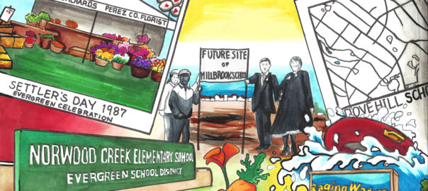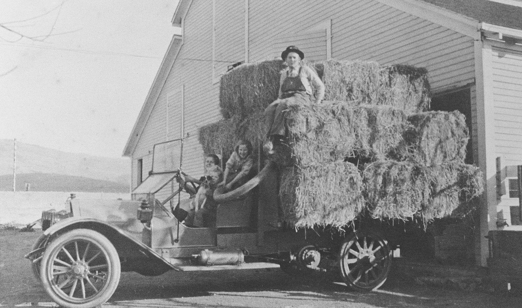
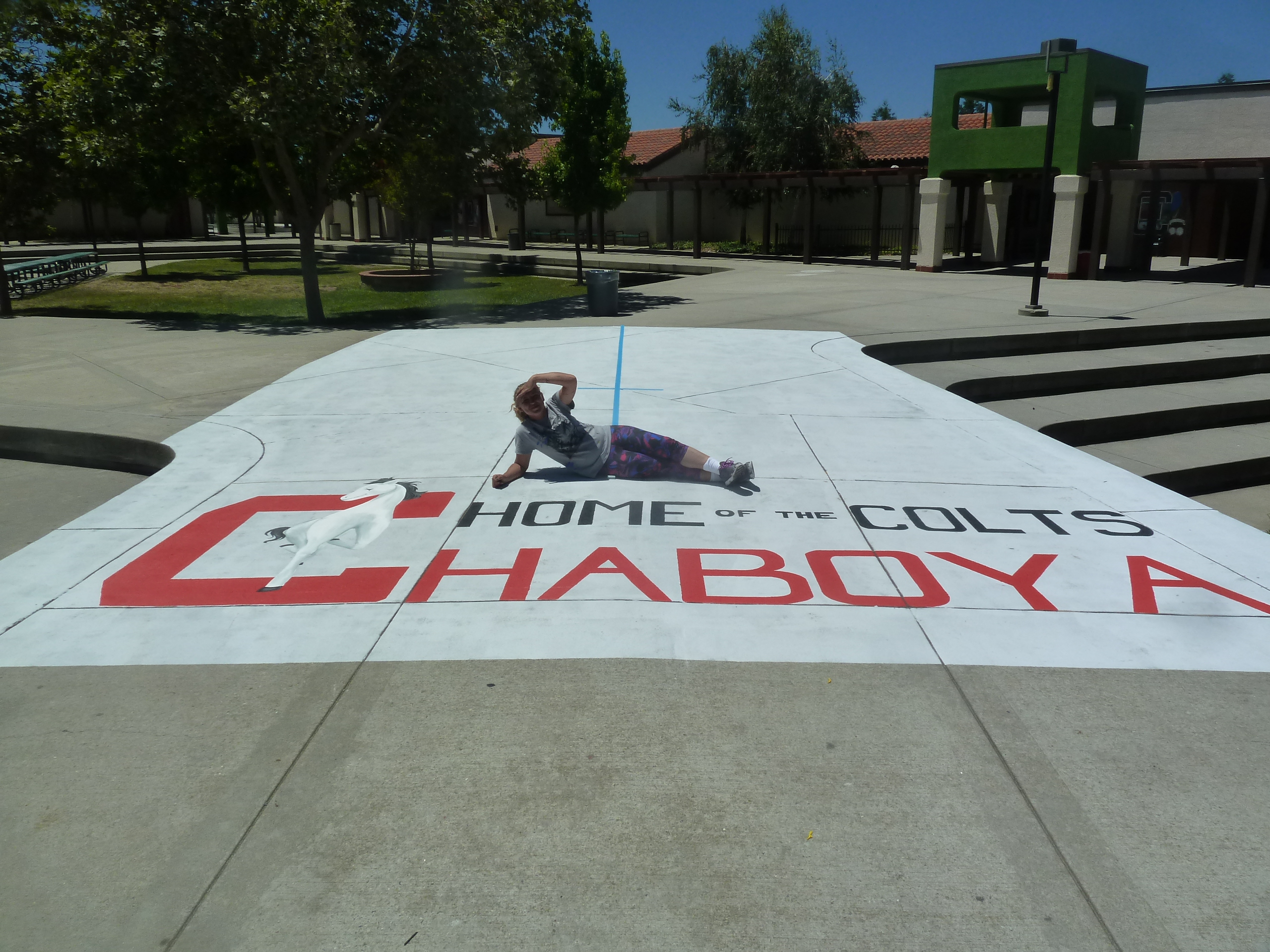
 I work a lot at Chaboya Middle School, in fact its the first school I ever painted at. People often ask, “Chaboya On Fowler Road?” And I always say yes, but I know its address is on a different street. Fowler Road is indeed very close by, but Chaboya is on Cortona Drive. What’s the confusion? It’s been redundant for me throughout my career, so I checked it out on behalf of the Evergreen Mural Walk.
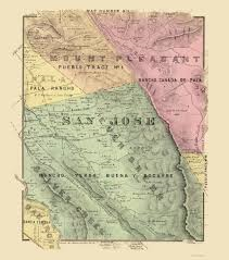
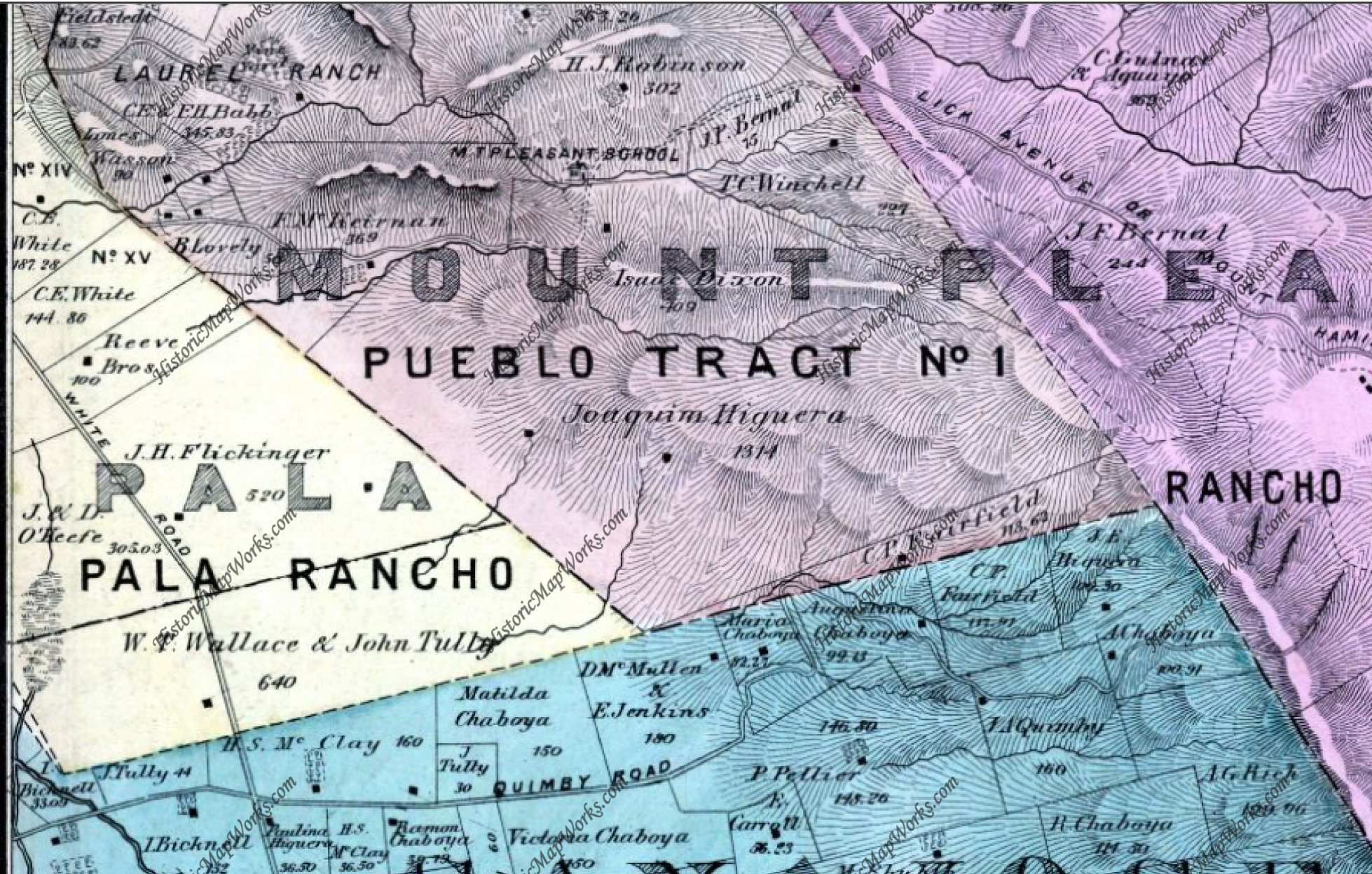
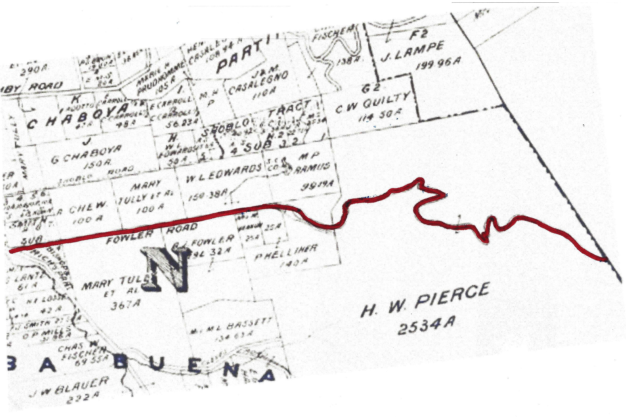
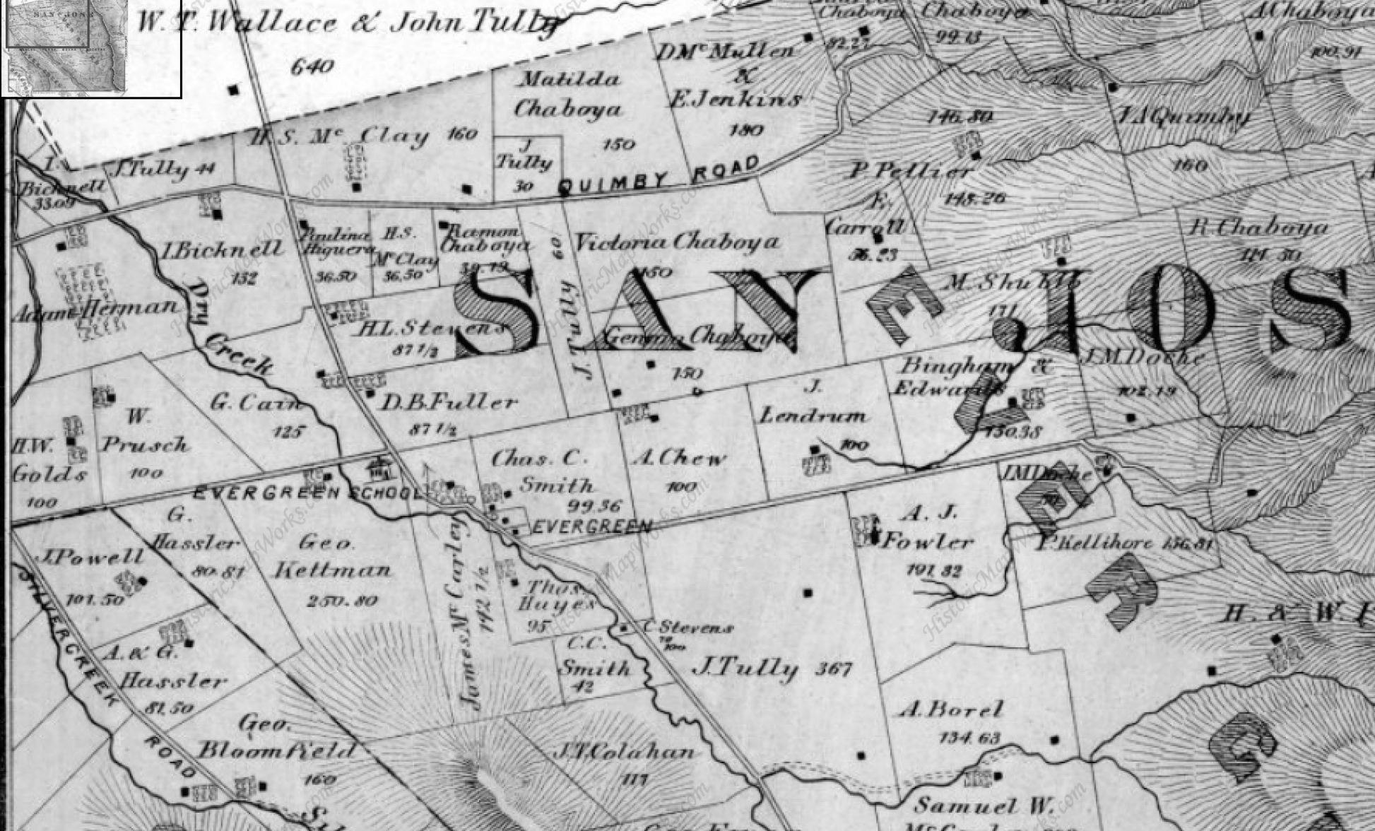 Fowler Creek was named after Andrew Fowler, whom I’m enjoying getting to know. The street was one of the first in Evergreen, as was the man. We’ll discuss him in further detail later. This road was built before Chew Lane/Aborn Road’s eastward section. This 1876 map hasn’t put a name to the street, but you can see A. J. Fowler’s property along the south side of the road. This was William Matthew’s portion of the attorneys fees paid out by Chaboya in his lengthy court battle.
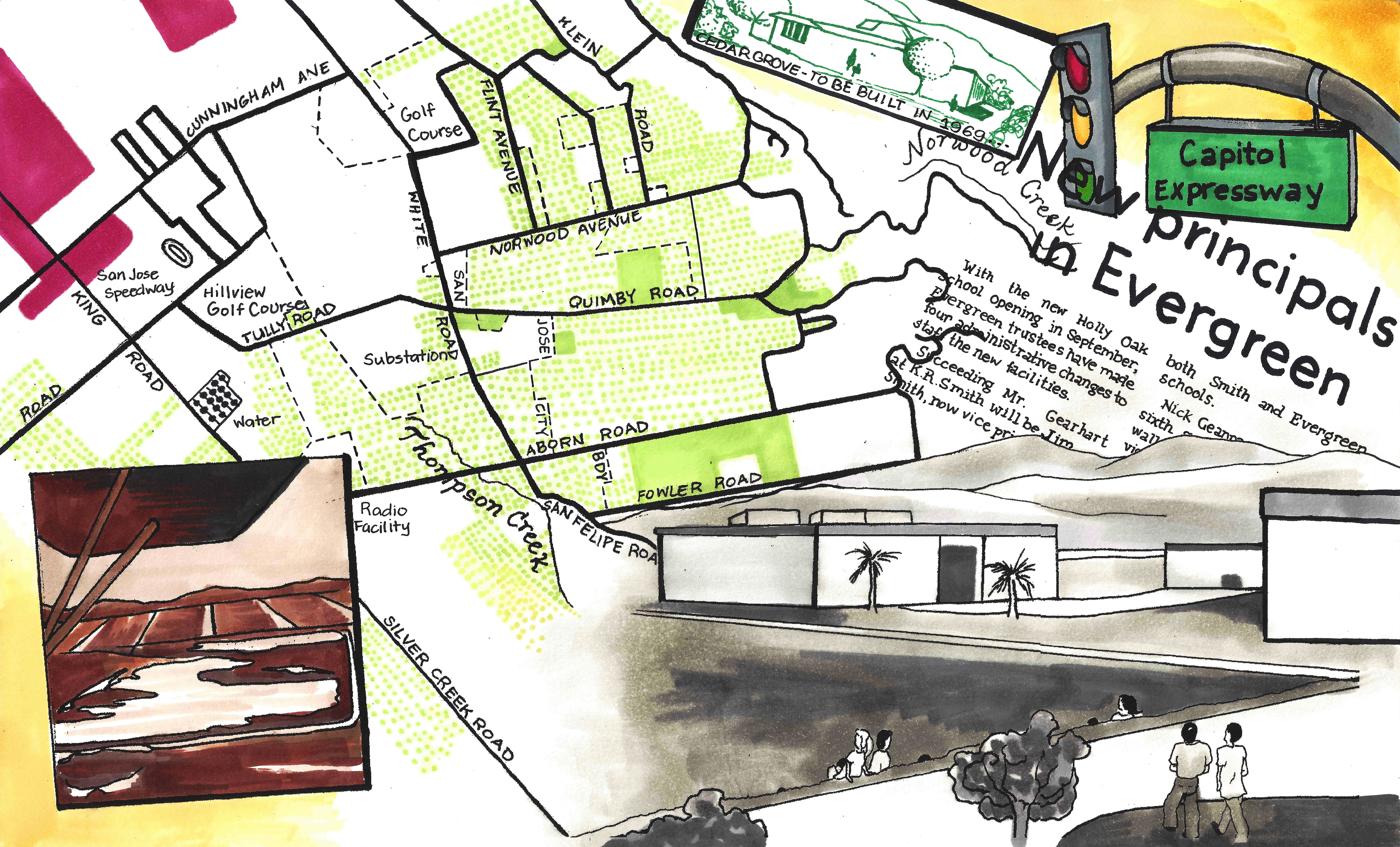
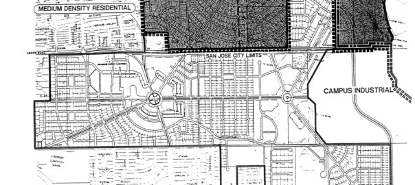
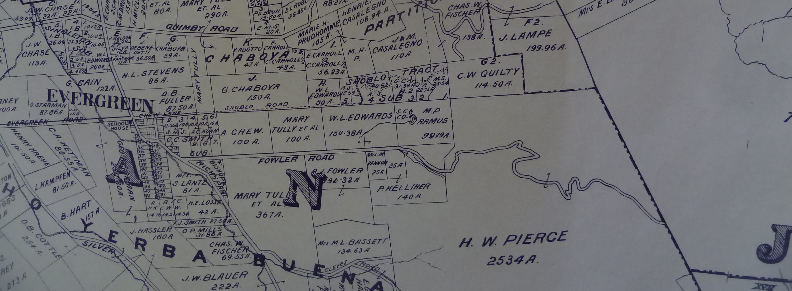 In 1899, Fowler’s name finally appears on the road. This Fowler Road runs all the way through. It did when I was a kid. What happened? This is Fowler Road’s modern path below.
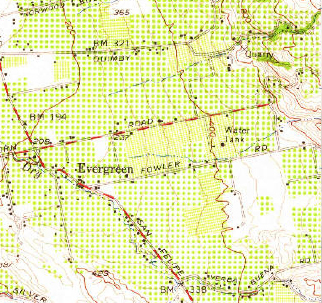
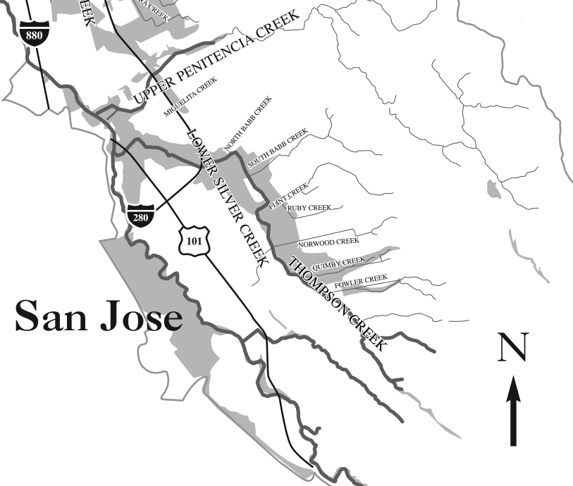
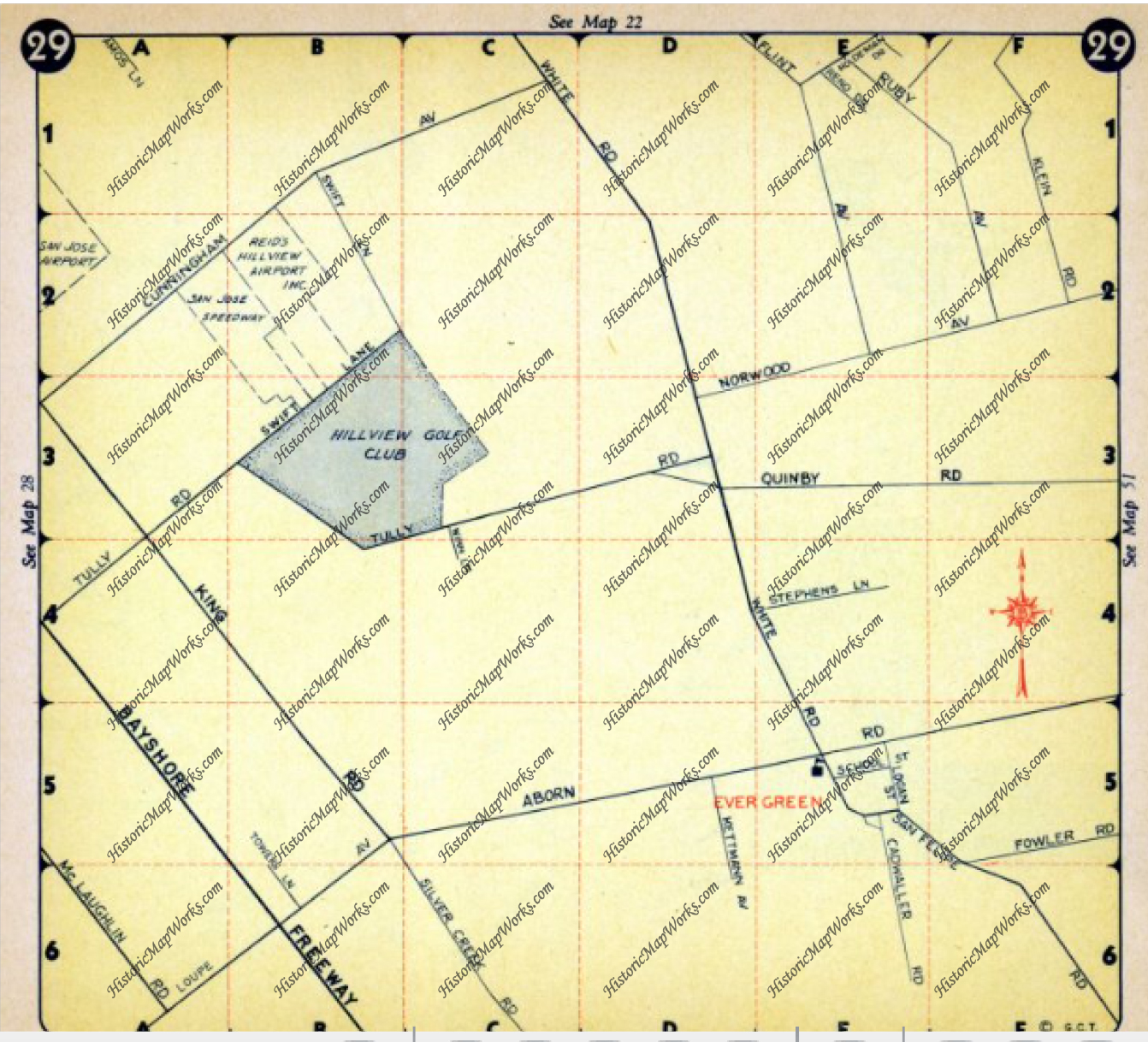
By 1956 however, Fowler is the straight thing I remembered it being as a child. It ran east of Ruby Avenue. This map cuts off the windy portion but it was a solid straight line.
Below, Fowler Road is broken up into two parts and straightened out in portions. There are switchbacks indicated on Fowler Road in 1899 on the Eastern zig zag which appear true on the modern map, but the road also ends sooner in the modern map. It ends even sooner if you’re driving. It ends at the straight spot. This road kept going in 1899. What gives?
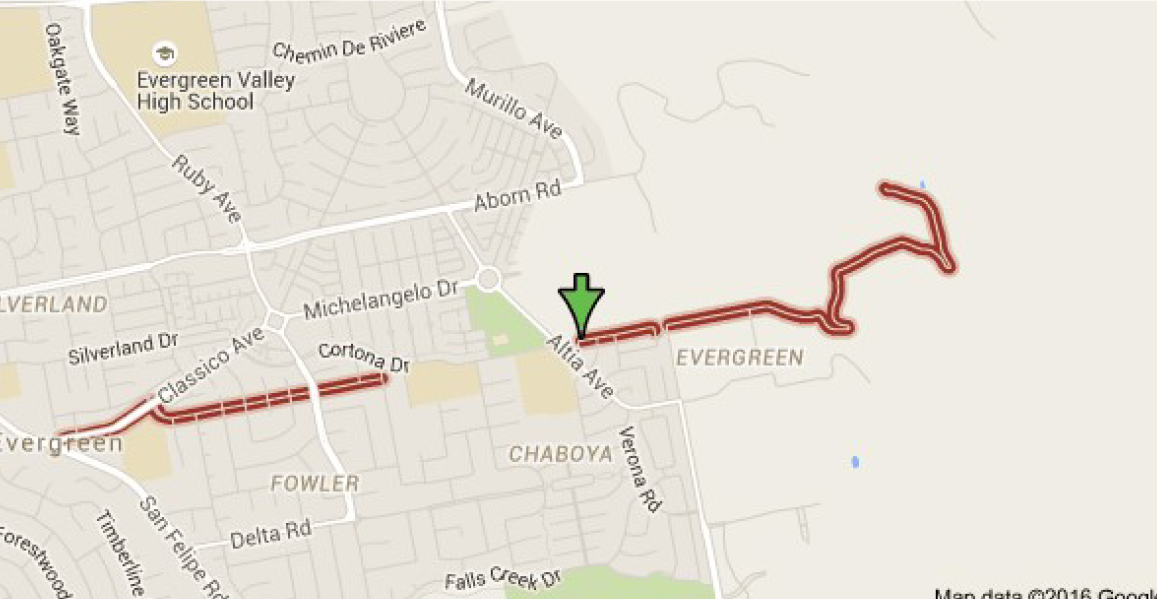
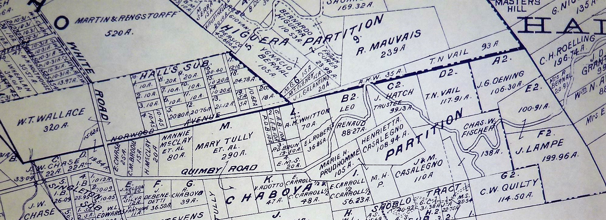
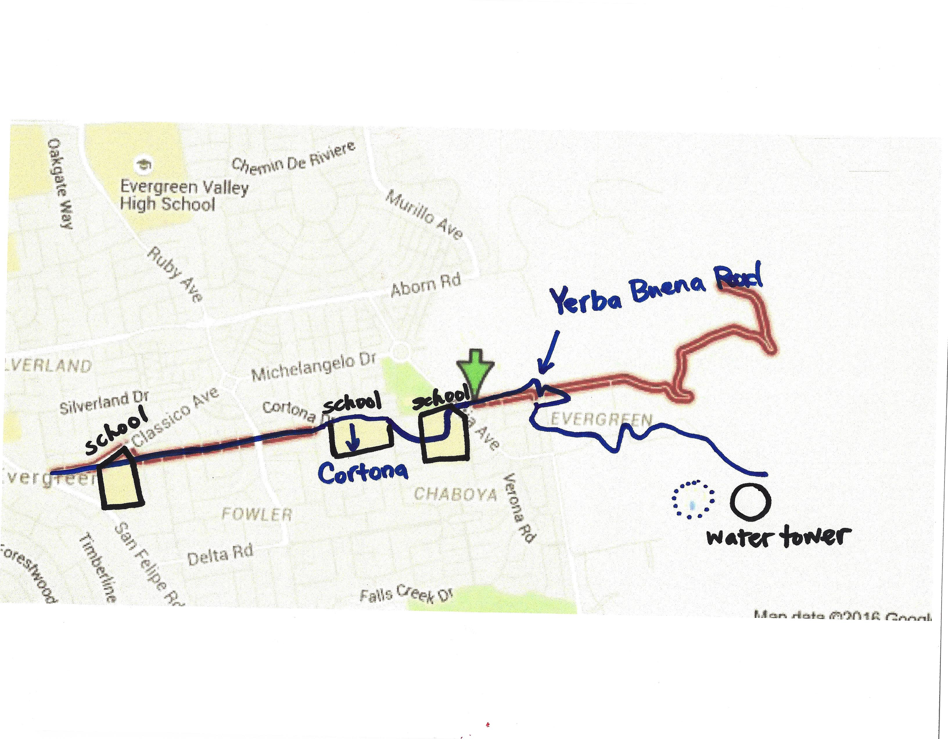
 Here’s what gives. New homes plans were put in place back in 1991 to get this area built out. Before that point, in was rolling Mirassou vineyards and orchards. Chaboya was built on Fowler Road in 1991, but the road’s path would change names as homes were built. The new bend in the western part of the road came with the build out of the the Classico neighborhood. Historic homes still line the straight entrance, but then Fowler Road takes a turn towards the development and later becomes Cortona Drive. Fowler Road would be built straight during the before 1956 but between proposal in 1991 and build out, something changed. A portion of the existing Fowler roadway, which clung to Fowler Creek, would become Cortona Drive. That’s the portion of Fowler which ran through P. Kelliher’s ranch in 1899. Fowler Road then picks up on the other side of a small park on Chaboya Middle School’s East corner, where the road turns in the Western most part of H. W. Pierce’s acreage. That’s where the arrow lands. Today, Fowler Road straightens out, drops again and is private roadway after that. You can see the windy road, but it appears to be shorter today.
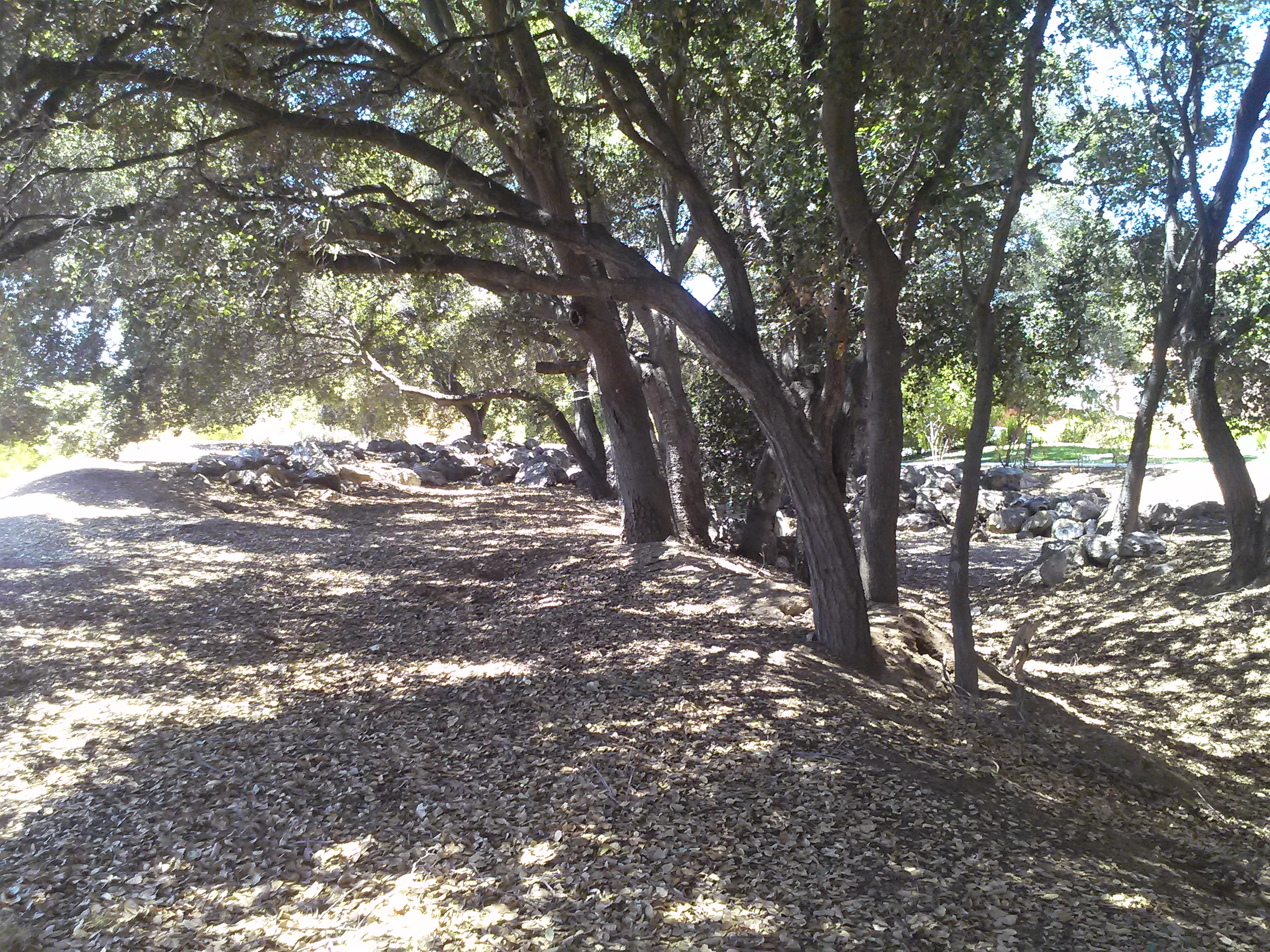
 Gemellos, why did you think about that? Cobble Stone. Now that I’ve investigated Cottle’s Cobble Stone and now Cadwallader Avenue’s fallen cobble stone bridge, I know there’s something up in areas where I find it in volume. It’s too heavy to clear and it was clearly a favorite of late 1800’s farmers marking their homesteads. I was in between appointments around Evergreen and I stopped when I saw it in volumes all over this area. In fact, I traced Fowler Road’s old path following the stone. I started at the most eastern section I could legally get to. I soaked up some rustic Evergreen treasures then saw this row of cobble stone.
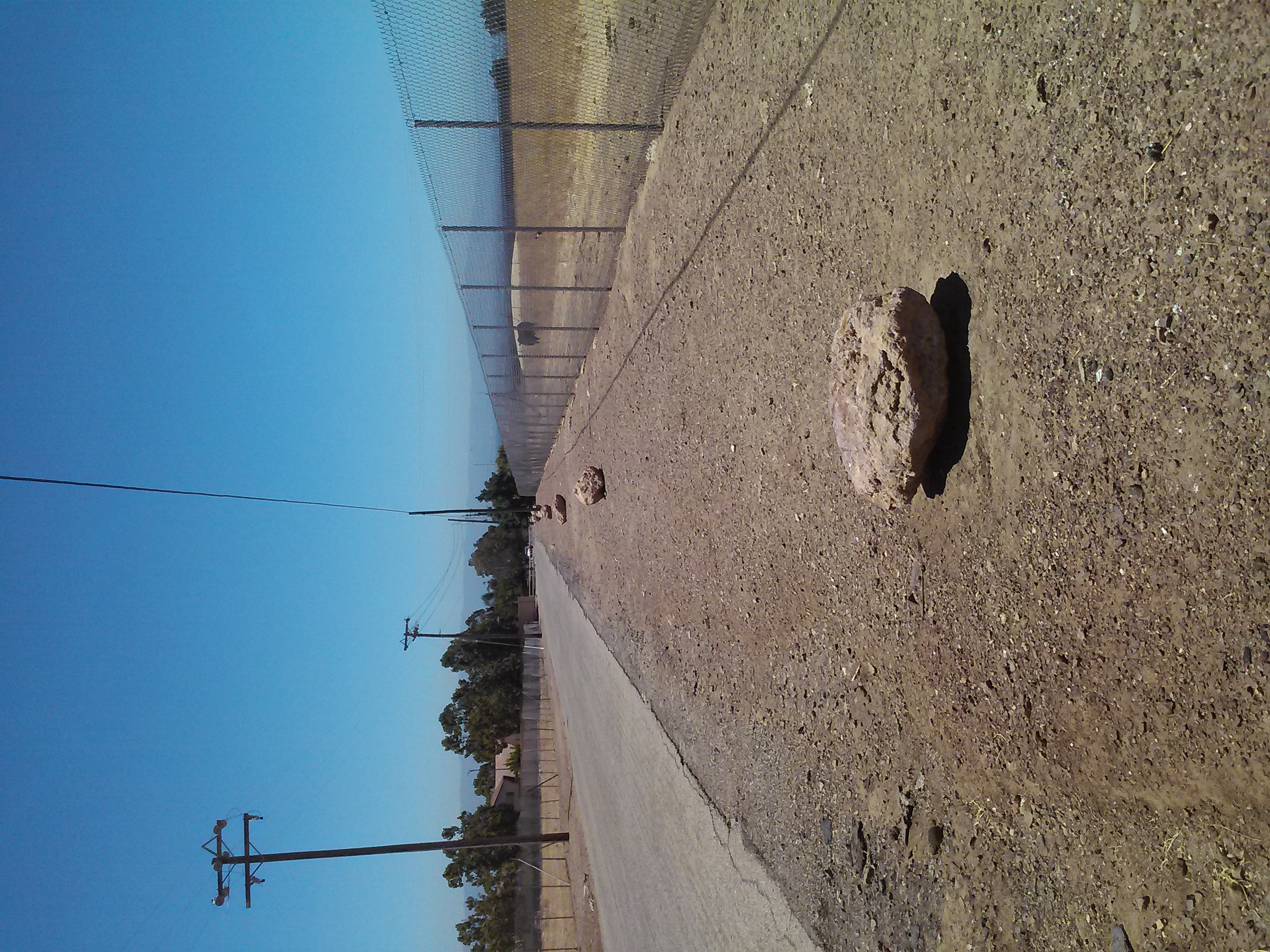 It feels like trail markers hikers make to let you know you’re headed in the right direction. When I found this kind of cobble stone along Keaton Loop, I knew it was roadway markers. This was something. I wasn’t sure this was Fowler’s original roadway, though. It’s not lining up with my understanding of the historic maps I’ve found.
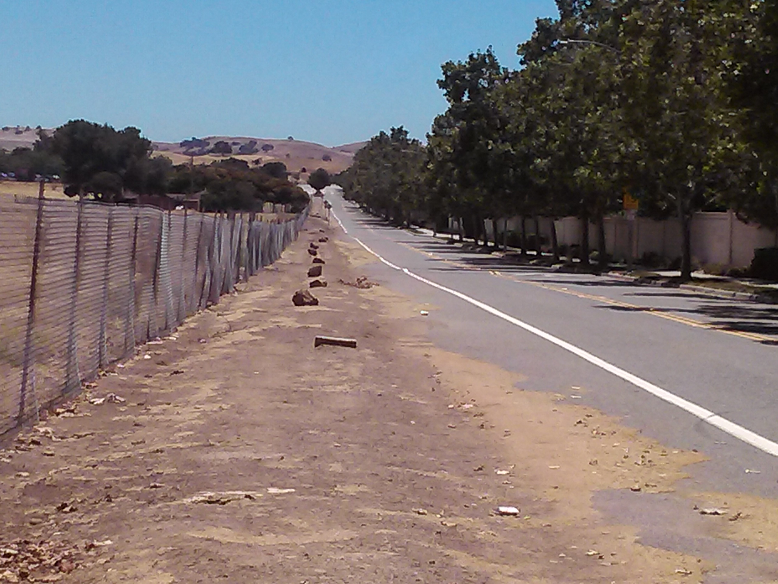 I found it again on Yerba Buena Road. Nothing creates perpendicular intersections up here in old Evergreen. What am I seeing? Every time I see this kind of rock, I know something is going on. Just before I turned right and westward looking for Fowler Road again, I looked left and bang.
 This water station was built out prior to 1956, and improved in 2000. It controls flooding in Fowler Creek. Fowler Creek now trickles in the winter but the homes are safe and the groundwater is saved for less than rainy days. This is at the intersection of Altia Avenue and Yerba Buena Road. This road looks like old Silver Creek Road, and would’ve been paved around the same time, being the same age. This is a little better maintained and a little less traveled as a City of San Jose Water Station. I think the stones were rolled over when the ranches turned into farms before they turned into home development. This undeveloped area shows us what it used to look like. That straight section of marker and present day Fowler Road is possibly the boundary of M. P. Ramus and Kellihore’s ranches in 1899.
 So, I met up with Fowler Road at Chaboya Middle School and the marker continued. Heading West, the Cobble Stone reoccurred at Fowler Creek Park. Makes sense. Evergreen used Cobble Stone to protect from flooding. Fowler Creek would be dammed up by cobble stone in several sections. Today, Fowler Creek only trickles in the rainy season. That makes sense, too, because the Creek is captured by a water tower at its most eastern and uphill point.
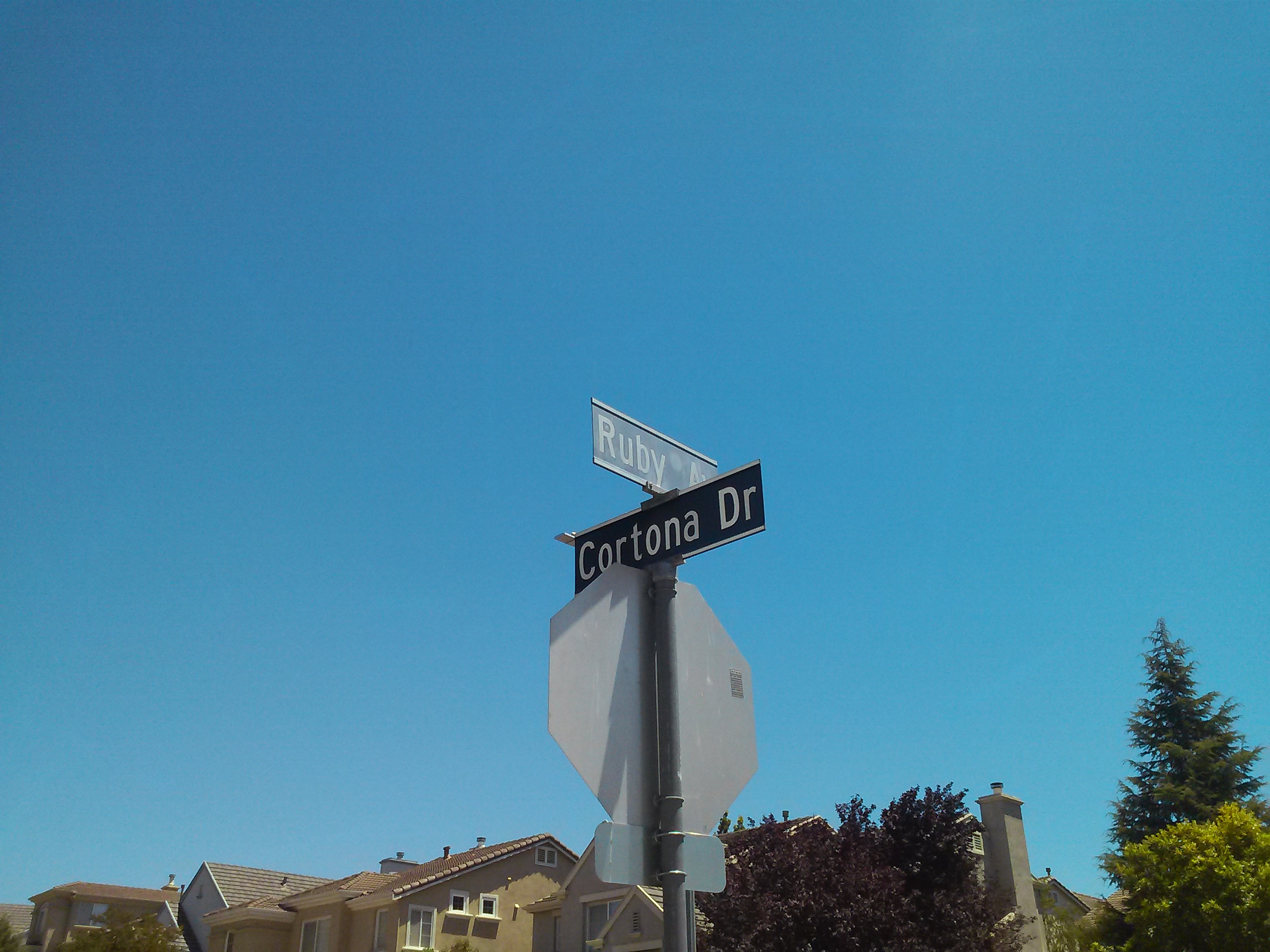 And then I started feeling silly because I’m excited about rocks. I followed it all the way to Ruby Avenue and Cortona Drive, once Fowler Road. So, what part of Cortona is old Fowler Road?
Let me get nerdy for a second, find north on each map and scale them. There. So, what happened?
Maybe a little clearer still, with the paths traced on one map….
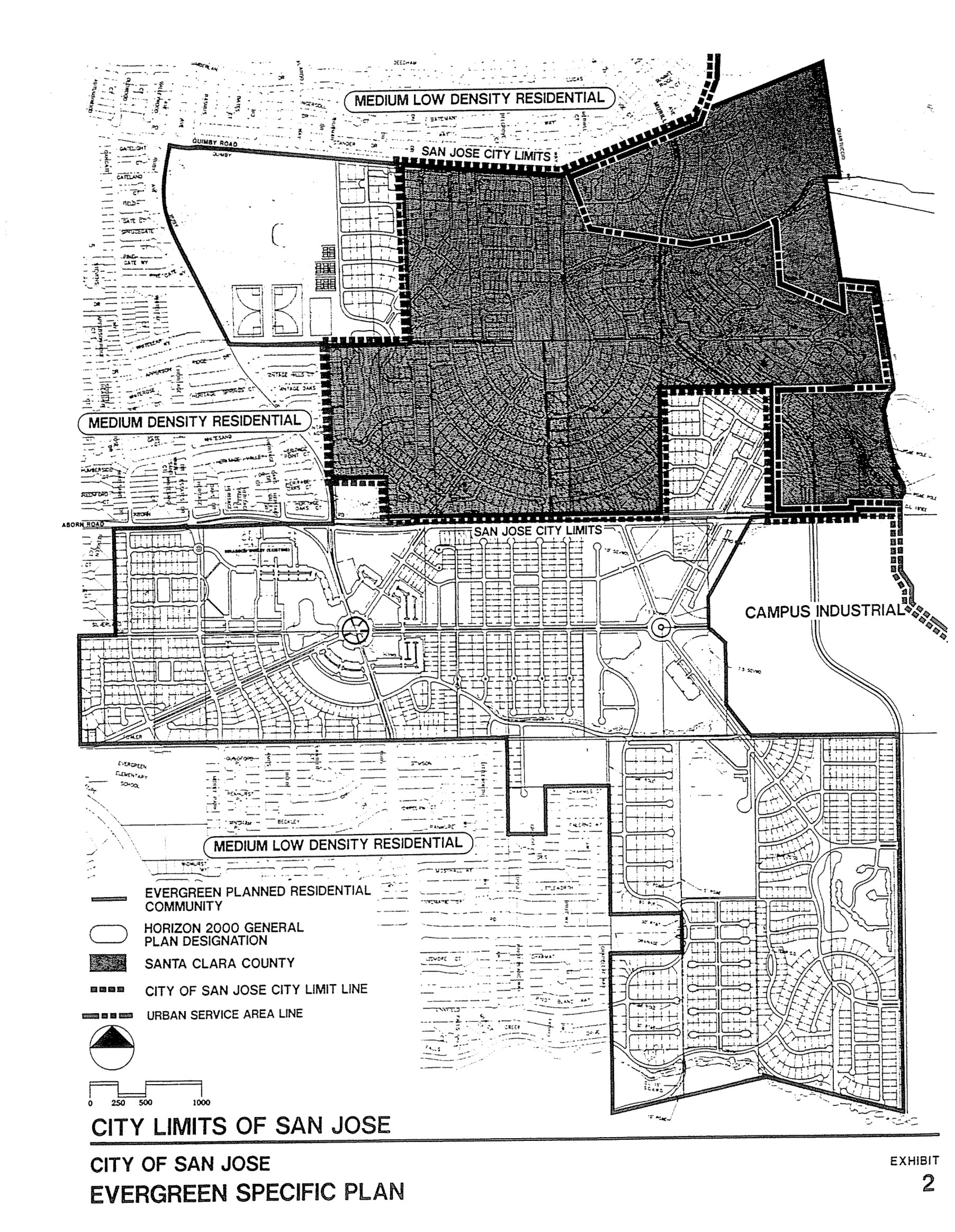
 Fowler Road’s path was straightened through the early 1900’s then altered by the schools built to service this growing Community. Evergreen School would have a horse tie up instead of a parking lot for a long time. The District Office was originally located there along with the school but as time went on, a larger school was needed and the office moved. Many District services still operate out of this office, though. Matsumoto Elementary School was also built on the Fowler Road path. When people ask me about Chaboya on Fowler Road, they mean built on top of Fowler Road itself. They were more correct than I ever realized. The cobble stone I observed was in the Yerba Buena Road portion of one time Fowler Road. The changes that occurred over time were fairly straight forward and made the road more useable. It’s cobble stone roots are still showing on both Cortona Drive and Fowler Road today.