Tag Archives: generations

Quimby Road – History


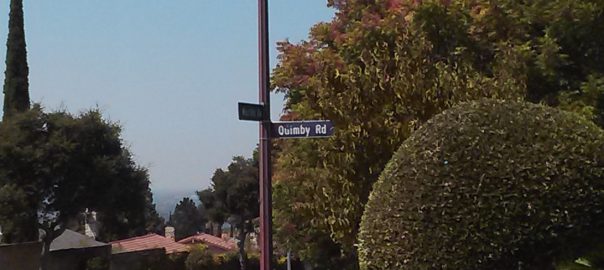
thumb200caQuimby Road, from its 1860’s creation, has been an artery into the town of Evergreen, intersecting with historic White Road and King Road for over 150 years now.  We’ve discussed previously in Evergreen Mural Walk’s blog Evergreen’s Own Mayor Quimby.  John Alonzo Quimby, San Jose Mayor, is indeed the roadway’s namesake, whose second home outside of downtown was here in Evergreen in the 1860’s.  Quimby Road on our Best Drives List, however, is host to many powerful stories and breathtaking vistas.

P1310216 (2)

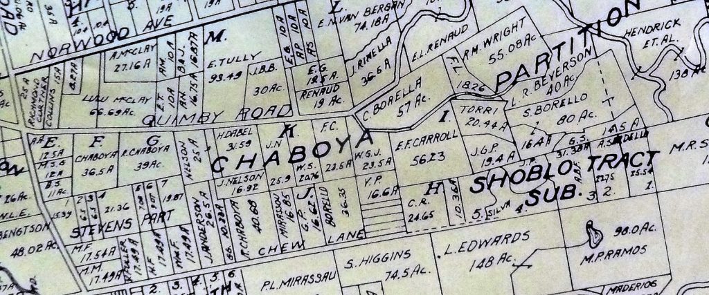
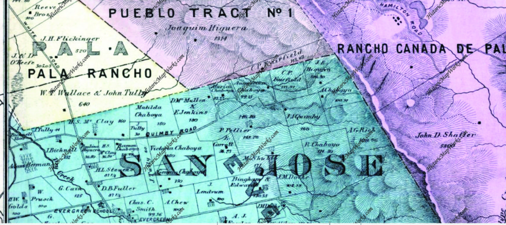
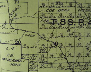
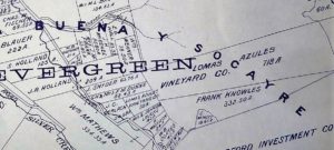
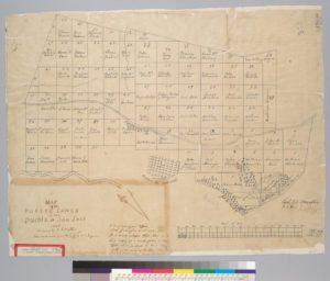
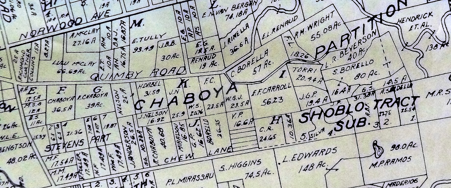
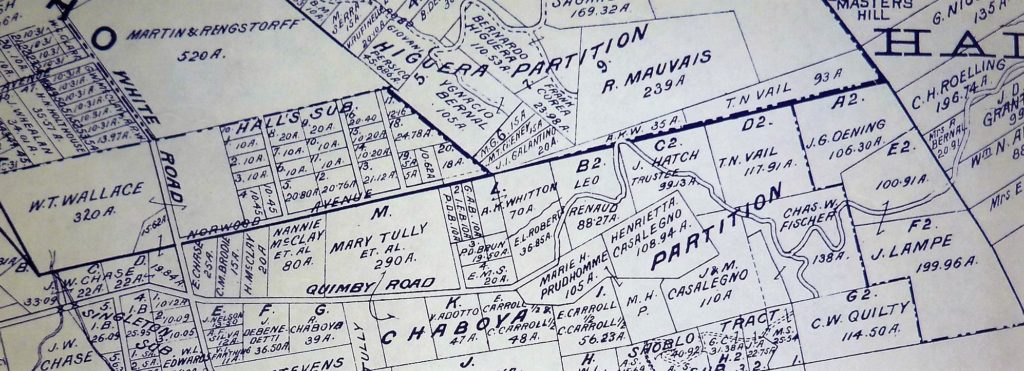
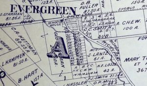
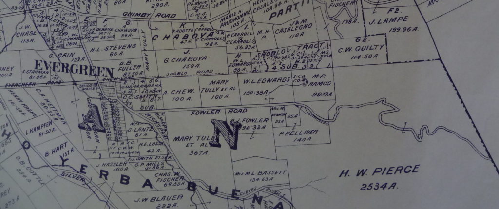
We’re looking at Quimby Road from the familiar now 1899 map, which I found at Evergreen Valley College’s library in the Heritage Room, curated by Colleen Cortese.  Let’s talk about what these parcels are now.
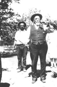
6254416259_78f082522aYou can see White Road further left.  Left is west and a pinch south.  White Road runs North and South and Norwood Avenue, running off the map here, ought to point directly East.  The right of the adjacent Chaboya properties, belonging Ramon Chaboya, is the Evergreen School District Office and Quimby Oak Middle School.   This is Ramon, or Raymond, Chaboya to the left here.  The western border of the western, or left, Renaud property is Ruby Avenue which later builds through to the Mirassau or Mirassou property on Chew Lane, which became Aborn Road.  This is a particularly interesting tid bit because of the Pellier lineage

.CAM11091The roadway was named for the one time Mayor, long time civil servant and Evergreen rancher.  Strangely enough though, the Quimby Family property, in the family as shown above, isn’t located on Quimby Road in 1899.  It appears to have been downsized and passed down to the Quimby’s daughter, then Mrs. Wright, lived on Chaboya Road.  Can I be honest with you?  This M. Wright parcel feels more like the corner of the Pellier Ranch.  The straightened portion becomes Murillo Avenue and the offshoot of Chaboya Road is there.  This is where the Sikh Gurdawa is today.  It would’ve outline the neighboring Pellier Ranch in 1876 and become the driveway by 1899.
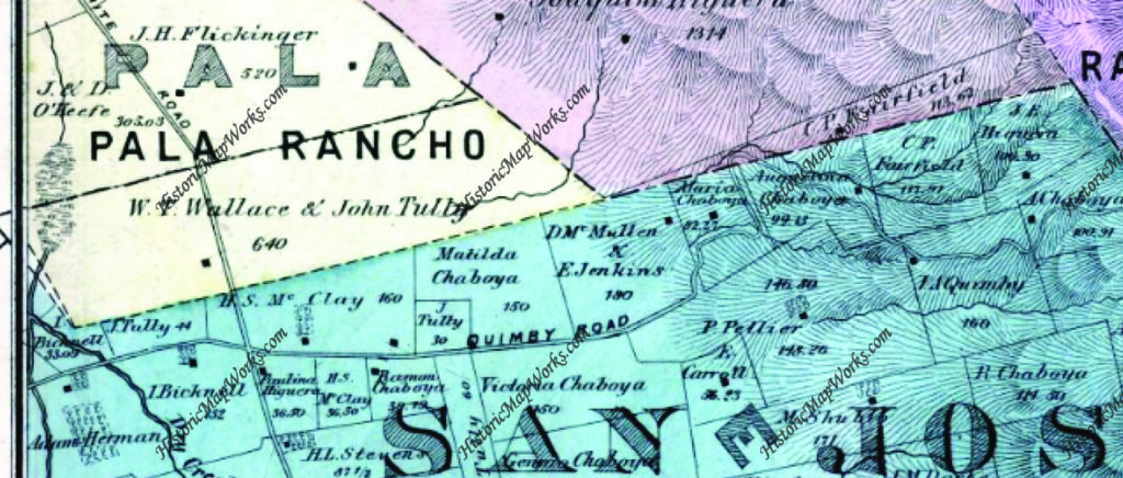
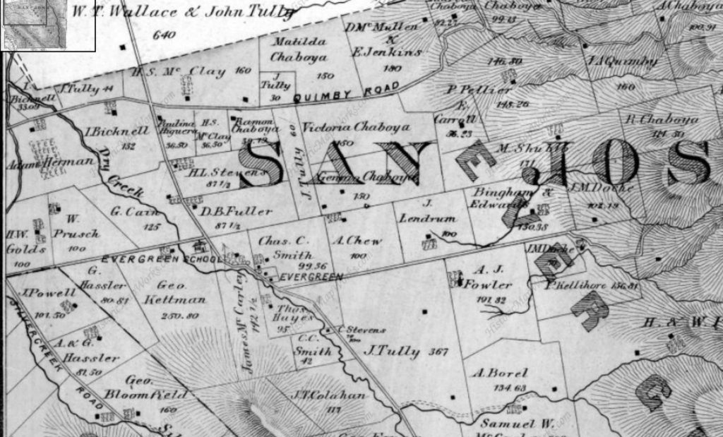
We’re going to look back at Quimby Road again, but this time in 1876.  I’m going to tell you that this zoom out is very deceiving.  The properties will appear to be the same size, but that is not the case.  They’re much larger and fewer.  They’ll just be bigger.  Check the acre size on the Ramon Chaboya and the McClay/Chaboya parcel to be sure.  Ramon Chaboya’s are both 39 acres.  The McClay/Chaboya parcel on Quimby Road is 36+ acres.

Map 006, San Jose, Evergreen, Silver Creek, Mount Pleasant, Pal

As stated above, Quimby Road connected Evergreen to downtown at its Northern end as Evergreen and Chew Lane did on the South side.  The portion of Tully Road where Quimby Road first appears was also known as Quimby Road.  This section was soon after renamed for the prominent businessman and landowner, John Tully, Lake Cunningham were developed.  You can see Cunningham on the Wallace & Tully parcel in yellow.  Tully Road would divide this property in half.

Along the dotted line, Norwood Avenue would’ve been built and Tully Road would border the Wallace Tully property to the North.  This is considered the boundary of Evergreen itself.
 6254426015_f091ee3233_bDuring the 1870’s, the Chaboya’s would spread out along Quimby Road with large ranches and a driveway that would later become Murillo and Chaboya.  Into the 1890’s the family would downsize and swap parcels with neighbors like the McClays, who would also downsize over the years as it passed down to later generations.  The Kettmann’s were upsizing, purchasing Mt. Hamilton land for goat herding, and surely used Quimby Road and Mt. Hamilton to get there.  The widowed Mrs. Tully was buying up property.  Also seemingly moving out of the Evergreen area is the Pellier Family, which couldn’t be further from the truth.
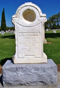
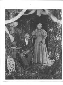
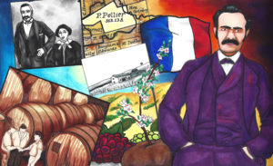
129607434_1399786458 12314282_198416020500512_5584157587879954674_o As we discussed before in RIP Louis Pellier, detailing a gravestone mix up, the Pierre Pellier family lost their budding male heir at the age of 16.  This was a huge blow for Mr. & Mrs. Pellier and their daughters , soon after the death of Pierre’s brother  .  There wasn’t another son.  Uncle Louis and his wife would have no children.  Uncle Jean would have children.  He is the only one who would carry on the family name.  But the Pellier daughters would step up, marry well and pass on their family lineage and French heritage.
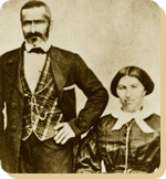
Interior-FirstGeneration-PierrePellierMrs. Pellier’s distant family members, the Renaud’s, would move in near the French immigrants and begin planting vineyards on Quimby Road.  One Pellier daughter would marry into the Renaud Family, third cousins or further removed.  Elise Pellier would marry Alfred Leon Renaud and have eight children in 17 years on a Quimby Road Estate.  In fact, Alfred Renaud would’ve passed away before Rose knew she was pregnant with their last child in 1901.  I think a Renaud property is across from Evergreen Valley High School, but the larger E. L. Renaud property may stand for Elise Leon Renaud.  In fact, there are still grapes grown here.  The homestead may have been across  Evergreen Valley High School while the grapevines grew up the street.
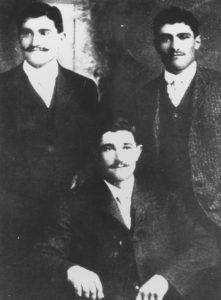
148) Herman, Peter, & John Mirassou, circa 1905Again, a Pierre and Henrietta Pellier daughter would marry a French transplant moving to the Santa Clara County to engage in agriculture. Pierre Mirassou would marry Henrietta Pellier, the eldest daughter, and a wine dynasty would be born from their union.

Pellier Daughter Josephine would marry Mr. Michael Casalegno, an Italian immigrant, and have six children on the Pellier Ranch.  I got to see their house, which has been moved and preserved within Evergreen.  This would’ve been the Pellier’s home at one point.  The largest ranch in Evergreen would again break up and become many of the largest ranches in Evergreen.  The awesome ending to this Evergreen story is that it doesn’t end and they continue to raise new generations in Evergreen today.  Rad.

I also need to confirm another historic Quimby Road lead that one of the Rinella daughters, a large Sicilian, Italian family, would marry into the LaMantia Family.  Mr. LaMantia would maintain orchards of his own and the vineyards for the Evergreen Cribari Winery.

Back to Quimby Road in the late 1800’s, though.  It would’ve been paved fairly early as an alternative route to James Lick Observatory.  Alum Rock Road’s construction would have to be innovative and swift so the Observatory could begin its construction.  Evergreen’s awesome drives and almost unchanged roadways have a lot to do with East San Jose and the Observatory’s development in Santa Clara County.  Suddenly Evergreen’s thousands of residents were receiving a little more love from its Department of Transportation.

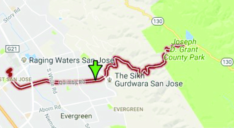
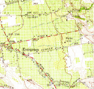
Let’s see if Quimby Road has changed much.  Here it is today.

And the side by side.  Can’t find it earlier than 1876.
Map 006, San Jose, Evergreen, Silver Creek, Mount Pleasant, Pal

IMG_0163The Evergreen artery, Quimby Road, has had some updates.  I think there’s been two path changes in Quimby’s 150 year history.  The first is the part of Quimby Road that now runs through to Mt. Hamilton Road.  In 1876, it merely ran through Evergreen or up to “the Summit”.  That was the boundary for Rancho Yerba Buena and is the color change at the end of each Quimby Road.  This area simply didn’t exist before.  Mt. Hamilton Road’s path too has been softened over time.
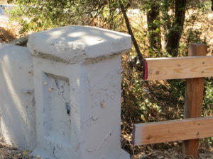
IMG_0182The second place updated is where I’m thinking is where I found evidence of it in a bridge. Quimby Road crosses creeks many times and therefore would’ve been washed out if unpaved or poorly maintained.  This update would’ve taken place adding a second and steeper hump between the J. A. Quimby and A. Chaboya in the 1876 map.  This was cleary updated in 1935.  I’ll have to find out when Quimby reached Highway 130 and see if they happened at the same time.
A Tribute to Wehner Mansion

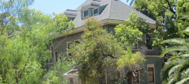
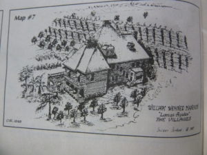
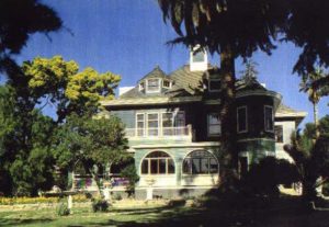
5985327859_3f314741f2_bHeritage Room azules.pdfThis guy once painted Civil War scenes on a panoramic scale in Chicago. Wonderful William Wehner, German born, American famed artist, moved to Evergreen in the 1880’s and built one of the most beautiful structures in Santa Clara County.  The Blue Hills Estate, Wehner Mansion or Cribari Mansion, whichever you prefer, has been a longstanding gem of Queen Anne architecture hiding in Evergreen.

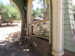
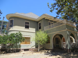
IMG_0214IMG_0206Behind locked gates, this historically designated but almost uninhabitable building has seen better days.  There’s a questionable title and legal loopholes being used to keep the home out of the bank’s hands exclusively, rendering it unable to be sold, preserved or renovated.  Wait a second, there is life here.  I felt it all around me when I took these photographs.  It’s just not human life.  The Mansion is quickly being reclaimed by nature, and a territorial young buck.  Read the above post for that story.

Wehner, Albert Haentz, Cribari and Mirassou families all utilized this stunning home and its expansive vineyards.  Until the 1970’s, this mansion was storage and winery for some of the world’s most famous vines.

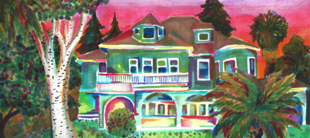
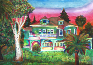
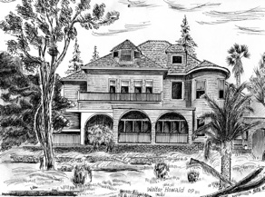
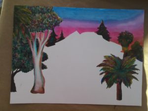
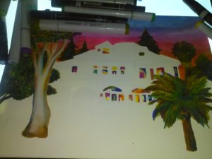
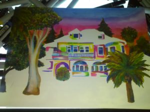
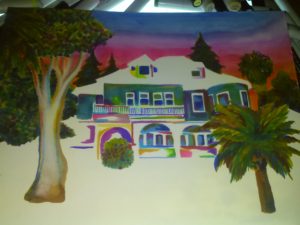
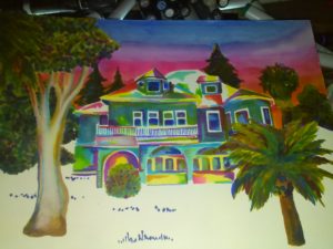
I know it’ll be some time before you make older friends who’ll let you snoop around their homes looking for nuggets of Evergreen gold.  Here’s a reimagining of the Wehner Mansion.

wehner mansion Wehner%20mansion

Here’s the progression of the drawing for your art buffs

HARD WON – Cowboy Wisdom

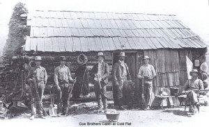
coe_brothers_smallPeter Coe Verbica carries many torches of tradition that are uniquely Evergreen in nature.  Mr. Peter Verbica is a member of the Revolutionary War fighting, Valley of Heart’s Delight rumor creating, dried apricot perfecting, cattle ranching, beautiful poetry writing, longtime Evergreen family, the Coes.  Today, Mr. Peter Coe Verbica is a successful businessman and a Silicon Valley author and poet, deriving inspiration from his long held family traditions.

P1310184Don’t worry if you feel a little confused about where the Coes actually come from.  You did see the Coe name in Willow Glen.  Coe Avenue runs right past Henry W. Coe’s home in “the Willows”, a town which became Willow Glen some time later.  Henry Coe, Sr., would move out to Evergreen in the 1860’s as the Yerba Buena land disputes starting settling.  After a poor year of farming in Willow Glen, Henry W. Coe would move the homestead to Evergreen, buying large tracks in Halls Valley and San Felipe Valley.  His sons would extend the grazing land further.  This cattle ranching track stretched all the way out to Morgan Hill, to Henry W. Coe State Park.

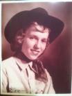
Winnifred Coe Verbica, who died on March 31, 2013, in the early 1950sP1300723This large Evergreen ranching property raised not just cattle, but generations of ranchers, or more specifically Cowboys.  It’s been rumored that Peter’s mother, Winnifred Coe Verbica, was bitten by a rattle snake as a baby on the Evergreen Ranch.  San Felipe Ranch, the main homestead, would be located at the Southern tip of Rancho Yerba Buena.  Various other homes and outposts are dotted throughout the ranching property because you’d be miles and miles away from home on a cattle run with men, dogs and horses to feed.  Mr. Verbica would be born on San Felipe Ranch, like his mother before him.  Cowboy Wisdom is something Mr. Verbica is well-versed in.

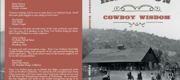
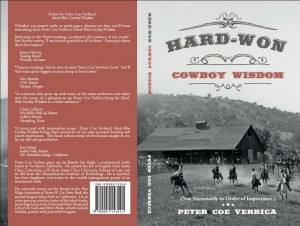
1888616_10152084007824902_1583107476_nMr. Verbica obtained his BA in English at Santa Clara University, and received his JD from Santa Clara University’s School of Law.  Though clearly well versed in city life, Peter Coe Verbica spent some time disseminating pearls in his book HARD-WON: Cowboy Wisdom.  This latest book from Peter Coe Verbica is short bursts of common sense uncommon to city-slickers.  Because of the brevity of the clips, it’s a perfect read for a busy person on the go to pick up in spare minutes.  Some of his passages made me laugh out loud in a crowded, busy place.  His snippets are in no particular order.  Mr. Verbica gives tips on cattle running, hunting, and ranch owning.  A simple kind of intelligence from self-sufficient, hardworking farmers can be gleamed throughout HARD-WON.  I highly recommend this book to anyone who has ever daydreamt about being a cowboy and lassoing their little brothers.

image1Here are some of my favorite snippets from HARD-WON: Cowboy Wisdom:

“15.  Don’t wear too big of a buckle unless you’ve earned it.”

“60.  Rides your fences.”

“78.   If someone doesn’t believe in his heart that the West is the Best, don’t trust him.”

“137.  When in rattle snake country, wear high boots.”

“193.  Don’t make fun of a ‘C’ student.  You may have to work for them someday.”

“213.  Unfenced mine shafts are the bane deer and curious children.”

“252.  Finish what you can start, but think first about what you’re starting.”

“292.  Give a horse’s hind end an appropriate distance so that you don’t get kicked.”

“300.  Eat the game you kill.”

“305.  Don’t be too proud to copy what you neighbor does, but try to make it better. – Courtesy of Barry Swenson

“370.  Don’t pen horses with barbed wire.”

“449.  There are lots of ways to skin a cat, but the easiest way is to let someone else do it.”

“476.  Think twice before trying to save your dog from a grizzly.”


Today’s Wehner Mansion

5985327859_3f314741f2_bP1310186 (2)This introduction to the subject matter at hand isn’t purposefully an alliteration.  It just happens to be one anyway.

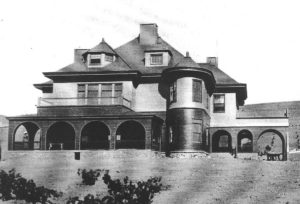
Heritage Room azules.pdfWonderful William Wenher was renowned for his winning white wines.  William Wehner was a Chicago-based panoramic painter and winemaker, born in Germany.  The Historic Manor was built by famous skyscaper architect, David Burnham, who would design and build only the one home in his career, friend of Wehner’s from Chicago.  His 1884 built Evergreen Estate still stands behind private gates and ropes, but that’s about all the care it’s had in a while.  These photos are courtesy of Colleen Cortese and the EVC Heritage Room.

P1320410lomasazulesUntil recently, I had only seen Colleen’s pictures and sketches of Evergreen’s Queen Anne Victorian.  Wehner, Albert Haentz, Cribaris and Mirassous have all made wine from the winery also on-site, Lomas Azules Winery.  Ebe Frasse, from the Cribari Family, has the fondest memories of growing up in the Blue Mansion.  This perspective had always seemed odd to me until I dropped in on the historic Evergreen jewel.  It is a literal drop into the seat of this Evergreen relic to its arched carriage entrance.


IMG_0206

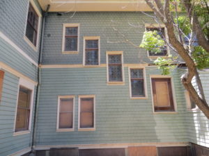
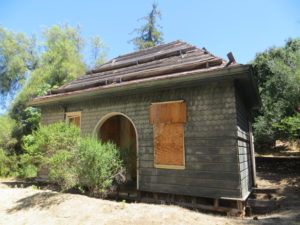
The Wehner Mansion today is boarded up and breaking down.  It clearly hasn’t had a new paint job since the 70’s.  It was deemed unfit for residence in 2014 by City Inspectors.  I like the colors, but an owner should be maintaining this important piece of San Jose History.  It has historic designation.

When I dropped by the property to lay my own eyes on it, I got lost.  Nothing new.  Actually, getting lost has helped me throughout this project.  Upon coming up to a Community stable and garden, the caretakers inquired if I was a real estate agent looking for the Wehner Mansion.  I wish.  But they wished too that something could be done about the beautiful piece of architecture that lay dormant and decaying in their backyard.

IMG_0216I found these windows to be stunning.  The glass remaining is a sight to behold.  If a replacement for this fifth window could be found, it would be incredible from inside.  I’m hoping this is a staircase on the other side.  The rounded feature is generally photographed and admired, but not much is said about its antique glass.  Mrs. Louise Lamantia remembers it well.  In fact, somewhere, some of this glass was donated to a historical society.

IMG_0220This second building here isn’t the attached Winery that’s been so well used by Evergreen vintners.  Wehner’s no dumby.  You’d never invite that nonsense into your backyard nearest your children.  I’d also expect more storage for barrels.

This is a tiny, one room building obscured by trees from Colleen’s sketch and initial sighting of the Wehner Mansion.  This is an old fashion frig or pantry.  This is a kitchen house designed to keep food for as long as it would naturally keep.  This was necessary in the 1800’s.  The Summer ones are built differently than Winter ones. It’s a science of keeping things fresh.  You can see why farming would be big business back then especially.

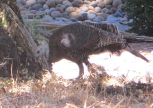
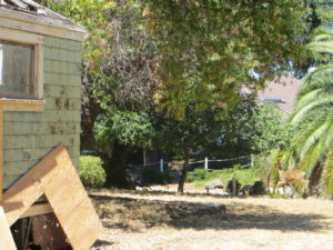
IMG_0219IMG_0217It is super quiet in these hills and this roped of manor is as well.  Wehner Mansion, also known as the Blue Hill Estate, isn’t without its tenants or residence today, though.  They just aren’t people.  The historic estate hosts a very territorial buck and a family of turkeys.  It’s so silent, you can hear them gobble from all the way over here.  I found that indigenous wildlife and a near by run-off creek trickle through Wehner Mansion while its title is questionable at best.  Its faith rests with the Title.  I’m making inquiries.

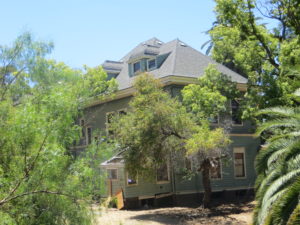
IMG_0232If I can fire enough people up and raise some awareness for this San Jose Gem, I’d like to do so and make something happen here.  I see a private venue for weddings or a Community Garden for a non-profit.  I see a Community Center for the Villages or an Evergreen History Museum.  Access is difficult, so the tenant would need to be perfect for the situation.  Let’s start talking about how to fill Wehner Mansion’s halls with laughter again.  It’s a piece of our History still standing.  There’s only a couple left.


Fowler Road and Creek

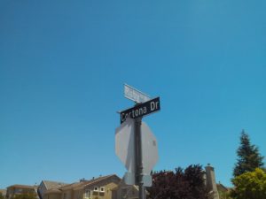
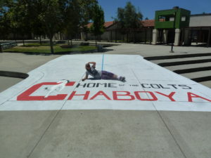
P1330025I work a lot at Chaboya Middle School, in fact its the first school I ever painted at.  People often ask, “Chaboya On Fowler Road?”  And I always say yes, but I know its address is on a different street.  Fowler Road is indeed very close by, but Chaboya is on Cortona Drive.  What’s the confusion?  It’s been redundant for me throughout my career, so I checked it out on behalf of the Evergreen Mural Walk.

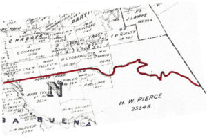
1876 MapFowler Creek was named after Andrew Fowler, whom I’m enjoying getting to know.  The street was one of the first in Evergreen, as was the man.  We’ll discuss him in further detail later.  This road was built before Chew Lane/Aborn Road’s eastward section.  This 1876 map hasn’t put a name to the street, but you can see A. J. Fowler’s property along the south side of the road.  This was William Matthew’s portion of the attorneys fees paid out by Chaboya in his lengthy court battle.

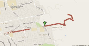
In 1899, Fowler’s name finally appears on the road.  This Fowler Road runs all the way through.  It did when I was a kid.  What happened?  This is Fowler Road’s modern path below.

Microsoft Edge

By 1956 however, Fowler is the straight thing I remembered it being as a child.  It ran east of Ruby Avenue.  This map cuts off the windy portion but it was a solid straight line.

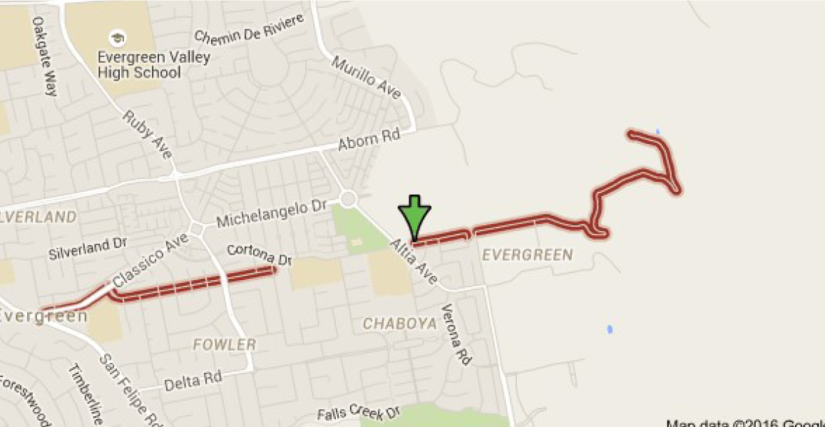
Below, Fowler Road is broken up into two parts and straightened out in portions.  There are switchbacks indicated on Fowler Road in 1899 on the Eastern zig zag which appear true on the modern map, but the road also ends sooner in the modern map.  It ends even sooner if you’re driving.  It ends at the straight spot.  This road kept going in 1899.  What gives?

fowler road san jose - Google Search

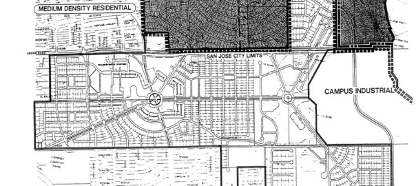
fowler road 2Here’s what gives.  New homes plans were put in place back in 1991 to get this area built out.  Before that point, in was rolling Mirassou vineyards and orchards.  Chaboya was built on Fowler Road in 1991, but the road’s path would change names as homes were built.  The new bend in the western part of the road came with the build out of the  the Classico neighborhood.  Historic homes still line the straight entrance, but then Fowler Road takes a turn towards the development and later becomes Cortona Drive.  Fowler Road would be built straight during the before 1956 but between proposal in 1991 and build out, something changed.  A portion of the existing Fowler roadway, which clung to Fowler Creek, would become Cortona Drive.  That’s the portion of Fowler which ran through P. Kelliher’s ranch in 1899.  Fowler Road then picks up on the other side of a small park on Chaboya Middle School’s East corner, where the road turns in the Western most part of H. W. Pierce’s acreage.  That’s where the arrow lands.  Today, Fowler Road straightens out, drops again and is private roadway after that.  You can see the windy road, but it appears to be shorter today.

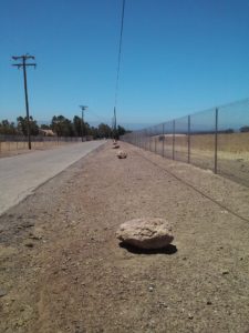
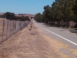
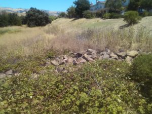
CAM11655 Gemellos, why did you think about that?  Cobble Stone.  Now that I’ve investigated Cottle’s Cobble Stone and now Cadwallader Avenue’s fallen cobble stone bridge, I know there’s something up in areas where I find it in volume.  It’s too heavy to clear and it was clearly a favorite of late 1800’s farmers marking their homesteads.  I was in between appointments around Evergreen and I stopped when I saw it in volumes all over this area.  In fact, I traced Fowler Road’s old path following the stone.  I started at the most eastern section I could legally get to.  I soaked up some rustic Evergreen treasures then saw this row of cobble stone.

CAM11651It feels like trail markers hikers make to let you know you’re headed in the right direction.  When I found this kind of cobble stone along Keaton Loop, I knew it was roadway markers.  This was something.  I wasn’t sure this was Fowler’s original roadway, though.  It’s not lining up with my understanding of the historic maps I’ve found.

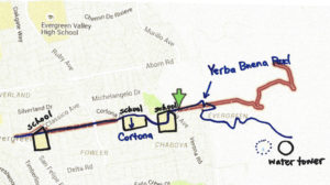
CAM11670I found it again on Yerba Buena Road.  Nothing creates perpendicular intersections up here in old Evergreen.  What am I seeing?   Every time I see this kind of rock, I know something is going on.  Just before I turned right and westward looking for Fowler Road again, I looked left and bang.

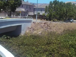
P1320018This water station was built out prior to 1956, and improved in 2000.  It controls flooding in Fowler Creek.  Fowler Creek now trickles in the winter but the homes are safe and the groundwater is saved for less than rainy days.  This is at the intersection of Altia Avenue and Yerba Buena Road.  This road looks like old Silver Creek Road, and would’ve been paved around the same time, being the same age.  This is a little better maintained and a little less traveled as a City of San Jose Water Station.   I think the stones were rolled over when the ranches turned into farms before they turned into home development.  This undeveloped area shows us what it used to look like.  That straight section of marker and present day Fowler Road is possibly the boundary of M. P. Ramus and Kellihore’s ranches in 1899.

CAM11678CAM11690So, I met up with Fowler Road at Chaboya Middle School and the marker continued.  Heading West, the Cobble Stone reoccurred at Fowler Creek Park.  Makes sense.  Evergreen used Cobble Stone to protect from flooding.  Fowler Creek would be dammed up by cobble stone in several sections.  Today, Fowler Creek only trickles in the rainy season.  That makes sense, too, because the Creek is captured by a water tower at its most eastern and uphill point.

CAM11692And then I started feeling silly because I’m excited about rocks.  I followed it all the way to Ruby Avenue and Cortona Drive, once Fowler Road.  So, what part of Cortona is old Fowler Road?

Let me get nerdy for a second, find north on each map and scale them.  There.  So, what happened?

fowler road san jose - Google Search

Maybe a little clearer still, with the paths traced on one map….

scan0167-1Fowler Road’s path was straightened through the early 1900’s then altered by the schools built to service this growing Community.  Evergreen School would have a horse tie up instead of a parking lot for a long time.  The District Office was originally located there along with the school but as time went on, a larger school was needed and the office moved.  Many District services still operate out of this office, though.  Matsumoto Elementary School was also built on the Fowler Road path.  When people ask me about Chaboya on Fowler Road, they mean built on top of Fowler Road itself.  They were more correct than I ever realized.  The cobble stone I observed was in the Yerba Buena Road portion of one time Fowler Road.  The changes that occurred over time were fairly straight forward and made the road more useable.  It’s cobble stone roots are still showing on both Cortona Drive and Fowler Road today.


Cottle’s Cobble Stone

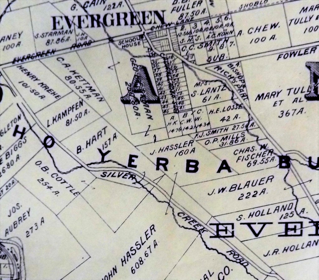
P1310192The Cottles were long time residents of Evergreen who lived in Silver Creek, creek adjacent along Dove Hill.  You can see them here, O. B. Cottle, directly on Silver Creek Road on the left side of this map.   Trusted historian, long time resident and valued Community member, Colleen Cortese, told me that I’d like pieces of Orval Cottle’s Cobble Stone fences along Silver Creek Road.  Try to say that 5 times past.  Cottles Cobble Stone, Cottles Cobble Stone…. I followed that lead and looked where she told me.

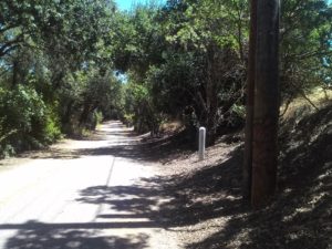
CAM11541In fact, I followed that path specifically along Silver Creek, the creek, that continues once the road ends.  This is a lovely little hike to commune with nature in a hurry.  I had my computer packed with historic maps with me, trying to feel my way across the land and features.  The Cottles lived around here somewhere.  This beginning to the path would’ve been the first place the road and creek crossed. Where this meets Yerba Buena Road in another crossing of the creek as Silver Creek Road once led up the hillside.   But… following the road didn’t do much for my hypothesis.

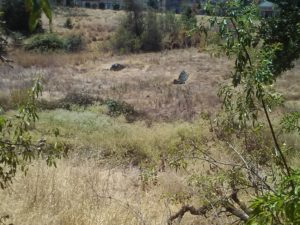
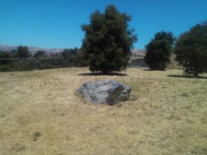
CAM11535Along my hike to the West of the trail, I found two giant stones out in the open that I could align visually to be fence, but no visible guts of a stone wall like I’d suspect.  I personally had zero desire to find out if there were rattle snakes certainly sunning on this gorgeous summer day.  This path was old Silver Creek Road that connected to San Felipe Road some time ago, so it could’ve been the most Southern point of the Cottle Ranch.

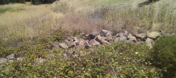
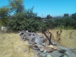
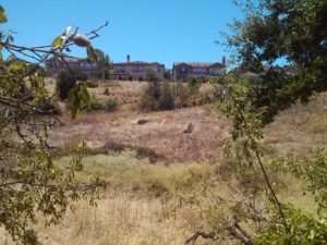
CAM11549CAM11556I veered for a hike up to the base of the electrical towers here, which appears to be a dog friendly path into Silver Creek.  Well, I found more giant stones like before, but there at the edge of the plateau was a great cobble stone barrier left in tact.  At the high elevation, I could see it all over the place.  I knew I had found it.

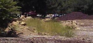
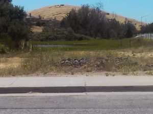
CAM11562I found my way back to my car and saw a pile of the same stones at the base of the pond there, across from Silver Creek Linear Park, as I was leaving.  I’ve been driving past here looking for Cottle’s Cobble stone a couple times and haven’t found it.  That’s what this was the whole time.  Not a decorative element by the home development company, but a genuine element.  Rusted barbed wire along the path would’ve been the genuine article too.  So I had to turn left off of Silver Creek Road and see if I could find anymore more of the cobble stone.


CAM11566CAM11564Jackpot.  In fact, totally cobble stone wall formations left behind in construction.  It’s apparent all over the place.  It was probably expensive to remove but considered quite charming.  This area, I suspect, was repurposed for the roadway here to the right.  This cobble stone barrier is relic of a forgotten time.  It’s beauty, however, never overlooked.

5985404833_eb2e904b36_bThe Cottles were married in Wisconsin in 1842 and came West to Nevada County in 1850, where he entered the mining boom.  Mr. Cottle did a little bouncing around as a kid.  In 1854, the couple relocated the family to Evergreen.  Orval had a hard time buying his property in Evergreen, Silver Creek adjacent specifically, and rumored to have paid for the same land 3 different times.

Thought the map above states 254 acres on Silver Creek Road, a contemporary 1860’s source describes the Cottle Estate as “Located seven miles south-east of San Jose, where the valley floor gives wasy to the low foothills of the Mt. Hamilton Range, was the Cottle Farm of some 320 acres.The little stream known as Silver Creek meandered through the Cottle acres at the foot of the hills and then some distance southward left the foothil area and ran through the valley lands.The home buildings of the Cottle Farm were located on the edge of the valley floor, as it broke into the wider expanse downward some ten or fifteen feet to the shallow bank of the creek.”

CAM11534Children playing with their neighbors and cousins, rolling rocks down the hill would knock out a portion of the stone wall.  That could be the reason these rocks have no noticeable debris between the giant rocks.  It’s actually something I thought about looking at the landscape.  The Cottles’ only daughter would end up marrying the neighbor boy, Frank McCray, who was present in the rocking and rolling that broke the cobble stone wall.

6254418671_24064aa570The Cottle Family cultivated orchards, vineyards, cattle, chicken and various other harvests.  They would have taken full advantage of Silver Creek running through their yard, using the natural irrigation and spring nearby.  It’s why the area is so grassy.  It was cleared for farming over a hundred years ago.  This is Mr. and Mrs. Cottle on their 50th wedding anniversary.  They were very well liked and their grandkids were born in Evergreen as well.


RIP – Louis Pellier

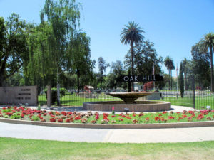
CEM47024782_124197784496When I went down to Oak Hill Cemetery on Fathers’ Day, because people lessen the likelihood of zombie apocalypse.  I was totally interested in anything Evergreen but they were scattered all over the place.  The only way to do this is wander around for a long time or check in the records people.  I’m going to have to dissect things into lawns and comb through records to find everyone.

That having been said, I knew there were some Pelliers buried here.  I forgot who initially was there, knowing it wasn’t the entire family.  In looking into the Pellier family originally, I also heard about this awesome grave discovery.  There was something fishy with the Louis Pellier headstones, but it looks weird to google on your phone and tip toe through a crowded graveyard.  Truth is Louis would and wouldn’t be here at Oak Hill Cemetery.

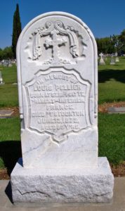
12314282_198416020500512_5584157587879954674_oSo, let’s start with our three Pellier brothers, the first generation to come to America.  The elder Pelliers were Louis, Pierre and Jean.  Louis A. Pellier was the brother who first came to America during the Gold Rush and first thought to bring the Prune and other fruit varietals to California soil.  His idea contributed to the California Fruit Industry we still enjoy today.  Louis Pellier would die in 1872, age the age of 55.  The eldest Louis Pellier wouldn’t be found at Oak Hill.  For a long while, his remains wouldn’t be found at all.

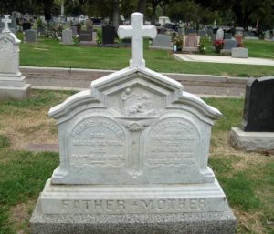
120013655_138395571327Interior-FirstGeneration-PierrePellierPierre would buy Pellier Ranch in Evergreen from his older brother, Louis, in 1863 after running someone else’s vineyards successfully near Mission San Jose.  Pierre and Henrietta Pellier raised their son and three daughters on their Evergreen ranch,  Although initially buried with his other relatives, Pierre Pellier would be buried at Oak Hill Cemetry.  I found he and his wife, Henrietta!  Wait. That’s a weird thing to get excited about.  I think this monument is stellar, though.  Again, weird thing to get excited about.

9ee89fc729d94679e4a4e7792a02a795Pellier’s son, Louis P. Pellier, would have been the patriarch once Pierre and Jean died.  Louis P. was being groomed to groom the vines and run the lucrative family business.  Louis P. Pellier would died at the age of 15 in 1873.  Passing a year after his uncle, the Pellier family was devastated.  They had no scions in the way of male heirs.  That having been said, his sisters stepped up and carried on the tradition of French Winemaking in the Evergreen hillside that eventually became the Mirassou Wine Dynasty.  The teenage

PelliWait, how did that happen?  They can’t get up and walk away.  Well, these Pelliers were laid to rest at Holy Cross or Kell Cemetery, opposite Communication Hill, on the outskirts of Willow Glen.  Here, for the most part patrons of St. Joseph’s Basilica were buried.  This included many notable Evergreenians.  Holy Cross Cemetery was sanctioned by the Catholic Church and operated from 1871-1890.  It was later replaced by a larger Catholic cemetery in 1882 which was closer to both Catholic churches.  Oak Hill Cemetery, close by, and Santa Clara Mission Cemetery was also available for Catholics.  In fact, many moved their loved ones to these other cemeteries.  The burial ground wasn’t maintained in the meantime and things got ran down.  Kids would play with things.  Earth would move.  Kell Cemetery was forgotten.  Today, it’s a source of Socio-Historic information for Archeologists.

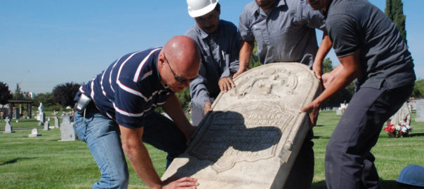
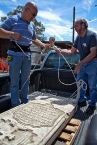
In 1930, the unmoved graves would be bulldozed through and cleared for grazing land.  I spoke to the gentlemen who united the monuments with the remains, Ralph Pearce and Judge Paul Bernal.  For some reason the elder Louis’s headstone would go missing 80 years, rescued by Clyde Arbuckle, San Jose Historian.  Judge Paul Bernal describes its discovery by Clyde.

129607541_1399786781“Around 1941 historian Clyde Arbuckle was at the Holy Cross Cemetery with his two children Jim and Susan.    As Jim and Susan chased a jackrabbit across the once cemetery, Clyde discovered the broken headstone of Louis Pellier lying face-down in the brush.   There are photos of Clyde and Helen Abuckle with the headstone propped back up in the cemetery in 1948/1949.  Between 1948/1949 and 1951, Arbuckle removed the headstone for safekeeping.”

arbuckleClyde Arbuckle would realize the treasure he had found.  The grand headstone was used as a prop for a documentary on Sunsweet Prunes in 1951.  Arbuckle’s collection was just underway.  He would be San Jose’s prevailing historian for many years.  The Prune King’s monument would be a piece of a vast collection which became the awesome organization History San Jose.  I’ve visited these guys.  Wow.  If you’re looking to get your nerd on, you can do it here.  But the collection was so broad, even this large piece was able to be overlooked for some time.  It was kept too safe.
129607434_1399786458Some years later, an orchardist and rancher would happen upon the headstone of Louis P. Pellier.  Farmer Lee Lester bought the property next door to the former cemetery.  Lester knew his prune history and thought he had found the most valuable piece of memorabilia, the Prune King’s headstone.  The monument was a little worse for wear, but it would be preserved as well by another San Jose history buff.  The gravestone would come back to Lester’s Baily Avenue farm for safekeeping and lean up against his barn exposed to the elements.

So, fast forward almost 100 years after its abandonment, Kell Cemetery was in the path of a proposed highway into the heart of Downtown.  That highway was the 87.  In 1984, these remains were moved to nearby Oak Hill with family or to the Catholic Cavalry Cemetery off of Alum Rock, its replacement, in a Pioneer Section.  All the remains moved.  Not all of the gravestones were located.  Many were in disrepair.  Both Louis Pellier’s remains would move to Alum Rock.

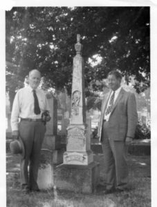
Jim%20Ralph%20Tim
Photo Courtesy of Ralph Pearce

Pioneer of Santa Clara County would often end up at the San Jose Public Library, like I have, in the California Room, in the midst of librarian Ralph Pearce.  In August 2011, Ralph let a member know that he thought he heard someone had a Louis Pellier headstone laying around.  The group having found the younger Louis’s monument in their possession, the search for the Prune King was on.  History San Jose confirmed it in archive databases, but the collection was so massive, it was housed in many multiple warehouses.  They opened their doors to the Pioneers of Santa Clara and Ralph Pearce, together creating the “In Grave Danger Gang”.

The “In Grave Danger Gang” would commemorate the reuniting of the Pellier Monuments on November 2, 2011 with Lester family, Pellier Family and the Pioneer Society members.

IMG_4028 [2794442]So, when I popped up at Oak Hill and asked for Louis Pellier, I wasn’t expecting the helpful lady to call me back with this little curve ball.  A two year old curve ball too young to be either first or second generation Louis.  Who’s this little guy?

Ralph Pearce and the Santa Clara Pioneers Society helped me figure it out!  It was buried deep in census statistics from the 1870’s and figuring out who was in the household who was old enough to father this child.  This little guy Louis belongs to another Louis Pellier, son of Jean Pellier.  This is the fourth generation of Louis Pellier, here who passed as a boy.  Jean’s son Louis A. was born in France in 1852, moved to the States with his family and married Christina Frances Alvarez.  They would have a son and also name him Louis A.  Whoa.  Those family names.  You could certain understand the confusion was all had.  Which brings up a whole new question.  Where’s the other L. A. Pellier located now?


Evergreen’s Own Mayor Quimby

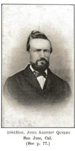
mayor quimbyWould you believe me if I told you that Evergreen and the City of San Jose had a Mayor Quimby over 125 years before the Simpsons?  Matt Groening’s portrait of the Mayor couldn’t contrast our factual character more.  I’m going to try to provide you with an accurate portrait of our fair-minded Mayor, John Alonzo Quimby.  I was lucky enough to find a contemporary family source in a Genealogical History for the Quimby Family from 1915, though newspapers and political publications didn’t say much..

quimby-coat-of-armsQuimby as a name is fairly popular in England, where its origins are traced back to the 11th century.  Though probably Germanic in origin and possibly Hebrew in its roots, the Quimby name, its variations (Quinby, Quinbee, Quenby, possibly Quincy, etc.) and its coat of arms are found all over England.  It dates back to an ancient Welsh King,  The Quimby Family came from a long line of Colonialists and Quakers.  The ancient family would come to Salem, then Massachussetts colony as early as 1640, seeking freedom from the religious persecution that brought so many people to America at the time.  They were not rumored in Salem Witch Hunts, but one relative died in heated fights with the Native Americans there.  His ancestors would’ve fought to create this country.
thumb200John A. Quimby would be born in Parsippany, New Jersey in 1818 to affluent, well respected parents.  His father would be a politician in New England.  Quimby’s father originally ran the lucrative family shoe making business before running for judge and serving the County court system 25-30 years in New Jersey.  His brother, Isaac, would be a General for the Union Army during the Civil War.  This is his famous brother from Back East to the right who eventually became a US Marshall.  My historian’s note here would be that photographs through the 1800’s would only be taken by the rich and famous or very large groups.  It was an infant of an art and a science as well as expensive to do.  Strangely enough, the politically minded family were Democrats for the most part, with the exception of our Mayor.  This may be the reason the Republican pioneer came to California in 1846.  Regardless, this photograph from the mid 1800’s should prove how well respected John Alonzo Quimby was.

Mayor Quimby first studied law and practiced with a Judge in New Jersey.  John Alonzo Quimby would come to California as early as 1846 with his father, but definitely arrived in Santa Clara County by 1849 with his first wife, Minerva Moody of New York.  It was said before leaving New Jersey that J. A. Quimby was one of Morristown, New Jersey’s best orators and they had a few.

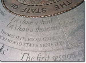
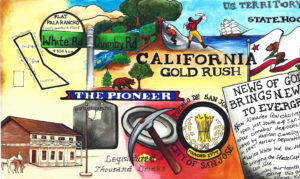
drinksJohn Alonzo Quimby would become entangled with California’s State Affairs early on, even running for US Senator at one point.  Quimby was present, along with delegate Charles White, at the “Legislature of A Thousand Drinks”, held in San Jose in 1849.  This Assembly would create California’s State Constitution and the creation of its Capitol, in San Jose.  In 1850, Quimby would see the need and build the first roadway from Santa Cruz to San Jose, laying the groundwork for Highway 17 today.  John would engage in the lumber business there as a City developed in the Valley.  The Captiol would move to Vallejo in 1851, and to Sacramento.  Even still, the site of the Capitol would become a second epicenter for the City of San Jose.  Quimby would be in the California legislature from 1855 to 1858 and be San Jose’s Mayor for two terms from 1863-1869.  J. A. Quimby would later be on the Board of County Supervisors for two terms.

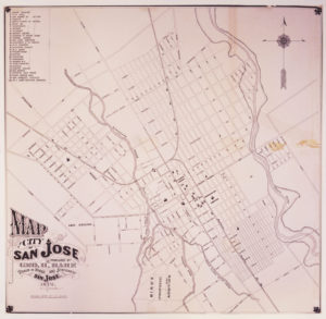
hb8r29p1tf-FID4scuThe well-respected lawmaker would become the creator of the Downtown San Jose we know nowadays.  For the sake of contract, the map to the right is San Jose in 1847.  It has a single road, the El Camino Real, today’s Alameda turning into Santa Clara beyond this point.  It’s layout is logical, like the numbered street we know, and it has well known San Jose founders sprinkled in.  The Guadalupe River creates a border for the small city.  At this point a lot of today’s Downtown isn’t even a thought.   In 1847, an acre of land downtown like these would cost $50.00.  Through his initiatives, crucial issues that arose in San Jose at California’s birth were solved through Mayor Quimby’s terms in office.

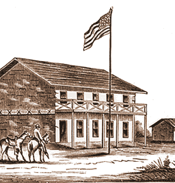
san_jose_2The Market Square was always a meeting place for the Pueblo of San Jose and so it only seemed fitting to hold California’s first meeting in California’s first civic meeting place.  In 1797, the Spanish would raise a Town Hall at the site for parades and City meetings.  There would be reports of ill maintained hotels and flooding at Market Square, which encouraged the Capitol’s relocation to Vallejo.  A dam would need to be built for the Guadalupe River to keep the Capitol dry.  This building still used in 1851 for San Jose’s administration, John A. Quimby would inherit San Jose with its run down buildings and infrastructure.  The Fire Department had no firehouse and broken down engines.  City Hall’s walls were crumbing.  After all, it was over 65 years old by the time he got to City Hall.  Furthermore, in 1863, the disputes created by settlement were still creating tensions.

1876 MapRancho Yerba Buena wasn’t up for dispute anymore.  John Alonzo Quimby himself legally purchased a large ranch 3 miles from Downtown Evergreen, next door to the Pellier Family, near where the Middle School stands today but up the road a little ways.  Victoria Chaboya’s property is more likely where the Quimby Oak Middle School stands today.  Oak trees are a main feature of Evergreen, not pine trees.  Quimby Oak rather rathers to the bed of Oak trees gathering along the Quimby Creek, running though Quimby and Pellier’s properties.  Quimby Road would always run past his Evergreen hills property.  J. A. Quimby was able to purchase a Creekside property near where the Chaboyas themselves called home.  The California Government didn’t uphold all of the Mexican land grants like the Chaboyas.  In fact, Rancho Yerba Buena was the exception to the rule in Santa Clara County.

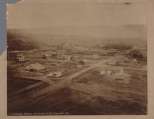
83f041e62c3569668922074fec6eb474Many were stripped of their holdings and left tiny portions of their former farms, including Antonio Chaboya’s brothers, by US Surveyors.  The railroad into San Jose was completed in 1863, when Quimby first became Mayor.  The land grab created room for new immigrants and U.S. citizens in early San Jose, which there were plenty arriving and on their way.  The first secular development in California, established in 1777, had been growing from the epicenter of Mission de Santa Clara de Asis, today’s Santa Clara University.  These homes, though close, were large and had adequate yards.  If these people were also farmers, though, their farms or vacation homes would be elsewhere, in modern day suburban communities surrounding San Jose’s Downtown.  To the right is Downtown San Jose looking towards the Mission in 1866, when J. A. Quimby was Mayor.

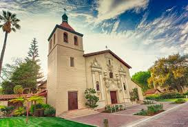
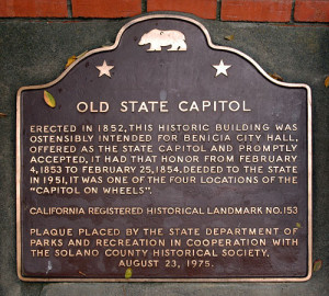
old_state_capitol_plaque_thumbMission Santa Clara feels like the outskirts of Downtown today.  You’re totally right.  What we feel like is Downtown today, First and Santa Clara Streets, would be John Alonzo Quimby’s impact on San Jose.    The one time Capitol, brought by delegates White and Reed and witnessed by Quimby no doubt, would be today’s Cesar Chavez Square on Market Street.  This would become a second burst of growth in San Jose’s adolescence.  Downtown is something different because of this second epicenter.  The bustling City would then center around Market and Santa Clara Streets, adding to the numbered streets and narrowing their lots.

SVHO2004-0812Then, during his Mayoral office, Quimby would bring together both parties to handle the disputes, fill San Jose’s Treasury by selling small “pueblo” lots Downtown and create services for the growing population.  Contemporaries would explain that the Cities of San Jose and Santa Clara were already touching and growing denser down the Alameda.  Plots were being sold for $50.00 an acre or city block around the Alameda and St. James Park.  Once Quimby took office, an acre cost $200.00.  US Surveyors would bring into question some of the $50.00 acres, allowing farms downtown to be broken up into subdivisions.  $50.00 plots were still being developed, however.  The City of San Jose would be considered as far east as Coyote Creek, as far south as Bird Avenue, as far west as Meridian Avenue and as far north as Hedding Street.  Quimby would improve the roadway system and rejuvenate San Jose’s infrastructure with the raising of funds, replacing rundown equipment and buildings.  Many of San Jose’s oldest standing buildings come from the Quimby era.  With a focus shifted away from the Mission and towards developing outward from the City Plaza, Cesar Chavez Park, Downtown San Jose’s small lots still exist today.  The numbered streets are a result of many of Quimby’s decisions.  He killed two very big birds with one very awesome stone that still can be felt today.  To the left is a map of San Jose shortly after he left City Hall.

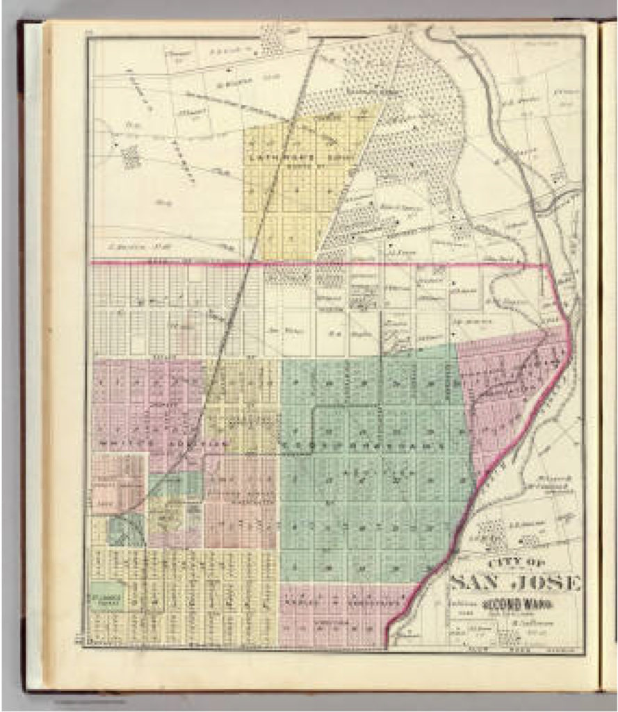
San Jose 2nd ward. - David Rumsey Historical Map CollectioncaThis is a map of San Jose while John Alonzo Quimby was on the Board of County Supervisors.  The rapid growth was prolific.  In 4 years, San Jose would need to be broken up into huge portions.  This is our modern downtown.  The First Ward is the old downtown.  Also notice that our Norths between the previous 2 maps are different.  That was just to make this one look pretty.  It’s ok.  Our 1847 Map had Guadalupe through then San Jose’s west on the bottom of the map.  Only a couple of those original rectangle bought for $50.00 still existed.  Most were these tiny boxes in 1876.  The colored portiosn are additions onto San Jose made during Quimby’s term.

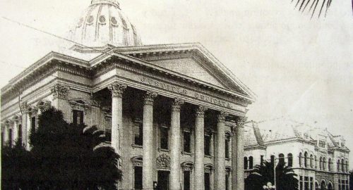
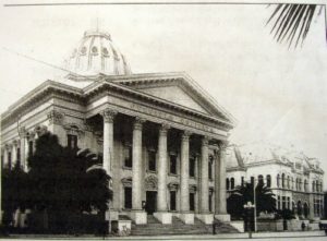
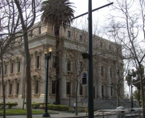
Courthouse1895Courthouse2007In 1860, San Jose would have 1000 residents.  By 1868, that had been multiplied to 7000 residents.  Having great leadership at the helm of a storm like that allows the transition to go smoothly.  John A. Quimby found a way to make room, make jobs, and revive an aging city.  He was also there at igniting of the Santa Clara County’s Fruit Industry.  Quimby would create the foundation for the large city with a dense downtown we enjoy today.   The San Jose Water Company was incorporated in 1866.  Gas services was introduced to San Jose in 1861, but the need for expanding those pipe systems were crucial.  The Normal School, today’s San Jose State University, would become State run in 1862.  The courthouse was built in 1867, now the St. James Post Office though its down was burned down some time ago.  The first public transit systems were in place in 1868, running down First Street to the domed courthouse.  The lightrail stops there today.  Does that make is a nearly 150 year old tradition to ride the modern trolley through Downtown?  The Canning Industry would be underway in San Jose in 1871.  Though Quimby gets the bulk of credit for the way he settled Downtown land disputes, he’s often overlooked during this crucial time in San Jose’s development.  Why he’s overlooked in unknown, because he seems to be well-respected by his contemporaries and loved ones.

CAM11091John and Minerva would have four kids, while maintaining his political life.  Minerva Moody would pass away in 1866, while he was Mayor, and John Alonzo Quimby would remarry the following year.  Irene Kamp, the new Mrs. Quimby, and John would have another two children who were also raised in Evergreen.  After serving the County for a number of years, John Quimby would become sick for a number of years starting in 1886.  Following the illness, Quimby retired from public life to his Evergreen farm.  It was said that he too raised vineyards in the Evergreen hills and Quimby Creek runs along the back side of Millbrook Elementary School today.  Quimby Road would be one of the third or fourth roads built in Evergreen, after San Felipe Road and Evergreen Road.  In fact, Quimby once ran Tully Road’s modern course into town after the turn at Eastridge Mall.  The Mall’s creation there was formed by Quimby’s 150 year old route.

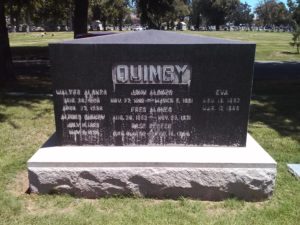
P1310216 (2)The large Evergreen estate passed to Irene and his family when John Alonzo Quimby passed in 1891.  This 1903 map shows a portion of the Quimby Ranch, 55 acres, still held by his daughter, Mrs. R. M. Wright.  One of his sons, Fred Alonzo Quimby, carried on the tradition of civic service into the 20th century, though sadly not in Santa Clara County.

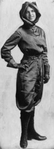
vinfiz_harriet58643d6960f486d90ad75b3a2f41f657Oh, and the awesome Harriet Quimby, first woman to have a pilot’s license, wouldn’t be from Evergreen or San Jose.  Instead, she probably heard about the road’s name on a flight to San Jose then lie ruthlessly about it, creating fairytales and misinformation about her early life.  Harriet was born in Michigan.  She was quite a character, but none of John Alonzo’s sons would marry a woman having a daughter Harriet.  She also freely lied about her age.  Don’t worry.  The Quimby’s are a huge family.  She probably wasn’t lying about the name, but could so easily weave misinformation into interviews because of the name’s popularity around the United States.

I think the obituaries for John A. Quimby about the most eloquent summarizations and indications of how he was received by his contemporaries, Democrat or Republican.  His was admired for both his political achievements and undertakings, as well as for his kindness and hospitality.

“Death of a Pioneer of San Jose – A Public Spirited Citizen – One who has served faithfully in various Public Offices and did much as a Private Citizen” said one local newspaper.  Another states “His life here since pioneer days was an active one until a few years ago… made him prominent amount residents of the county.”  It goes on, “The pioneer residents of this county will bear willing testimony to the deep regard entertained for the departed [Quimby] by all who had the pleasure and profit of an intimate acquaintance…”

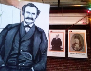
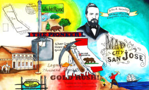
1833The Artwork which features J. A. Quimby also features possible inspiration Charles White.  After writing this, I’m wondering if we’ve given John Alonzo enough credit either.  His leadership created the City we enjoy today, which modern people from Evergreen continue to develop it and serve the same offices.  The Simpson’s bumbling Mayor couldn’t be further away from our Mayor Quimby.

After doing this article, here’s the updated White and Quimby Piece.

1833


“Nor-wood”

mapThe lead for Norwood is a real stumper.  As a name, its quite popular.  Norwood Avenue dates back to the mid 1800’s.  So, what was it named after?  There were fabulous people named Norwood who would settle into Santa Clara County in 1849, but Mr. Joseph Gould Norwood would make his home in the Alviso/Santa Clara township, nowhere near Evergreen.  So, that’s not our Norwood.  I reviewed historical maps and grant records throughout Evergreen’s history looking for a Norwood family to tie this name to.  I couldn’t find one.

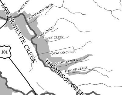
watershed1421300_242476552761125_6880580855870102685_oNorwood’s Creek is definitely a geographic feature of Evergreen and has been for a long time.  Today, the creek exists beyond the private road at the end of Norwood, but is diverted through housing developments through water tanks and pumping stations.  There’s probably a sizable water pipe under the street that later empties as Norwood Avenue ends on White Road.  That’s why the current path is a straight line at points.  This pipe system is necessary because Evergreen has had a long history of flooding with its sometimes unpredictable waterways.  Frank Cunningham lost his large property with a huge lake on it because the City of San Jose needed to be able to better control the watershed.
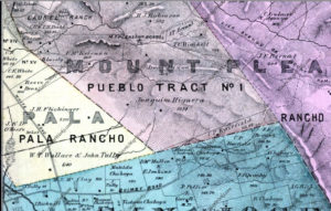
Map 006, San Jose, Evergreen, Silver Creek, Mount Pleasant, Pal000000Looking into Norwood, the Avenue itself in between Quimby Road and Tully Road came about between two maps.  In 1876, a County wide Atlas was created and there’s no mention of Norwood Avenue.  It runs along the line between these yellow, orange and the lower green section.  We are looking at once corners of Ranchos Pala and Rancho Yerba Buena, and the adjacent Pueblo Tract.  Tully Road isn’t a thing yet, but it will be located on the strong black line noting his and partner Wallace’s property.

Interior-FirstGeneration-PierrePellierThe Norwood Creek would feed into the farms, vineyards and orchards of Joaquin Higuera, Tully & Wallace, Pierre Pellier, and J. A. Quimby possibly at the time.  The creek would’ve provided a natural irrigation.  The Pellier Ranch was one of the largest in Evergreen with Norwood Creek traveling through it.  John Tully would own property all over Evergreen.  In fact, John Tully’s lawsuit from Antonio Chaboya opened up the conversation for other European farmers homesteading on Rancho Yerba Buena.
P1310185 (4)Fourteen years later, in 1890, Norwood Avenue runs through to present day Flint Avenue.  At its creation, it’s spelt Flindt Avenue.  Here, you see John Tully’s partnership with Wallace desolve with his passing and the family sold his half of the property away in small 10 acre lots.

6254426015_f091ee3233_bLarger farms like the McClay family’s, shown here to the left, and Leo Renaud on the South side of Norwood Avenue.  On the South corner of White Road and Norwood Avenue was Elmer Chase, Richmond Chase and Valley of Heart’s Delight Fruit Packing Co. owner.  With the elder Pelliers passing, the property passed to Pierre’s daughter Henrietta, who married Mr. Mirassou, then Mr. Casalegno.  One of her daughters would marry Mr. Renaud on Norwood Avenue.  The creekbed isn’t show here in this picture, but the properties are growing smaller.  The map would be impossible to read with all of Evergreen’s creeks also noted.  This area was awesome for vineyards.

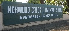
norwood-creek-elementaryRemington Drive where Norwood Creek Elementary School is located is most likely this beginning stretch of road off of Quimby Road which doesn’t quite connect but is very near the school’s location along Mr. Tully’s widow’s property.  The Hall’s Subdivision along Norwood Avenue would be one of the first in the area, along with the Cadwallader Subdivision.

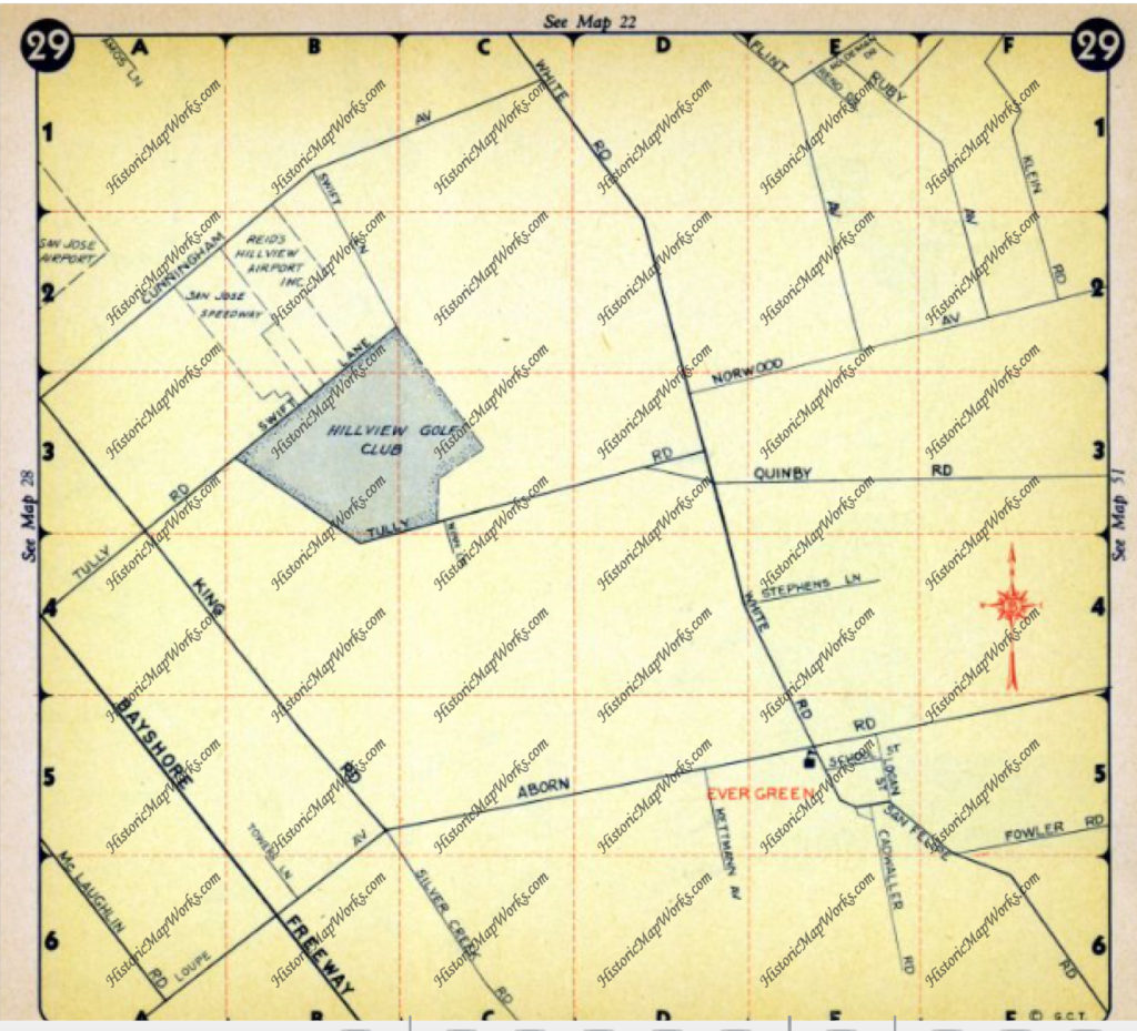
Evergreen - Page 029, Atlas: Santa Clara County 1956, Californi

This map in 1956 shows Norwood Avenue in the center.  Remington hasn’t become a major paved road yet.  Notice how Evergreen written in red is so much lower.  Its not that the Norwood area or the creek is outside Evergreen or Rancho Yerba Buena.

Norwood is the relationship it has with downtown Evergreen and its placement within the Rancho.  When broken into two parts its North Woods.  It is farthest North of the along the Rancho Yerba Buena border.  In all likelihood, the Creek was named Norwood long before the avenue.  It was a popular family name for people from northern lying woodlands.  This was the woods to the North of Evergreen along a main artery of White Road.  The Norwood area as the Rancho had streams trickling through it and densely populated with trees, with nearby farmhands houses on the North side.  The woods provided the Chaboyas a little buffer with their ranches along Quimby Road.  The forested area would create a natural boundary for the cattle as well.  John Tully would plant eucalyptus trees along Tully Road which still grow today in the heavily wooded area.  This would also refer to the area where Cedar Grove Elementary School is located, but we’ll talk about “Cedar” in Evergreen at another time.
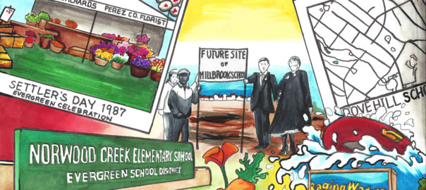
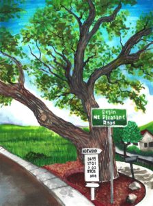
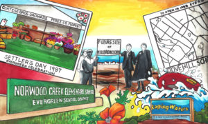
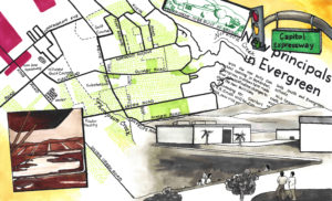
Here’s the artwork with references to Norwood Creek.

19851969

1850 - bridge19921847

Nirum Cadwallader – Evergreen’s generous Mining Tycoon

san jose newsNirum’s an awesome name, as is Cadwallader.  For the purposes of my research, I much prefer it to Smith, Stevens, Jones or John.  However, when looking into Mr. Cadwallader, he occurs all over the map.  The fabulous women of History San Jose pulled it all together for me.  I’m always looking for a portrait on my Evergreen individuals.  This one happens to be in print, not a photograph.
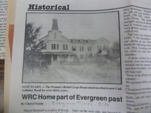
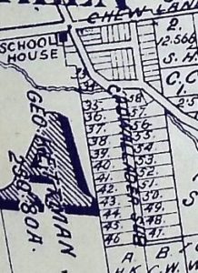
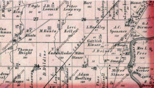
P1310185 (2)Mr. Nirum Cadwallader, for whom the school is named, as previously discussed donated the lands to both the Evergreen Schoolhouse at the corner of San Felipe and Evergreen Roads in 1860 and to the Women’s Relief Corps in 1887, located on Cadwallader Avenue.  The WRC is probably one of these subdivision plots.  By my estimation of the 5 acres donated, I think it’s probably 34 or 57.  Those are the only ones bigger enough and “on” Cadwallader.  At the time, Cadwallader Avenue started at San Felipe Road.  Now, there are only foot bridges connecting Cadwallader to Keaton Loop, formerly San Felipe Road.  We’ll discuss this in further detail later.  No doubt, Mr. Cadwallader helped shape Evergreen as we know it.
books cadwalladerbooks cadThe earliest records of Mr. Nirum Cadwallader appear from Birchville, California, because that’s where he initially struck it rich.  Originally from Ohio, Nirum Cadwallader would be apart of the Gold Rush of 1849.  In an illustrated version of Popular Science in 1866 would bring attention to Mr. Cadwallader’s patent on a technique of compressing air in dynamic to create larger blasts.

4592131824_302x427Nirum Cadwallader (1833-1890) was the great grandson of Ohio’s Seneca County’s Hopewell Township’s first settler, Nathan Cadwallader.  Nirum’s father Samuel Cadwallader and wife Mary would raise 7 children, of which Nirum was the eldest.  He would’ve been sixteen as he would’ve heard the news of gold from California.  As a young man, Cadwallader would work his way up the chain at the Milton Mining Company, surely getting the necessary experience that took him to his future heights.  The Cadwallader family name is quite popular there in Ohio and along the east coast, also spelt Cadwalader.  It and the family originate from Wales, being a descriptive term for the Welsh people.   The family’s lineage can be traced back to a Welsh King.  Chances are the Cadwalladers were well off in Ohio.  There are a long line of Cadwallader inventors preceding and succeeding him.  The first Cadwalladers would leave England in 1640, arriving in Virginia, and slowly migrating west from there.

Hopewell Township, Atlas: Seneca County 1874, Ohio Historical MAs a young man, Cadwallader would work his way up the chain at the Milton Mining Company, surely getting the experience that took him to his future heights. However established, Nirum Cadwallader would break out from Milton and arrive in California in 1855, at the age of 22.  Nirum would become a prolific businessman, acquiring stocks and equity in numerous mining, telephone, water and utility companies in Nevada County, California.  He was a very rich and well-respected man quickly after coming to California.  Mr. Cadwallader would be married twice, but his first wife passed away while he still lived in Birchville. I couldn’t find any records of the first marriage or the children they might have had.  After returning home, no doubt to grieve, Nirum would marry the much younger Emma J. Hart (1847-1930) also from Ohio, having 3 children together.  Nirum Cadwallader would own 160 acres in Ohio as shown to the left in this 1874 Atlas.  Samuel, his father, would live with Nirum for part of the year, probably during Ohio’s colder months.

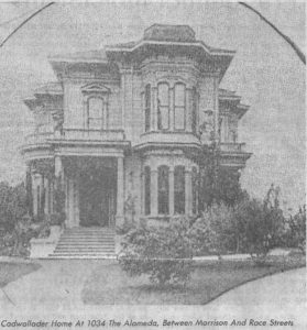
cadwallader residenceIf you’re mining for gold in Nevada County, California, you would need quicksilver to obtain pure gold and remove other elements from the compound.  If you’re a forward thinking man with mining interests and better mining techniques like Mr. Cadwallader, you might look for some quicksilver mines of your own.  This is what probably brought Mr. and Mrs. Cadwallader to San Jose for good in 1881.  Although it is unclear whether or not he had any part of the Silver Creek Mines before their flooding and abandonment, Nirum Cadwallader would purchase land in the heart of Evergreen in the 1860’s, though they never lived there.  This was a second property to vacation from their downtown home, which was located off of the Alameda, in the heart of Downtown San Jose.  It’s been torn down.  When Cadwallader donated the land because he hadn’t built on it, he made a huge impact on the Community of Evergreen.  Mr. Nirum Cadwallader has been rumored to be a very generous man throughout his life.

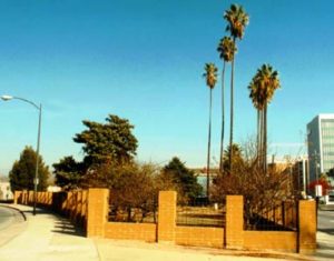
scan0135In 1888, Birchville’s mining industry would dry up as the mines were picked clean.  The population of Nevada County quickly shrank.  Forward thinking Mr. Cadwallader had already set up shop elsewhere.  His patent made him rich, as did his business ownings.  Mr. Cadwallader died in 1890, a year after the WRC opened.  Mrs. Emma Cadwallade, the widow, would deed a park in his honor.  The small park still exists between 1st and 2nd Streets at Keyes Street.  It is the cutest wedge of land with palm trees.  This crossroads would dictate the direction you were heading before highways were built.  Monterey Road was the closest thing to a highway, also being a portion of the El Camino Real.  First Street heading North lead you Santa Clara and then the Alameda which turns to the El Camino Real to San Francisco.  Heading down Second Street took you towards Oakland via Oakland Road from Thirteenth Street.

P1320428In donating the property to the Women’s Relief Corps in December 1887, constructed in 1889,  a ceremony was held to commemorate the occasion in Evergreen on April 6, 1889.  The WRC took a year and a half to build on Cadwallader Avenue.  A mile long precession and banquet hosted by “ladies of Evergreen”, notable ladies like Mrs. E. J. Smith, Mrs. J. J. Jones, Miss Fowler, and Miss McClay.   The occasion was celebrated with Mr. and Mrs. W. L. Edwards, Mr. and Mrs. Samuel Cunningham, Mr. and Mrs. Lantz (neighbors nearby the WRC), Miss Minnie Keliher and the Chew Family.  It was said that Mr. Cadwallader held the event to show off his beautiful wife from Ohio.  She later remarried Mr. Taylor in 1910, twenty years later.

P1310185 (3)Mr. Nirum Cadwallader’s Evergreen property turned into one of the first densely built home developments in the downtown of Evergreen.  It was all located around Cadwallader Avenue, named in his honor.  Close by Cadwallader Subdivision were the Smith properties and General Store, Andy Kettmann’s Saloon and the Schoolhouse.  When the town grew, it did so because people enjoyed having neighbors and countryside in the places like the Cadwallader Subdivision shown to the right.  If you worked these farms nearby, you probably couldn’t afford lots of acres of your own.  Plus, you were too busy to ever profit off of the land or tend to it yourself.  Evergreen’s farming industry took the whole village to harvest.  Evergreen School Sessions would sync with the harvest season, because the kids would be home working as well.

signpostPatricia Loomis discussed the WRC’s opening with first person resources in her article “Cadwallader Ave. Has Had Problems” in her ‘Sign Posts’ series, revisiting historic events in San Jose’s history for the San Jose News in October 17, 1975.  What I hadn’t realized before I found Patricia Loomis’s Sign Post was that Cadwallader Avenue went through to San Felipe.  The road bridge would be washed out in 1893 after heavy rains.  At the time, Cadwallader crossed Thompson Creek, formerly known as Dry Creek because it ran dry in summer months.  The wash out surely as something to do with the redirecting of San Felipe Road.  It’s never been replaced.